Craig Head
Coastal Feature, Headland, Point in Banffshire
Scotland
Craig Head

Craig Head is a prominent coastal feature located in Banffshire, Scotland. Situated on the eastern coast of the country, it is a picturesque headland that juts out into the North Sea. With its rugged cliffs and stunning views, Craig Head is a popular destination for nature enthusiasts and tourists alike.
The headland is characterized by its towering cliffs, reaching heights of up to 100 feet in some places. These cliffs are composed mainly of sandstone, which has been eroded over time by the relentless action of the sea. As a result, the coastline around Craig Head features a series of dramatic sea caves and rock formations, providing a haven for various seabird species.
The headland itself is covered in lush vegetation, with hardy grasses and wildflowers clinging to its slopes. This provides a habitat for a range of wildlife, including rabbits, foxes, and various bird species such as gulls and puffins. The area is also known for its rich marine life, with seals often spotted basking on the rocks and dolphins occasionally seen swimming offshore.
Visitors to Craig Head can enjoy breathtaking panoramic views of the North Sea and the surrounding coastline. On a clear day, it is possible to see as far as the distant peaks of the Cairngorms National Park. The headland is also a popular spot for hiking and birdwatching, with several trails and observation points scattered throughout the area.
Overall, Craig Head is a stunning coastal feature that offers visitors a unique opportunity to experience the beauty of Scotland's eastern coastline. Its rugged cliffs, diverse wildlife, and breathtaking views make it a must-visit destination for nature lovers and outdoor enthusiasts.
If you have any feedback on the listing, please let us know in the comments section below.
Craig Head Images
Images are sourced within 2km of 57.698215/-2.9203247 or Grid Reference NJ4567. Thanks to Geograph Open Source API. All images are credited.


Craig Head is located at Grid Ref: NJ4567 (Lat: 57.698215, Lng: -2.9203247)
Unitary Authority: Moray
Police Authority: North East
What 3 Words
///middle.saturate.cosmic. Near Findochty, Moray
Nearby Locations
Related Wikis

Strathlene
Strathlene is an area between Buckie and Findochty which has a caravan site facing onto the Moray Firth. At one time the Strathlene House Hotel, a former...
Strathlene Golf Course
Strathlene at Findochty, near Buckie, is one of the oldest golf courses in Scotland. It was established in 1877 and is home to Strathlene Buckie Golf Club...
Findochty Castle
Findochty Castle is a ruined 16th century L-plan tower house, near Findochty, Moray, Scotland, about 2.5 miles (4.0 km) north-east of Buckie, and about...
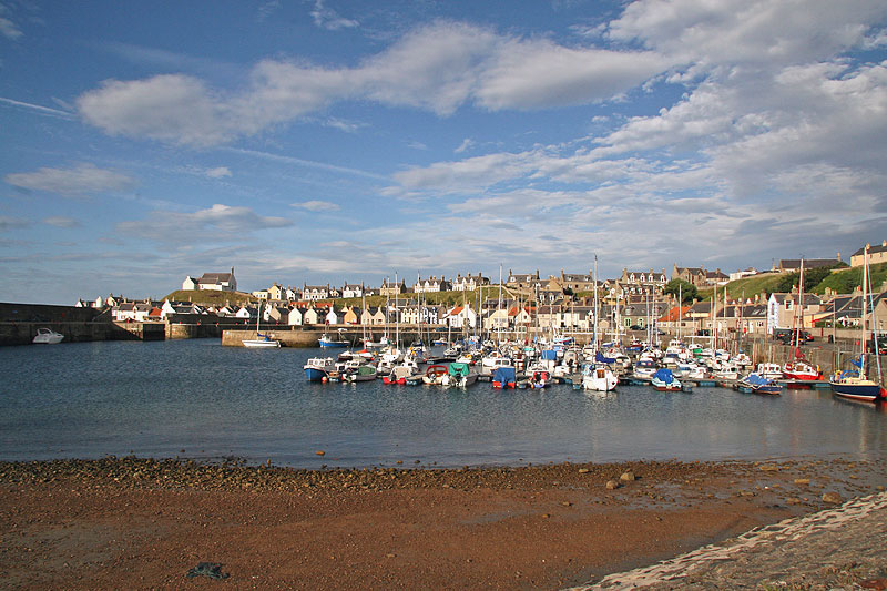
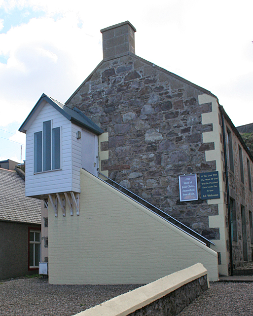
Findochty
Findochty (pronounced , Scots: Finichty, Scottish Gaelic: Am Fionn Ochdamh) is a village in Moray, Scotland, on the shores of the Moray Firth; historically...
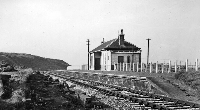
Findochty railway station
Findochty railway station was a railway station in the small fishing village of Findochty, Moray about 3 miles to the east of Buckie. The railway station...
Buckpool
Buckpool is a village on the coast of Moray, Scotland. Originally known as Nether Buckie, it is now effectively a part of the town of Buckie as the nearby...
Portessie railway station
Portessie railway station was a joint Highland Railway (HR) and Great North of Scotland Railway (GNoSR) station at the junction between the Moray Coast...
Portessie
Portessie (Scots: Peterhythe or The Sloch) is a small fishing village east of Buckie, on the north-east coast of Scotland. It is commonly nicknamed "the...
Nearby Amenities
Located within 500m of 57.698215,-2.9203247Have you been to Craig Head?
Leave your review of Craig Head below (or comments, questions and feedback).