Knowe of Skea

Coastal Feature, Headland, Point in Orkney

Scotland

Knowe of Skea

Rocky foreshore This is near to Muckle Water, with a view of Skea Hill in the background.
Rocky foreshore Credit: Isla17

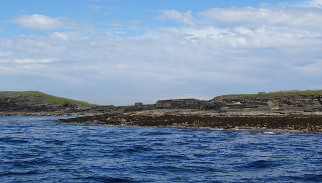
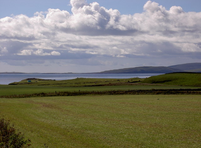
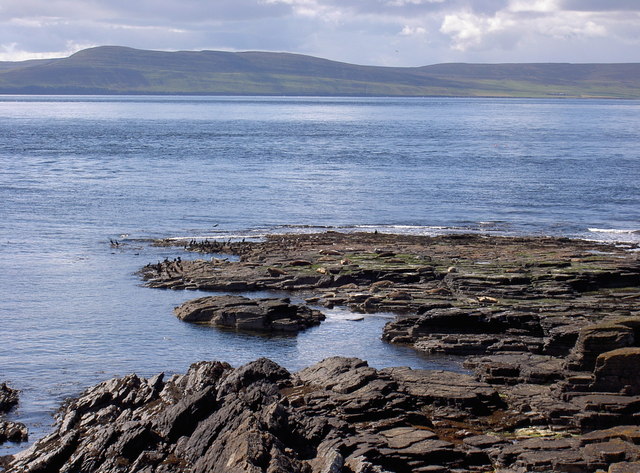
Knowe of Skea is a prominent headland located on the western coast of Orkney, an archipelago in Scotland. Situated near the village of Birsay, this coastal feature stands tall and offers breathtaking views of the surrounding landscape.

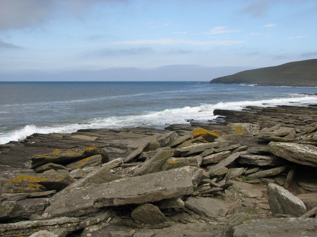
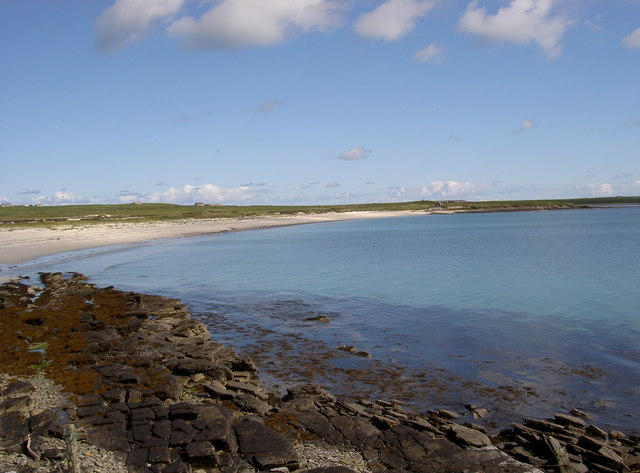
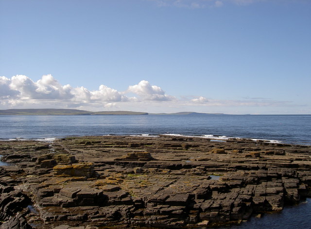
The headland is characterized by its rugged cliffs, which rise dramatically from the crashing waves of the Atlantic Ocean. These cliffs are composed of layers of sandstone, revealing the geological history of the area. Visitors can witness the erosion caused by the relentless force of the sea, as well as the unique rock formations that have been sculpted over time.

Knowe of Skea is a popular spot for birdwatching enthusiasts, as it serves as a nesting site for various seabirds. Fulmars, guillemots, and kittiwakes can often be seen perched on the cliffs or soaring above the water. The headland is also home to a diverse array of plant species, including sea pinks and thrift, which add vibrant splashes of color to the landscape.

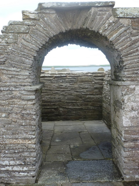
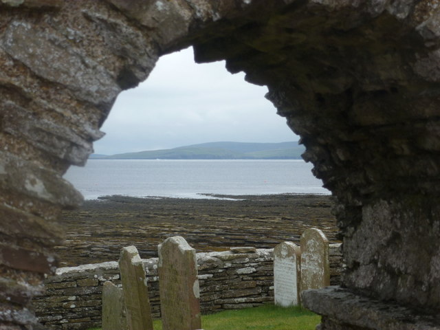
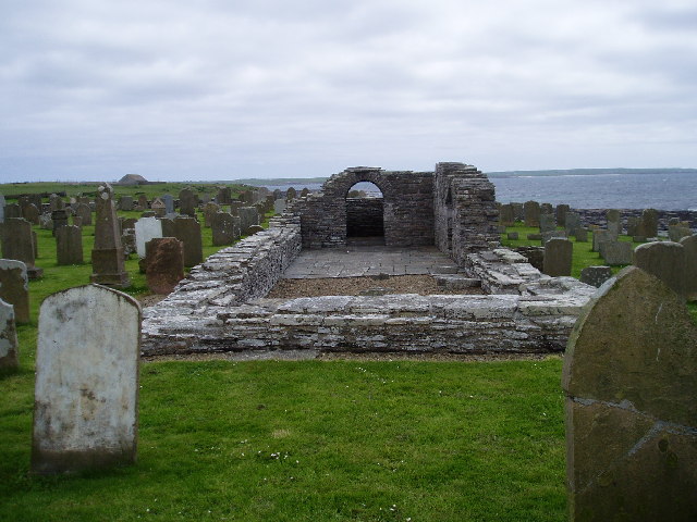
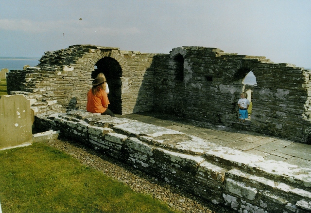
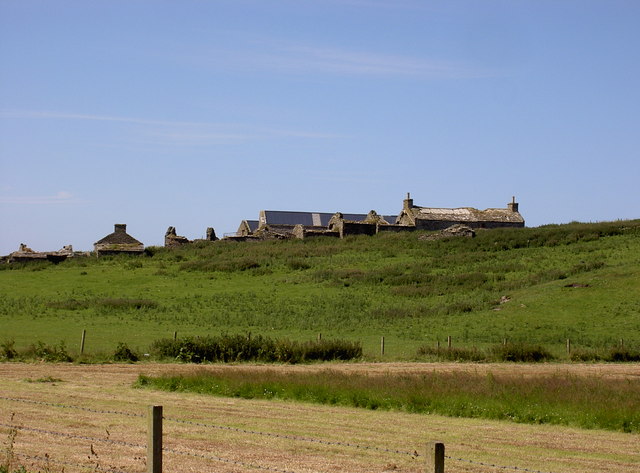
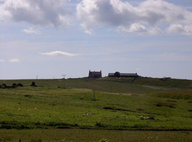
In addition to its natural beauty, Knowe of Skea has historical significance. The headland is believed to have been a Viking burial ground, with archaeological excavations revealing the presence of burial mounds. These ancient structures provide a glimpse into the lives and customs of the Norse settlers who inhabited the area centuries ago.

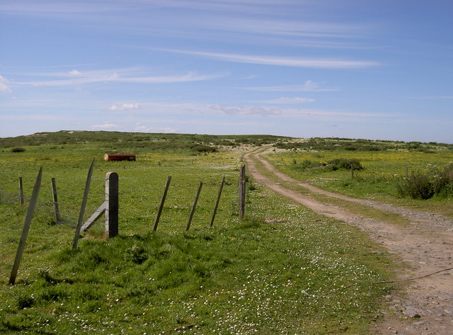
Accessible via a coastal path, Knowe of Skea offers a unique opportunity for visitors to immerse themselves in Orkney's rich natural and historical heritage. Whether it's admiring the stunning vistas, observing the diverse wildlife, or contemplating the ancient burial sites, this headland is a must-visit destination for those exploring the wonders of Orkney.

If you have any feedback on the listing, please let us know in the comments section below.

Knowe of Skea Images

Images are sourced within 2km of 59.259487/-2.9802184 or Grid Reference HY4441. Thanks to Geograph Open Source API. All images are credited.

Rocky foreshore This is near to Muckle Water, with a view of Skea Hill in the background.
Rocky foreshore
This is near to Muckle Water, with a view of Skea Hill in the background.
Tuquoy: Cross Kirk A small ruined chapel by the water's edge, currently undergoing renovation work.
Tuquoy: Cross Kirk
A small ruined chapel by the water's edge, currently undergoing renovation work.
Tuquoy: Cross Kirk churchyard Looking across the graveyard at <a href="https://www.geograph.org.uk/photo/2630796">HY4543 : Tuquoy: Cross Kirk</a>, a view cunningly avoiding the most conspicuous of the renovation work, although a couple of scaffold poles are visible.
Tuquoy: Cross Kirk churchyard
Looking across the graveyard at HY4543 : Tuquoy: Cross Kirk, a view cunningly avoiding the most conspicuous of the renovation work, although a couple of scaffold poles are visible.
Tuquoy: looking through the church arch A view through the arch of <a href="https://www.geograph.org.uk/photo/2630796">HY4543 : Tuquoy: Cross Kirk</a>, with the renovation work currently underway behind us. The tops of the gravestones can be seen over the east wall of the church, with the Rapness part of Westray across the other side of the Bay of Tuquoy.
Tuquoy: looking through the church arch
A view through the arch of HY4543 : Tuquoy: Cross Kirk, with the renovation work currently underway behind us. The tops of the gravestones can be seen over the east wall of the church, with the Rapness part of Westray across the other side of the Bay of Tuquoy.
Tuquoy: sea view from the church Looking towards the distant island of Rousay from <a href="https://www.geograph.org.uk/photo/2630796">HY4543 : Tuquoy: Cross Kirk</a>.
Tuquoy: sea view from the church
Looking towards the distant island of Rousay from HY4543 : Tuquoy: Cross Kirk.
Tuquoy: Kirk Taing Looking across the broad, shallow ledge of rocks to the south of <a href="https://www.geograph.org.uk/photo/2630796">HY4543 : Tuquoy: Cross Kirk</a>, on whose churchyard wall we are stood. The wall directly separates the church grounds from the shoreline. The island of Rousay is in the background.
Tuquoy: Kirk Taing
Looking across the broad, shallow ledge of rocks to the south of HY4543 : Tuquoy: Cross Kirk, on whose churchyard wall we are stood. The wall directly separates the church grounds from the shoreline. The island of Rousay is in the background.
Skea Skerries, Westray Firth Grey Atlantic seals, Shags and Great black-backed gulls on Skea Skerries.
Skea Skerries, Westray Firth
Grey Atlantic seals, Shags and Great black-backed gulls on Skea Skerries.
West side of Bakie Skerry, Berst Ness, Westray Bedrock slabs of sandstone form Bakie Skerry on Berst Ness, Westray.
West side of Bakie Skerry, Berst Ness, Westray
Bedrock slabs of sandstone form Bakie Skerry on Berst Ness, Westray.
Cross-kirk, Tuquoy, Westside, Westray The ruins of a medieval church on Westray. This photo is from the west side of the church.
Cross-kirk, Tuquoy, Westside, Westray
The ruins of a medieval church on Westray. This photo is from the west side of the church.
Cross-kirk at Tuquoy Atmospheric site for the ruin, in its graveyard right at the edge of the shore.
Cross-kirk at Tuquoy
Atmospheric site for the ruin, in its graveyard right at the edge of the shore.
Knowe o Skea, near Langskaill View over farmland at Langskaill towards Knowe o Skea (the 'bump' with green tent on it).  Island of Rousay in background to right.
Knowe o Skea, near Langskaill
View over farmland at Langskaill towards Knowe o Skea (the 'bump' with green tent on it). Island of Rousay in background to right.
Sandy Links of Gairy, Westside, Westray Like all sandy areas in Westray, this is over-run with rabbits.  Is used occasionally for Motocross races.
Sandy Links of Gairy, Westside, Westray
Like all sandy areas in Westray, this is over-run with rabbits. Is used occasionally for Motocross races.
Arable farmland, Powdykes, Westside, Westray Farmland of Powdykes in foreground - being cut for winter silage.  Cottages of Netherhouse on horizon.
Arable farmland, Powdykes, Westside, Westray
Farmland of Powdykes in foreground - being cut for winter silage. Cottages of Netherhouse on horizon.
Overgrown burn (stream) near Netherhouse, Westray This burn, or stream, carries on to the sea.  To the right of centre, you can just make out a little bump against the sea which is the remains of the Broch o Burristae.
Overgrown burn (stream) near Netherhouse, Westray
This burn, or stream, carries on to the sea. To the right of centre, you can just make out a little bump against the sea which is the remains of the Broch o Burristae.
Old Manse, Westside, Westray The Old Manse has recently been extensively renovated.  The farm steading to the right is now also being converted into a dwelling house.
Old Manse, Westside, Westray
The Old Manse has recently been extensively renovated. The farm steading to the right is now also being converted into a dwelling house.
Mae Sands, Westside, Westray
Bakie Skerry, off Knowe of Skea
Westray Firth Taken from Knowe of Skea, Westside, Westray.  Island of Rousay in background.
Westray Firth
Taken from Knowe of Skea, Westside, Westray. Island of Rousay in background.
Show me another place!

Knowe of Skea is located at Grid Ref: HY4441 (Lat: 59.259487, Lng: -2.9802184)

Unitary Authority: Orkney Islands

Police Authority: Highlands and Islands

What 3 Words

///daydream.plotter.tourist. Near Pierowall, Orkney Islands

Related Wikis

Westside Church

Westside Church, (also known as Cross Kirk), is a ruined 12th century church located on the island of Westray in Orkney, Scotland. Archaeological excavations...

Westray

Westray (, Scots: Westree) is one of the Orkney Islands in Scotland, with a usual resident population of just under 600 people. Its main village is Pierowall...

Pierowall

Pierowall is a village of Westray in the Orkney Islands, off the coast of the northern Scottish mainland. The village is the island's largest settlement...

Noltland Castle

Noltland Castle is located near Pierowall on the island of Westray in the Orkney Islands of Scotland. It dates mainly to the later 16th century, although...

Nearby Amenities

Located within 500m of 59.259487,-2.9802184
Knowe of Skea
Historic: archaeological_site
Lat/Long: 59.2591277/-2.9814346
Cairns
Historic: archaeological_site
Lat/Long: 59.2605494/-2.9827767
The data included in this document is from www.openstreetmap.org. The data is made available under ODbL.

Have you been to Knowe of Skea?

Leave your review of Knowe of Skea below (or comments, questions and feedback).