Low Hauxley

Settlement in Northumberland

England

Low Hauxley

Coquet Island From Low Hauxley
Coquet Island Credit: Chris Morgan

Low Hauxley is a small coastal village located in the county of Northumberland, England. Situated on the northeastern coast, it lies within the wider area known as Druridge Bay. The village is nestled between the towns of Amble to the south and Warkworth to the north.

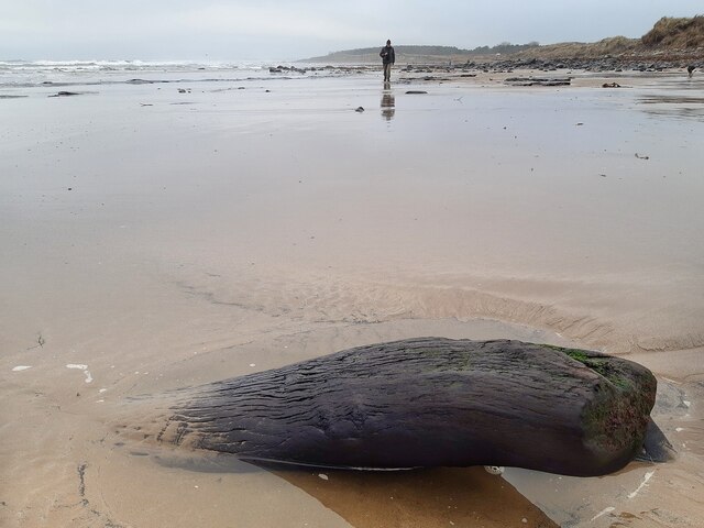
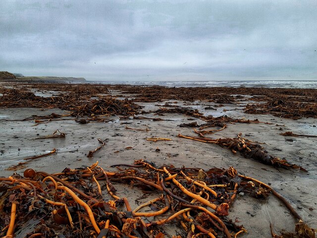
Low Hauxley is renowned for its natural beauty and picturesque surroundings. Its main attraction is the stunning beach, which stretches for miles and boasts golden sands and clear waters. The beach is backed by sand dunes, creating a tranquil and serene atmosphere. It is a popular spot for beachcombing, birdwatching, and leisurely walks.

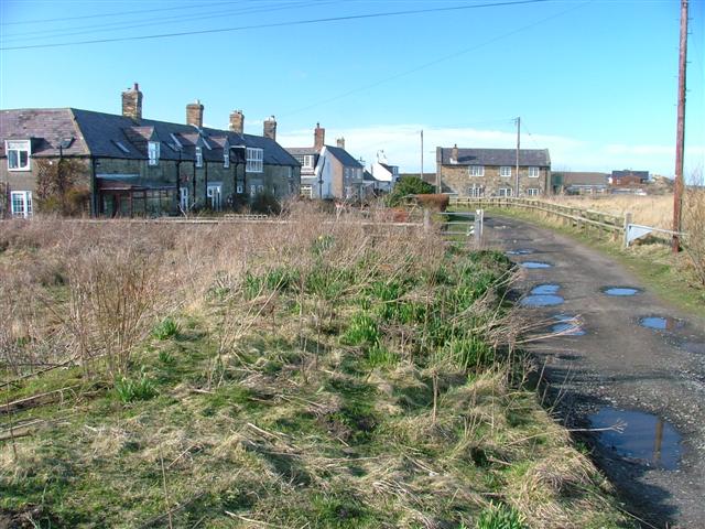
The village itself is small and peaceful, with a close-knit community. It features a handful of residential properties, a local pub, and a caravan park offering holiday accommodation. The pub serves as a social hub for both locals and visitors, providing a warm and friendly atmosphere.

Nature enthusiasts will be delighted by the diverse wildlife that can be found in the surrounding area. Low Hauxley is part of the Northumberland Coast Area of Outstanding Natural Beauty, and it is home to various species of birds, including puffins, kittiwakes, and terns. The nearby Druridge Bay Country Park offers further opportunities for exploration, with nature trails and a lake.

Overall, Low Hauxley offers a peaceful and idyllic coastal retreat, perfect for those seeking a serene escape in the beautiful Northumberland countryside.

If you have any feedback on the listing, please let us know in the comments section below.

Low Hauxley Images

Images are sourced within 2km of 55.320438/-1.551275 or Grid Reference NU2803. Thanks to Geograph Open Source API. All images are credited.

Coquet Island From Low Hauxley
Coquet Island
From Low Hauxley
Bondi Carrs Low Hauxley
Bondi Carrs
Low Hauxley
Rocks at Low Hauxley
Tree trunk in sand near Togston Links Remnant from the Quaternary peat deposits found nearby <a href="https://www.geograph.org.uk/photo/2918958">NU2802 : Quaternary peat deposit, Low Hauxley shore</a>
Tree trunk in sand near Togston Links
Remnant from the Quaternary peat deposits found nearby NU2802 : Quaternary peat deposit, Low Hauxley shore
Storm debris, Druridge Bay
Circa Cafe, Amble Opening out on to a filling station forecourt, the Circa Cafe is a curious combination of café and antiques shop. Inside, the antiques and collectables showroom is surprisingly large with an extensive range of items for sale. To the left of the café is a Londis store.
Circa Cafe, Amble
Opening out on to a filling station forecourt, the Circa Cafe is a curious combination of café and antiques shop. Inside, the antiques and collectables showroom is surprisingly large with an extensive range of items for sale. To the left of the café is a Londis store.
Low tide at Togston Links
Bondi Carrs exposed at low tide
Low tide at Hauxley Links
Silver Carrs exposed at low tide
Cottages on the dunes
Exposed rocks at Hauxley Haven
Low tide at Amble Links
High Hauxley
High Hauxley
Lighthouse on Coquet Island View from Links Road, Amble
Lighthouse on Coquet Island
View from Links Road, Amble
The Beach off Links Road, Amble View to Wellhaugh Point
The Beach off Links Road, Amble
View to Wellhaugh Point
The Amble Inn, Amble The Amble Inn is situated on Sandpiper Way, Amble and is operated by The Inn Collection Group. Built at a cost of £4million, with the assistance of a £448,500 grant from the Rural Growth Network’s Strategic Economic Infrastructure Fund, which is part of the North East Local Enterprise Partnership (LEP) £6million capital programme that aims to support rural businesses and stimulate business growth within the rural areas of Northumberland, Durham and Gateshead. It was opened in 2019.
The Amble Inn, Amble
The Amble Inn is situated on Sandpiper Way, Amble and is operated by The Inn Collection Group. Built at a cost of £4million, with the assistance of a £448,500 grant from the Rural Growth Network’s Strategic Economic Infrastructure Fund, which is part of the North East Local Enterprise Partnership (LEP) £6million capital programme that aims to support rural businesses and stimulate business growth within the rural areas of Northumberland, Durham and Gateshead. It was opened in 2019.
Part of the scene at Hauxley Reserve What a top quality amenity. Well worth a visit. Great cafe, great facility, great staff. And the birds here were a major draw.
Part of the scene at Hauxley Reserve
What a top quality amenity. Well worth a visit. Great cafe, great facility, great staff. And the birds here were a major draw.
Show me another place!

Low Hauxley is located at Grid Ref: NU2803 (Lat: 55.320438, Lng: -1.551275)

Unitary Authority: Northumberland

Police Authority: Northumbria

What 3 Words

///exhales.detective.doubt. Near Amble, Northumberland

Related Wikis

Low Hauxley

Low Hauxley is a small village in Northumberland, in the former Alnwick district, less than 1 mile (1.6 km) from Amble and around 27 miles (43 km) from...
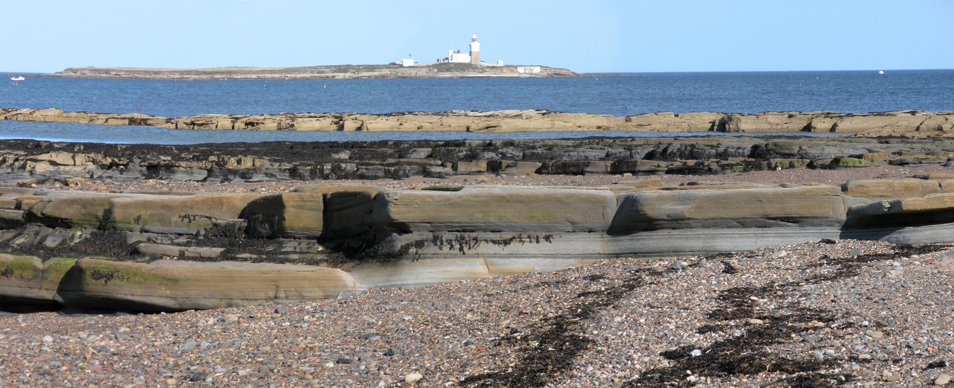
Coquet Island

Coquet Island is a small island of about 6 hectares (15 acres), situated 1.2 kilometres (0.75 mi) off Amble on the Northumberland coast, northeast England...

Hadston Skeers

Hadston Skeers (or Carrs) (Ordnance Survey reference NU 283428) are towards the northern End of Druridge Bay, Northumberland. They are made up of shelves...

Amble

Amble is a town on the North Sea coast of Northumberland, England, at the mouth of the River Coquet; Coquet Island is visible from its beaches and harbour...

Nearby Amenities

Located within 500m of 55.320438,-1.551275
Low Hauxley
Place: locality
Wikidata: Q6692882
Lat/Long: 55.3184591/-1.5520302
Historic: mine
Mineral: coal
Source: NPE
Lat/Long: 55.3229973/-1.5554291
Beacon Hill
Place: locality
Lat/Long: 55.3217117/-1.5520208
Bus Stop
Bench: yes
Bus: yes
Covered: yes
Public Transport: platform
Shelter: yes
Lat/Long: 55.3203502/-1.5512024
Post Box
Collection Times: Mo-Fr 09:00; Sa 07:00
Note: enlarged aperture
Post Box Type: wall
Ref: NE65 41
Royal Cypher: EVIIR
Royal Cypher Wikidata: Q33102324
Lat/Long: 55.3183281/-1.5516063
Generator Method: photovoltaic
Generator Output Electricity: yes
Generator Source: solar
Generator Type: solar_photovoltaic_panel
Location: roof
Power: generator
Lat/Long: 55.3188897/-1.550845
Bench
Lat/Long: 55.3203883/-1.5511404
Bench
Lat/Long: 55.3226303/-1.5507817
The data included in this document is from www.openstreetmap.org. The data is made available under ODbL.

Have you been to Low Hauxley?

Leave your review of Low Hauxley below (or comments, questions and feedback).