Slates of the Altar
Coastal Feature, Headland, Point in Orkney
Scotland
Slates of the Altar
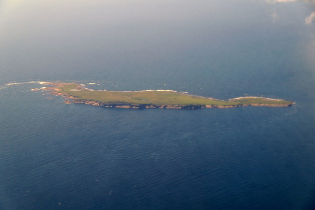
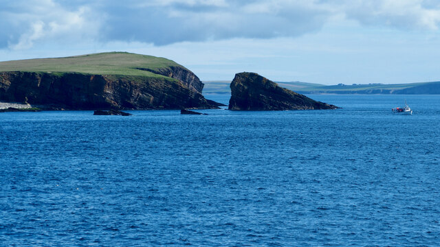
Slates of the Altar is a prominent coastal feature located on the headland of Orkney, a group of islands situated off the northeastern coast of Scotland. This unique geological formation is characterized by a series of jagged cliffs, jutting out into the North Sea, creating a dramatic and awe-inspiring sight.
The name "Slates of the Altar" derives from the distinctive layered appearance of the cliffs, resembling the stacked slates of a religious altar. These layers are composed of sedimentary rocks, primarily sandstone and shale, which have been shaped by millions of years of geological processes.
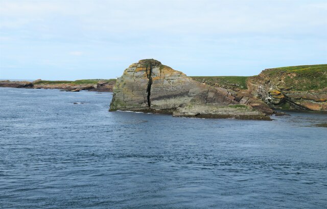
The cliffs of Slates of the Altar stand tall, reaching heights of up to 50 meters (164 feet), and are known for their striking vertical striations. These patterns are a result of the alternating layers of differently colored rocks, ranging from shades of gray to reddish-brown, which have been exposed through erosion.
The site is a popular destination for nature enthusiasts and photographers, offering breathtaking panoramic views of the surrounding coastline and sea. It is also home to a diverse array of seabirds, including fulmars, kittiwakes, and guillemots, which nest on the cliff faces during the breeding season.
Access to Slates of the Altar is relatively easy, with a well-maintained footpath leading visitors to the headland. However, caution is advised when exploring the area, as the cliffs can be unstable and subject to erosion. It is recommended to stay on designated paths and avoid venturing too close to the edge for safety reasons.
Overall, Slates of the Altar is a natural wonder of Orkney, captivating visitors with its striking beauty and geological significance.
If you have any feedback on the listing, please let us know in the comments section below.
Slates of the Altar Images
Images are sourced within 2km of 58.740607/-3.0523565 or Grid Reference ND3984. Thanks to Geograph Open Source API. All images are credited.
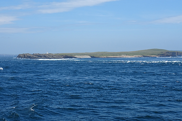
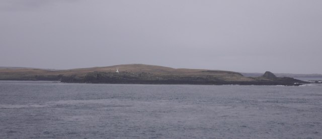
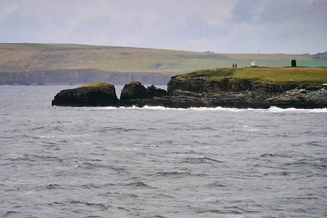
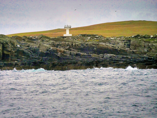
![Warbister Hill Site of a possible building, an enclosure, a quarry, and a modern triangulation pillar; see “Swona, Warbister Hill | Canmore.” 2021. Canmore.org.uk &lt;<span class="nowrap"><a title="https://canmore.org.uk/site/347495/swona-warbister-hill" rel="nofollow ugc noopener" href="https://canmore.org.uk/site/347495/swona-warbister-hill">Link</a><img style="margin-left:2px;" alt="External link" title="External link - shift click to open in new window" src="https://s1.geograph.org.uk/img/external.png" width="10" height="10"/></span> &gt; [accessed 7 June 2021]](https://s1.geograph.org.uk/geophotos/06/86/06/6860697_42cec7a5.jpg)
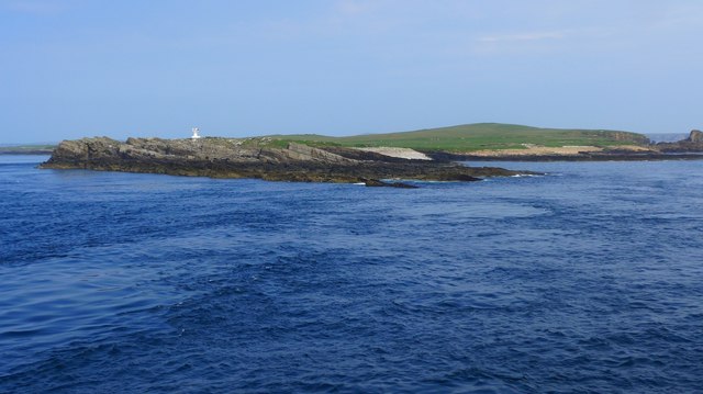
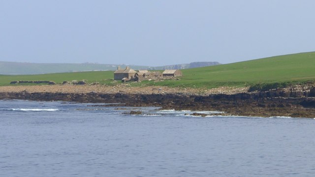
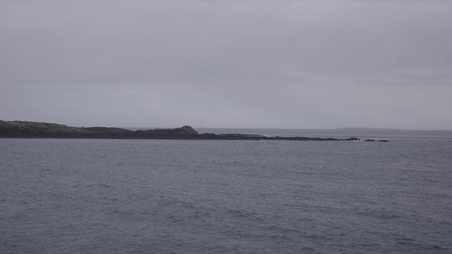
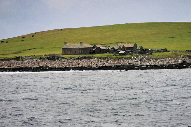
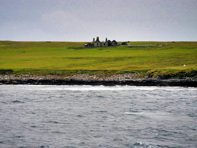
![The Haven Seems to be the main access onto the now un-inhabited island. See “Swona, the Haven | Canmore.” 2021. Canmore.org.uk &lt;<span class="nowrap"><a title="https://canmore.org.uk/site/347498/swona-the-haven" rel="nofollow ugc noopener" href="https://canmore.org.uk/site/347498/swona-the-haven">Link</a><img style="margin-left:2px;" alt="External link" title="External link - shift click to open in new window" src="https://s1.geograph.org.uk/img/external.png" width="10" height="10"/></span> &gt; [accessed 7 June 2021]
For the farmstead behind see “Swona, Norhead | Canmore.” 2021. Canmore.org.uk &lt;<span class="nowrap"><a title="https://canmore.org.uk/site/345421/swona-norhead" rel="nofollow ugc noopener" href="https://canmore.org.uk/site/345421/swona-norhead">Link</a><img style="margin-left:2px;" alt="External link" title="External link - shift click to open in new window" src="https://s1.geograph.org.uk/img/external.png" width="10" height="10"/></span> &gt; [accessed 7 June 2021]](https://s3.geograph.org.uk/geophotos/06/86/07/6860703_6e889d80.jpg)
Slates of the Altar is located at Grid Ref: ND3984 (Lat: 58.740607, Lng: -3.0523565)
Unitary Authority: Orkney Islands
Police Authority: Highlands and Islands
What 3 Words
///ponies.agents.alongside. Near St Margaret's Hope, Orkney Islands
Nearby Locations
Related Wikis

Swona
Swona is an uninhabited privately-owned island in the Pentland Firth off the north coast of Scotland. == Geography and geology == Swona is the more northerly...

MV Cemfjord
The Cemfjord was a Cyprus-registered cargo ship which foundered in the Pentland Firth off the north-east coast of Scotland on 2 January 2015. Built as...

SM U-29 (Germany)
SM U-29 was a Type U-27 U-boat of the Imperial German Navy. She served during the First World War. U-29's last commander was Captain Otto Weddigen. U-29...

Burwick, Orkney
Burwick () is a small harbour on the island of South Ronaldsay in the Orkney Islands, Scotland. It is the closest Orkney harbour to the Scottish mainland...
Cantick Head Lighthouse
The Cantick Head Lighthouse is an active 19th century lighthouse on the Scottish island of South Walls in the Orkney Islands. It is located at the end...

Switha
Switha is a small uninhabited island towards the south of Orkney, Scotland, approximately 41 hectares in area. == Geography and geology == Switha lies...

South Ronaldsay
South Ronaldsay (, also , Scots: Sooth Ronalshee) is one of the Orkney Islands off the north coast of Scotland. It is linked to the Orkney Mainland by...

HMS Opal (1915)
HMS Opal was an Admiralty M-class destroyer of the Royal Navy. She served in the First World War following her construction at Sunderland in 1915. Attached...
Nearby Amenities
Located within 500m of 58.740607,-3.0523565Have you been to Slates of the Altar?
Leave your review of Slates of the Altar below (or comments, questions and feedback).