Low Fulney

Settlement in Lincolnshire South Holland

England

Low Fulney

The River Welland The River Welland at Spalding looking towards the twin bridges from the town side
The River Welland Credit: Peter Latham

Low Fulney is a small village located in the county of Lincolnshire, England. Situated approximately 2 miles east of the town of Spalding, it falls within the administrative district of the South Holland local government. With a population of around 400 residents, it offers a tranquil and rural environment.

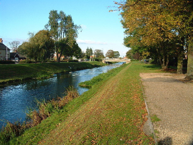
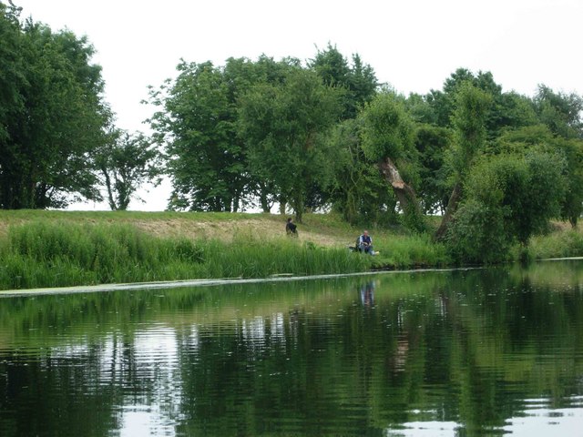
The village is predominantly residential, with a mix of traditional cottages and modern houses. Nestled alongside the picturesque River Welland, Low Fulney boasts scenic views and a peaceful atmosphere. The area is known for its agricultural heritage, with vast farmlands surrounding the village.

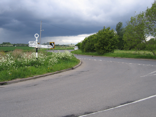
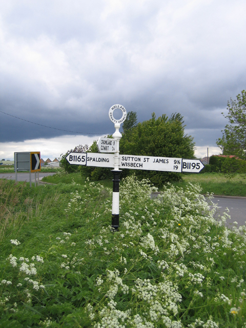
Low Fulney is well-connected by road, with easy access to the A16, providing links to nearby towns and cities such as Peterborough and Boston. The village benefits from a regular bus service, ensuring convenient transportation options for its residents.

Although the village does not have its own shops or amenities, the town of Spalding is just a short distance away, offering a range of services including supermarkets, schools, healthcare facilities, and recreational activities. Low Fulney is also within close proximity to popular tourist attractions such as Ayscoughfee Hall Museum and Gardens, providing residents with opportunities for leisure and cultural experiences.

Overall, Low Fulney offers a peaceful and idyllic setting, making it an attractive place to reside for those seeking a quiet and rural lifestyle, while still enjoying the conveniences of nearby towns and amenities.

If you have any feedback on the listing, please let us know in the comments section below.

Low Fulney Images

Images are sourced within 2km of 52.785948/-0.119754 or Grid Reference TF2622. Thanks to Geograph Open Source API. All images are credited.

The River Welland The River Welland at Spalding looking towards the twin bridges from the town side
The River Welland
The River Welland at Spalding looking towards the twin bridges from the town side
Springfields Factory Outlet and Festival Gardens Springfields in Spalding is home to over 40 outlet stores selling famous named brands in fashion and home at great discounts all year round. Also don‘t miss the beautiful landscaped festival gardens.
Springfields Factory Outlet and Festival Gardens
Springfields in Spalding is home to over 40 outlet stores selling famous named brands in fashion and home at great discounts all year round. Also don‘t miss the beautiful landscaped festival gardens.
Centre of Weston Hills, looking E
Ditches off Delgate Bank, Weston Hills, looking W
St. Paul, Fulney
St. Paul, Fulney
SS Mary & Nicolas, Spalding
Road junction, Low Fulney, Lincs where Fulney Drove meets the sharp bend in the B1165 east of Spalding.
Road junction, Low Fulney, Lincs
where Fulney Drove meets the sharp bend in the B1165 east of Spalding.
Holland County Council fingerpost road sign, Low Fulney, Lincs This is a well preserved sign from the pre-1974 division of Lincolnshire, situated where Fulney Drove meets the B1165 Rangell Gate (west) and Weston Hills Road (east). In 2001  Lincolnshire County Council established a working group called 'Traditional Roadsigns in Lincolnshire', which has so far overseen the refurbishment of over 100 signs.
Holland County Council fingerpost road sign, Low Fulney, Lincs
This is a well preserved sign from the pre-1974 division of Lincolnshire, situated where Fulney Drove meets the B1165 Rangell Gate (west) and Weston Hills Road (east). In 2001 Lincolnshire County Council established a working group called 'Traditional Roadsigns in Lincolnshire', which has so far overseen the refurbishment of over 100 signs.
Farm track near Spalding, Lincolnshire Looking ESE from Swindler's Drove
Farm track near Spalding, Lincolnshire
Looking ESE from Swindler's Drove
Fenland countryside This field alongside Swindler's Drove is criss-crossed with drains similar to the one in the picture. These drains mark the field boundaries so, although it may appear to be one giant field it is in fact several small ones joined seamlessly to the viewer's eye. Glass houses at Sycamore Farm (<a href="https://www.geograph.org.uk/gridref/TF2724">TF2724</a>) in the distance.
Fenland countryside
This field alongside Swindler's Drove is criss-crossed with drains similar to the one in the picture. These drains mark the field boundaries so, although it may appear to be one giant field it is in fact several small ones joined seamlessly to the viewer's eye. Glass houses at Sycamore Farm (TF2724) in the distance.
Fulney Lock, Spalding The River Welland is tidal this side of Fulney Lock which helps protect Spalding from flooding in the event of a very high tide. In this photograph the level of water in the tidal part of the river is the same as in the non-tidal section and the gates are almost closed. As the tide level becomes higher the gates will close fully.
The Lincolnshire Fens used to be subject to severe flooding both from high tides and raised river levels after heavy rain. After the 1953 floods major improvement work was carried out including upgrading sluice gates, flood barriers and drainage channels. Round Spalding tidal defence on the rivers and drains is provided by doors which close on the rising tide, preventing flood water ingress, but open during low tide periods allowing rivers and drains to discharge freely into the tidal reaches and thus into the Wash. Fulney Lock on the River Welland, Marsh Road Sluice at the outfall of the Coronation Channel, Surfleet sluice at the outfall of the River Glen and the sluice on Vernatt’s Drain are examples round Spalding. See <a href="https://www.geograph.org.uk/photo/851286">TF2829 : River Glen joining the River Welland</a> and <a href="https://www.geograph.org.uk/photo/188932">TF2524 : Marsh Road Sluice, Spalding, at high tide.</a>.
Fulney Lock, Spalding
The River Welland is tidal this side of Fulney Lock which helps protect Spalding from flooding in the event of a very high tide. In this photograph the level of water in the tidal part of the river is the same as in the non-tidal section and the gates are almost closed. As the tide level becomes higher the gates will close fully. The Lincolnshire Fens used to be subject to severe flooding both from high tides and raised river levels after heavy rain. After the 1953 floods major improvement work was carried out including upgrading sluice gates, flood barriers and drainage channels. Round Spalding tidal defence on the rivers and drains is provided by doors which close on the rising tide, preventing flood water ingress, but open during low tide periods allowing rivers and drains to discharge freely into the tidal reaches and thus into the Wash. Fulney Lock on the River Welland, Marsh Road Sluice at the outfall of the Coronation Channel, Surfleet sluice at the outfall of the River Glen and the sluice on Vernatt’s Drain are examples round Spalding. See TF2829 : River Glen joining the River Welland and TF2524 : Marsh Road Sluice, Spalding, at high tide..
Marsh Road Sluice, Spalding, at high tide. This large sluice gate is at the end of the Coronation Channel.
Marsh Road Sluice, Spalding, at high tide.
This large sluice gate is at the end of the Coronation Channel.
Marsh Road Sluice, Spalding On the Coronation Channel side of the massive sluice gate.
Marsh Road Sluice, Spalding
On the Coronation Channel side of the massive sluice gate.
The Coronation Channel, Spalding Built in 1953 as part of the flood defences for Spalding, this part of the channel just clips the sw corner of the square. The church is St Paul's in the suburb of Fulney, in <a href="https://www.geograph.org.uk/gridref/TF2623">TF2623</a>.
The Coronation Channel, Spalding
Built in 1953 as part of the flood defences for Spalding, this part of the channel just clips the sw corner of the square. The church is St Paul's in the suburb of Fulney, in TF2623.
Coronation Channel, Fulney Showing the Spalding Water Taxi approaching its Springfields terminus.  The Coronation Channel was built in 1953 to prevent the Welland flooding Spalding.
Coronation Channel, Fulney
Showing the Spalding Water Taxi approaching its Springfields terminus. The Coronation Channel was built in 1953 to prevent the Welland flooding Spalding.
Springfields Springfields is a retail village on the outskirts of Spalding with a range of factory outlet stores.
Springfields
Springfields is a retail village on the outskirts of Spalding with a range of factory outlet stores.
Springfields As well as the retail area, Springfields also features extensive gardens.
Springfields
As well as the retail area, Springfields also features extensive gardens.
Coronation Channel, Fulney A fisherman sits on the bank just south of the B1165 bridge.
Coronation Channel, Fulney
A fisherman sits on the bank just south of the B1165 bridge.
Show me another place!

Low Fulney is located at Grid Ref: TF2622 (Lat: 52.785948, Lng: -0.119754)

Division: Parts of Holland

Administrative County: Lincolnshire

District: South Holland

Police Authority: Lincolnshire

What 3 Words

///daring.strumming.snipe. Near Spalding, Lincolnshire

Nearby Locations

Low Fulney Fulney, Low

Related Wikis

Gleed Girls' Technology College

Gleed Girls' Technology College was a secondary school on Neville Avenue in Spalding, Lincolnshire, England. It opened on 28 April 1941 as Spalding The...

Gleed Boys' School

Gleed Boys' School was a secondary school for boys aged 11 to 16, in Spalding, Lincolnshire, England. The school has been merged with Gleed Girls' Technology...

Spalding Academy, Lincolnshire

Spalding Academy, formerly Sir John Gleed School, is a mixed secondary school and sixth form in Spalding, Lincolnshire, England. The Sir John Gleed School...

Weston railway station (Lincolnshire)

Weston railway station was a station in Weston, Lincolnshire on the Midland and Great Northern Joint Railway, Built by the Norwich and Spalding Railway...

Spalding High School, Lincolnshire

Spalding High School (SHS) is a grammar school for girls and a mixed sixth form located in Spalding, Lincolnshire, England. == Location and admissions... ==

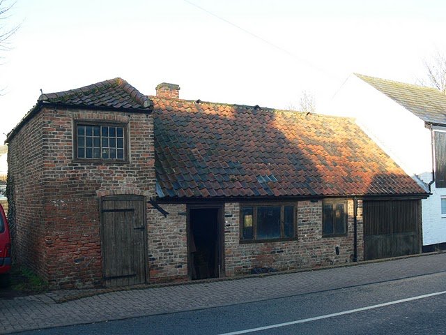
Chain Bridge Forge, Spalding

Chain Bridge Forge is an early 19th-century blacksmith's workshop, on High Street, Spalding, Lincolnshire, England. The forge, on the south bank of the...

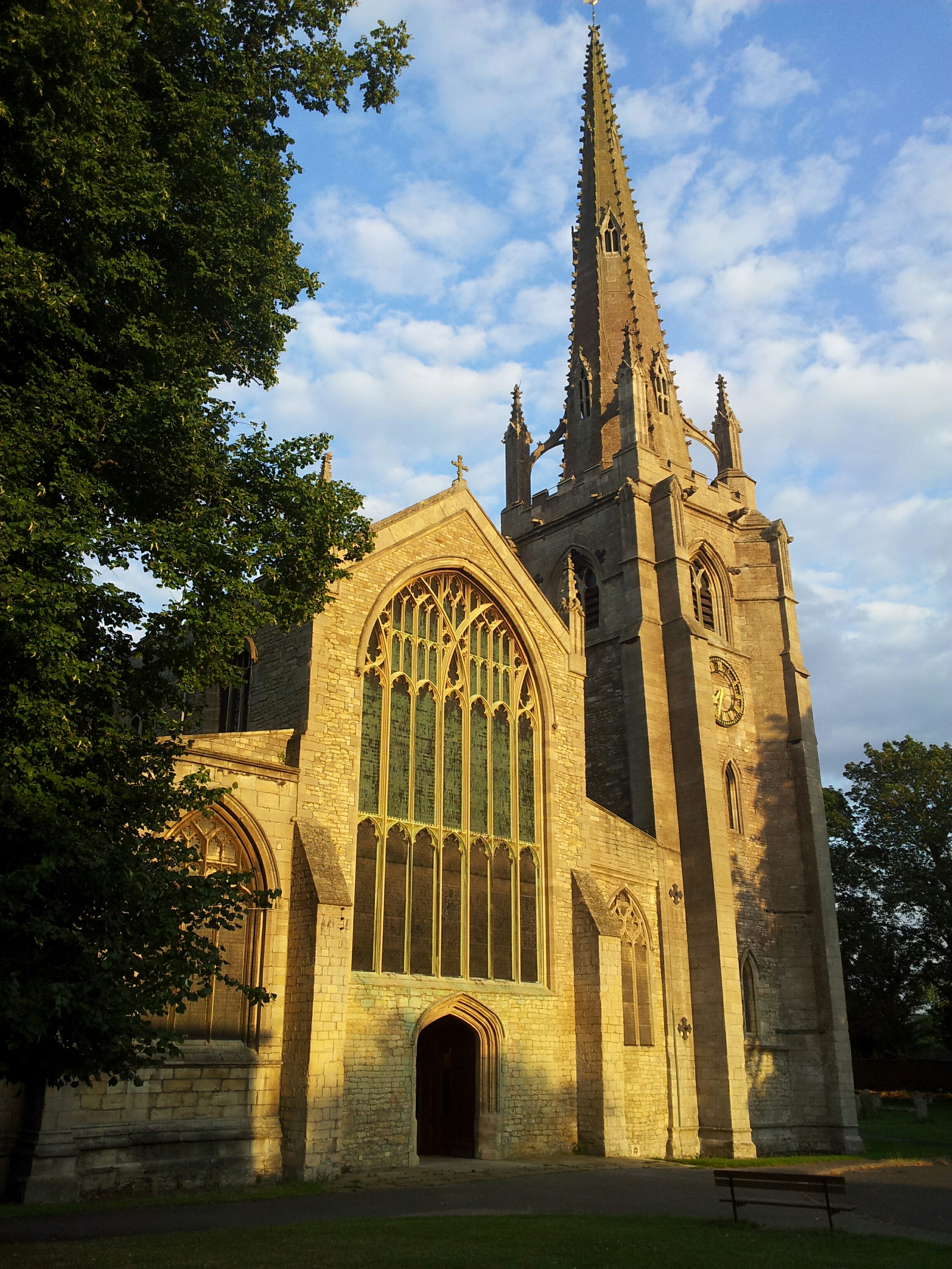
St Mary and St Nicolas, Spalding

The Church of St Mary and St Nicolas is an active Church of England parish church in Spalding, Lincolnshire, England. It was built c. 1284 on the site...

Weston Hills, Lincolnshire

Weston Hills is a hamlet in the civil parish of Weston in the South Holland district of Lincolnshire, England. Weston Hills, a linear village on a north...

Related Videos

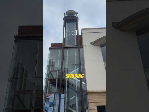
Spalding, Lincolnshire, UK Walking Tour 2021 (Small English Town)

Walking around small English town of Spalding, Lincolnshire.

Black Cat Travel M111 BCT (Ex GX54 AOR)

Black Cat Travel M111 BCT (Ex GX54 AOR)

Our Winter Wonderland Walk

winter #lightshow #walk #spalding #springfield #christmas #england.

Nearby Amenities

Located within 500m of 52.785948,-0.119754
Fulney House
Place: isolated_dwelling
Source: Bing
Lat/Long: 52.7892452/-0.1176518
Low Fulney Estate
Place: hamlet
Source: Bing
Lat/Long: 52.7856189/-0.1209909
Park Home Estate
Place: locality
Source: Bing
Lat/Long: 52.7824811/-0.1198052
Fulney Farm
Historic Place: farm
Source: Bing
Lat/Long: 52.7849514/-0.1210398
Generator Method: photovoltaic
Generator Output Electricity: yes
Generator Source: solar
Generator Type: solar_photovoltaic_panel
Power: generator
Lat/Long: 52.7838162/-0.1224682
Generator Method: photovoltaic
Generator Output Electricity: yes
Generator Source: solar
Generator Type: solar_photovoltaic_panel
Power: generator
Lat/Long: 52.7836373/-0.1224929
Butters Factory Shop
Addr City: Spalding
Addr Postcode: PE12 6EH
Addr Street: Kellet Gate
Opening Hours: Mo-Fr 09:00-17:00, Sa 09:00-14:00, Su 10:00-14:00
Payment Cash: yes
Payment Debit Cards: yes
Shop: garden_centre
Lat/Long: 52.7836607/-0.1231181
Entrance: yes
Lat/Long: 52.7835698/-0.1232921
Flamingo Plants
Addr City: Spalding
Addr Postcode: PE12 6EH
Addr Street: Kellet Gate
Man Made: works
Product: plants
Lat/Long: 52.7842268/-0.1216296
The data included in this document is from www.openstreetmap.org. The data is made available under ODbL.

Have you been to Low Fulney?

Leave your review of Low Fulney below (or comments, questions and feedback).