Fulney, Low

Settlement in Lincolnshire South Holland

England

Fulney, Low

A field of pumpkins east of Spalding
A field of pumpkins east of Spalding Credit: Richard Humphrey

Fulney is a small village located in the district of South Holland, within the county of Lincolnshire, in eastern England. Situated near the banks of the River Welland, Fulney is part of the civil parish of Spalding. The village is primarily residential, with a population of around 800 people.

Known for its picturesque countryside and tranquil atmosphere, Fulney offers a charming rural setting. The surrounding landscape is dominated by lush green fields, and the area benefits from a mild climate, characterized by warm summers and mild winters.

Fulney is within close proximity to the bustling market town of Spalding, which provides residents with a range of amenities, including shopping centers, supermarkets, schools, and healthcare facilities. The village is well-connected to other parts of Lincolnshire and beyond, with good transportation links, including a nearby railway station and easy access to major road networks.

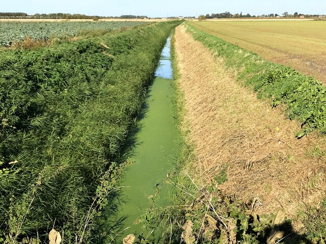
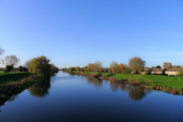
In terms of attractions, Fulney benefits from its proximity to the River Welland, which offers opportunities for fishing and boating enthusiasts. The village also boasts several quaint pubs and restaurants, serving traditional English cuisine and providing a friendly local atmosphere.

Overall, Fulney is a peaceful and idyllic village, perfect for those seeking a tranquil rural lifestyle, while still being within reach of essential amenities and nearby towns.

If you have any feedback on the listing, please let us know in the comments section below.

Fulney, Low Images

Images are sourced within 2km of 52.785948/-0.119754 or Grid Reference TF2622. Thanks to Geograph Open Source API. All images are credited.

A field of pumpkins east of Spalding
A crop of pumpkins near Western Hills, Spalding
Wheat Mere Drain near Western Hills, Spalding
Gamlyn's Almshouses, Spalding Listed Grade II. "An almshouse for twenty two persons was endowed in 1590 [Listed Buildings site says 1501] by Sir Matthew Gamlyn. These almshouses are a rebuilding of those original almshouses. They were built in 1843-4" <span class="nowrap"><a title="https://historicengland.org.uk/listing/the-list/list-entry/1064003?section=official-listing" rel="nofollow ugc noopener" href="https://historicengland.org.uk/listing/the-list/list-entry/1064003?section=official-listing">Link</a><img style="margin-left:2px;" alt="External link" title="External link - shift click to open in new window" src="https://s1.geograph.org.uk/img/external.png" width="10" height="10"/></span>
Gamlyn's Almshouses, Spalding
Listed Grade II. "An almshouse for twenty two persons was endowed in 1590 [Listed Buildings site says 1501] by Sir Matthew Gamlyn. These almshouses are a rebuilding of those original almshouses. They were built in 1843-4" LinkExternal link
Coronation Channel, Spalding A wide channel diverting most of the Welland's water around the east side of Spalding was completed in 1953, following the severe floods of 1947.
Coronation Channel, Spalding
A wide channel diverting most of the Welland's water around the east side of Spalding was completed in 1953, following the severe floods of 1947.
River Welland from Double Street, Spalding A very muddy-looking Welland can be seen here at the end of winter, with houses of the High Street on the eastern bank.
River Welland from Double Street, Spalding
A very muddy-looking Welland can be seen here at the end of winter, with houses of the High Street on the eastern bank.
Pair of cottages The two cottages reflected in the River Welland are numbers 69 and 71 Albion Street, and are listed grade II by Historic England - <span class="nowrap"><a title="https://historicengland.org.uk/listing/the-list/list-entry/1063990?section=official-list-entry" rel="nofollow ugc noopener" href="https://historicengland.org.uk/listing/the-list/list-entry/1063990?section=official-list-entry">Link</a><img style="margin-left:2px;" alt="External link" title="External link - shift click to open in new window" src="https://s1.geograph.org.uk/img/external.png" width="10" height="10"/></span>
Pair of cottages
The two cottages reflected in the River Welland are numbers 69 and 71 Albion Street, and are listed grade II by Historic England - LinkExternal link
Footbridge over the Welland The Albion Street Bridge is a few tens of metres downstream from the site of the historic chain bridge.  The Welland here is calm, flow stilled by the great sluice at Fulney Lock.
Footbridge over the Welland
The Albion Street Bridge is a few tens of metres downstream from the site of the historic chain bridge. The Welland here is calm, flow stilled by the great sluice at Fulney Lock.
Albion Street Bridge Footbridge over the Welland, between Commercial Road and Albion Street (see also <a href="https://www.geograph.org.uk/photo/7373336">TF2523 : Footbridge over the Welland</a>).  At the far end is the grade II Langtoft House.
Albion Street Bridge
Footbridge over the Welland, between Commercial Road and Albion Street (see also TF2523 : Footbridge over the Welland). At the far end is the grade II Langtoft House.
Albion Street Bridge from Commercial Road See also <a href="https://www.geograph.org.uk/photo/7373336">TF2523 : Footbridge over the Welland</a>.
Albion Street Bridge from Commercial Road
The River Welland Looking downstream from the Albion Street footbridge (<a href="https://www.geograph.org.uk/photo/7373336">TF2523 : Footbridge over the Welland</a>). The Welland here is calm, flow stilled by the great sluice at Fulney Lock.  Most of the trees are Lime trees.
The River Welland
Looking downstream from the Albion Street footbridge (TF2523 : Footbridge over the Welland). The Welland here is calm, flow stilled by the great sluice at Fulney Lock. Most of the trees are Lime trees.
The River Welland Looking upstream from the Albion Street footbridge (<a href="https://www.geograph.org.uk/photo/7373336">TF2523 : Footbridge over the Welland</a>). The Welland here is calm, flow stilled by the great sluice at Fulney Lock.  The trees are a mixture of Willow and Lime trees. The distant tower is the hose tower of the former fire station in Double Street.
The River Welland
Looking upstream from the Albion Street footbridge (TF2523 : Footbridge over the Welland). The Welland here is calm, flow stilled by the great sluice at Fulney Lock. The trees are a mixture of Willow and Lime trees. The distant tower is the hose tower of the former fire station in Double Street.
Footbridge and Welland The Albion Street footbridge (<a href="https://www.geograph.org.uk/photo/7373336">TF2523 : Footbridge over the Welland</a>) over the River Welland seen from Albion Street.
Footbridge and Welland
The Albion Street footbridge (TF2523 : Footbridge over the Welland) over the River Welland seen from Albion Street.
Footbridge to Commercial Road Albion Street footbridge crossing the River Welland (see <a href="https://www.geograph.org.uk/photo/7373336">TF2523 : Footbridge over the Welland</a>).
Footbridge to Commercial Road
Albion Street footbridge crossing the River Welland (see TF2523 : Footbridge over the Welland).
PSPO map Public Spaces Protection Orders (PSPOs) were introduced in 2014, to help local authorises tackle anti-social behaviour locally.  They incorporated earlier replace Designated Public Place Orders (DPPOs), Gating Orders and Dog Control Orders into a single framework - in effect allowing local authorities to create what some called "automatic asbo zones" with sweeping powers.

What was intended when the legislation was introduced was that these would be put in place around night clubs or problematic pubs.  What local authorities actually did was to envelope their entire districts in them.  This map seems to date from after 2017, when councils were reminded that zones had to delineate "public" spaces, that is areas utilised for social or commercial activities, not purely residential. It seems more proportionate than the first designation. Interestingly there is no mention of dog control - but the council has separate by-laws covering fouling. They refer all complaints of aggressive dogs to the Police.  The council describe the order here: <span class="nowrap"><a title="https://www.sholland.gov.uk/pspo" rel="nofollow ugc noopener" href="https://www.sholland.gov.uk/pspo">Link</a><img style="margin-left:2px;" alt="External link" title="External link - shift click to open in new window" src="https://s1.geograph.org.uk/img/external.png" width="10" height="10"/></span>.
PSPO map
Public Spaces Protection Orders (PSPOs) were introduced in 2014, to help local authorises tackle anti-social behaviour locally. They incorporated earlier replace Designated Public Place Orders (DPPOs), Gating Orders and Dog Control Orders into a single framework - in effect allowing local authorities to create what some called "automatic asbo zones" with sweeping powers. What was intended when the legislation was introduced was that these would be put in place around night clubs or problematic pubs. What local authorities actually did was to envelope their entire districts in them. This map seems to date from after 2017, when councils were reminded that zones had to delineate "public" spaces, that is areas utilised for social or commercial activities, not purely residential. It seems more proportionate than the first designation. Interestingly there is no mention of dog control - but the council has separate by-laws covering fouling. They refer all complaints of aggressive dogs to the Police. The council describe the order here: LinkExternal link.
The London Plane Tree on the bank There are two trees in this image.  The large London Plane  central to the view, and the smaller Lime to the left.
The London Plane Tree on the bank
There are two trees in this image. The large London Plane central to the view, and the smaller Lime to the left.
Row of Specimen Trees The row of London Plane and  lime trees along the riverbank on Commercial Road.  The nearest is the tree seen in <a href="https://www.geograph.org.uk/photo/7373536">TF2523 : The London Plane Tree on the bank</a>.
Row of Specimen Trees
The row of London Plane and lime trees along the riverbank on Commercial Road. The nearest is the tree seen in TF2523 : The London Plane Tree on the bank.
Lower tree trunk The trunk of the great Tree seen in <a href="https://www.geograph.org.uk/photo/7373536">TF2523 : The London Plane Tree on the bank</a>.
Lower tree trunk
The trunk of the great Tree seen in TF2523 : The London Plane Tree on the bank.
Show me another place!

Fulney, Low is located at Grid Ref: TF2622 (Lat: 52.785948, Lng: -0.119754)

Division: Parts of Holland

Administrative County: Lincolnshire

District: South Holland

Police Authority: Lincolnshire

What 3 Words

///daring.strumming.snipe. Near Spalding, Lincolnshire

Nearby Locations

Low Fulney Fulney, Low

Related Wikis

Gleed Girls' Technology College

Gleed Girls' Technology College was a secondary school on Neville Avenue in Spalding, Lincolnshire, England. It opened on 28 April 1941 as Spalding The...

Gleed Boys' School

Gleed Boys' School was a secondary school for boys aged 11 to 16, in Spalding, Lincolnshire, England. The school has been merged with Gleed Girls' Technology...

Spalding Academy, Lincolnshire

Spalding Academy, formerly Sir John Gleed School, is a mixed secondary school and sixth form in Spalding, Lincolnshire, England. The Sir John Gleed School...

Weston railway station (Lincolnshire)

Weston railway station was a station in Weston, Lincolnshire on the Midland and Great Northern Joint Railway, Built by the Norwich and Spalding Railway...

Nearby Amenities

Located within 500m of 52.785948,-0.119754
Fulney House
Place: isolated_dwelling
Source: Bing
Lat/Long: 52.7892452/-0.1176518
Low Fulney Estate
Place: hamlet
Source: Bing
Lat/Long: 52.7856189/-0.1209909
Park Home Estate
Place: locality
Source: Bing
Lat/Long: 52.7824811/-0.1198052
Fulney Farm
Historic Place: farm
Source: Bing
Lat/Long: 52.7849514/-0.1210398
Generator Method: photovoltaic
Generator Output Electricity: yes
Generator Source: solar
Generator Type: solar_photovoltaic_panel
Power: generator
Lat/Long: 52.7838162/-0.1224682
Generator Method: photovoltaic
Generator Output Electricity: yes
Generator Source: solar
Generator Type: solar_photovoltaic_panel
Power: generator
Lat/Long: 52.7836373/-0.1224929
Butters Factory Shop
Addr City: Spalding
Addr Postcode: PE12 6EH
Addr Street: Kellet Gate
Opening Hours: Mo-Fr 09:00-17:00, Sa 09:00-14:00, Su 10:00-14:00
Payment Cash: yes
Payment Debit Cards: yes
Shop: garden_centre
Lat/Long: 52.7836607/-0.1231181
Entrance: yes
Lat/Long: 52.7835698/-0.1232921
Flamingo Plants
Addr City: Spalding
Addr Postcode: PE12 6EH
Addr Street: Kellet Gate
Man Made: works
Product: plants
Lat/Long: 52.7842268/-0.1216296
The data included in this document is from www.openstreetmap.org. The data is made available under ODbL.

Have you been to Fulney, Low?

Leave your review of Fulney, Low below (or comments, questions and feedback).