Beamhurst

Settlement in Staffordshire East Staffordshire

England

Beamhurst

Did the Earth Move for you ? This major distribution centre shines like a beacon, illuminating the A50 near Uttoxeter at night. It occupies a sizeable portion of this square.The A50 trunk road was not yet constructed in the 1940's and does not appear on the O/S Map for that period.
Did the Earth Move for you ? Credit: Roger May

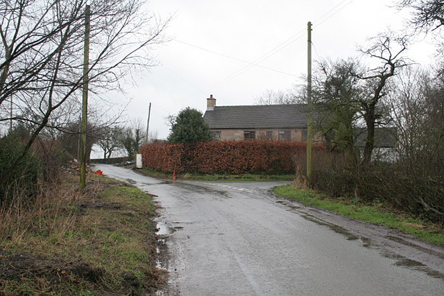
Beamhurst is a small village located in the county of Staffordshire, England. Situated approximately 7 miles east of Uttoxeter, it falls within the administrative district of East Staffordshire. With a population of around 200 residents, Beamhurst is a close-knit community that offers a peaceful and rural setting.

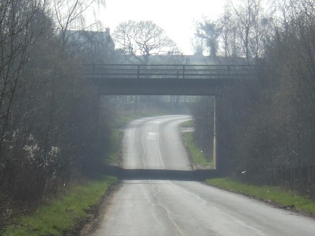
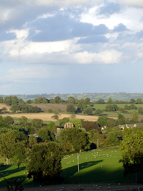
The village is known for its picturesque countryside, characterized by rolling hills, charming farmlands, and tranquil meadows. It is surrounded by the beauty of the Staffordshire Moorlands and benefits from the proximity to the River Blythe, which flows nearby. This natural setting attracts nature enthusiasts, walkers, and cyclists seeking to explore the area's scenic trails and wildlife.

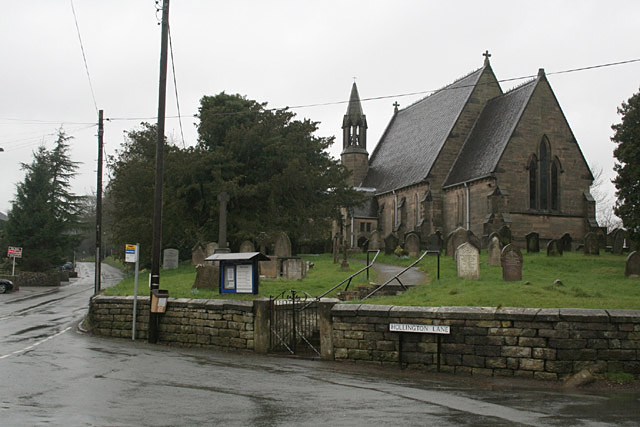
Beamhurst has a rich history, with evidence of human settlement dating back to the Roman era. The village is home to several historic buildings, including St. Mary's Church, a Grade II listed structure that dates back to the 12th century. The church features stunning architectural details and serves as a reminder of the village's long-standing heritage.

Although Beamhurst is a small village, it offers some amenities to its residents. There is a community hall that hosts various events and gatherings, providing a space for social activities. The village also benefits from its proximity to Uttoxeter, which offers a wider range of services such as schools, healthcare facilities, and shopping opportunities.

Overall, Beamhurst is a charming and idyllic village in Staffordshire, offering a peaceful and rural lifestyle to its residents while being conveniently located near larger towns for additional amenities.

If you have any feedback on the listing, please let us know in the comments section below.

Beamhurst Images

Images are sourced within 2km of 52.92505/-1.914288 or Grid Reference SK0536. Thanks to Geograph Open Source API. All images are credited.

Did the Earth Move for you ? This major distribution centre shines like a beacon, illuminating the A50 near Uttoxeter at night. It occupies a sizeable portion of this square.The A50 trunk road was not yet constructed in the 1940's and does not appear on the O/S Map for that period.
Did the Earth Move for you ?
This major distribution centre shines like a beacon, illuminating the A50 near Uttoxeter at night. It occupies a sizeable portion of this square.The A50 trunk road was not yet constructed in the 1940's and does not appear on the O/S Map for that period.
Upper Nobut Nobbut a little place - a hall, a farm an half-a-dozen cottages
Upper Nobut
Nobbut a little place - a hall, a farm an half-a-dozen cottages
Buildings at Fole Farm This is an old established farm from at least the mid-18th century, improved with new building around 1846.
I am indebted to a former resident of this farm for the information and dates.
Buildings at Fole Farm
This is an old established farm from at least the mid-18th century, improved with new building around 1846. I am indebted to a former resident of this farm for the information and dates.
Fole Bridge - where to next? In practice the main road makes a sharp turn to the left on the other side of the bridge.
Fole Bridge - where to next?
In practice the main road makes a sharp turn to the left on the other side of the bridge.
Broadoak Farm near Bramshall
Townend Farm at Beamhurst Dating probably from the late 17th/early 18th Century.
Townend Farm at Beamhurst
Dating probably from the late 17th/early 18th Century.
JCB World Parts Centre near Uttoxeter JCB can be found at several locations in and near Uttoxeter.
JCB World Parts Centre near Uttoxeter
JCB can be found at several locations in and near Uttoxeter.
Watery Lane near Beamhurst
Hollywood Farm near Beamhurst
Hollington Lane at Stramshall
View towards Toot Hill (marked by the twin trees on the skyline, centre of picture) The name Toot Hill (Toothill, Tut Hill) is widely held to indicate an ancient surveying landmark. This location above the Tean Valley would certainly fit the bill.
View towards Toot Hill (marked by the twin trees on the skyline, centre of picture)
The name Toot Hill (Toothill, Tut Hill) is widely held to indicate an ancient surveying landmark. This location above the Tean Valley would certainly fit the bill.
A50 crossing Fole Lane
Remind me to check my water! I got an unplanned opportunity to take a shot of the A50 near Uttoxeter last week when my radiator sprang a leak and I had to be towed home to Preston.  The light green coloured building on the opposite side of the carriageway is the huge JCB plant, which employs many local people and is the largest source of employment in the area.
Remind me to check my water!
I got an unplanned opportunity to take a shot of the A50 near Uttoxeter last week when my radiator sprang a leak and I had to be towed home to Preston. The light green coloured building on the opposite side of the carriageway is the huge JCB plant, which employs many local people and is the largest source of employment in the area.
JCB World Parts Centre alongside the A50
The junction with the A522 Looking towards the A522 junction beyond which on the skyline is the relatively new JCB parts centre.
The junction with the A522
Looking towards the A522 junction beyond which on the skyline is the relatively new JCB parts centre.
Hollington Lane Hollington Lane is a very minor road running away from the village of Stramshall.
Hollington Lane
Hollington Lane is a very minor road running away from the village of Stramshall.
Hollington Lane Standing near New House Farm looking along a very narrow Hollington Lane.
Hollington Lane
Standing near New House Farm looking along a very narrow Hollington Lane.
Hollington Lane Standing by a very muddy field entrance looking along Hollington Lane on a bright almost cloudless morning.
Hollington Lane
Standing by a very muddy field entrance looking along Hollington Lane on a bright almost cloudless morning.
Show me another place!

Beamhurst is located at Grid Ref: SK0536 (Lat: 52.92505, Lng: -1.914288)

Administrative County: Staffordshire

District: East Staffordshire

Police Authority: Staffordshire

What 3 Words

///inflation.pills.servers. Near Uttoxeter, Staffordshire

Nearby Locations

Beamhurst

Related Wikis

Related Videos

fxhj8bkqnbfxdx bnnmnnhnujju

Limit Future :Amazing design! What do you think? Tag your friends! . Follow:@limitfuture for more! By : @rvnarquitetura .

The New Broom, Checkley, Staffordshire, England 🏴󠁧󠁢󠁥󠁮󠁧󠁿

The New Broom, Checkley, Staffordshire, England 󠁧󠁢󠁥󠁮󠁧󠁿 All prices correct at time of video, April 2019. Fabulous place to ...

Just Stay Quiet A Minute. Oh Sorry Mate. 🤣🐇🐰🎥✅

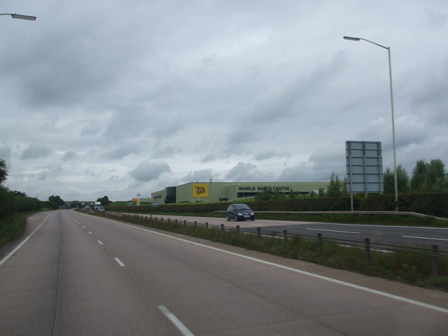
Today we are joined by @PJAudits as we take a look at JCB World Parts Centre, Waterloo Park, A522, Beamhurst, Uttoxeter ST14 ...

Nearby Amenities

Located within 500m of 52.92505,-1.914288
Bus Stop
The Cock Inn
Bus: yes
Naptan AtcoCode: 3800C301000
Naptan Bearing: NW
Naptan CommonName: The Cock Inn
Naptan Indicator: Adj
Naptan Landmark: The Cock Inn
Naptan Street: Stramshall Road
Naptan Verified: no
Public Transport: platform
Source: naptan_import
Lat/Long: 52.922556/-1.9107548
Bus Stop
The Cock Inn
Bus: yes
Naptan AtcoCode: 3800C301001
Naptan Bearing: SE
Naptan CommonName: The Cock Inn
Naptan Indicator: Opp
Naptan Landmark: The Cock Inn
Naptan Street: Beamhurst Lane
Naptan Verified: no
Public Transport: platform
Source: naptan_import
Lat/Long: 52.9224659/-1.9105318
Barrier: cattle_grid
Lat/Long: 52.9225145/-1.9198125
Barrier: stile
Steps: 1
Stile: stepover
Lat/Long: 52.9231487/-1.9147294
Barrier: stile
Steps: 2
Stile: stepover
Lat/Long: 52.9244199/-1.9135251
Restaurant
Restaurant Gilmore
Addr Housename: Strine's Farm
Addr Postcode: ST14 5DZ
Website: http://restaurantgilmore.com
Lat/Long: 52.9234282/-1.9076457
Barrier: stile
Steps: 2
Stile: stepover
Lat/Long: 52.9225383/-1.9105961
Barrier: stile
Steps: 1
Stile: stepover
Lat/Long: 52.9238967/-1.9088738
Ford: yes
Lat/Long: 52.9220004/-1.9103629
The data included in this document is from www.openstreetmap.org. The data is made available under ODbL.

Have you been to Beamhurst?

Leave your review of Beamhurst below (or comments, questions and feedback).