Ashy Geo
Coastal Feature, Headland, Point in Caithness
Scotland
Ashy Geo
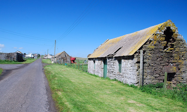
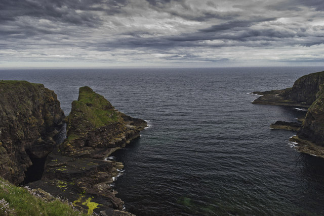
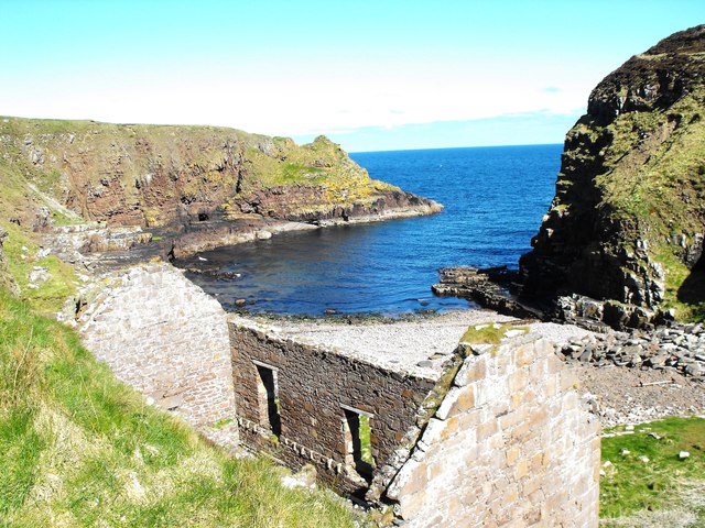
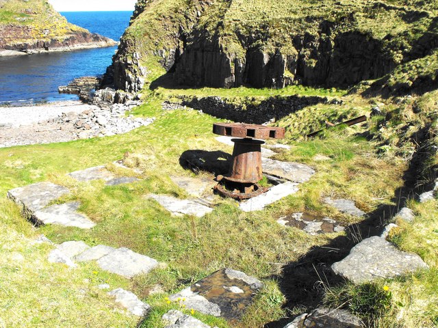
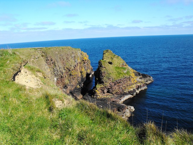
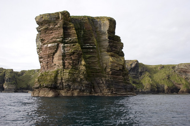
Ashy Geo is a prominent coastal feature located in Caithness, a county in the northernmost part of Scotland. Situated on the east coast, Ashy Geo is known for being a stunning headland that juts out into the North Sea. With its striking cliffs and rugged terrain, it is a popular attraction for locals and tourists alike.
The name "Ashy Geo" originates from the Old Norse language, with "geo" meaning a narrow inlet or cove. This is an accurate description of the geographical formation found at Ashy Geo, as it features a deep, narrow inlet carved out by the relentless action of the sea over thousands of years.
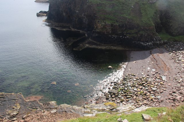
The headland itself is composed of sedimentary rocks, predominantly sandstone and limestone, which have been eroded by the powerful waves crashing against the cliffs. This erosion has created dramatic sea caves and arches that are a sight to behold.
Visitors to Ashy Geo can enjoy breathtaking views of the surrounding coastline and the vast expanse of the North Sea. The area is also home to a diverse range of wildlife, including seabirds nesting on the cliffs and seals basking on the rocks below.
Due to its exposed location, Ashy Geo can be subject to harsh weather conditions, with strong winds and rough seas being common. Therefore, caution should be exercised when exploring the headland, especially near the cliffs and the edge of the inlet.
In summary, Ashy Geo in Caithness is a stunning headland that offers visitors a chance to witness the raw power of the North Sea. With its captivating geological formations and abundant wildlife, it is a must-visit destination for nature enthusiasts and photography enthusiasts alike.
If you have any feedback on the listing, please let us know in the comments section below.
Ashy Geo Images
Images are sourced within 2km of 58.388273/-3.1015145 or Grid Reference ND3544. Thanks to Geograph Open Source API. All images are credited.


Ashy Geo is located at Grid Ref: ND3544 (Lat: 58.388273, Lng: -3.1015145)
Unitary Authority: Highland
Police Authority: Highlands and Islands
What 3 Words
///below.eagle.greyhound. Near Wick, Highland
Nearby Locations
Related Wikis

Sarclet
Sarclet is a remote clifftop crofting township, situated on the east coast of Caithness, lying slightly north of Loch Sarclet in the Scottish Highlands...

Thrumster, Caithness
Thrumster is a crofting township on the main A99 road between Wick and Inverness. It is the nearest village to Wick. The transmission mast used to broadcast...
Thrumster railway station
Thrumster was a railway station located at Thrumster, Highland, Scotland between Wick and Lybster. The station building can still be seen alongside the...
Whiterow
Whiterow is a small coastal hamlet, on the east coast of Caithness, lying 1 mile southeast of Wick, Scottish Highlands. It is in the Scottish council area...
Welsh's Crossing Halt railway station
Welsh's Crossing Halt was a railway station located south of Thrumster, Highland between Wick and Lybster. == History == The station was opened as part...

Battle of Tannach
The Battle of Tannach (Blare Tannie or Blar-Tannie, Scottish Gaelic: Tannach Moor) was a Scottish clan battle fought about 3 miles (4.8 km) southwest of...

A99 road
The A99 road is entirely within the former county of Caithness in the Highland of Scotland. It runs generally north/northeast from the A9 at Latheron to...

Ulbster
Ulbster is a scattered crofting hamlet on the eastern coast of Caithness, within the parish of Wick, in the Scottish Highlands, within the Highland Council...
Nearby Amenities
Located within 500m of 58.388273,-3.1015145Have you been to Ashy Geo?
Leave your review of Ashy Geo below (or comments, questions and feedback).