Rough of Warse

Coastal Feature, Headland, Point in Caithness

Scotland

Rough of Warse

Gill's Bay The Ferry Terminal on the North coast to St Margaret's Hope on Orkney
Gill's Bay Credit: G McK

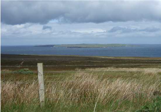
Rough of Warse is a prominent coastal feature located in Caithness, a county in the northernmost part of mainland Scotland. This headland, also referred to as a point, is situated on the east coast of Caithness, jutting out into the North Sea. It is positioned approximately 9 kilometers northeast of the town of Wick.

Rough of Warse is characterized by its rugged and rocky terrain, which extends out into the sea. The headland is formed by layers of sedimentary rocks, primarily sandstone and flagstone, which have been eroded over time by the powerful waves of the North Sea. The result is a dramatic and picturesque landscape, with towering cliffs and jagged rock formations.

The headland is an important site for birdwatching enthusiasts, as it serves as a breeding ground for a variety of seabirds. Species such as kittiwakes, guillemots, and fulmars can be observed nesting on the cliffs during the breeding season. Additionally, Rough of Warse is home to a diverse range of marine life, including seals, dolphins, and occasionally whales.

Access to Rough of Warse is limited due to the treacherous nature of the terrain, with steep cliffs and strong currents posing a safety risk to visitors. However, the headland can be admired from a distance, offering stunning views of the surrounding coastline and the North Sea. It is a popular spot for photography, nature walks, and enjoying the raw beauty of the Scottish coastline.

If you have any feedback on the listing, please let us know in the comments section below.

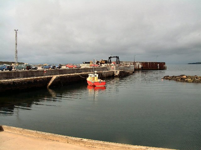
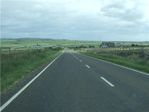
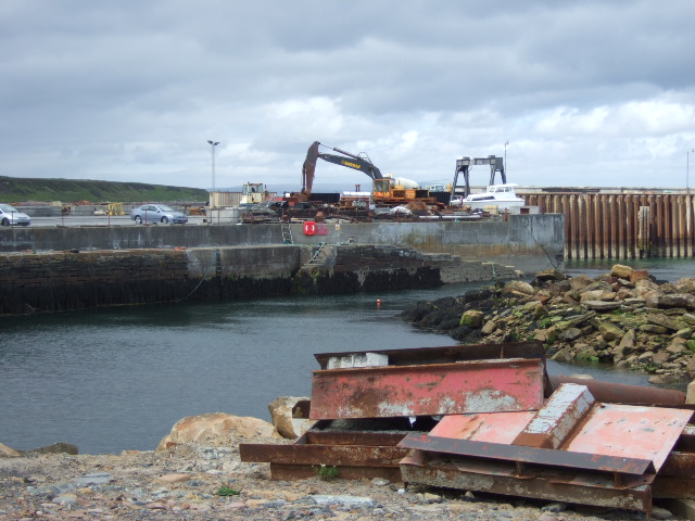
Rough of Warse Images

Images are sourced within 2km of 58.638948/-3.1555845 or Grid Reference ND3372. Thanks to Geograph Open Source API. All images are credited.

Gill's Bay The Ferry Terminal on the North coast to St Margaret's Hope on Orkney
Gill's Bay
The Ferry Terminal on the North coast to St Margaret's Hope on Orkney
John O'Groats Youth Hostel, Canisbay The Youth Hostel is small and cosy a wee bit back from John O' Groats.
John O'Groats Youth Hostel, Canisbay
The Youth Hostel is small and cosy a wee bit back from John O' Groats.
Canisbay Church
Canisbay Church
Gill's Bay Ferry Terminal The vehicle ferry to South Ronaldsay leaves here every hour.
Gill's Bay Ferry Terminal
The vehicle ferry to South Ronaldsay leaves here every hour.
Gills Bay A view looking north over the information boards at the parking area above Gills Bay. The uninhabited Island of Stroma is visible in the distance.
Gills Bay
A view looking north over the information boards at the parking area above Gills Bay. The uninhabited Island of Stroma is visible in the distance.
Rough of Warse A view looking down onto seals hauled out on the rocks of the Rough of Warse in Gills Bay, from the cliff near the parking area off the A836..
Rough of Warse
A view looking down onto seals hauled out on the rocks of the Rough of Warse in Gills Bay, from the cliff near the parking area off the A836..
Canisbay Free Evangelical Church
Approach to Gills On A846 from Mey.
Approach to Gills
On A846 from Mey.
View towards Stroma island In the Pentland Firth; from near Gills.
View towards Stroma island
In the Pentland Firth; from near Gills.
Junction for Gills Bay ferry terminal Off A836.
Junction for Gills Bay ferry terminal
Off A836.
'The Cottage' House on A836, near access to Gills Bay ferry terminal.
'The Cottage'
House on A836, near access to Gills Bay ferry terminal.
Development construction at Gills Bay Improvements to the ferry terminal, for boats to South Ronaldsay (Orkney), under way. See <span class="nowrap"><a title="http://www.caithness.org/atoz/gills/index.htm" rel="nofollow ugc noopener" href="http://www.caithness.org/atoz/gills/index.htm">Link</a><img style="margin-left:2px;" alt="External link" title="External link - shift click to open in new window" src="https://s1.geograph.org.uk/img/external.png" width="10" height="10"/></span> - since 2001 the shortest/safest Pentland Firth crossing.
Development construction at Gills Bay
Improvements to the ferry terminal, for boats to South Ronaldsay (Orkney), under way. See LinkExternal link - since 2001 the shortest/safest Pentland Firth crossing.
Sailings timetable For the Pentland Ferry between Gills Bay and St Margarets Hope (South Ronaldsay, Orkney).
Sailings timetable
For the Pentland Ferry between Gills Bay and St Margarets Hope (South Ronaldsay, Orkney).
Entrance to Canisbay Church of Scotland Off A836.
Entrance to Canisbay Church of Scotland
Off A836.
Canisbay church and churchyard
A 400 yr old gravestone In Carisbay churchyard, Dated 1601.
A 400 yr old gravestone
In Carisbay churchyard, Dated 1601.
Plaque above old gravestone Recounting the original inscription from a gravestone in Carisbay churchyard dated 19th May 1601.
Plaque above old gravestone
Recounting the original inscription from a gravestone in Carisbay churchyard dated 19th May 1601.
Kirkstyle This ruin on the north side of the Canisbay graveyard could perhaps be part of the old Slayel Distillery, which functioned somewhere along this stretch of coast.
Kirkstyle
This ruin on the north side of the Canisbay graveyard could perhaps be part of the old Slayel Distillery, which functioned somewhere along this stretch of coast.
Show me another place!

Rough of Warse is located at Grid Ref: ND3372 (Lat: 58.638948, Lng: -3.1555845)

Unitary Authority: Highland

Police Authority: Highlands and Islands

What 3 Words

///robot.regularly.ledge. Near John o' Groats, Highland

Related Wikis

Gills, Caithness

Galltair is a remote coastal, scattered crofting township and former fishing village, on the north coast of Caithness, Scottish Highlands, in the Scottish...

Gills Bay

Gills Bay, which is situated about 3 mi (4.8 km) west of John o' Groats with the community of Gills close by, has one of the longest stretches of low-lying...

Canisbay Parish Church

Canisbay Parish Church is a Church of Scotland church in Canisbay, Scotland, that dates back to the early 1600s and is the most northernly church on mainland...

Canisbay

Canisbay is a rural hamlet located about one mile (1.5 kilometres) southwest of Huna and two and a half miles (four kilometres) southwest of John o' Groats...

Nearby Amenities

Located within 500m of 58.638948,-3.1555845
Source: PGS
Lat/Long: 58.6372271/-3.156575
Source: PGS
Lat/Long: 58.6372931/-3.1580531
Source: PGS
Lat/Long: 58.6376159/-3.1584986
Source: PGS
Lat/Long: 58.6376931/-3.159054
Source: PGS
Lat/Long: 58.6378933/-3.1599966
Source: PGS
Lat/Long: 58.6396325/-3.162102
Source: PGS
Lat/Long: 58.6385741/-3.1627543
Source: PGS
Lat/Long: 58.6386384/-3.1633397
Source: PGS
Lat/Long: 58.6383493/-3.1477773
Source: PGS
Lat/Long: 58.6379024/-3.1501935
Source: PGS
Lat/Long: 58.6373947/-3.153814
Leisure: slipway
Lat/Long: 58.6381763/-3.1616314
Ferry Terminal
Gills Bay
Ferry: yes
Public Transport: station
Wikidata: Q24677728
Lat/Long: 58.6392153/-3.1613074
Toilets
Lat/Long: 58.6382865/-3.1618631
Cafe
Lat/Long: 58.6383451/-3.1618254
Gills Bay
Natural: bay
Wikidata: Q5562434
Wikipedia: en:Gills Bay
Lat/Long: 58.6432779/-3.1535912
Ferry Terminal
Pentland Ferries
Ferry: yes
Public Transport: station
Lat/Long: 58.6383114/-3.1617899
Power: pole
Lat/Long: 58.6346004/-3.15755
Power: pole
Lat/Long: 58.6347103/-3.1582526
Power: pole
Lat/Long: 58.6348942/-3.1591541
Power: pole
Lat/Long: 58.6351108/-3.1600109
Power: pole
Lat/Long: 58.6360979/-3.1620433
Power: pole
Lat/Long: 58.6367678/-3.1622687
Power: pole
Lat/Long: 58.6376217/-3.1625367
Power: pole
Lat/Long: 58.63558/-3.1608555
Power: pole
Lat/Long: 58.635673/-3.1594099
Power: pole
Lat/Long: 58.6357555/-3.1580698
Power: pole
Lat/Long: 58.6358463/-3.1566079
Power: pole
Lat/Long: 58.6359161/-3.1552719
Power: pole
Lat/Long: 58.6360154/-3.1536923
Power: pole
Lat/Long: 58.6361/-3.1525756
Power: pole
Lat/Long: 58.6361718/-3.1513289
Power: pole
Lat/Long: 58.6362627/-3.149928
Waste Basket
Lat/Long: 58.6368623/-3.1557083
The data included in this document is from www.openstreetmap.org. The data is made available under ODbL.

Have you been to Rough of Warse?

Leave your review of Rough of Warse below (or comments, questions and feedback).