Beam Bridge

Settlement in Somerset Somerset West and Taunton

England

Beam Bridge

Dobrée Park, Rockwell Green
Dobrée Park, Rockwell Green Credit: Jonathan Thacker

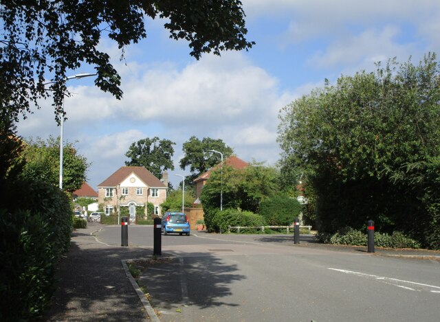
Beam Bridge is a small village located in the county of Somerset, England. Nestled in the picturesque countryside, it is situated approximately 6 miles west of the bustling town of Taunton. The village is named after the historic beam bridge that spans the nearby River Tone, which has played a significant role in the village's history.

The village itself has a charming and tranquil atmosphere, with a population of around 500 residents. It is characterized by its traditional stone houses, quaint cottages, and well-maintained gardens. The community is close-knit, with a strong sense of local pride and a friendly atmosphere that welcomes visitors.

Beam Bridge offers a range of amenities for its residents, including a local pub, a village hall, and a primary school. The village hall serves as a hub for social events and community gatherings, hosting various activities and clubs throughout the year. The primary school provides education for children in the area, ensuring a convenient and accessible learning environment for families.

Surrounded by scenic countryside, Beam Bridge is an ideal location for nature enthusiasts and outdoor enthusiasts. The nearby Quantock Hills and Exmoor National Park offer stunning landscapes and a plethora of walking and cycling trails to explore. Additionally, the River Tone provides opportunities for fishing and boating.

In conclusion, Beam Bridge is a charming village in Somerset, offering a peaceful and idyllic lifestyle for its residents. With its rich history, beautiful surroundings, and strong community spirit, it is a place that truly captures the essence of rural England.

If you have any feedback on the listing, please let us know in the comments section below.

Beam Bridge Images

Images are sourced within 2km of 50.965683/-3.27153 or Grid Reference ST1019. Thanks to Geograph Open Source API. All images are credited.

Dobrée Park, Rockwell Green
Layby on the A38, heading east
Entrance to new housing estate being built on the A38
Direction Sign – Signpost near White Ball in Sampford Arundel parish Located on the west side of a crossroads northeast of White Ball in Sampford Arundel parish. 4 arms and pyramid finial. See also <a title="https://www.geograph.org.uk/photo/2154974" href="https://www.geograph.org.uk/photo/2154974">Link</a>.

Milestone Society National ID: SO_ST1019A
Direction Sign – Signpost near White Ball in Sampford Arundel parish
Located on the west side of a crossroads northeast of White Ball in Sampford Arundel parish. 4 arms and pyramid finial. See also Link. Milestone Society National ID: SO_ST1019A
Sampford Farm, Sampford Arundel
Railway bridge over the former A38
Sampford Arundel Primary School
Churchyard gates, Sampford Arundel Commemorate Queen Victoria's Diamond Jubilee 1897 <span class="nowrap"><a title="https://historicengland.org.uk/listing/the-list/list-entry/1344595?section=official-list-entry" rel="nofollow ugc noopener" href="https://historicengland.org.uk/listing/the-list/list-entry/1344595?section=official-list-entry">Link</a><img style="margin-left:2px;" alt="External link" title="External link - shift click to open in new window" src="https://s1.geograph.org.uk/img/external.png" width="10" height="10"/></span>
Churchyard gates, Sampford Arundel
Commemorate Queen Victoria's Diamond Jubilee 1897 LinkExternal link
War memorial, Sampford Arundel Erected in 1921 <span class="nowrap"><a title="https://historicengland.org.uk/listing/the-list/list-entry/1436144?section=official-list-entry" rel="nofollow ugc noopener" href="https://historicengland.org.uk/listing/the-list/list-entry/1436144?section=official-list-entry">Link</a><img style="margin-left:2px;" alt="External link" title="External link - shift click to open in new window" src="https://s1.geograph.org.uk/img/external.png" width="10" height="10"/></span>
War memorial, Sampford Arundel
Erected in 1921 LinkExternal link
Church of the Holy Cross, Sampford Arundel The tower dates from the fifteenth century, most of the rest was rebuilt in the 1870s <span class="nowrap"><a title="https://historicengland.org.uk/listing/the-list/list-entry/1178017?section=official-list-entry" rel="nofollow ugc noopener" href="https://historicengland.org.uk/listing/the-list/list-entry/1178017?section=official-list-entry">Link</a><img style="margin-left:2px;" alt="External link" title="External link - shift click to open in new window" src="https://s1.geograph.org.uk/img/external.png" width="10" height="10"/></span>
Church of the Holy Cross, Sampford Arundel
The tower dates from the fifteenth century, most of the rest was rebuilt in the 1870s LinkExternal link
The churchyard, Sampford Arundel
Barn at Sampford Arundel
Grass field near Beam Bridge
Abandoned route of the A38, Beam Bridge
A troubled tower All Saints church is not that old but the wooden shingles on the spire have been causing concerns. The local community has been trying to raise £20,000 for repairs.
A troubled tower
All Saints church is not that old but the wooden shingles on the spire have been causing concerns. The local community has been trying to raise £20,000 for repairs.
West end of All Saints church, Rockwell Green The end wall and the shodows of the neighbours.
West end of All Saints church, Rockwell Green
The end wall and the shodows of the neighbours.
Old Milestone east of Beam Bridge, against old Toll House Metal plate attached to stone post by the UC road, in parish of Sampford Arundel (Taunton Deane
District), Beam Bridge, beside old toll house, against rendered wall, on East side of road. Taunton roll top iron plate, erected by the Taunton turnpike trust in the 19th century. An earlier photograph can be found here <a title="https://www.geograph.org.uk/photo/6035573" href="https://www.geograph.org.uk/photo/6035573">Link</a>.

Inscription reads:-
TAUNTON
9
MILES 

Somerset HER listed. HER number: 37673 <span class="nowrap"><a title="https://www.heritagegateway.org.uk/Gateway/Results_Single.aspx?uid=37673&resourceID=100" rel="nofollow ugc noopener" href="https://www.heritagegateway.org.uk/Gateway/Results_Single.aspx?uid=37673&resourceID=100">Link</a><img style="margin-left:2px;" alt="External link" title="External link - shift click to open in new window" src="https://s1.geograph.org.uk/img/external.png" width="10" height="10"/></span>

Milestone Society National ID: SO_TAEX09
Old Milestone east of Beam Bridge, against old Toll House
Metal plate attached to stone post by the UC road, in parish of Sampford Arundel (Taunton Deane District), Beam Bridge, beside old toll house, against rendered wall, on East side of road. Taunton roll top iron plate, erected by the Taunton turnpike trust in the 19th century. An earlier photograph can be found here Link. Inscription reads:- TAUNTON 9 MILES Somerset HER listed. HER number: 37673 LinkExternal link Milestone Society National ID: SO_TAEX09
Old Milestone in Sampford Arundel parish, west of Beam Bridge Metal plate attached to concrete post by the UC road, in parish of SAMPFORD ARUNDEL (TAUNTON DEANE District), West of Beam Bridge, in bank, on West side of road. Wiveliscombe iron plate, erected by the Wiveliscombe turnpike trust in the 19th century.

Inscription reads:-
WIVELISCOMBE
6
MILES

Grade II listed.
List Entry Number: 1344594 <span class="nowrap"><a title="https://historicengland.org.uk/listing/the-list/list-entry/1344594" rel="nofollow ugc noopener" href="https://historicengland.org.uk/listing/the-list/list-entry/1344594">Link</a><img style="margin-left:2px;" alt="External link" title="External link - shift click to open in new window" src="https://s1.geograph.org.uk/img/external.png" width="10" height="10"/></span>

Milestone Society National ID: SO_WVSP06.
Old Milestone in Sampford Arundel parish, west of Beam Bridge
Metal plate attached to concrete post by the UC road, in parish of SAMPFORD ARUNDEL (TAUNTON DEANE District), West of Beam Bridge, in bank, on West side of road. Wiveliscombe iron plate, erected by the Wiveliscombe turnpike trust in the 19th century. Inscription reads:- WIVELISCOMBE 6 MILES Grade II listed. List Entry Number: 1344594 LinkExternal link Milestone Society National ID: SO_WVSP06.
Show me another place!

Beam Bridge is located at Grid Ref: ST1019 (Lat: 50.965683, Lng: -3.27153)

Administrative County: Somerset

District: Somerset West and Taunton

Police Authority: Avon and Somerset

What 3 Words

///hometown.diverts.continues. Near Milverton, Somerset

Nearby Locations

Beam Bridge Pinksmoor

Related Wikis

Sampford Arundel

Sampford Arundel is a village and civil parish in Somerset, England. It is situated near Wellington and 10 miles (16.1 km) south west of Taunton. The village...

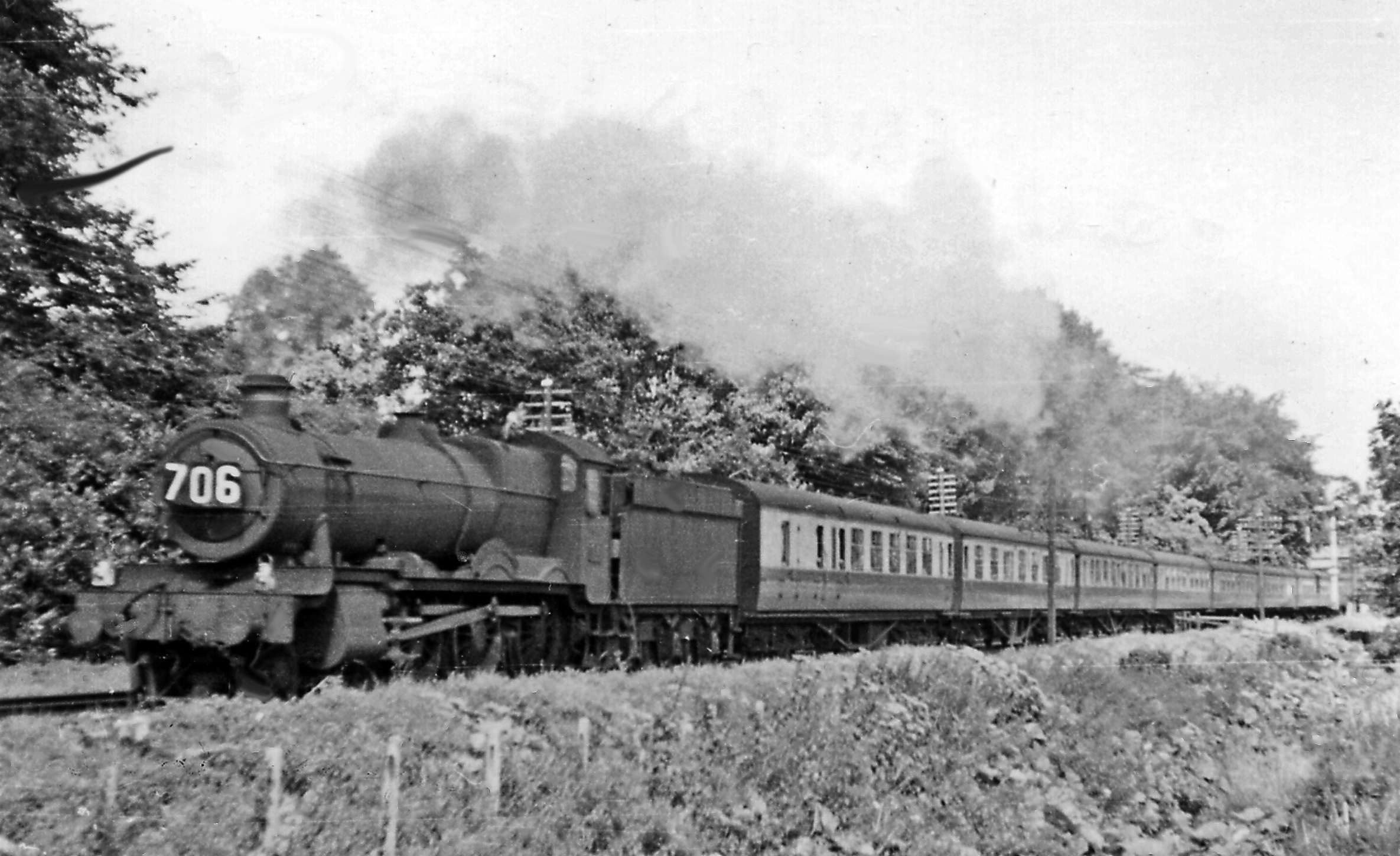
Wellington Bank, Somerset

Wellington Bank is a steep railway embankment and associated climb located on the Bristol to Exeter line, that climbs from just northeast of Wellington...

Thorne St Margaret

Thorne St Margaret is a village in the civil parish of Wellington Without in the Taunton Deane district of Somerset, England. It is situated 3 miles west...

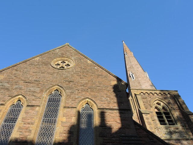
Church of St Margaret, Thorne St Margaret

The Anglican Church of St Margaret in Thorne St Margaret, Somerset, England was built in the 15th century. It is a Grade II* listed building. == History... ==

Rockwell Green

Rockwell Green is a village near Wellington, in the Somerset West and Taunton district of Somerset, England. It lies just east of the Somerset-Devon border...
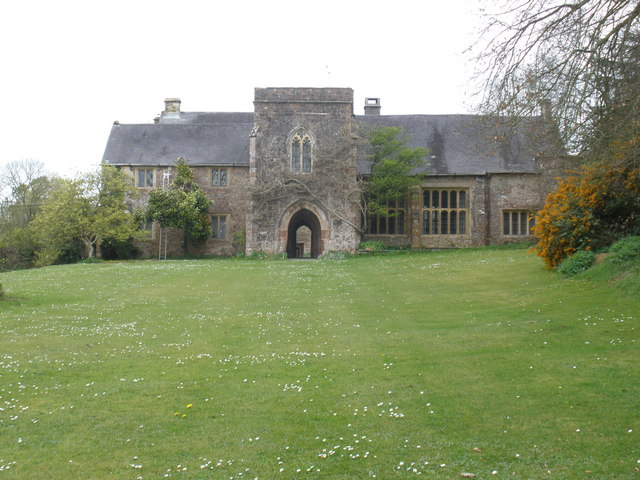
Greenham Barton

Greenham Barton is a 13th-century manor house in the civil parish of Stawley, Somerset, England (at Greenham, west of Wellington in Somerset). Built in...
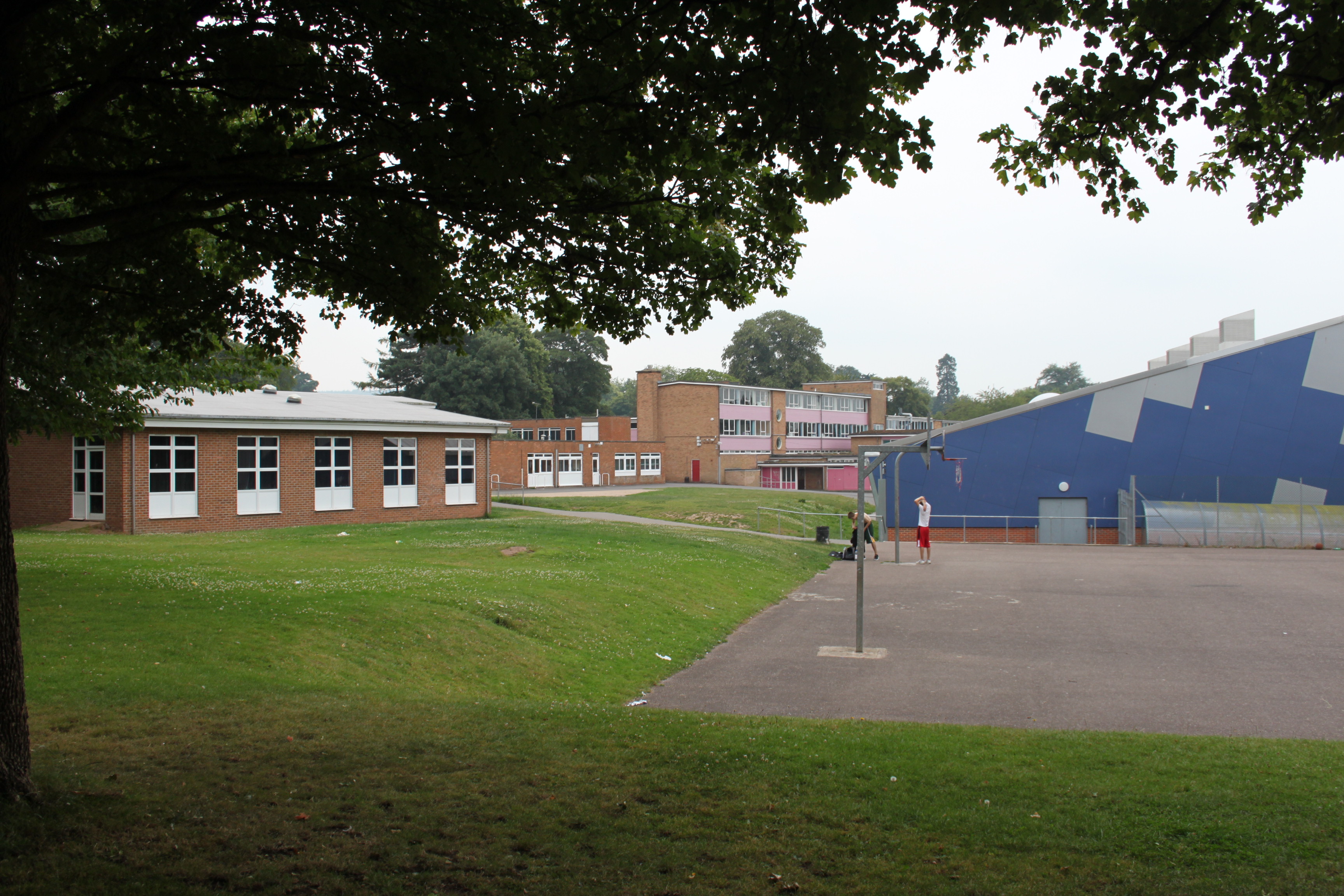
Court Fields School

Court Fields School is located in Wellington, Somerset, England. Court Fields is home to the “Theatre Of Leaves”, which is known to be one of the most...

Church of St Peter and St Paul, Runnington

The Anglican Church of St Peter and St Paul at Runnington in Langford Budville, Somerset, England was built in the 15th century. It is a Grade II* listed...

Nearby Amenities

Located within 500m of 50.965683,-3.27153
Post Box
Operator: Royal Mail
Operator Wikidata: Q638098
Post Box Type: lamp
Ref: TA21 330
Royal Cypher: EIIR
Royal Cypher Wikidata: Q33102113
Lat/Long: 50.9665342/-3.2723848
Sampford Arundel
Place: village
Wikidata: Q2387943
Wikipedia: en:Sampford Arundel
Lat/Long: 50.9623529/-3.2697863
Give Way
Lat/Long: 50.9667927/-3.2736379
Post Box
Operator: Royal Mail
Operator Wikidata: Q638098
Post Box Type: lamp
Ref: TA21 399
Royal Cypher: EIIR
Royal Cypher Wikidata: Q33102113
Lat/Long: 50.9621748/-3.2693039
Public Bookcase
Booth: K6
Disused Amenity: telephone
Man Made: telephone_box
Note: Former telephone box
Public Bookcase Type: phone_box
Lat/Long: 50.9623539/-3.2700745
Historic: memorial
Memorial: war_memorial
Wikidata: Q26678134
Lat/Long: 50.9624581/-3.2714033
Milestone
Distance: 9 mi
Historic: milestone
Inscription: Taunton 9 Miles
Lat/Long: 50.9664467/-3.2714376
Give Way
Lat/Long: 50.9662865/-3.273225
Give Way
Lat/Long: 50.9663865/-3.2725287
Give Way
Lat/Long: 50.9664883/-3.2715129
Give Way
Lat/Long: 50.9665101/-3.2741314
Entrance: yes
Lat/Long: 50.9624313/-3.2721703
Give Way
Lat/Long: 50.9623083/-3.270208
Power: pole
Lat/Long: 50.9687973/-3.2766321
Power: pole
Lat/Long: 50.9677973/-3.2772195
Power: pole
Lat/Long: 50.9668582/-3.2777318
Power: pole
Source: bing
Lat/Long: 50.9616485/-3.2719088
The data included in this document is from www.openstreetmap.org. The data is made available under ODbL.

Have you been to Beam Bridge?

Leave your review of Beam Bridge below (or comments, questions and feedback).