Scarwall

Coastal Feature, Headland, Point in Caithness

Scotland

Scarwall

Bluebells at Brough
Bluebells at Brough Credit: sylvia duckworth

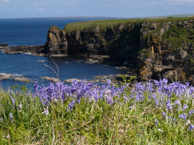
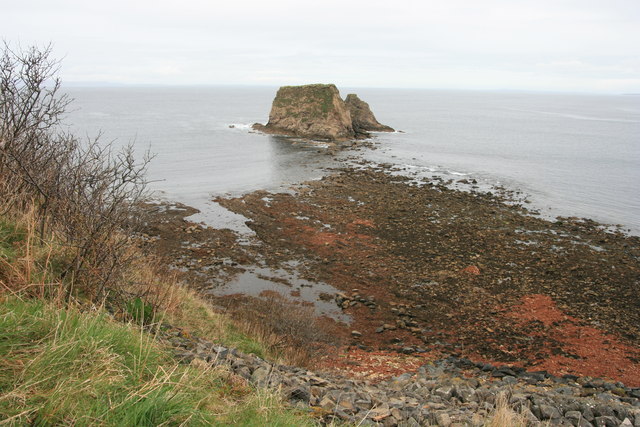
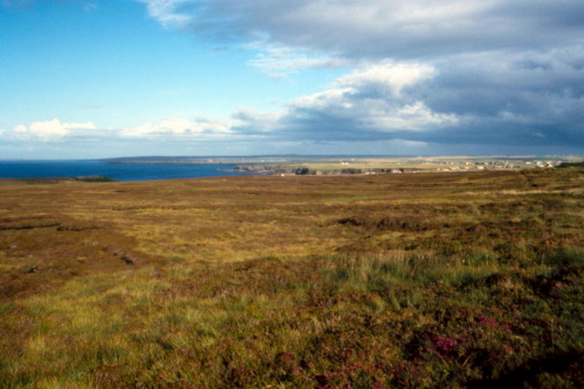
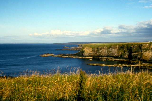
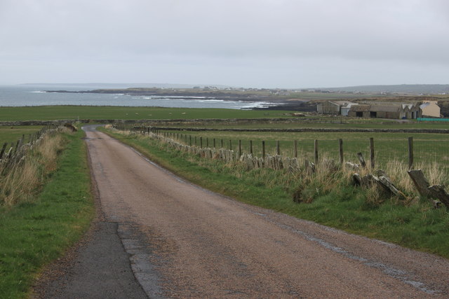
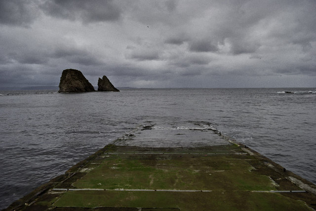
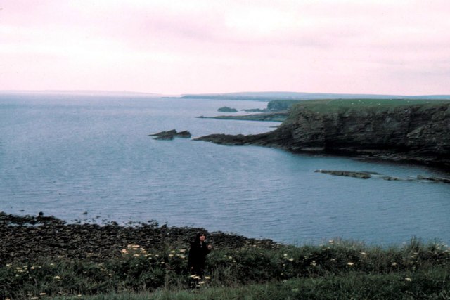
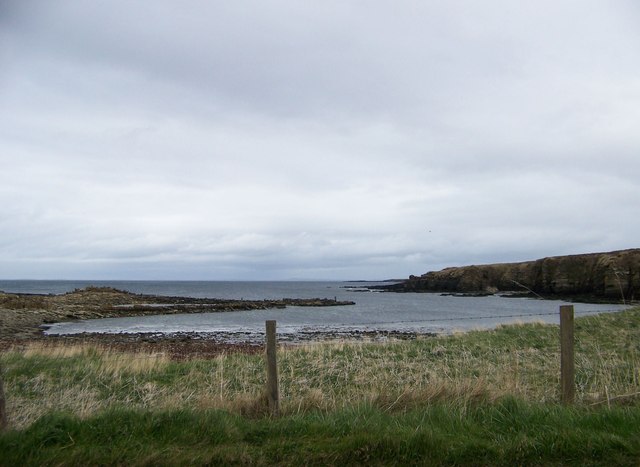
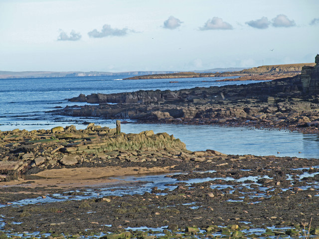
Scarwall is a prominent coastal feature located in Caithness, Scotland. It is a headland or point that juts out into the North Sea, offering breathtaking views of the surrounding landscape. Situated near the town of Wick, Scarwall is known for its rugged beauty and dramatic cliffs that form part of the coastal scenery.

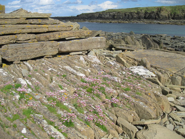
The headland is formed by the erosion of layers of sedimentary rocks, primarily sandstone and slate, which have been shaped by the powerful forces of the sea over thousands of years. This geological history is evident in the distinctive rock formations that can be observed along the coastline.

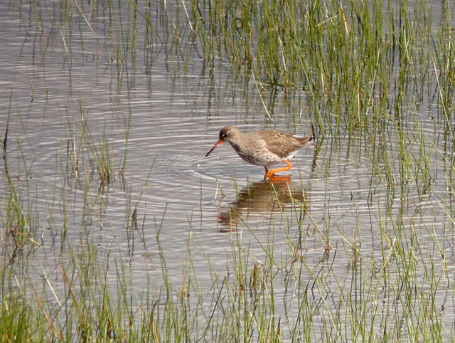
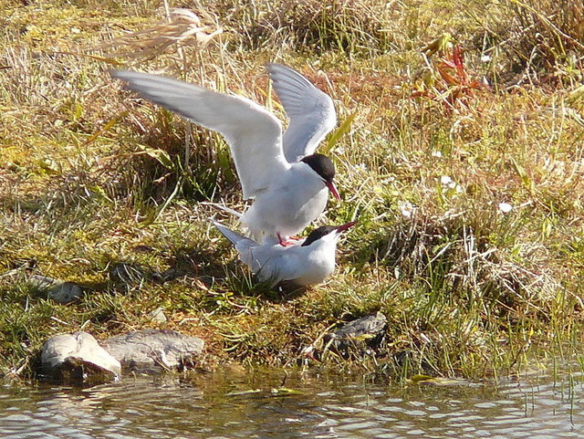
Scarwall is a popular destination for nature enthusiasts and hikers due to its diverse wildlife and scenic trails. The headland is home to a variety of bird species, including puffins, gannets, and fulmars, making it a haven for birdwatchers. Visitors can also spot seals basking on the rocky shores or catch a glimpse of dolphins swimming in the nearby waters.

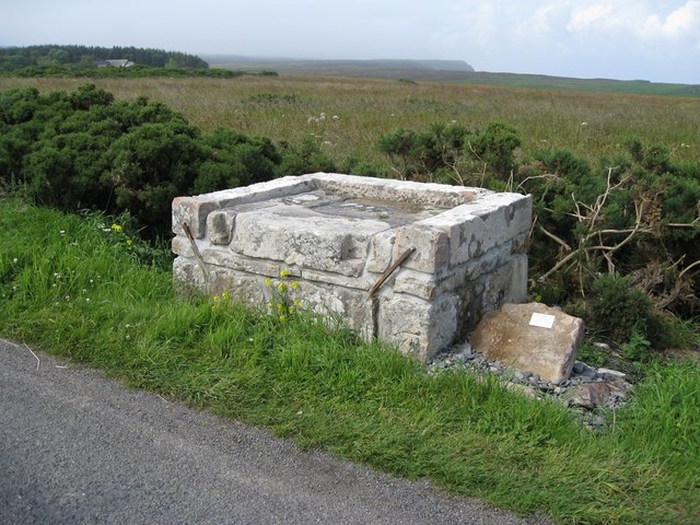
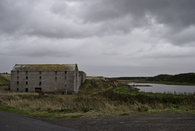
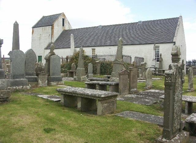
The area surrounding Scarwall is rich in history and heritage, with several archaeological sites nearby. Ruins of ancient fortifications can be found, hinting at the strategic importance of this headland in the past. Local legends and folklore also add an air of mystery to the area, attracting those interested in delving into the stories of the region.

Overall, Scarwall in Caithness offers a captivating coastal experience, combining natural beauty, wildlife, and a touch of history. Its dramatic cliffs and diverse ecosystems make it a must-visit destination for nature lovers and those seeking a unique coastal adventure.

If you have any feedback on the listing, please let us know in the comments section below.

Scarwall Images

Images are sourced within 2km of 58.648036/-3.3374715 or Grid Reference ND2274. Thanks to Geograph Open Source API. All images are credited.

Bluebells at Brough
Bluebells at Brough
Redshank at St. John's Pool
Arctic terns Full of the joys of Spring at St. John's Pool.
Arctic terns
Full of the joys of Spring at St. John's Pool.
Daffodils near Brough Looking from the B855 towards Clett and Little Clett, these daffodils adorn the hillside above the track leading down to Brough slipway.
Daffodils near Brough
Looking from the B855 towards Clett and Little Clett, these daffodils adorn the hillside above the track leading down to Brough slipway.
The Clett and Little Clett
Dunnet Head - 1987 Dunnet Head, peat ditch, Sanders Loch visible in the distance.
Dunnet Head - 1987
Dunnet Head, peat ditch, Sanders Loch visible in the distance.
Dunnet Head, Brough - 1987 Dunnet Head, Brough seen from A855.
Dunnet Head, Brough - 1987
Dunnet Head, Brough seen from A855.
Dunnet Head, Brough - 1987 Dunnet Head, Brough, Little Clett.
Dunnet Head, Brough - 1987
Dunnet Head, Brough, Little Clett.
Dunnet Head, Brough - 1987 Dunnet Head, Brough, The Stacks.
Dunnet Head, Brough - 1987
Dunnet Head, Brough, The Stacks.
Lighthouse Loading Platform The adjacent inscription reads "This platform was used for the loading of carts with oil and other stores for Dunnet Head Lighthouse.  Constructed c1831 by the Northern Lighthouse Board.  Restored by the Brough Bay Association 2011."
Lighthouse Loading Platform
The adjacent inscription reads "This platform was used for the loading of carts with oil and other stores for Dunnet Head Lighthouse. Constructed c1831 by the Northern Lighthouse Board. Restored by the Brough Bay Association 2011."
Ham Harbour Ham harbour has not been used or maintained for many years. The details of its construction have been revealed in the sections of wall which still stand. Compare with <a href="https://www.geograph.org.uk/photo/24555">ND2473 : Ham Harbour</a> taken nearly eight years ago.
Ham Harbour
Ham harbour has not been used or maintained for many years. The details of its construction have been revealed in the sections of wall which still stand. Compare with ND2473 : Ham Harbour taken nearly eight years ago.
Detail of old harbour wall at Ham Part of the remaining wall of the derelict harbour at Ham.
Detail of old harbour wall at Ham
Part of the remaining wall of the derelict harbour at Ham.
A typical Caithness lane near Ham
Slipway at Brough
Slipway at Brough
Ham old mill
Ham old mill
Brough - 1975 Brough, The Kame, Grassy Clett.
Brough - 1975
Brough, The Kame, Grassy Clett.
Ham Harbour from the road One of the advantages of having to stop for oncoming cars on a single-track road is being able to grab a quick photo
Ham Harbour from the road
One of the advantages of having to stop for oncoming cars on a single-track road is being able to grab a quick photo
Ham Harbour Low Tide
Ham Harbour
Low Tide
Show me another place!

Scarwall is located at Grid Ref: ND2274 (Lat: 58.648036, Lng: -3.3374715)

Unitary Authority: Highland

Police Authority: Highlands and Islands

What 3 Words

///goad.jigging.heckler. Near Thurso, Highland

Related Wikis

Brough Castle (Caithness)

Brough Castle is a ruined castle near Brough, Caithness. It is believed to date from the 12th to 14th centuries. == Description == The foundations of...

Brough, Caithness

Brough is a small village (population 66) in Caithness in the North of Scotland. It is located on the B855 single-track road, the most northerly numbered...

Ham, Caithness

Ham is a village in the Caithness region in the Scottish council area of Highland. It has a very short river running from a mill pond to the sea - a total...

Dunnet Church

Dunnet Parish Church is a Church of Scotland church in Dunnet, Caithness, northern Scotland. References to St Mary's Parish Church are known from as far...

Nearby Amenities

Located within 500m of 58.648036,-3.3374715
Created By: almien_coastlines
Source: PGS
Lat/Long: 58.647127/-3.329179
Created By: almien_coastlines
Source: PGS
Lat/Long: 58.647638/-3.329184
Created By: almien_coastlines
Source: PGS
Lat/Long: 58.647507/-3.330165
Created By: almien_coastlines
Source: PGS
Lat/Long: 58.647377/-3.331146
Created By: almien_coastlines
Source: PGS
Lat/Long: 58.647634/-3.330904
Created By: almien_coastlines
Source: PGS
Lat/Long: 58.647891/-3.33066
Created By: almien_coastlines
Source: PGS
Lat/Long: 58.647888/-3.331642
Created By: almien_coastlines
Source: PGS
Lat/Long: 58.647376/-3.331637
Created By: almien_coastlines
Source: PGS
Lat/Long: 58.647501/-3.33262
Created By: almien_coastlines
Source: PGS
Lat/Long: 58.6475/-3.333111
Created By: almien_coastlines
Source: PGS
Lat/Long: 58.64737/-3.334092
Created By: almien_coastlines
Source: PGS
Lat/Long: 58.648138/-3.334099
Created By: almien_coastlines
Source: PGS
Lat/Long: 58.648008/-3.334589
Created By: almien_coastlines
Source: PGS
Lat/Long: 58.648004/-3.336062
Created By: almien_coastlines
Source: PGS
Lat/Long: 58.648256/-3.337538
Created By: almien_coastlines
Source: PGS
Lat/Long: 58.648255/-3.338029
Created By: almien_coastlines
Source: PGS
Lat/Long: 58.647996/-3.339009
Source: PGS
Lat/Long: 58.6477527/-3.3393712
Source: PGS
Lat/Long: 58.6476585/-3.3393014
Source: PGS
Lat/Long: 58.6470729/-3.3410218
Source: PGS
Lat/Long: 58.6469455/-3.3410844
Source: PGS
Lat/Long: 58.6469134/-3.3422111
Source: PGS
Lat/Long: 58.646556/-3.343651
Source: PGS
Lat/Long: 58.6471867/-3.3450883
Source: PGS
Lat/Long: 58.6477035/-3.3458492
Power: pole
Lat/Long: 58.644524/-3.3331993
Power: pole
Lat/Long: 58.6445758/-3.3322592
Cafe
Windhaven Cafe
Addr City: Thurso
Addr Postcode: KW14 8YE
Email: windhaven.booking@hotmail.com
Phone: +44 1847 851927
Lat/Long: 58.6457476/-3.3447794
The data included in this document is from www.openstreetmap.org. The data is made available under ODbL.

Have you been to Scarwall?

Leave your review of Scarwall below (or comments, questions and feedback).