The Craigs

Coastal Feature, Headland, Point in West Lothian

Scotland

The Craigs

The bay at North Queensferry In the middle distance the houses on the point leading down to the Town Pier, with the Forth (Rail) Bridge beyond.
The bay at North Queensferry Credit: Oliver Dixon

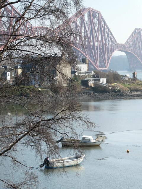
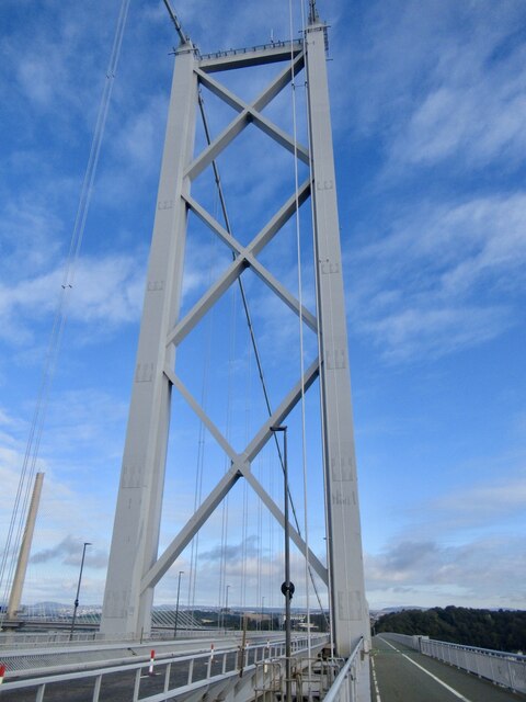
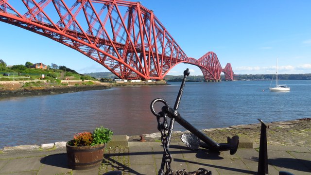
The Craigs, located in West Lothian, Scotland, is a prominent coastal feature that encompasses a headland and a point. It is a picturesque area that attracts locals and tourists alike due to its stunning natural beauty and rich history.

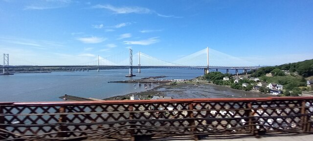
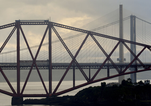
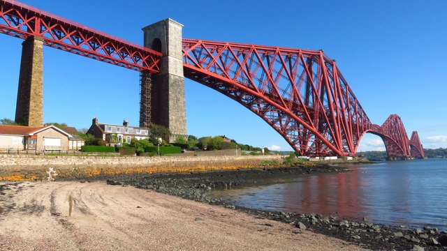
Perched on the coastline, The Craigs offers breathtaking views of the surrounding landscape. The headland, characterized by its rugged cliffs and rocky outcrops, juts out into the North Sea, providing a dramatic and awe-inspiring scene. The point, located at the end of the headland, offers panoramic vistas of the sea and the nearby countryside.

The Craigs is not only a scenic attraction but also holds historical significance. It is believed to have been inhabited since ancient times, with evidence of human activity dating back to prehistoric periods. The area is dotted with archaeological sites, including remains of ancient settlements and burial grounds.

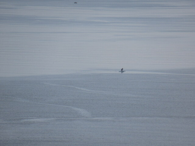
In addition to its natural and historical significance, The Craigs also serves as a haven for wildlife. The coastal location provides a suitable habitat for various bird species, including gulls, cormorants, and puffins. The cliffs and rock formations also attract marine life, such as seals and dolphins, making it a popular spot for wildlife enthusiasts and birdwatchers.

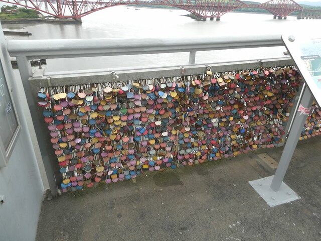
Visitors to The Craigs can enjoy leisurely walks along the coastal paths, exploring the numerous caves and rock pools, or simply admiring the stunning views. It is a place that offers a unique blend of natural beauty, historical intrigue, and abundant wildlife, making it a must-visit destination in West Lothian.

If you have any feedback on the listing, please let us know in the comments section below.

The Craigs Images

Images are sourced within 2km of 55.990506/-3.3926863 or Grid Reference NT1378. Thanks to Geograph Open Source API. All images are credited.

The bay at North Queensferry In the middle distance the houses on the point leading down to the Town Pier, with the Forth (Rail) Bridge beyond.
The bay at North Queensferry
In the middle distance the houses on the point leading down to the Town Pier, with the Forth (Rail) Bridge beyond.
North Queensferry from the Forth Bridge
Old Lighthouse The old lighthouse at North Queensferry which just happened to be open to visitors on the day we were there looking for the old milestone in the wall nearby.
Old Lighthouse
The old lighthouse at North Queensferry which just happened to be open to visitors on the day we were there looking for the old milestone in the wall nearby.
Old lighthouse We were able to climb up inside the lighthouse with the guide telling us interesting information.   But not sure what this bit does!
Old lighthouse
We were able to climb up inside the lighthouse with the guide telling us interesting information. But not sure what this bit does!
Stand up paddle boarders, North Queensferry, View under the Forth Bridge from the road bridge.
Stand up paddle boarders, North Queensferry,
View under the Forth Bridge from the road bridge.
Cables, Forth Road Bridge Well coated, like the Forth Bridge in zinc containing paint to slow down corrosion through sacrificial protection.
Cables, Forth Road Bridge
Well coated, like the Forth Bridge in zinc containing paint to slow down corrosion through sacrificial protection.
North Tower, Forth Road Bridge
Forth railway bridge View from the inside of the lighthouse
Forth railway bridge
View from the inside of the lighthouse
Love padlocks Numerous padlocks  testifying to (hopefully) true love attached to the parapet at the north end of the suspended section of the Forth Road Bridge.
Love padlocks
Numerous padlocks testifying to (hopefully) true love attached to the parapet at the north end of the suspended section of the Forth Road Bridge.
Piers at North Queensferry Seen from the cycle track on the Forth Road Bridge. The original (rail) Forth Bridge beyond.
Piers at North Queensferry
Seen from the cycle track on the Forth Road Bridge. The original (rail) Forth Bridge beyond.
The Forth Bridge The classic view of the iconic rail bridge seen from North Queensferry waterfront.
The Forth Bridge
The classic view of the iconic rail bridge seen from North Queensferry waterfront.
A Fraction of Three of the Forth Bridges Taken from the upper deck of the 'Regal Princess', this gave an opportunity to see the three iconic bridges from an unusual viewpoint.
A Fraction of Three of the Forth Bridges
Taken from the upper deck of the 'Regal Princess', this gave an opportunity to see the three iconic bridges from an unusual viewpoint.
North Queensferry
North Queensferry
Forth Railway Bridge from North Queensferry
Forth Railway Bridge & anchor at North Queensferry
Lighthouse at Town Pier, North Queensferry The lighthouse was built in 1817 by Robert Stevenson (grandfather of the author Robert Louis Stevenson), the miniature North Queensferry Light Tower guided boats safely across the Firth of Forth until the ferry service closed in the 1960s. Its has the claim as being the world’s smallest working light tower and Scotland’s smallest museum.
Lighthouse at Town Pier, North Queensferry
The lighthouse was built in 1817 by Robert Stevenson (grandfather of the author Robert Louis Stevenson), the miniature North Queensferry Light Tower guided boats safely across the Firth of Forth until the ferry service closed in the 1960s. Its has the claim as being the world’s smallest working light tower and Scotland’s smallest museum.
Forth Railway Bridge from southbound platform on North Queensferry Station
Albert Hotel, North Queensferry A plaque on the building relates, "Built in 1824 the hotel was named after Prince Albert who visited North Queensferry in 1842. It stands on the site of the former 'Hope Tavern', once known as Mitchell's Inn after the landlord who also ran a coaching business."
Albert Hotel, North Queensferry
A plaque on the building relates, "Built in 1824 the hotel was named after Prince Albert who visited North Queensferry in 1842. It stands on the site of the former 'Hope Tavern', once known as Mitchell's Inn after the landlord who also ran a coaching business."
Show me another place!

The Craigs is located at Grid Ref: NT1378 (Lat: 55.990506, Lng: -3.3926863)

Unitary Authority: City of Edinburgh

Police Authority: Edinburgh

What 3 Words

///comedy.mindset.kebab. Near Queensferry, Edinburgh

Related Wikis

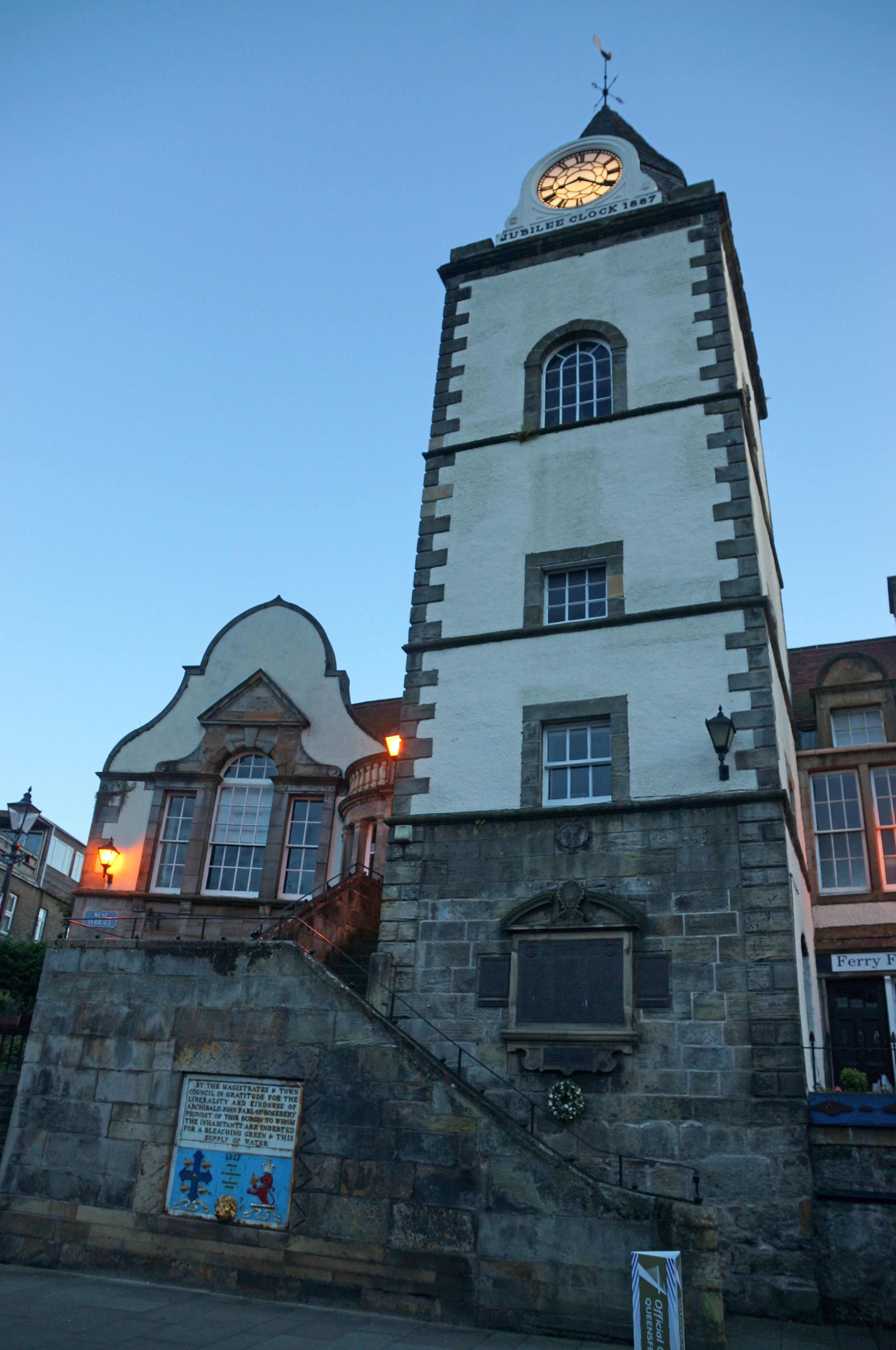
South Queensferry Tolbooth

The South Queensferry Tollbooth is a municipal structure in the High Street, South Queensferry, Edinburgh, Scotland. The structure, which served as the...

South Queensferry railway station

South Queensferry railway station served the town of South Queensferry, Edinburgh, Scotland from 1868 to 1929 on the South Queensferry Branch. == History... ==
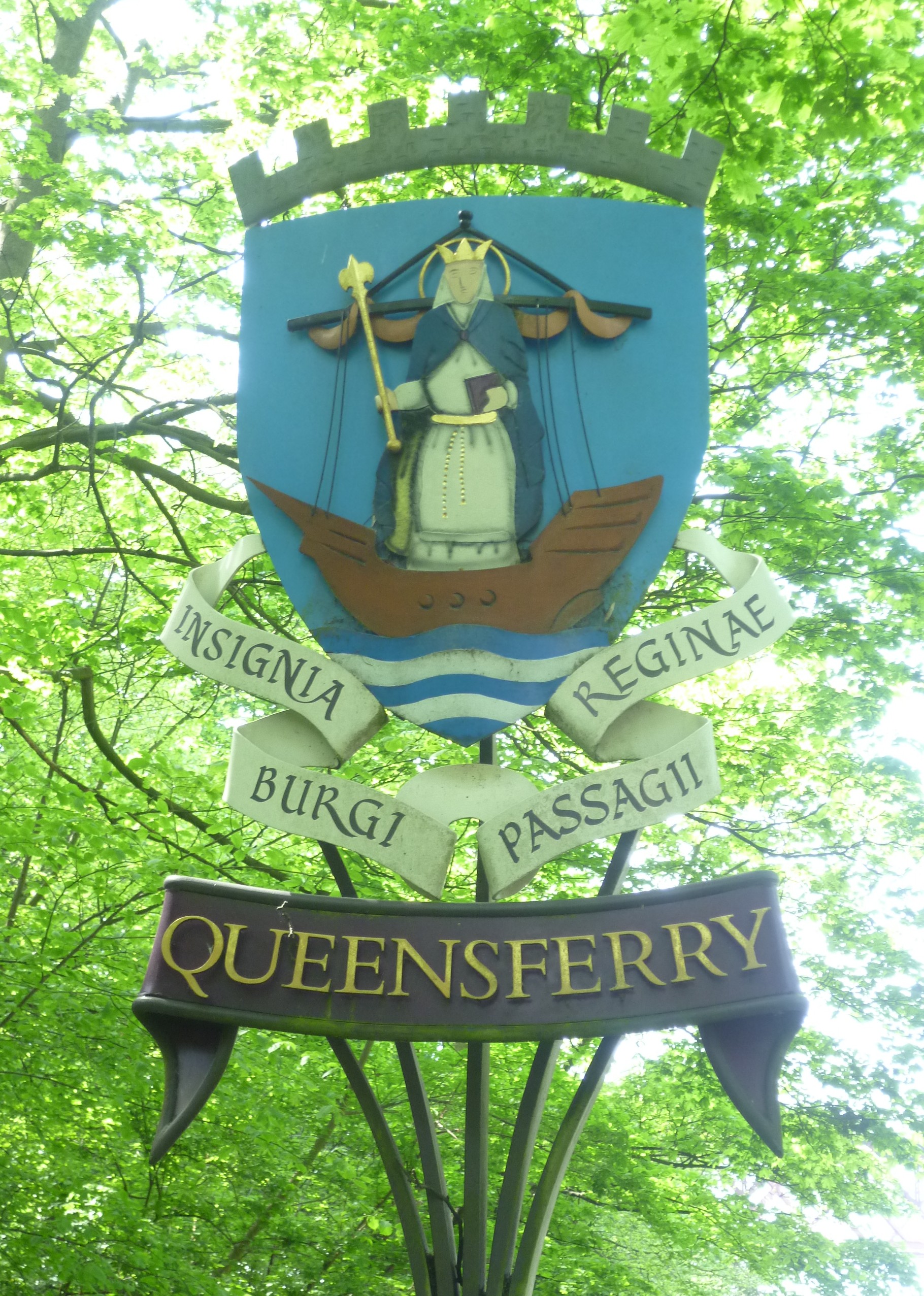
South Queensferry

Queensferry, also called South Queensferry or simply "The Ferry", is a town to the west of Edinburgh, Scotland. Traditionally a royal burgh of West Lothian...

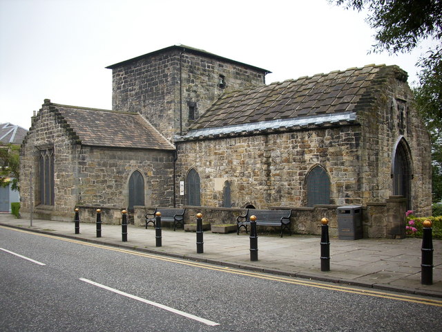
Priory Church, South Queensferry

The Priory Church of St Mary of Mount Carmel, commonly called the Priory Church or St Mary's Episcopal Church, is a congregation of the Scottish Episcopal...

Nearby Amenities

Located within 500m of 55.990506,-3.3926863
Traffic Signals
Traffic Signals: signal
Lat/Long: 55.9905391/-3.3975854
South Queensferry
Alt Name: Queensferry
Alt Name Gd: Taobh a Deas Chas Chaolais;Cas Faoileas;Cas Chaolais
Is In: Edinburgh, Scotland, UK
Loc Name: The Ferry
Name Ga: Cas Chaolas
Name Gd: Port na Bànrighinn a Deas
Place: town
Population: 9420
Source: NPE
Wikidata: Q767798
Wikipedia: en:South Queensferry
Lat/Long: 55.9902293/-3.3966999
Traffic Calming: cushion
Lat/Long: 55.9880127/-3.3941265
Traffic Calming: cushion
Lat/Long: 55.9871182/-3.3961775
Traffic Calming: hump
Lat/Long: 55.9877934/-3.3972181
Traffic Calming: hump
Lat/Long: 55.9885093/-3.399262
Traffic Calming: hump
Lat/Long: 55.9862765/-3.3928505
Traffic Calming: hump
Lat/Long: 55.9866023/-3.3898814
Post Box
Collection Times: Mo-Fr 15:30, Sa 10:00
Post Box Type: pillar
Ref: EH30 273
Source: survey
Lat/Long: 55.9866364/-3.3908474
Booth: K6
Covered: booth
Disused Amenity: telephone
Man Made: telephone_box
Lat/Long: 55.9874072/-3.3904803
Entrance: main
Lat/Long: 55.9885154/-3.3969948
Post Box
Collection Times: Mo-Fr 15:45, Sa 09:30
Ref: EH30 160
Source: survey
Lat/Long: 55.9875451/-3.3968803
Toilets
Access: yes
Male: yes
Toilets Disposal: flush
Wheelchair: no
Lat/Long: 55.9899117/-3.3959187
Traffic Calming: hump
Lat/Long: 55.9877908/-3.3931774
Bicycle Parking
Bicycle Parking: stands
Capacity: 10
Check Date Capacity: 2021-12-27
Covered: no
Lat/Long: 55.9900618/-3.3958518
Telephone
Booth: K6
Check Date: 2021-12-27
Covered: booth
Listed Status: Category B
Lat/Long: 55.990299/-3.3969255
Pub
The Ferry Tap
Addr City: South Queensferry
Addr Housenumber: 36
Addr Postcode: EH30 9HN
Addr Street: High Street
Fhrs Id: 663517
Source Addr: FHRS Open Data
Lat/Long: 55.9897531/-3.395141
Parking
Access: disabled
Capacity Disabled: 2
Parking: street_side
Lat/Long: 55.9898776/-3.394791
Post Box
Brand: Royal Mail
Brand Wikidata: Q638098
Brand Wikipedia: en:Royal Mail
Collection Times: Mo-Fr 17:00, Sa 12:00
Operator: Royal Mail
Operator Wikidata: Q638098
Post Box Design: type_g
Post Box Type: pillar
Ref: EH30 176
Royal Cypher: scottish_crown
Source: survey
Lat/Long: 55.9898249/-3.3948504
Bus Stop
Viewforth Place
Bench: no
Bin: yes
Bus: yes
Naptan AtcoCode: 6200203320
Naptan Bearing: N
Naptan CommonName: Burgess Park
Naptan Indicator: At 12
Naptan Landmark: Burgess Road
Naptan NaptanCode: 36236936
Naptan PlusbusZoneRef: EDINBUR
Naptan Street: Kirkliston Road
Public Transport: platform
Shelter: no
Source: naptan_import
Tactile Paving: no
Lat/Long: 55.986768/-3.3969118
Bus Stop
The Loan
Bench: yes
Bin: yes
Bus: yes
Lit: yes
Naptan AdministrativeAreaCode: 124
Naptan Area Name: Edinburgh
Naptan AtcoAreaCode: 620
Naptan AtcoCode: 6200203325
Naptan Bearing: N
Naptan CommonName: The Loan
Naptan Indicator: N-bound
Naptan Landmark: at Scotmid
Naptan LocalityName: Queensferry
Naptan NaptanCode: 36236952
Naptan NptgLocalityCode: ES003099
Naptan PlusbusZoneRef: EDINBUR
Naptan QualifierName: Edinburgh
Naptan SourceLocalityType: Lo
Naptan StopAreaCode: 620G203325
Naptan StopAreaType: GPBS
Naptan StopArea Name: QUEENSFERRY The Loan
Naptan Street: The Loan
Naptan Verified: yes
Passenger Information Display: yes
Public Transport: platform
Shelter: yes
Source: NaPTAN + Survey
Tactile Paving: no
Lat/Long: 55.9891486/-3.397557
Bus Stop
Queensferry Police Station
Bin: yes
Bus: yes
Naptan AdministrativeAreaCode: 124
Naptan Area Name: Edinburgh
Naptan AtcoAreaCode: 620
Naptan AtcoCode: 6200203340
Naptan Bearing: E
Naptan CommonName: Queensferry Police Station
Naptan Indicator: opp
Naptan Landmark: Rose Lane
Naptan LocalityName: Queensferry
Naptan NaptanCode: 36236896
Naptan NptgLocalityCode: ES003099
Naptan PlusbusZoneRef: EDINBUR
Naptan QualifierName: Edinburgh
Naptan SourceLocalityType: Lo
Naptan StopAreaCode: 620G203340
Naptan StopAreaType: GPBS
Naptan StopArea Name: QUEENSFERRY Queensferry Police Station
Naptan Street: Hopetoun Road
Naptan Verified: yes
Public Transport: platform
Shelter: yes
Source: NaPTAN + Survey
Lat/Long: 55.9908863/-3.399184
Bus Stop
Burgess Road
Bench: no
Bus: yes
Naptan AdministrativeAreaCode: 124
Naptan Area Name: Edinburgh
Naptan AtcoAreaCode: 620
Naptan AtcoCode: 6200203350
Naptan Bearing: E
Naptan CommonName: Burgess Road
Naptan Indicator: E-bound
Naptan Landmark: Kirkliston Road
Naptan LocalityName: Queensferry
Naptan NaptanCode: 36238276
Naptan NptgLocalityCode: ES003099
Naptan PlusbusZoneRef: EDINBUR
Naptan QualifierName: Edinburgh
Naptan SourceLocalityType: Lo
Naptan StopAreaCode: 620G203350
Naptan StopAreaType: GPBS
Naptan StopArea Name: QUEENSFERRY Burgess Road
Naptan Street: Burgess Road
Naptan Verified: yes
Public Transport: platform
Shelter: yes
Source: NaPTAN + Survey
Lat/Long: 55.987174/-3.3958205
Bus Stop
Queen Margaret Drive
Bench: yes
Bin: yes
Bus: yes
Lit: no
Naptan AdministrativeAreaCode: 124
Naptan Area Name: Edinburgh
Naptan AtcoAreaCode: 620
Naptan AtcoCode: 6200203360
Naptan Bearing: E
Naptan CommonName: Queen Margaret Drive
Naptan Indicator: opp
Naptan Landmark: at 25a
Naptan LocalityName: Queensferry
Naptan NaptanCode: 36236932
Naptan NptgLocalityCode: ES003099
Naptan PlusbusZoneRef: EDINBUR
Naptan QualifierName: Edinburgh
Naptan SourceLocalityType: Lo
Naptan Street: Station Road
Naptan Verified: yes
Passenger Information Display: yes
Public Transport: platform
Shelter: yes
Source: NaPTAN + Survey
Tactile Paving: no
Lat/Long: 55.9875293/-3.3903696
Bus Stop
Ashburnham Road
Bench: yes
Bin: yes
Bus: yes
Lit: no
Naptan AdministrativeAreaCode: 124
Naptan Area Name: Edinburgh
Naptan AtcoAreaCode: 620
Naptan AtcoCode: 6200203370
Naptan Bearing: E
Naptan CommonName: Ashburnham Road
Naptan Indicator: opp
Naptan Landmark: High School
Naptan LocalityName: Queensferry
Naptan NaptanCode: 36236928
Naptan NptgLocalityCode: ES003099
Naptan PlusbusZoneRef: EDINBUR
Naptan QualifierName: Edinburgh
Naptan SourceLocalityType: Lo
Naptan StopAreaCode: 620G203370
Naptan StopAreaType: GPBS
Naptan StopArea Name: QUEENSFERRY Ashburnham Road
Naptan Street: Station Road
Naptan Verified: yes
Public Transport: platform
Shelter: yes
Source: NaPTAN + Survey
Tactile Paving: no
Lat/Long: 55.9873333/-3.3872823
Bus Stop
Hawes Pier
Naptan AtcoCode: 6200203400
Naptan Bearing: W
Naptan CommonName: Hawes Pier
Naptan Indicator: 30m West of car park
Naptan Landmark: Hawes Pier
Naptan NaptanCode: 36238392
Naptan Street: Edinburgh Road (New Halls Road)
Naptan Verified: no
Public Transport: platform
Source: naptan_import
Lat/Long: 55.9903465/-3.3854493
Bus Stop
Hawes Pier
Bench: no
Bin: yes
Lit: yes
Naptan AtcoCode: 6200203410
Naptan Bearing: E
Naptan CommonName: Hawes Pier
Naptan Indicator: Tour Stop
Naptan Landmark: Hawes Inn
Naptan NaptanCode: 36247373
Naptan Street: Edinburgh Road (New Halls Road)
Naptan Verified: no
Public Transport: platform
Shelter: no
Source: naptan_import
Tactile Paving: no
Lat/Long: 55.9905394/-3.3854731
Bus Stop
Ashburnham Road
Bench: no
Bin: no
Bus: yes
Lit: yes
Naptan AdministrativeAreaCode: 124
Naptan Area Name: Edinburgh
Naptan AtcoAreaCode: 620
Naptan AtcoCode: 6200246550
Naptan Bearing: W
Naptan CommonName: Ashburnham Road
Naptan Indicator: after
Naptan Landmark: High School
Naptan LocalityName: Queensferry
Naptan NaptanCode: 36236927
Naptan NptgLocalityCode: ES003099
Naptan PlusbusZoneRef: EDINBUR
Naptan QualifierName: Edinburgh
Naptan SourceLocalityType: Lo
Naptan StopAreaCode: 620G203370
Naptan StopAreaType: GPBS
Naptan StopArea Name: QUEENSFERRY Ashburnham Road
Naptan Street: Station Road
Naptan Verified: yes
Public Transport: platform
Shelter: no
Source: NaPTAN + Survey
Tactile Paving: no
Lat/Long: 55.9872216/-3.387631
Bus Stop
Burgess Road
Bench: yes
Bin: no
Bus: yes
Lit: yes
Naptan AdministrativeAreaCode: 124
Naptan Area Name: Edinburgh
Naptan AtcoAreaCode: 620
Naptan AtcoCode: 6200246570
Naptan Bearing: W
Naptan CommonName: Burgess Road
Naptan Indicator: W-bound
Naptan Landmark: Kirkliston Road
Naptan LocalityName: Queensferry
Naptan NaptanCode: 36238275
Naptan NptgLocalityCode: ES003099
Naptan PlusbusZoneRef: EDINBUR
Naptan QualifierName: Edinburgh
Naptan SourceLocalityType: Lo
Naptan StopAreaCode: 620G203350
Naptan StopAreaType: GPBS
Naptan StopArea Name: QUEENSFERRY Burgess Road
Naptan Street: Burgess Road
Naptan Verified: yes
Public Transport: platform
Shelter: yes
Source: NaPTAN + Survey
Tactile Paving: no
Lat/Long: 55.9870783/-3.3964512
Bus Stop
Queensferry Police Station
Bin: yes
Bus: yes
Naptan AdministrativeAreaCode: 124
Naptan Area Name: Edinburgh
Naptan AtcoAreaCode: 620
Naptan AtcoCode: 6200246580
Naptan Bearing: W
Naptan CommonName: Queensferry Police Station
Naptan Indicator: at
Naptan Landmark: Episcopalian Church
Naptan LocalityName: Queensferry
Naptan NaptanCode: 36236895
Naptan NptgLocalityCode: ES003099
Naptan PlusbusZoneRef: EDINBUR
Naptan QualifierName: Edinburgh
Naptan SourceLocalityType: Lo
Naptan StopAreaCode: 620G203340
Naptan StopAreaType: GPBS
Naptan StopArea Name: QUEENSFERRY Queensferry Police Station
Naptan Street: Hopetoun Road
Naptan Verified: yes
Public Transport: platform
Shelter: yes
Source: NaPTAN + Survey
Tactile Paving: no
Lat/Long: 55.990705/-3.3983263
Bus Stop
The Loan
Bench: yes
Bin: yes
Bus: yes
Lit: yes
Naptan AdministrativeAreaCode: 124
Naptan Area Name: Edinburgh
Naptan AtcoAreaCode: 620
Naptan AtcoCode: 6200246595
Naptan Bearing: S
Naptan CommonName: The Loan
Naptan Indicator: S-bound
Naptan Landmark: Hawthorn Bank
Naptan LocalityName: Queensferry
Naptan NaptanCode: 36236953
Naptan NptgLocalityCode: ES003099
Naptan PlusbusZoneRef: EDINBUR
Naptan QualifierName: Edinburgh
Naptan SourceLocalityType: Lo
Naptan StopAreaCode: 620G203325
Naptan StopAreaType: GPBS
Naptan StopArea Name: QUEENSFERRY The Loan
Naptan Street: The Loan
Naptan Verified: yes
Public Transport: platform
Shelter: yes
Source: NaPTAN + Survey
Tactile Paving: no
Lat/Long: 55.9899716/-3.3976386
Traffic Calming: hump
Lat/Long: 55.9882609/-3.3979641
Pub
The Inchcolm Inn
Lat/Long: 55.9907136/-3.400563
South Queensferry Lighthouse
Disused Man Made: lighthouse
Lat/Long: 55.9907182/-3.3853552
Bicycle Parking
Bicycle Parking: stands
Capacity: 32
Covered: no
Lat/Long: 55.9896602/-3.3989461
Bicycle Parking
Bicycle Parking: stands
Capacity: 6
Covered: no
Lat/Long: 55.9897196/-3.3893542
Bicycle Parking
Bicycle Parking: stands
Capacity: 4
Covered: no
Lat/Long: 55.9904018/-3.3860921
Toilets
Female: yes
Male: no
Source: survey
Lat/Long: 55.9901966/-3.385979
Telephone
Booth: KX100
Check Date: 2022-10-05
Covered: booth
Phone: +44 131 319 1627
Source: survey
Lat/Long: 55.9901521/-3.3861841
Post Box
Brand: Royal Mail
Brand Wikidata: Q638098
Check Date: 2022-10-05
Collection Times: Mo-Fr 09:00; Sa 07:00
Operator: Royal Mail
Operator Wikidata: Q638098
Post Box Design: reproduction_penfold
Post Box Type: pillar
Ref: EH30 356D
Royal Cypher: VR
Royal Cypher Wikidata: Q33102356
Lat/Long: 55.9900854/-3.3879857
Toilets
Source: survey
Lat/Long: 55.9906294/-3.385445
Post Box
Brand: Royal Mail
Brand Wikidata: Q638098
Collection Times: Mo-Fr 09:00; Sa 07:00
Operator: Royal Mail
Operator Wikidata: Q638098
Post Box Type: pillar
Ref: EH30 158D
Royal Cypher: scottish_crown
Source: survey
Lat/Long: 55.9901447/-3.3862112
Post Box
Collection Times: Mo-Fr 09:00; Sa 07:00
Operator: Royal Mail
Operator Wikidata: Q638098
Post Box Type: pillar
Ref: EH30 161D
Royal Cypher: scottish_crown
Source: survey
Lat/Long: 55.9909223/-3.3995033
Restaurant
The Railbridge Bistro
Addr City: South Queensferry
Addr Housenumber: 4
Addr Postcode: EH30 9TA
Addr Street: Newhalls Road
Fhrs Id: 661751
Source: survey
Website: https://therailbridgebistro.com/
Lat/Long: 55.9899019/-3.3868462
Pub
Thirty Knots
Addr City: South Queensferry
Contact Website: https://www.thirtyknots-southqueensferry.co.uk/
Food: yes
Old Name: Harry Ramsden's at the 3 Bridges Bar
Outdoor Seating: yes
Smoking: no
Lat/Long: 55.9897254/-3.3876775
Crossing
Crossing: traffic_signals
Crossing Island: no
Tactile Paving: yes
Lat/Long: 55.9905314/-3.397397
Bar
Orocco Pier
Addr City: South Queensferry
Addr Housenumber: 17
Addr Postcode: EH30 9PP
Addr Street: High Street
Fhrs Id: 663503
Source: local_knowledge
Source Addr: FHRS Open Data
Lat/Long: 55.9902692/-3.3964391
Restaurant
The Boat House
Addr City: South Queensferry
Addr Housenumber: 19
Addr Postcode: EH30 9PP
Addr Street: High Street
Fhrs Id: 663518
Source Addr: FHRS Open Data
Lat/Long: 55.9901625/-3.3961304
Historic: memorial
Lat/Long: 55.9903532/-3.3862897
Cafe
Bikers Cove
Lat/Long: 55.9902772/-3.3854544
The Little Parlour
Addr City: South Queensferry
Addr Street: High Street
Shop: ice_cream
Lat/Long: 55.9896188/-3.3935665
Cafe
Manna House Bakery
Addr City: South Queensferry
Addr Housenumber: 45-46
Addr Postcode: EH30 9HN
Addr Street: High Street
Check Date: 2023-08-12
Opening Hours: Mo-Su 09:00-17:00
Phone: +44 131 331 1661
Shop: bakery
Lat/Long: 55.9896262/-3.3941457
Restaurant
Queen's Spice
Cuisine: indian
Lat/Long: 55.9906648/-3.3973688
Cafe
The Little Bakery
Addr City: South Queensferry
Addr Housenumber: 6-7
Addr Postcode: EH30 9PP
Addr Street: High Street
Fhrs Id: 769492
Website: https://www.littlebakery.co.uk/
Lat/Long: 55.9905437/-3.3971218
Sea Kist
Check Date: 2023-08-12
Shop: antiques
Lat/Long: 55.9896148/-3.394051
South Queensferry Local Office Registrar
Check Date: 2023-08-12
Government: register_office
Office: government
Operator: Edinburgh Council
Lat/Long: 55.9897662/-3.3938296
Queensferry Museum
Addr City: South Queensferry
Addr Housenumber: 53
Addr Postcode: EH30 9HP
Addr Street: High Street
Operator: Edinburgh Council
Tourism: museum
Website: https://www.edinburghmuseums.org.uk/venue/queensferry-museum
Wikidata: Q113369783
Lat/Long: 55.9897575/-3.3936378
Town Cryer
Addr City: South Queensferry
Addr Housenumber: 42
Addr Postcode: EH30 9HN
Addr Street: High Street
Check Date: 2023-08-12
Fhrs Id: 663543
Phone: +44 131 3311331
Shop: convenience
Source Addr: FHRS Open Data
Lat/Long: 55.9896648/-3.3944829
Bench
Backrest: yes
Check Date: 2023-05-13
Material: wood
Lat/Long: 55.9883241/-3.3905786
Bench
Backrest: yes
Check Date: 2023-05-13
Material: wood
Lat/Long: 55.9883625/-3.391409
Check Date: 2021-12-27
Information: map
Map Size: city
Map Type: street
Tourism: information
Lat/Long: 55.9898007/-3.393911
words&pictures
Addr Housenumber: 48
Addr Street: High Street
Check Date: 2023-08-12
Shop: art
Lat/Long: 55.9896068/-3.3939615
Fast Food
Good Fortune
Addr City: South Queensferry
Addr Housenumber: 10-12
Addr Postcode: EH30 9RA
Addr Street: Hopetoun Road
Cuisine: chinese
Fhrs Id: 663712
Source Addr: FHRS Open Data
Lat/Long: 55.9908809/-3.3987336
Recycling
Recycling Clothes: yes
Recycling Glass Bottles: yes
Recycling Paper: yes
Recycling Plastic: yes
Recycling Type: container
Lat/Long: 55.9890693/-3.3977273
Pub
Anchor Inn
Lat/Long: 55.9897891/-3.3924101
Fast Food
Bamboo
Addr City: South Queensferry
Addr Postcode: EH30 9SD
Addr Street: The Loan
Cuisine: chinese
Fhrs Id: 662029
Opening Hours: We-Mo 17:00-23:00
Source Addr: FHRS Open Data
Lat/Long: 55.9895568/-3.3986943
Barnardo's
Brand: Barnardo's
Brand Wikidata: Q2884670
Brand Wikipedia: en:Barnardo's
Opening Hours: Mo-Sa 09:30-17:30; Su 11:00-16:00
Shop: charity
Lat/Long: 55.9895754/-3.3991595
Dentist
Bellstane Dental Care
Healthcare: dentist
Lat/Long: 55.9908028/-3.3974179
Veterinary
Westport Veterinary Clinic
Phone: +44 131 331 3451
Survey Date: 2020-09-26
Lat/Long: 55.9891541/-3.398758
Restaurant
Chilli Waves
Addr City: South Queensferry
Addr Housenumber: 55
Addr Postcode: EH30 9SD
Addr Street: The Loan
Cuisine: indian
Fhrs Id: 662092
Opening Hours: Su-Th 16:00-23:00, Fr,Sa 16:00-24:00
Source Addr: FHRS Open Data
Lat/Long: 55.9895667/-3.3989278
Neilsons
Check Date: 2023-08-12
Office: estate_agent
Lat/Long: 55.9898488/-3.3945956
Cafe
Picnic
Addr City: South Queensferry
Addr Housenumber: 5
Addr Postcode: EH30 9LH
Addr Street: Mid Terrace
Fhrs Id: 951437
Source Addr: FHRS Open Data
Lat/Long: 55.9898406/-3.3956123
Cafe
Ravenous Beastie
Addr City: South Queensferry
Addr Housenumber: 15
Addr Postcode: EH30 9LL
Addr Street: West Terrace
Fhrs Id: 662316
Source Addr: FHRS Open Data
Lat/Long: 55.9900544/-3.396402
The Little Pad
Addr City: South Queensferry
Addr Housenumber: 44
Addr Postcode: EH30 9HN
Addr Street: High Street
Check Date: 2023-08-12
Disused Craft: silversmith
Old Name: Scruples
Shop: pet_grooming
Lat/Long: 55.9896587/-3.394355
Pub
The Staghead Hotel
Tourism: hotel
Lat/Long: 55.9904468/-3.3968883
Fast Food
Graziano's
Addr City: South Queensferry
Addr Housenumber: 2
Addr Postcode: EH30 9RA
Addr Street: Hopetoun Road
Cuisine: fish_and_chips;kebab;pasta;pizza
Fhrs Id: 807071
Phone: +44 131 331 1644
Source Addr: FHRS Open Data
Lat/Long: 55.9906899/-3.397556
Atm
Check Date: 2021-12-27
Lat/Long: 55.9895258/-3.3985968
Addr City: South Queensferry
Addr Housenumber: 15
Addr Street: Ashburnham Loan
Lat/Long: 55.9886667/-3.3854311
Addr City: South Queensferry
Addr Housenumber: 16
Addr Street: Ashburnham Loan
Lat/Long: 55.9886323/-3.3856345
Addr City: South Queensferry
Addr Housenumber: 17
Addr Street: Ashburnham Loan
Lat/Long: 55.988582/-3.3859366
Addr City: South Queensferry
Addr Housenumber: 18
Addr Street: Ashburnham Loan
Lat/Long: 55.9885675/-3.3861603
Addr City: South Queensferry
Addr Housenumber: 19
Addr Street: Ashburnham Loan
Lat/Long: 55.9885463/-3.38646
Addr City: South Queensferry
Addr Housenumber: 20
Addr Street: Ashburnham Loan
Lat/Long: 55.9885614/-3.3866649
Addr City: South Queensferry
Addr Housenumber: 21
Addr Street: Ashburnham Loan
Lat/Long: 55.9886703/-3.3870874
Addr City: South Queensferry
Addr Housenumber: 22
Addr Street: Ashburnham Loan
Lat/Long: 55.9886864/-3.3876625
Addr City: South Queensferry
Addr Housenumber: 23
Addr Street: Ashburnham Loan
Lat/Long: 55.9885612/-3.3878611
Addr City: South Queensferry
Addr Housenumber: 24
Addr Street: Ashburnham Loan
Lat/Long: 55.9888492/-3.38823
Addr City: South Queensferry
Addr Housenumber: 25
Addr Street: Ashburnham Loan
Lat/Long: 55.9888787/-3.3877685
Addr City: South Queensferry
Addr Housenumber: 26
Addr Street: Ashburnham Loan
Lat/Long: 55.9889075/-3.3875728
Addr City: South Queensferry
Addr Housenumber: 27
Addr Street: Ashburnham Loan
Lat/Long: 55.9889313/-3.3872882
Addr City: South Queensferry
Addr Housenumber: 28
Addr Street: Ashburnham Loan
Lat/Long: 55.98888/-3.3868619
Addr City: South Queensferry
Addr Housenumber: 29
Addr Street: Ashburnham Loan
Lat/Long: 55.9889914/-3.3868384
Addr City: South Queensferry
Addr Housenumber: 30
Addr Street: Ashburnham Loan
Lat/Long: 55.989035/-3.38656
Addr City: South Queensferry
Addr Housenumber: 31
Addr Street: Ashburnham Loan
Lat/Long: 55.9888303/-3.3865461
Addr City: South Queensferry
Addr Housenumber: 32
Addr Street: Ashburnham Loan
Lat/Long: 55.9887732/-3.3861419
Addr City: South Queensferry
Addr Housenumber: 33
Addr Street: Ashburnham Loan
Lat/Long: 55.9890029/-3.3861448
Addr City: South Queensferry
Addr Housenumber: 34
Addr Street: Ashburnham Loan
Lat/Long: 55.9891077/-3.386058
Addr City: South Queensferry
Addr Housenumber: 35
Addr Street: Ashburnham Loan
Lat/Long: 55.9890729/-3.3856918
Addr City: South Queensferry
Addr Housenumber: 36
Addr Street: Ashburnham Loan
Lat/Long: 55.9888532/-3.3856579
Addr City: South Queensferry
Addr Housenumber: 37
Addr Street: Ashburnham Loan
Lat/Long: 55.9889191/-3.385228
Traffic Calming: hump
Lat/Long: 55.9872906/-3.3877676
Check Date: 2021-12-27
Traffic Calming: cushion
Lat/Long: 55.9873116/-3.3930078
Traffic Calming: cushion
Lat/Long: 55.987445/-3.3899265
Traffic Calming: cushion
Lat/Long: 55.9881482/-3.3954336
Traffic Calming: cushion
Lat/Long: 55.9881411/-3.396536
Traffic Calming: cushion
Lat/Long: 55.9876022/-3.3920626
Traffic Calming: hump
Lat/Long: 55.9889194/-3.3989635
Traffic Calming: hump
Lat/Long: 55.9887274/-3.3976018
Traffic Calming: cushion
Lat/Long: 55.9875192/-3.3909432
Give Way
Lat/Long: 55.9875865/-3.3970424
Traffic Calming: cushion
Lat/Long: 55.9870183/-3.3950791
Traffic Calming: cushion
Lat/Long: 55.9873729/-3.388924
Check Date: 2021-12-27
Traffic Calming: cushion
Lat/Long: 55.986926/-3.3938483
Traffic Calming: hump
Lat/Long: 55.9867014/-3.3911746
Traffic Calming: hump
Lat/Long: 55.986773/-3.3922647
Addr City: South Queensferry
Addr Housename: Ashburnham Lodge
Addr Housenumber: 37
Addr Street: Station Road
Lat/Long: 55.9873699/-3.386922
Addr City: South Queensferry
Addr Housenumber: 1
Addr Street: Burgess Road
Lat/Long: 55.9873903/-3.392478
Addr City: South Queensferry
Addr Housenumber: 10
Addr Street: Burgess Road
Lat/Long: 55.9869686/-3.3932859
Addr City: South Queensferry
Addr Housenumber: 11
Addr Street: Burgess Road
Lat/Long: 55.9868869/-3.3934233
Addr City: South Queensferry
Addr Housenumber: 12
Addr Street: Burgess Road
Lat/Long: 55.9868579/-3.3935101
Addr City: South Queensferry
Addr Housenumber: 13
Addr Street: Burgess Road
Lat/Long: 55.9868189/-3.3936748
Addr City: South Queensferry
Addr Housenumber: 14
Addr Street: Burgess Road
Lat/Long: 55.9867914/-3.3938018
Addr City: South Queensferry
Addr Housenumber: 15
Addr Street: Burgess Road
Lat/Long: 55.9867812/-3.3938486
Addr City: South Queensferry
Addr Housenumber: 16
Addr Street: Burgess Road
Lat/Long: 55.9867498/-3.3939937
Addr City: South Queensferry
Addr Housenumber: 2
Addr Street: Burgess Road
Lat/Long: 55.9873628/-3.3925473
Addr City: South Queensferry
Addr Housenumber: 26
Addr Street: Station Road
Lat/Long: 55.9874434/-3.3922075
Addr City: South Queensferry
Addr Housenumber: 28
Addr Street: Station Road
Lat/Long: 55.9874524/-3.3920797
Addr City: South Queensferry
Addr Housenumber: 3
Addr Street: Burgess Road
Lat/Long: 55.9872919/-3.3926917
Addr City: South Queensferry
Addr Housenumber: 30
Addr Street: Station Road
Lat/Long: 55.9874456/-3.3918186
Addr City: South Queensferry
Addr Housenumber: 32
Addr Street: Station Road
Lat/Long: 55.9874385/-3.3917097
Addr City: South Queensferry
Addr Housenumber: 34
Addr Street: Station Road
Lat/Long: 55.9874163/-3.3914354
Addr City: South Queensferry
Addr Housenumber: 36
Addr Street: Station Road
Lat/Long: 55.9874092/-3.3913262
Addr City: South Queensferry
Addr Housenumber: 38
Addr Street: Station Road
Lat/Long: 55.987313/-3.3900018
Addr City: South Queensferry
Addr Housenumber: 4
Addr Street: Burgess Road
Lat/Long: 55.987248/-3.3927737
Addr City: South Queensferry
Addr Housenumber: 40
Addr Street: Station Road
Lat/Long: 55.9873041/-3.3898653
Addr City: South Queensferry
Addr Housenumber: 42
Addr Street: Station Road
Lat/Long: 55.9872844/-3.3896482
Addr City: South Queensferry
Addr Housenumber: 44
Addr Street: Station Road
Lat/Long: 55.9872753/-3.3895074
Addr City: South Queensferry
Addr Housenumber: 46
Addr Street: Station Road
Lat/Long: 55.9872629/-3.3893025
Addr City: South Queensferry
Addr Housenumber: 48
Addr Street: Station Road
Lat/Long: 55.9872539/-3.3891636
Addr City: South Queensferry
Addr Housenumber: 5
Addr Street: Burgess Road
Lat/Long: 55.9872326/-3.3928023
Addr City: South Queensferry
Addr Housenumber: 50
Addr Street: Station Road
Lat/Long: 55.9872219/-3.3889948
Addr City: South Queensferry
Addr Housenumber: 52
Addr Street: Station Road
Lat/Long: 55.9872128/-3.388855
Addr City: South Queensferry
Addr Housenumber: 54
Addr Street: Station Road
Lat/Long: 55.9871939/-3.3886495
Addr City: South Queensferry
Addr Housenumber: 56
Addr Street: Station Road
Lat/Long: 55.9871854/-3.3885182
Addr City: South Queensferry
Addr Housenumber: 58
Addr Street: Station Road
Lat/Long: 55.9871853/-3.3883018
Addr City: South Queensferry
Addr Housenumber: 6
Addr Street: Burgess Road
Lat/Long: 55.9871886/-3.3928844
Addr City: South Queensferry
Addr Housenumber: 60
Addr Street: Station Road
Lat/Long: 55.9871765/-3.3881653
Addr City: South Queensferry
Addr Housenumber: 62
Addr Street: Station Road
Lat/Long: 55.9871636/-3.3879454
Addr City: South Queensferry
Addr Housenumber: 64
Addr Street: Station Road
Lat/Long: 55.9871548/-3.3878112
Addr City: South Queensferry
Addr Housenumber: 66
Addr Street: Station Road
Lat/Long: 55.9871249/-3.3875338
Addr City: South Queensferry
Addr Housenumber: 7
Addr Street: Burgess Road
Lat/Long: 55.9871093/-3.3930234
Addr City: South Queensferry
Addr Housenumber: 8
Addr Street: Burgess Road
Lat/Long: 55.9870492/-3.3931355
Addr City: South Queensferry
Addr Housenumber: 9
Addr Street: Burgess Road
Lat/Long: 55.9870272/-3.3931766
Give Way
Lat/Long: 55.9871137/-3.3967837
Addr City: South Queensferry
Addr Housenumber: 6
Addr Street: Kirkliston Road
Lat/Long: 55.9873781/-3.3971827
Give Way
Lat/Long: 55.986024/-3.3928384
Entrance: yes
Lat/Long: 55.9862072/-3.3949744
Addr City: South Queensferry
Addr Housenumber: 10
Addr Street: Kirkliston Road
Lat/Long: 55.9868968/-3.3970486
Addr City: South Queensferry
Addr Housenumber: 8
Addr Street: Kirkliston Road
Lat/Long: 55.9871333/-3.3970866
Maid of the Forth
Phone: +44 131 331 5000
Shop: gift
Website: http://maidoftheforth.co.uk/
Lat/Long: 55.9905855/-3.385413
Post Box
Brand: Royal Mail
Brand Wikidata: Q638098
Brand Wikipedia: en:Royal Mail
Collection Times: Mo-Fr 16:45; Sa 11:45
Operator: Royal Mail
Operator Wikidata: Q638098
Post Box Type: pillar
Ref: EH30 159
Royal Cypher: scottish_crown
Lat/Long: 55.9894219/-3.3986442
Post Office
South Queensferry Post Office
Addr Postcode: EH30 9SD
Branch: South Queensferry
Brand: Post Office
Brand Wikidata: Q1783168
Check Date: 2020-02-20
Contact Website: https://www.postoffice.co.uk/branch-finder/2148242/south-queensferry
Ref Pol Id: 7854
Lat/Long: 55.9894876/-3.3987581
Addr City: South Queensferry
Addr Housenumber: 1
Addr Street: Station Road
Lat/Long: 55.9882727/-3.3965975
Addr City: South Queensferry
Addr Housenumber: 10
Addr Street: Station Road
Lat/Long: 55.9879693/-3.3945746
Addr City: South Queensferry
Addr Housenumber: 11
Addr Street: Station Road
Lat/Long: 55.9881984/-3.3940675
Addr City: South Queensferry
Addr Housenumber: 12
Addr Street: Station Road
Lat/Long: 55.9878374/-3.3943019
Addr City: South Queensferry
Addr Housenumber: 13
Addr Street: Station Road
Lat/Long: 55.9881843/-3.3935664
Addr City: South Queensferry
Addr Housenumber: 14
Addr Street: Station Road
Lat/Long: 55.9877672/-3.3937823
Addr City: South Queensferry
Addr Housenumber: 2
Addr Street: Station Road
Lat/Long: 55.9879691/-3.3965897
Addr City: South Queensferry
Addr Housenumber: 3
Addr Street: Station Road
Lat/Long: 55.9882845/-3.39613
Addr City: South Queensferry
Addr Housenumber: 4
Addr Street: Station Road
Lat/Long: 55.9880056/-3.3961276
Addr City: South Queensferry
Addr Housenumber: 5
Addr Street: Station Road
Lat/Long: 55.9882858/-3.3954936
Addr City: South Queensferry
Addr Housenumber: 6
Addr Postcode: EH30 9HY
Addr Street: Station Road
Lat/Long: 55.9880056/-3.3956605
Addr City: South Queensferry
Addr Housenumber: 7
Addr Street: Station Road
Lat/Long: 55.9882789/-3.394927
Addr City: South Queensferry
Addr Housenumber: 8
Addr Street: Station Road
Lat/Long: 55.9879866/-3.3950946
Addr City: South Queensferry
Addr Housenumber: 9
Addr Street: Station Road
Lat/Long: 55.9882309/-3.3944133
Bench
Backrest: yes
Lat/Long: 55.9898011/-3.3940222
Bench
Backrest: yes
Lat/Long: 55.9898153/-3.3941617
Bench
Backrest: yes
Lat/Long: 55.9898311/-3.3942998
Fast Food
Maurizio's
Addr City: South Queensferry
Addr Housenumber: 12-14
Addr Postcode: EH30 9HR
Addr Street: Edinburgh Road
Cuisine: fish_and_chips
Drive Through: no
Fhrs Id: 1136472
Website: http://www.mauriziossouthqueensferry.co.uk/
Lat/Long: 55.9897411/-3.3921849
Bench
Backrest: yes
Lat/Long: 55.9901045/-3.3877651
Bench
Backrest: yes
Check Date: 2021-01-04
Lat/Long: 55.9897125/-3.3894464
Bench
Backrest: yes
Lat/Long: 55.9900381/-3.3881187
Bench
Backrest: yes
Lat/Long: 55.9901604/-3.3874388
Bench
Backrest: yes
Lat/Long: 55.9902181/-3.3871102
Bench
Backrest: yes
Lat/Long: 55.9903374/-3.3864504
Bench
Backrest: yes
Lat/Long: 55.9902774/-3.3867789
Historic: memorial
Lat/Long: 55.9899775/-3.3867692
Inchcolm Seals
Artist Wikidata: Q110454498
Artist Name: Kenneth A Raeburn
Artwork Type: statue
Description: Statue of two seals: a mother and a child
Tourism: artwork
Wikidata: Q110454353
Lat/Long: 55.9904891/-3.3855193
Give Way
Direction: backward
Lat/Long: 55.9909363/-3.3999345
Forth Railway Bridge Viewpoint
Direction: 22;NNE
Tourism: viewpoint
Lat/Long: 55.9901031/-3.3879036
Defibrillator
Defibrillator Location: On outside wall of Coastguard station, facing main road
Emergency: defibrillator
Indoor: no
Lat/Long: 55.99058/-3.3852941
Ashley Clarke Signature Salon
Addr City: South Queensferry
Addr Housenumber: 16
Addr Postcode: EH30 9LL
Addr Street: West Terrace
Phone: +44 131 3315208
Shop: hairdresser
Website: https://www.ashleyclarkesignaturesalon.com/
Lat/Long: 55.9900846/-3.3965402
Pub
Hawes Inn
Addr City: South Queensferry
Addr Housenumber: 7
Addr Postcode: EH30 9TA
Addr Street: Newhalls Road
Brand: Vintage Inns
Brand Wikidata: Q87067899
Changing Table: yes
Contact Website: https://www.vintageinn.co.uk/restaurants/scotland-northern-ireland/thehawesinnsouthqueensferry
Fhrs Id: 663501
Highchair: yes
Phone: +44 845 11 25 001
Source: survey
Lat/Long: 55.9903967/-3.3846798
Addr City: South Queensferry
Addr Country: GB
Addr Housenumber: 7
Addr Postcode: EH30 9TA
Addr Street: Newhalls Road
Source: survey
Lat/Long: 55.9904893/-3.3847379
Bus Stop
Queen Margaret Drive
Bench: yes
Bin: no
Bus: yes
Lit: yes
Naptan AdministrativeAreaCode: 124
Naptan Area Name: Edinburgh
Naptan AtcoAreaCode: 620
Naptan AtcoCode: 6200246560
Naptan Bearing: W
Naptan CommonName: Queen Margaret Drive
Naptan Indicator: after
Naptan Landmark: Margerita Villa
Naptan LocalityName: Queensferry
Naptan NaptanCode: 36236929
Naptan NptgLocalityCode: ES003099
Naptan PlusbusZoneRef: EDINBUR
Naptan QualifierName: Edinburgh
Naptan SourceLocalityType: Lo
Naptan Street: Station Road
Naptan Verified: yes
Public Transport: platform
Shelter: yes
Source: NaPTAN + Survey
Tactile Paving: no
Lat/Long: 55.9874811/-3.3909104
Description: Forth Bridge World Heritage Site
Historic: memorial
Image: https://www.mapillary.com/app/?focus=photo&pKey=J9wxvanFj3bhYe0OCrX41g
Inscription: United Nations Educational, Scientific and Cultural Organization. The Forth Bridge inscribe on the World Heritage List in 2015
Memorial: plaque
Lat/Long: 55.9900462/-3.3957844
Hawes WWPS
Colour: gray
Man Made: street_cabinet
Operator: Scottish Water
Utility: sewerage
Lat/Long: 55.9904279/-3.3860844
Rooms at Ravenous Beastie
Addr City: South Queensferry
Addr Housenumber: 15
Addr Postcode: EH30 9LL
Addr Street: West Terrace
Tourism: guest_house
Lat/Long: 55.9899962/-3.3964453
Leisure: picnic_table
Lat/Long: 55.9912734/-3.3971941
Bench
Backrest: yes
Lat/Long: 55.991404/-3.396938
Bench
Backrest: yes
Lat/Long: 55.991431/-3.3969205
Bench
Backrest: yes
Lat/Long: 55.9916583/-3.3967516
Bench
Backrest: yes
Lat/Long: 55.9918465/-3.3965262
Bench
Backrest: yes
Lat/Long: 55.9919236/-3.3964415
Bench
Backrest: yes
Lat/Long: 55.9920073/-3.3961015
Bench
Backrest: yes
Lat/Long: 55.9919794/-3.3960101
Bench
Backrest: yes
Lat/Long: 55.9919391/-3.3958937
Barnardo's
Brand: Barnardo's
Brand Wikidata: Q2884670
Brand Wikipedia: en:Barnardo's
Second Hand: yes
Shop: charity
Survey Date: 2020-09-26
Lat/Long: 55.9892555/-3.3987417
Crossing
Crossing: marked
Crossing Markings: yes
Lat/Long: 55.9896816/-3.3987997
Clock
Jubilee Clock
Date: 1887
Display: analog
Faces: 4
Wikimedia Commons: File:Jubilee_Clock_Tower,_South_Queensferry.jpg
Lat/Long: 55.9902645/-3.3969238
Ferry Tasty
Addr City: South Queensferry
Addr Housenumber: 16
Addr Postcode: EH30 9RA
Addr Street: Hopetoun Road
Cuisine: sandwich
Disused Amenity: fast_food
Fhrs Id: 1264747
Source Addr: FHRS Open Data
Lat/Long: 55.9908893/-3.3988935
Hair Chair
Shop: hairdresser
Lat/Long: 55.9907649/-3.3999243
Deery
Shop: funeral_directors
Lat/Long: 55.9908112/-3.3998502
Optimeyes
Brand: Optimeyes
Phone: +44 131 629 4200
Shop: optician
Website: https://www.optimeyesopticians.co.uk/
Lat/Long: 55.9908141/-3.3996046
The Wax Bar
Shop: beauty
Lat/Long: 55.9908176/-3.3996746
Barclays
Shop: funeral_directors
Lat/Long: 55.9908207/-3.3997367
Generator Method: photovoltaic
Generator Output Electricity: yes
Generator Source: solar
Generator Type: solar_photovoltaic_panel
Power: generator
Lat/Long: 55.986651/-3.3891937
Bench
Backrest: yes
Lat/Long: 55.9907742/-3.3981569
Bench
Backrest: yes
Lat/Long: 55.990771/-3.3980927
Bicycle Parking
Bicycle Parking: stands
Capacity: 6
Covered: no
Lat/Long: 55.990739/-3.3979596
Crossing
Crossing: traffic_signals
Crossing Island: no
Tactile Paving: yes
Lat/Long: 55.9907409/-3.3983537
Cafe
Brew Culture Coffee & Tea
Addr City: South Queensferry
Addr Housenumber: 31A
Addr Postcode: EH30 9PP
Addr Street: High Street
Cuisine: coffee_shop
Outdoor Seating: no
Phone: +447501 176810
Source: bing;local knowledge
Website: https://www.instagram.com/brewculture.coffeeandtea/
Lat/Long: 55.9899716/-3.3955584
Generator Method: photovoltaic
Generator Output Electricity: yes
Generator Source: solar
Generator Type: solar_photovoltaic_panel
Power: generator
Lat/Long: 55.9876467/-3.391132
Generator Method: photovoltaic
Generator Output Electricity: yes
Generator Source: solar
Generator Type: solar_photovoltaic_panel
Power: generator
Lat/Long: 55.9878297/-3.3909362
South Queensferry
Historic Railway: station
Railway: site
Wikidata: Q97585798
Wikipedia: en:South Queensferry railway station
Lat/Long: 55.9888143/-3.3962331
House of Boë
Addr City: South Queensferry
Addr Housenumber: 35a
Addr Postcode: EH30 9HW
Addr Street: High Street
Contact Email: info@houseofboe.com
Contact Phone: +44 131 378 5628
Contact Website: https://www.houseofboe.com/
Shop: alcohol
Start Date: 2022
Lat/Long: 55.9899009/-3.395182
Forth Bridges
Tourism: viewpoint
Lat/Long: 55.9920241/-3.3961803
Allium
Addr City: South Queensferry
Addr Housenumber: 4a
Addr Postcode: EH30 9RA
Addr Street: Hopetoun Road
Contact Email: gallery@alliumqueensferry.com
Contact Website: https://alliumqueensferry.com/
Shop: gift
Lat/Long: 55.990711/-3.3976836
MAISIE´S BOUTIQUE
Addr City: South Queensferry
Addr Housenumber: 5
Addr Postcode: EH30 9LH
Addr Street: Mid Terrace
Contact Website: https://maisies-boutique.co.uk/
Shop: gift
Lat/Long: 55.9898633/-3.3957208
Barrier: bollard
Lat/Long: 55.9897839/-3.3950739
Barrier: bollard
Lat/Long: 55.989992/-3.3959558
Toilets
Access: yes
Female: yes
Toilets Disposal: flush
Wheelchair: no
Lat/Long: 55.9899443/-3.3960587
JOYCE PATON
Addr City: South Queensferry
Addr Street: High Street
Check Date: 2023-08-12
Shop: clothes
Lat/Long: 55.9896007/-3.3937899
Ice Cream
LOU LOU´s Coffee Shop
Lat/Long: 55.989729/-3.3934652
Waste Basket
Lat/Long: 55.9904602/-3.3855099
Waste Basket
Lat/Long: 55.9905809/-3.3849358
Barrier: bollard
Lat/Long: 55.9896485/-3.3934818
Bellstane
Information: guidepost
Operator: Forth Bridges Trail
Tourism: information
Lat/Long: 55.9906163/-3.397361
The Binks
Information: guidepost
Operator: Forth Bridges Trail
Tourism: information
Lat/Long: 55.9915271/-3.3985154
The Harbour
Information: guidepost
Operator: Forth Bridges Trail
Tourism: information
Lat/Long: 55.9911278/-3.3969688
High Street
Information: guidepost
Operator: Forth Bridges Trail
Tourism: information
Lat/Long: 55.9897987/-3.3939395
Seals Craig
Information: guidepost
Operator: Forth Bridges Trail
Tourism: information
Lat/Long: 55.9897575/-3.3891921
Hawes
Information: guidepost
Operator: Forth Bridges Trail
Tourism: information
Lat/Long: 55.9903466/-3.3863999
Future Gym
Leisure: fitness_centre
Lat/Long: 55.9899392/-3.3983639
Bench
Lat/Long: 55.9901183/-3.3958642
Bench
Lat/Long: 55.990095/-3.3958058
Bench
Lat/Long: 55.9916586/-3.3987186
Bench
Lat/Long: 55.9915337/-3.3994041
Leisure: picnic_table
Lat/Long: 55.9915785/-3.3992069
Bicycle Parking
Bicycle Parking: stands
Capacity: 6
Covered: yes
Lat/Long: 55.9905945/-3.3973598
Bench
Backrest: yes
Lat/Long: 55.9890776/-3.3958597
Bench
Backrest: yes
Lat/Long: 55.9890736/-3.3957942
Barrier: cycle_barrier
Lat/Long: 55.9889303/-3.395371
Barrier: bollard
Lat/Long: 55.9913802/-3.3979352
Bench
Lat/Long: 55.9901277/-3.3975757
Artwork Type: mural
Tourism: artwork
Lat/Long: 55.989845/-3.3885297
Drinking Water
Top Up Tap
Operator: Scottish Water
Operator Wikidata: Q7438022
Lat/Long: 55.9897435/-3.3893329
Crossing
Crossing: traffic_signals
Crossing Island: no
Tactile Paving: yes
Lat/Long: 55.9904336/-3.397614
The South Queensferry Mosaic Mural
Artwork Type: mosaic
Tourism: artwork
Lat/Long: 55.9889777/-3.3957548
Shop: car_repair
Lat/Long: 55.9900627/-3.3856131
Bicycle Parking
Bicycle Parking: wall_loops
Capacity: 8
Covered: no
Lat/Long: 55.9897013/-3.3880817
Neil MacLean
Shop: hairdresser
Lat/Long: 55.9908125/-3.3995452
Barrier: fence
Lat/Long: 55.9883536/-3.3913711
Waste Basket
Colour: green
Material: metal
Waste: trash
Lat/Long: 55.9882119/-3.3915934
Board Type: wildlife
Direction: 300
Information: board
Tourism: information
Lat/Long: 55.988197/-3.3915688
The South Queensferry Mosaic Mural
Information: board
Tourism: information
Lat/Long: 55.9890649/-3.3956265
Historic: anchor
Lat/Long: 55.9911993/-3.3982084
Harbour Lane Studio
Addr City: South Queensferry
Addr Postcode: EH30 9PT
Addr Street: Harbour Lane
Shop: art
Website: https://www.harbourlane.com/
Lat/Long: 55.9908968/-3.3973003
Artwork Type: statue
Tourism: artwork
Lat/Long: 55.9895889/-3.3914984
Addr Housenumber: 39
Addr Street: Morison Gardens
Lat/Long: 55.9890963/-3.400299
Addr Housenumber: 41
Addr Street: Morison Gardens
Lat/Long: 55.9890667/-3.4001899
Addr Housenumber: 42
Addr Street: Morison Gardens
Lat/Long: 55.989019/-3.4002058
Addr Housenumber: 43
Addr Street: Morison Gardens
Lat/Long: 55.9890283/-3.3998794
Addr Housenumber: 44
Addr Street: Morison Gardens
Lat/Long: 55.9889796/-3.3998978
Addr Housenumber: 45
Addr Street: Morison Gardens
Lat/Long: 55.9890006/-3.3997626
Addr Housenumber: 46
Addr Street: Morison Gardens
Lat/Long: 55.988964/-3.399793
Addr Housenumber: 47
Addr Street: Morison Gardens
Lat/Long: 55.988949/-3.3995595
Addr Housenumber: 48
Addr Street: Morison Gardens
Lat/Long: 55.9889118/-3.3995887
Addr Housenumber: 50
Addr Street: Morison Gardens
Lat/Long: 55.9888735/-3.3994646
Addr Housenumber: 52
Addr Street: Morison Gardens
Lat/Long: 55.9888328/-3.3992496
Addr Housenumber: 49
Addr Street: Morison Gardens
Lat/Long: 55.9889178/-3.3994363
Addr Housenumber: 51
Addr Street: Morison Gardens
Lat/Long: 55.9888771/-3.3992227
Addr Housenumber: 55
Addr Street: Morison Gardens
Lat/Long: 55.9888101/-3.3988565
Addr Housenumber: 59
Addr Street: Morison Gardens
Lat/Long: 55.9887487/-3.3985189
Addr Housenumber: 53
Addr Street: Morison Gardens
Lat/Long: 55.988856/-3.3991069
Addr Housenumber: 58
Addr Street: Morison Gardens
Lat/Long: 55.9887463/-3.3987848
Addr Housenumber: 62
Addr Street: Morison Gardens
Lat/Long: 55.9886787/-3.3984334
Addr Housenumber: 54
Addr Street: Morison Gardens
Lat/Long: 55.9888096/-3.3991319
Addr Housenumber: 56
Addr Street: Morison Gardens
Lat/Long: 55.9887642/-3.398885
Addr Housenumber: 61
Addr Street: Morison Gardens
Lat/Long: 55.9887217/-3.398417
Addr Housenumber: 57
Addr Street: Morison Gardens
Lat/Long: 55.9887946/-3.3987624
Addr Housenumber: 63
Addr Street: Morison Gardens
Lat/Long: 55.9886889/-3.3981804
Addr Housenumber: 64
Addr Street: Morison Gardens
Lat/Long: 55.9886406/-3.398189
Addr Housenumber: 60
Addr Street: Morison Gardens
Lat/Long: 55.9886975/-3.3985396
Addr Housenumber: 2
Addr Street: Kirkliston Road
Lat/Long: 55.9875809/-3.397271
The data included in this document is from www.openstreetmap.org. The data is made available under ODbL.

Have you been to The Craigs?

Leave your review of The Craigs below (or comments, questions and feedback).