Almorness Point

Coastal Feature, Headland, Point in Kirkcudbrightshire

Scotland

Almorness Point

Hestan Island View across from Balcary.
Hestan Island Credit: Debbie Turner

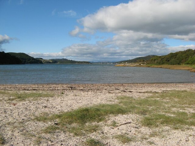
Almorness Point is a prominent headland located in Kirkcudbrightshire, Dumfries and Galloway, Scotland. Situated on the southern coast of the country, it is known for its stunning coastal features and picturesque views.

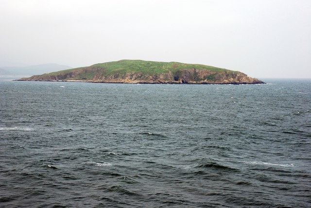
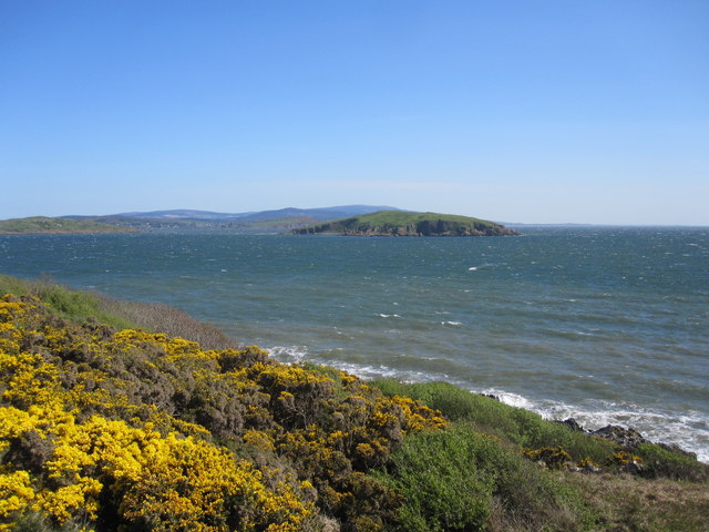
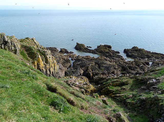
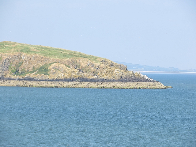
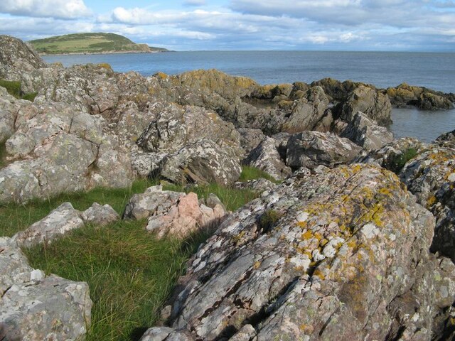
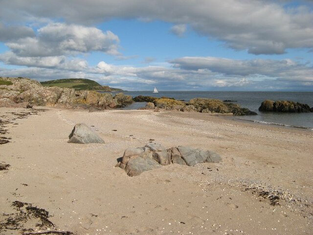
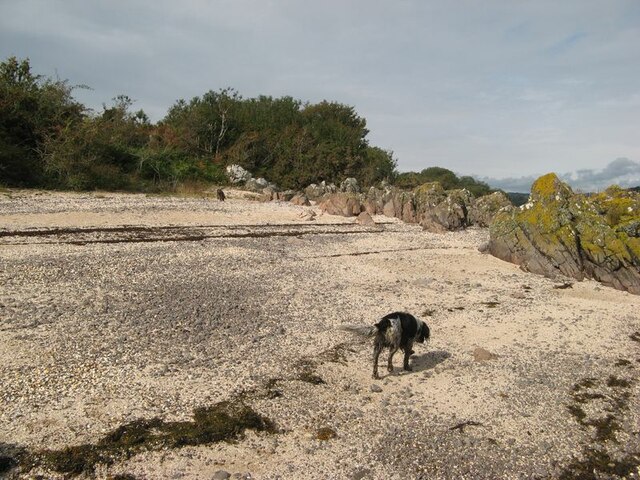
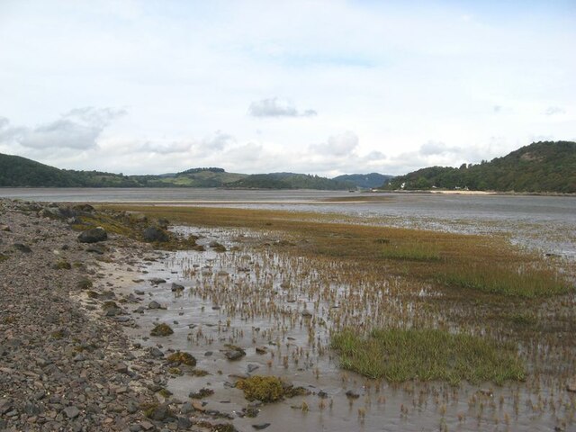
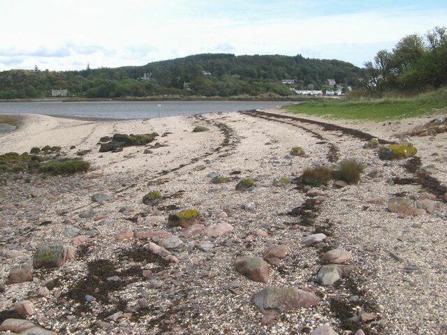
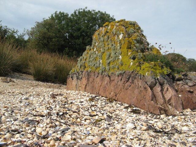
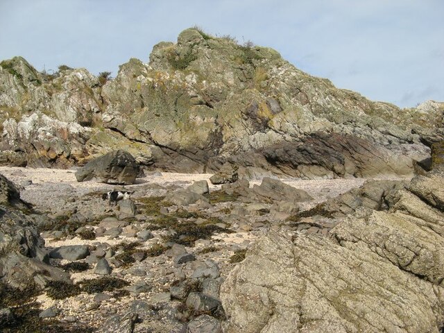
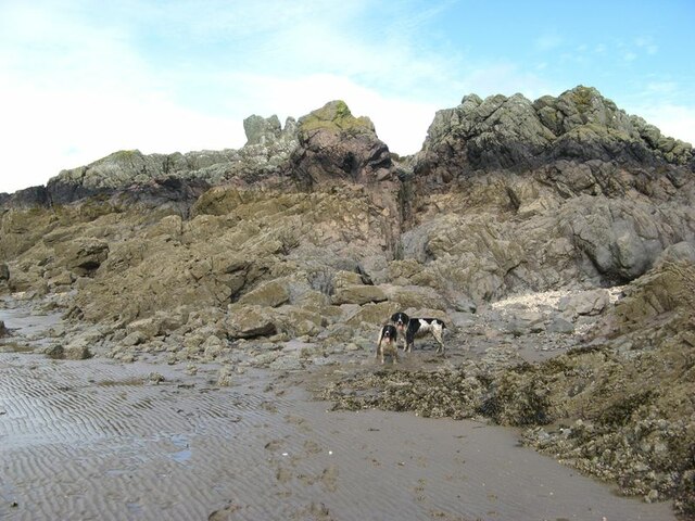
This headland is characterized by its rocky cliffs, which rise dramatically from the sea and offer breathtaking vistas of the surrounding landscape. The point extends into the Solway Firth, a body of water that separates Scotland and England. It is an important landmark for sailors and seafarers navigating the region, providing a distinctive visual reference point along the coast.

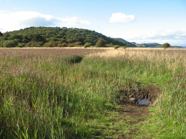
Almorness Point is part of the Almorness Peninsula, a designated Site of Special Scientific Interest (SSSI) due to its rich and diverse wildlife. The area is home to a variety of seabirds, such as gulls, fulmars, and cormorants, which nest on the cliffs and can be observed in their natural habitat. Additionally, the surrounding waters are frequented by seals and dolphins, adding to the area's appeal for nature enthusiasts.

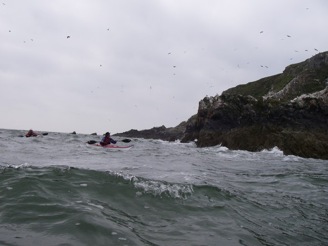
Visitors to Almorness Point can enjoy scenic walks along the coastal path, which offers panoramic views of the Solway Firth and the neighboring hills. The headland is also a popular spot for birdwatching, photography, and outdoor activities like fishing and kayaking.

Overall, Almorness Point in Kirkcudbrightshire is a stunning coastal feature renowned for its rugged cliffs, diverse wildlife, and captivating views.

If you have any feedback on the listing, please let us know in the comments section below.

Almorness Point Images

Images are sourced within 2km of 54.845152/-3.807236 or Grid Reference NX8451. Thanks to Geograph Open Source API. All images are credited.

Hestan Island View across from Balcary.
Hestan Island
View across from Balcary.
Daft Anne's Steps Hestan Island Passing Daft Anne's steps on Hestan Island.
Daft Anne's Steps Hestan Island
Passing Daft Anne's steps on Hestan Island.
Hestan Island An abandoned tractor at the southern end of Hestan Island. At that time the island was unoccupied on a permanent basis, but old residents sometimes visited for the summer. For a more recent image of the tractor see Walter Baxter's 2012 image <a href="https://www.geograph.org.uk/photo/2951556">NX8350 : Hestan Island Lighthouse</a>.
Hestan Island
An abandoned tractor at the southern end of Hestan Island. At that time the island was unoccupied on a permanent basis, but old residents sometimes visited for the summer. For a more recent image of the tractor see Walter Baxter's 2012 image NX8350 : Hestan Island Lighthouse.
Hestan Island from Balcary Point Hestan Island taken on a beautiful clear May Bank Holiday weekend in 2011, with gorse in full boom.
Hestan Island from Balcary Point
Hestan Island taken on a beautiful clear May Bank Holiday weekend in 2011, with gorse in full boom.
Daft Ann's Steps at Hestan Island The rocky outcrops at the southern end of the island are, according to local legend, named Daft Ann’s Steps after a girl who drowned while crossing Auchencairn Bay between the island and Balcary Point.
Daft Ann's Steps at Hestan Island
The rocky outcrops at the southern end of the island are, according to local legend, named Daft Ann’s Steps after a girl who drowned while crossing Auchencairn Bay between the island and Balcary Point.
A casualty on Hestan Island The bones of a sheep lie below steep slopes at the southwest corner of the island.
A casualty on Hestan Island
The bones of a sheep lie below steep slopes at the southwest corner of the island.
Southern tip of Hestan Hestan is a tidal island at the mouth of Auchencairn Bay.
Southern tip of Hestan
Hestan is a tidal island at the mouth of Auchencairn Bay.
Horse Isles Bay A surprising and secluded bay on the east side of Almorness.
Horse Isles Bay
A surprising and secluded bay on the east side of Almorness.
Rough Firth from Horse Isles Bay Looking northwards across the bay and onto Rough Firth.
Rough Firth from Horse Isles Bay
Looking northwards across the bay and onto Rough Firth.
Reed bed The marshy area of the merse is occupied by a wonderful reed bed.
Reed bed
The marshy area of the merse is occupied by a wonderful reed bed.
Rocks on Almorness Lichen-encrusted rocks form the shore to west of White Port. Pink-coloured granitic veins give variety to an otherwise rather grey area.
Rocks on Almorness
Lichen-encrusted rocks form the shore to west of White Port. Pink-coloured granitic veins give variety to an otherwise rather grey area.
White Port A view of the east end of the pretty beach of White Port.
White Port
A view of the east end of the pretty beach of White Port.
Shell beach Lines of stranded seaweed make a contrast with the brightly-coloured shells on the east side of Rough Island.
Shell beach
Lines of stranded seaweed make a contrast with the brightly-coloured shells on the east side of Rough Island.
Samphire bed A patch of muddy sand near to the causeway has a fine growth of samphire.
Samphire bed
A patch of muddy sand near to the causeway has a fine growth of samphire.
Shore by the causeway The shelly beach near to the causeway, which appears to be a form of tombolo.
Shore by the causeway
The shelly beach near to the causeway, which appears to be a form of tombolo.
Granite outcrop An isolated rock outcrop on the shell beach is a fine example of a pink, granitic vein. Many such veins appear to be associated with the intrusion of the nearby Criffel-Dalbeattie pluton, with fingers reaching out into the greywackes of Silurian age. Prominent exposures of such rocks can also be found nearby on the mainland at Rockcliffe. Wave action and abrasion has kept the lower part clear of encrustation, but the top has a delightfully thick growth of lichens.
Granite outcrop
An isolated rock outcrop on the shell beach is a fine example of a pink, granitic vein. Many such veins appear to be associated with the intrusion of the nearby Criffel-Dalbeattie pluton, with fingers reaching out into the greywackes of Silurian age. Prominent exposures of such rocks can also be found nearby on the mainland at Rockcliffe. Wave action and abrasion has kept the lower part clear of encrustation, but the top has a delightfully thick growth of lichens.
Rough Island shore This is rough terrain, with chaotic exposures of fractured and deformed rock. Is it the origin of the name Rough Island?
Rough Island shore
This is rough terrain, with chaotic exposures of fractured and deformed rock. Is it the origin of the name Rough Island?
Intertidal rocks Rocks exposed in the intertidal zone at the south end of Rough Island.
Intertidal rocks
Rocks exposed in the intertidal zone at the south end of Rough Island.
Show me another place!

Almorness Point is located at Grid Ref: NX8451 (Lat: 54.845152, Lng: -3.807236)

Unitary Authority: Dumfries and Galloway

Police Authority: Dumfries and Galloway

What 3 Words

///entitles.breezes.steaming. Near Dalbeattie, Dumfries & Galloway

Nearby Locations

Almorness Point

Related Wikis

Hestan Island

Hestan Island is a small coastal island at the southern foot of the River Urr estuary in the Solway Firth, in the historical county of Kirkcudbrightshire...

Rough Island, Scotland

"Rough Island" is also used as a translation of "Garbh Eilean", a common Scottish name for islandsRough Island is a 20-acre (8 ha) uninhabited tidal island...

Urr Water

Urr Water or River Urr (arc. River Orr) is a river in which flows through the counties of Dumfriesshire and Kirkcudbrightshire in southwest Scotland....

Rough Firth

Rough Firth is an inlet on the northern coast of the Solway Firth in the Stewartry area of Dumfries and Galloway, Scotland. The firth lies between Almorness...

Rockcliffe, Dumfries and Galloway

Rockcliffe is a small, coastal village in Kirkcudbrightshire, Dumfries and Galloway in Scotland, with a view of Rough Island, Hestan Island, the Solway...

Kippford

Kippford (/ˈkɪpfəd/; otherwise Scaur) is a small village along the Solway coast, in the historic county of Kirkcudbrightshire in Dumfries and Galloway...

Orchardton Castle

Orchardton Castle overlooks the Solway Coast. Built in the 1880s, this is a Grade B listed property formerly known as Orchardton House. Built around a...

Colvend and Southwick

Colvend and Southwick is a community council area and civil parish within the Stewartry area of Dumfries and Galloway, Scotland. It is also part of the...

Nearby Amenities

Located within 500m of 54.845152,-3.807236
Source: PGS
Lat/Long: 54.843985/-3.8110522
Source: PGS
Lat/Long: 54.8441722/-3.8103291
Source: PGS
Lat/Long: 54.8445005/-3.8093715
Source: PGS
Lat/Long: 54.8446553/-3.8084317
Source: PGS
Lat/Long: 54.8450448/-3.8077928
Source: PGS
Lat/Long: 54.8452529/-3.8072118
Source: PGS
Lat/Long: 54.8463118/-3.8073261
Source: PGS
Lat/Long: 54.8466447/-3.807222
Source: PGS
Lat/Long: 54.8469848/-3.8074339
Source: PGS
Lat/Long: 54.8474468/-3.8079033
Source: PGS
Lat/Long: 54.8483333/-3.8079286
Source: PGS
Lat/Long: 54.8485969/-3.8074215
Source: PGS
Lat/Long: 54.8485748/-3.8065713
Source: PGS
Lat/Long: 54.8489083/-3.8067349
Source: PGS
Lat/Long: 54.8495081/-3.8071013
Source: PGS
Lat/Long: 54.8438414/-3.8135215
Source: PGS
Lat/Long: 54.8438512/-3.8129416
Source: PGS
Lat/Long: 54.8438738/-3.812006
Source: PGS
Lat/Long: 54.8439149/-3.811454
White Port
Natural: beach
Lat/Long: 54.8478935/-3.806709
Moyl
Ele: 62
Natural: peak
Source: Popular Edition (Scotland)
Lat/Long: 54.8451745/-3.8132696
The data included in this document is from www.openstreetmap.org. The data is made available under ODbL.

Have you been to Almorness Point?

Leave your review of Almorness Point below (or comments, questions and feedback).