Ivy Stone
Coastal Feature, Headland, Point in Somerset Somerset West and Taunton
England
Ivy Stone

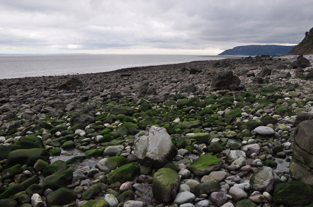
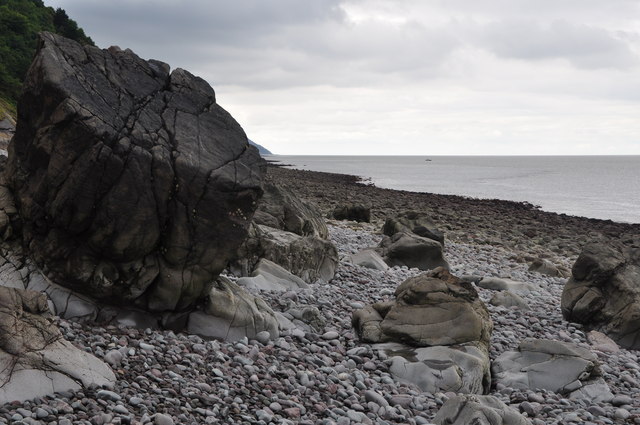
Ivy Stone is a prominent coastal feature located in Somerset, England. It is classified as a headland, also known as a point, due to its distinct geographic formation. Situated on the coastline of the Bristol Channel, Ivy Stone juts out into the water, offering breathtaking views of the surrounding landscape.
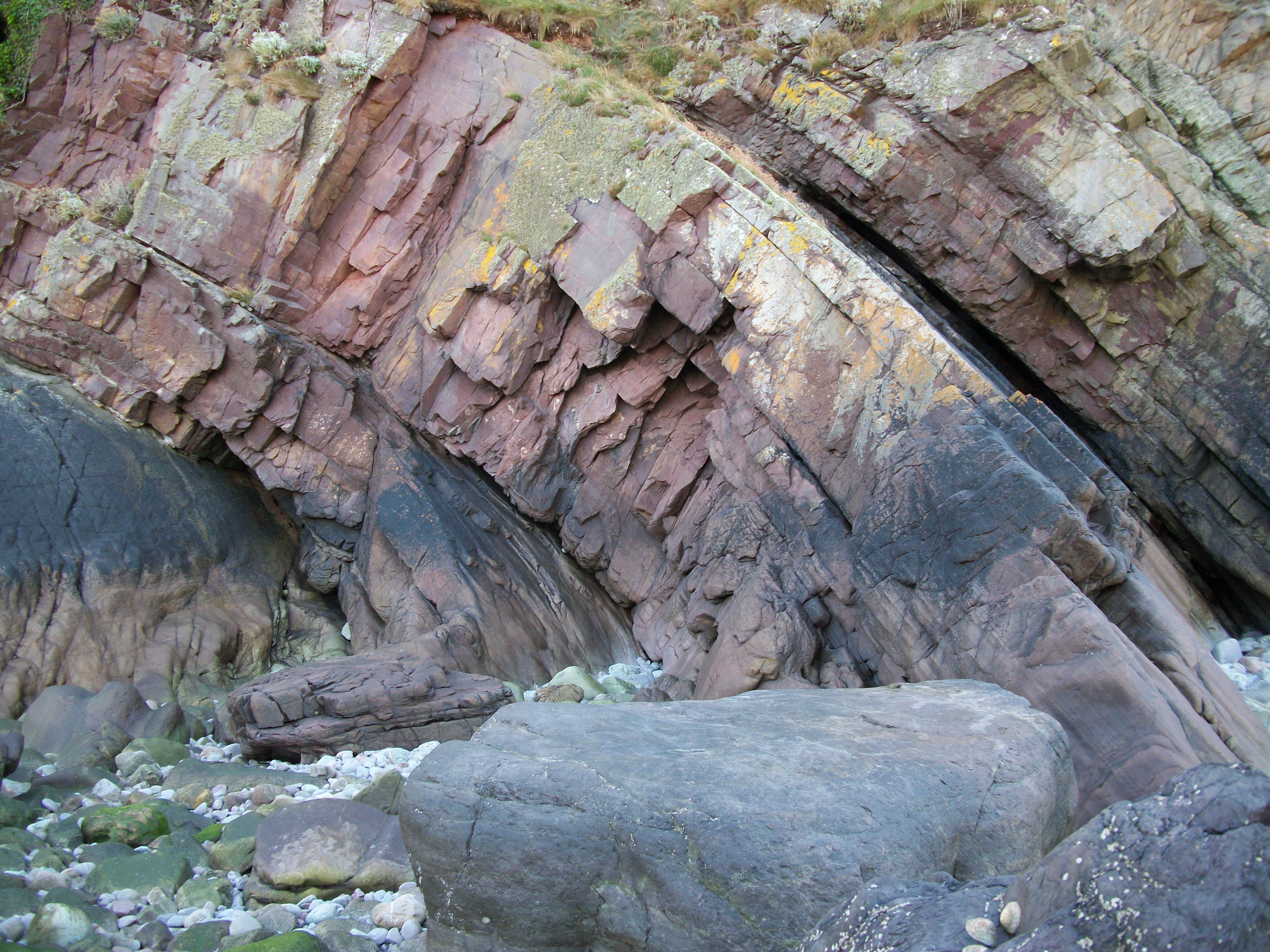
The headland is characterized by its rugged cliffs, which have been shaped over centuries by the relentless pounding of the waves. These cliffs, made up of layers of sedimentary rock, showcase a variety of colors and textures, adding to the visual appeal of the area. At the top of the headland, there is a grassy plateau that provides an ideal vantage point for visitors to admire the panoramic vistas of the channel and the expansive coastline.
Ivy Stone is a popular destination for nature enthusiasts and hikers. The headland is home to a diverse range of flora and fauna, including rare plant species that have adapted to the harsh coastal environment. Visitors can explore the numerous walking trails that wind their way along the cliffs, offering glimpses of nesting seabirds and occasionally seals basking on nearby rocks.
In addition to its natural beauty, Ivy Stone also holds historical significance. It is believed that the headland served as a lookout point during various periods of conflict, providing strategic advantages to those who controlled it. Today, remnants of ancient fortifications can still be seen, adding an additional layer of intrigue to the site.
Overall, Ivy Stone is a captivating coastal feature that showcases the beauty of Somerset's coastline. Its dramatic cliffs, diverse wildlife, and historical significance make it a must-visit destination for nature lovers and history enthusiasts alike.
If you have any feedback on the listing, please let us know in the comments section below.
Ivy Stone Images
Images are sourced within 2km of 51.22602/-3.6643525 or Grid Reference SS8348. Thanks to Geograph Open Source API. All images are credited.


Ivy Stone is located at Grid Ref: SS8348 (Lat: 51.22602, Lng: -3.6643525)
Administrative County: Somerset
District: Somerset West and Taunton
Police Authority: Avon and Somerset
What 3 Words
///scraper.reply.disengage. Near Porlock, Somerset
Nearby Locations
Related Wikis
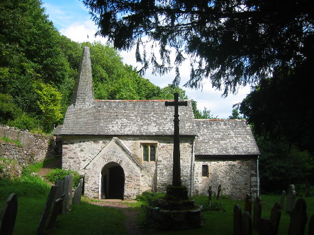
Culbone Church
Culbone Church, located in the village of Culbone in Somerset, is said to be the smallest parish church in England. The church, dedicated to the Welsh...

Culbone
Culbone (also called Kitnor) is a hamlet consisting of little more than the parish church and a few houses, in the parish of Oare in the Exmoor National...
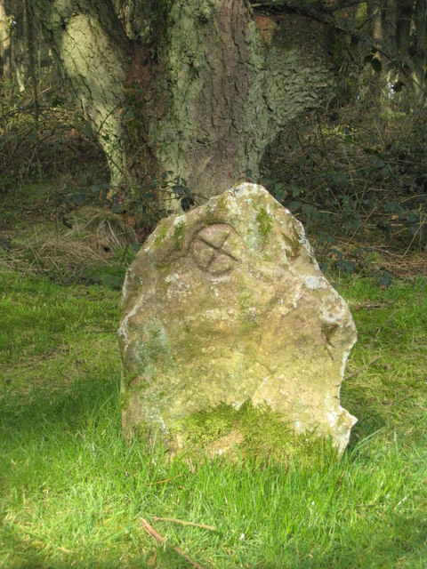
Culbone Stone
The Culbone Stone, an early mediaeval standing stone, is close to Culbone in the English county of Somerset. The stone is made from Hangman grit, a local...
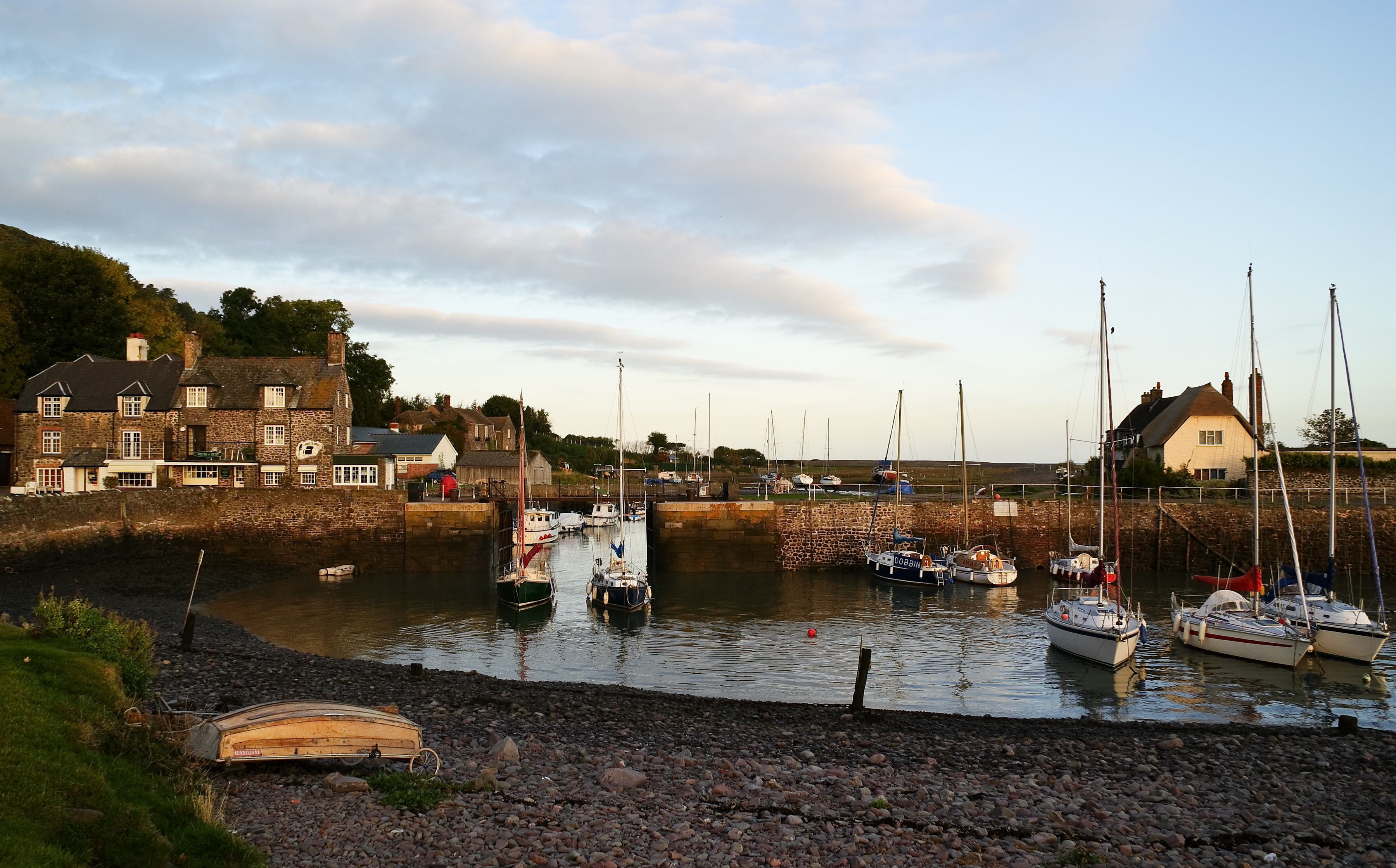
Porlock Weir
Porlock Weir is a harbour settlement approximately 1.5 miles (2.4 km) west of the inland village of Porlock, Somerset, England. "Porlock" comes from the...

Robber's Bridge
Robber's Bridge, or Robbers Bridge, is an old masonry arch bridge in the royal forest of Exmoor near Doone Valley, carrying the minor road from Porlock...

Church of St Mary, Oare
The Anglican Church of St Mary in Oare, Somerset, England, was built in the 15th century. It is a Grade II* listed building. == History == The nave and...
Glenthorne
Glenthorne (grid reference SS800497) is a 13.3 hectare geological Site of Special Scientific Interest in the parish of Oare within the Exmoor National...

Porlock Stone Circle
Porlock Stone Circle is a stone circle located on Exmoor, near the village of Porlock in the south-western English county of Somerset. The Porlock ring...
Nearby Amenities
Located within 500m of 51.22602,-3.6643525Have you been to Ivy Stone?
Leave your review of Ivy Stone below (or comments, questions and feedback).