Lonmay

Settlement in Aberdeenshire

Scotland

Lonmay

Aberdeenshire staggered junction A minor road meets the B9033 in the flat Aberdeenshire landscape, with Newark Farm in the right background.   The B9033 is about 12 km long and loops around from Lumms Crossroads on the A90 to a roundabout at Fraserburgh: <span class="nowrap"><a title="https://www.sabre-roads.org.uk/wiki/index.php?title=B9033" rel="nofollow ugc noopener" href="https://www.sabre-roads.org.uk/wiki/index.php?title=B9033">Link</a><img style="margin-left:2px;" alt="External link" title="External link - shift click to open in new window" src="https://s1.geograph.org.uk/img/external.png" width="10" height="10"/></span> .
Aberdeenshire staggered junction Credit: Bill Harrison

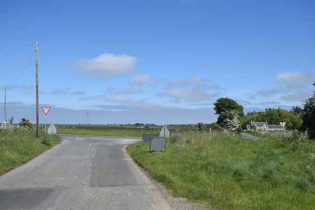
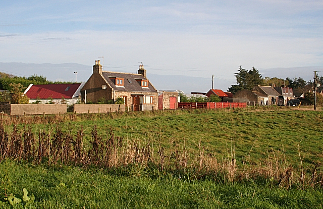
Lonmay is a small rural village located in the Aberdeenshire council area in Scotland. Situated approximately 40 miles north of Aberdeen, it lies on the eastern coast of Scotland, overlooking the North Sea. With a population of around 400 people, Lonmay is known for its peaceful and picturesque surroundings.

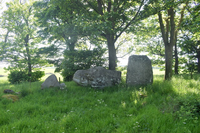
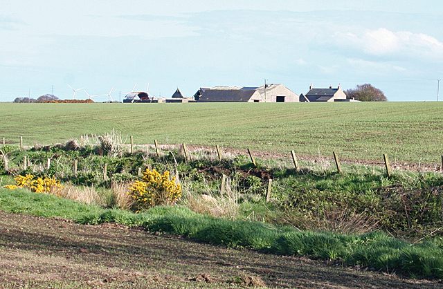
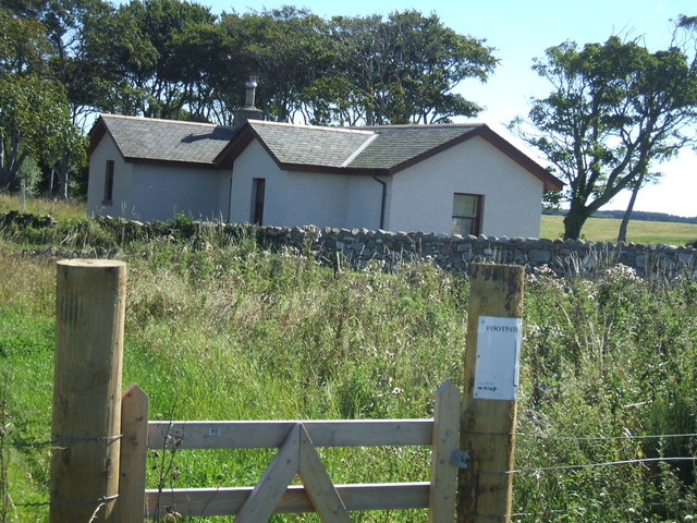
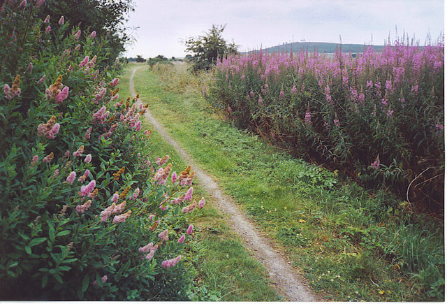
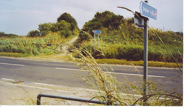
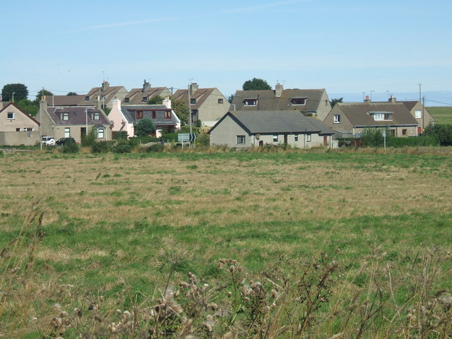
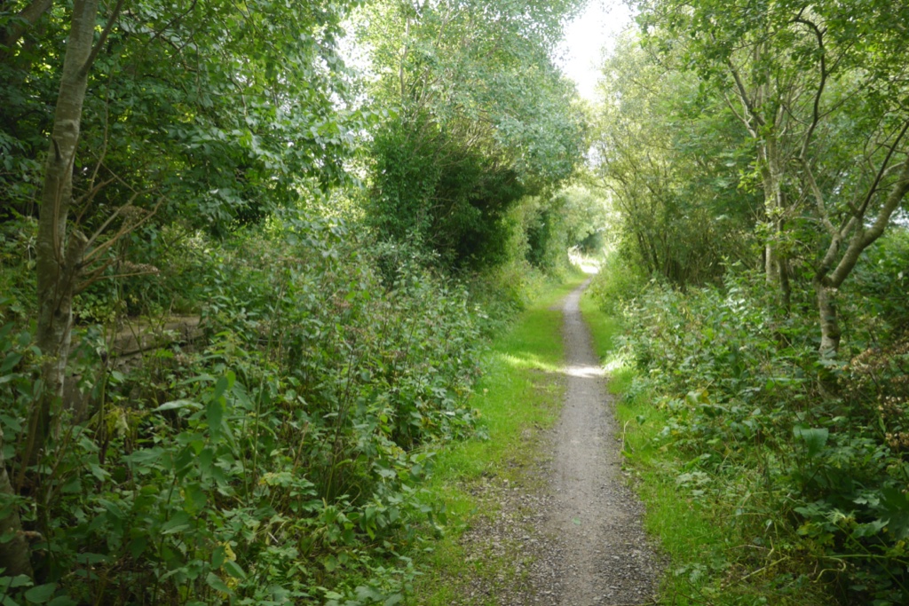
The village is surrounded by rolling hills and farmland, offering breathtaking views of the Scottish countryside. It is characterized by traditional stone-built houses and cottages, giving it a charming and timeless atmosphere. The local economy is primarily agricultural, with farming and livestock being the main occupations for many residents.

Lonmay is home to St. Brandon's Church, a historic building dating back to the 13th century. The church is renowned for its stunning stained glass windows and intricate stone carvings. It serves as a focal point for the community, hosting regular religious services and community events.

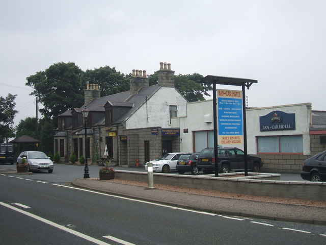
In terms of amenities, Lonmay has a primary school, providing education for children in the local area. For additional services and facilities, residents often travel to nearby towns such as Fraserburgh or Peterhead. These larger towns offer a wider range of shops, healthcare facilities, and leisure activities.

The village of Lonmay offers a tranquil and close-knit community, with a strong sense of local pride. Its idyllic Scottish countryside setting and rich history make it an attractive destination for those seeking a peaceful retreat or a glimpse into rural Scottish life.

If you have any feedback on the listing, please let us know in the comments section below.

Lonmay Images

Images are sourced within 2km of 57.616896/-1.964978 or Grid Reference NK0258. Thanks to Geograph Open Source API. All images are credited.

Aberdeenshire staggered junction A minor road meets the B9033 in the flat Aberdeenshire landscape, with Newark Farm in the right background.   The B9033 is about 12 km long and loops around from Lumms Crossroads on the A90 to a roundabout at Fraserburgh: <span class="nowrap"><a title="https://www.sabre-roads.org.uk/wiki/index.php?title=B9033" rel="nofollow ugc noopener" href="https://www.sabre-roads.org.uk/wiki/index.php?title=B9033">Link</a><img style="margin-left:2px;" alt="External link" title="External link - shift click to open in new window" src="https://s1.geograph.org.uk/img/external.png" width="10" height="10"/></span> .
Aberdeenshire staggered junction
A minor road meets the B9033 in the flat Aberdeenshire landscape, with Newark Farm in the right background. The B9033 is about 12 km long and loops around from Lumms Crossroads on the A90 to a roundabout at Fraserburgh: LinkExternal link .
Berrybrae stone circle: recumbent stone and flankers This site photographs better in the winter when the trees admit more light.  For more, see Canmore listing 21099: <span class="nowrap"><a title="https://canmore.org.uk/site/21099/berrybrae" rel="nofollow ugc noopener" href="https://canmore.org.uk/site/21099/berrybrae">Link</a><img style="margin-left:2px;" alt="External link" title="External link - shift click to open in new window" src="https://s1.geograph.org.uk/img/external.png" width="10" height="10"/></span> .
Berrybrae stone circle: recumbent stone and flankers
This site photographs better in the winter when the trees admit more light. For more, see Canmore listing 21099: LinkExternal link .
Berrybrae Recumbent Stone Circle (1) This circle is inside a small circular wood, making it quite difficult to photograph. The recumbent and three other stones are still in their original positions, and one stone has been re-erected. See <span class="nowrap"><a title="http://canmore.rcahms.gov.uk/en/site/21099/details/berrybrae/" rel="nofollow ugc noopener" href="http://canmore.rcahms.gov.uk/en/site/21099/details/berrybrae/">Link</a><img style="margin-left:2px;" alt="External link" title="External link - shift click to open in new window" src="https://s1.geograph.org.uk/img/external.png" width="10" height="10"/></span> for more information. <a href="https://www.geograph.org.uk/photo/4468847">NK0257 : Berrybrae Recumbent Stone Circle (2)</a>
Berrybrae Recumbent Stone Circle (1)
This circle is inside a small circular wood, making it quite difficult to photograph. The recumbent and three other stones are still in their original positions, and one stone has been re-erected. See LinkExternal link for more information. NK0257 : Berrybrae Recumbent Stone Circle (2)
Berrybrae Recumbent Stone Circle (2) The nearest stone is of red granite. To the right is the west flanker, with the recumbent beyond. See <span class="nowrap"><a title="http://canmore.rcahms.gov.uk/en/site/21099/details/berrybrae/" rel="nofollow ugc noopener" href="http://canmore.rcahms.gov.uk/en/site/21099/details/berrybrae/">Link</a><img style="margin-left:2px;" alt="External link" title="External link - shift click to open in new window" src="https://s1.geograph.org.uk/img/external.png" width="10" height="10"/></span> for more information. <a href="https://www.geograph.org.uk/photo/4468853">NK0257 : Berrybrae Recumbent Stone Circle (3)</a>
Berrybrae Recumbent Stone Circle (2)
The nearest stone is of red granite. To the right is the west flanker, with the recumbent beyond. See LinkExternal link for more information. NK0257 : Berrybrae Recumbent Stone Circle (3)
Berrybrae Recumbent Stone Circle (3) The recumbent and flankers silhouetted against the afternoon sun. The west flanker (on the right) is as it originally was, but the east flanker has broken off, leaving only a short stump standing. See <span class="nowrap"><a title="http://canmore.rcahms.gov.uk/en/site/21099/details/berrybrae/" rel="nofollow ugc noopener" href="http://canmore.rcahms.gov.uk/en/site/21099/details/berrybrae/">Link</a><img style="margin-left:2px;" alt="External link" title="External link - shift click to open in new window" src="https://s1.geograph.org.uk/img/external.png" width="10" height="10"/></span> for more information. <a href="https://www.geograph.org.uk/photo/4468858">NK0257 : Berrybrae Recumbent Stone Circle (4)</a>
Berrybrae Recumbent Stone Circle (3)
The recumbent and flankers silhouetted against the afternoon sun. The west flanker (on the right) is as it originally was, but the east flanker has broken off, leaving only a short stump standing. See LinkExternal link for more information. NK0257 : Berrybrae Recumbent Stone Circle (4)
Berrybrae Recumbent Stone Circle (4) All the surviving stones are in the west arc of the circle. The large dark one on the left is the recumbent, with the broken east flanker in front of it. The next one is still in its original position, but the one furthest to the right has been re-erected after falling over. See <span class="nowrap"><a title="http://canmore.rcahms.gov.uk/en/site/21099/details/berrybrae/" rel="nofollow ugc noopener" href="http://canmore.rcahms.gov.uk/en/site/21099/details/berrybrae/">Link</a><img style="margin-left:2px;" alt="External link" title="External link - shift click to open in new window" src="https://s1.geograph.org.uk/img/external.png" width="10" height="10"/></span> for more information. <a href="https://www.geograph.org.uk/photo/4468867">NK0257 : Berrybrae Recumbent Stone Circle (5)</a>
Berrybrae Recumbent Stone Circle (4)
All the surviving stones are in the west arc of the circle. The large dark one on the left is the recumbent, with the broken east flanker in front of it. The next one is still in its original position, but the one furthest to the right has been re-erected after falling over. See LinkExternal link for more information. NK0257 : Berrybrae Recumbent Stone Circle (5)
Berrybrae Recumbent Stone Circle (5) The recumbent here has an unusual feature in the boss in the centre of its upper surface. Behind it, in the shade, is the tallest stone of the circle, the west flanker, and the broken east flanker is on the right. The stone at the far side of the circle had fallen but was re-erected in 1976. See <span class="nowrap"><a title="http://canmore.rcahms.gov.uk/en/site/21099/details/berrybrae/" rel="nofollow ugc noopener" href="http://canmore.rcahms.gov.uk/en/site/21099/details/berrybrae/">Link</a><img style="margin-left:2px;" alt="External link" title="External link - shift click to open in new window" src="https://s1.geograph.org.uk/img/external.png" width="10" height="10"/></span> for more information. <a href="https://www.geograph.org.uk/photo/4468878">NK0257 : Berrybrae Recumbent Stone Circle (6)</a>
Berrybrae Recumbent Stone Circle (5)
The recumbent here has an unusual feature in the boss in the centre of its upper surface. Behind it, in the shade, is the tallest stone of the circle, the west flanker, and the broken east flanker is on the right. The stone at the far side of the circle had fallen but was re-erected in 1976. See LinkExternal link for more information. NK0257 : Berrybrae Recumbent Stone Circle (6)
Berrybrae Recumbent Stone Circle (6) The tall stone is the massive west flanker, and to its right is the recumbent, with its unusually-shaped upper surface. See <span class="nowrap"><a title="http://canmore.rcahms.gov.uk/en/site/21099/details/berrybrae/" rel="nofollow ugc noopener" href="http://canmore.rcahms.gov.uk/en/site/21099/details/berrybrae/">Link</a><img style="margin-left:2px;" alt="External link" title="External link - shift click to open in new window" src="https://s1.geograph.org.uk/img/external.png" width="10" height="10"/></span> for more information. See <span class="nowrap"><a title="http://canmore.rcahms.gov.uk/en/site/21099/details/berrybrae/" rel="nofollow ugc noopener" href="http://canmore.rcahms.gov.uk/en/site/21099/details/berrybrae/">Link</a><img style="margin-left:2px;" alt="External link" title="External link - shift click to open in new window" src="https://s1.geograph.org.uk/img/external.png" width="10" height="10"/></span> for more information. <a href="https://www.geograph.org.uk/photo/4468888">NK0257 : Berrybrae Recumbent Stone Circle (7)</a>
Berrybrae Recumbent Stone Circle (6)
The tall stone is the massive west flanker, and to its right is the recumbent, with its unusually-shaped upper surface. See LinkExternal link for more information. See LinkExternal link for more information. NK0257 : Berrybrae Recumbent Stone Circle (7)
Berrybrae Recumbent Stone Circle (7) From the very edge of the wooded circle, the whole extent of the circle can be seen. See <span class="nowrap"><a title="http://canmore.rcahms.gov.uk/en/site/21099/details/berrybrae/" rel="nofollow ugc noopener" href="http://canmore.rcahms.gov.uk/en/site/21099/details/berrybrae/">Link</a><img style="margin-left:2px;" alt="External link" title="External link - shift click to open in new window" src="https://s1.geograph.org.uk/img/external.png" width="10" height="10"/></span> for more information. <a href="https://www.geograph.org.uk/photo/4468895">NK0257 : Berrybrae Recumbent Stone Circle (8)</a>
Berrybrae Recumbent Stone Circle (7)
From the very edge of the wooded circle, the whole extent of the circle can be seen. See LinkExternal link for more information. NK0257 : Berrybrae Recumbent Stone Circle (8)
Berrybrae Recumbent Stone Circle (8) The stone circle is inside this small circular wood in the field. Fortunately the crop was not so well grown that it precluded visiting the circle. Later in the year, it will be impossible because the crop will be too tall. See <span class="nowrap"><a title="http://canmore.rcahms.gov.uk/en/site/21099/details/berrybrae/" rel="nofollow ugc noopener" href="http://canmore.rcahms.gov.uk/en/site/21099/details/berrybrae/">Link</a><img style="margin-left:2px;" alt="External link" title="External link - shift click to open in new window" src="https://s1.geograph.org.uk/img/external.png" width="10" height="10"/></span> for more information. <a href="https://www.geograph.org.uk/photo/4468842">NK0257 : Berrybrae Recumbent Stone Circle (1)</a>
Berrybrae Recumbent Stone Circle (8)
The stone circle is inside this small circular wood in the field. Fortunately the crop was not so well grown that it precluded visiting the circle. Later in the year, it will be impossible because the crop will be too tall. See LinkExternal link for more information. NK0257 : Berrybrae Recumbent Stone Circle (1)
Berrybrae Looking over a ditch from the very muddy field edge just beside the road.
Berrybrae
Looking over a ditch from the very muddy field edge just beside the road.
'Lodge' house adjacent to Buchan Line on a minor road / old rail line crossing point
'Lodge' house adjacent to Buchan Line
on a minor road / old rail line crossing point
Lonmay, Old Formartine & Buchan Railway Lonmay once had a station on the Maud - Fraserburgh railway which was opened in 1965. Lonmay also has potatoes named after it eg Lonmay Pinks, which reflects well on this farming area in Buchan.
Lonmay, Old Formartine & Buchan Railway
Lonmay once had a station on the Maud - Fraserburgh railway which was opened in 1965. Lonmay also has potatoes named after it eg Lonmay Pinks, which reflects well on this farming area in Buchan.
A92 Crossing with the F&B Way A railway bridge once crossed this road, but today the Formartine 7 Buchan Way descends to ground level. The road is busy with refrigerated fish lorries thundering south from Fraserburgh ("The Broch") to the large UK cities and to France.
A92 Crossing with the F&B Way
A railway bridge once crossed this road, but today the Formartine 7 Buchan Way descends to ground level. The road is busy with refrigerated fish lorries thundering south from Fraserburgh ("The Broch") to the large UK cities and to France.
Lonmay village view from Buchan Line. Lonmay is a fairly scattered community, rather than a unified village, with clumps of housing in about 4 sites. Historical claim to fame - Elvis Presley's ancestor emigrated from this area
Lonmay village
view from Buchan Line. Lonmay is a fairly scattered community, rather than a unified village, with clumps of housing in about 4 sites. Historical claim to fame - Elvis Presley's ancestor emigrated from this area
Ban Car Hotel, Lonmay Small country hotel on Peterhead to Fraserburgh road. Large function area which is popular for local weddings.
Ban Car Hotel, Lonmay
Small country hotel on Peterhead to Fraserburgh road. Large function area which is popular for local weddings.
Berrybrae Stone Circle In a copse 50m into the field.
Berrybrae Stone Circle
In a copse 50m into the field.
Cortiebrae Traditional cottages by the back road to Inverallochy.
Cortiebrae
Traditional cottages by the back road to Inverallochy.
Show me another place!

Lonmay is located at Grid Ref: NK0258 (Lat: 57.616896, Lng: -1.964978)

Unitary Authority: Aberdeenshire

Police Authority: North East

What 3 Words

///tripods.protects.tropic. Near Fraserburgh, Aberdeenshire

Nearby Locations

Lonmay

Related Wikis

Lonmay

Lonmay (Scottish Gaelic: Lòn Magh) is a village and parish in the Buchan area of Aberdeenshire, Scotland. It lies along the A90 road, between Peterhead...

Lonmay railway station

Lonmay railway station was a railway station in Lonmay, Aberdeenshire. == History == The station was opened on 24 April 1865 by the Formartine and Buchan...

Cortes, Aberdeenshire

Cortes is a rural settlement in the Banff and Buchan area of Aberdeenshire, Scotland, situated in the parish of Rathen, 7.8 kilometres (4.8 mi) south of...
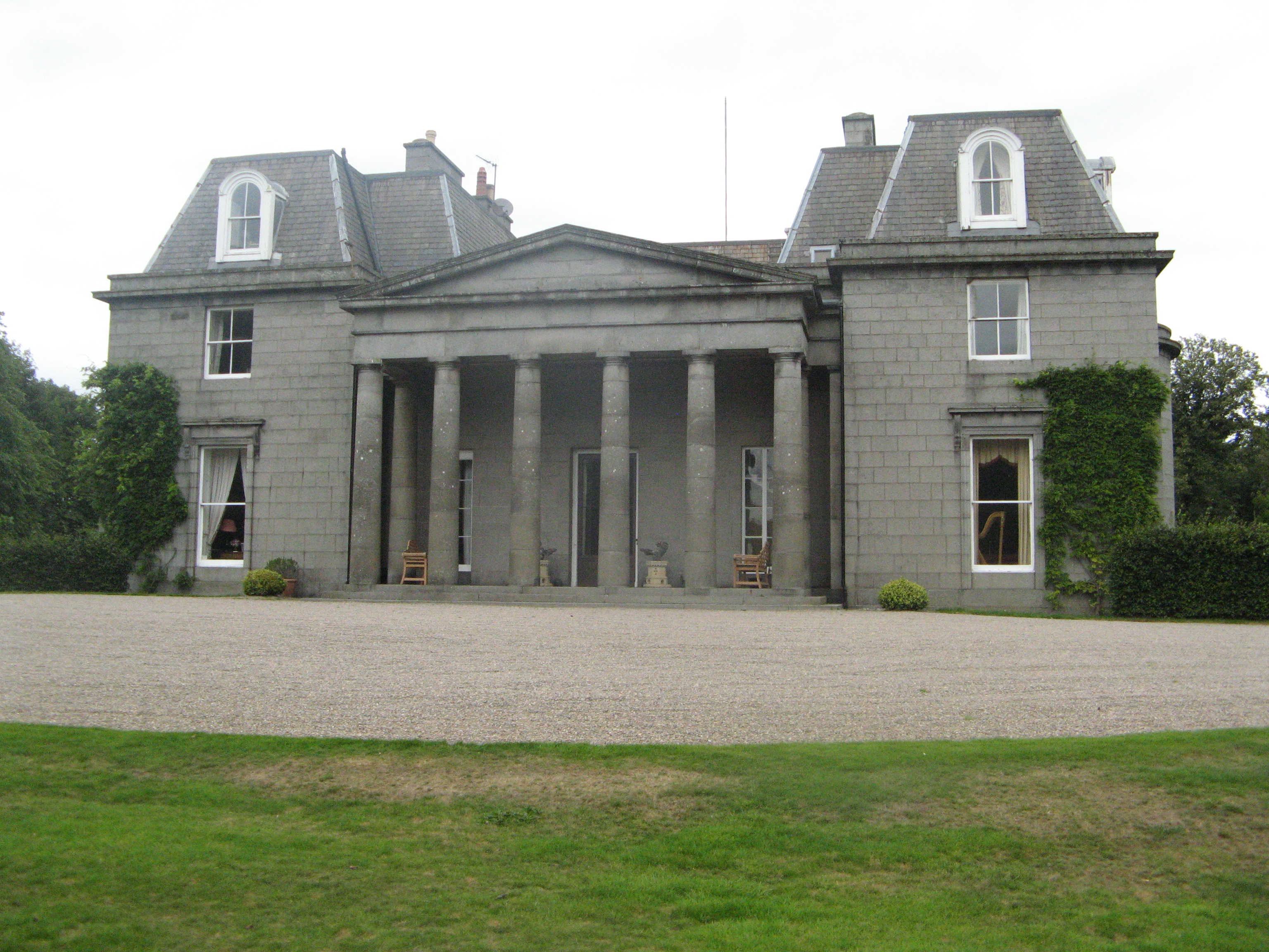
Crimonmogate

Crimonmogate is an estate near Crimond, Aberdeenshire. The estate formed part of Lonmay parish, dates back to the 14th century, and was included in the...

Nearby Amenities

Located within 500m of 57.616896,-1.964978
Speed Camera
Note: nescamp gps position wrong
Ref: 104
Website: http://www.nescamp.co.uk/details?cid=4
Lat/Long: 57.616736/-1.9647473
Note: incorrect position
Website: http://www.nescamp.co.uk/details?cid=4
Lat/Long: 57.6186037/-1.9683246
Power: tower
Lat/Long: 57.6176735/-1.9576921
Power: tower
Lat/Long: 57.619944/-1.9597646
Whitehillock
Place: locality
Lat/Long: 57.6157333/-1.9599898
Marchlands
Place: hamlet
Lat/Long: 57.6158482/-1.9636044
Power: pole
Lat/Long: 57.6156525/-1.9625212
Power: pole
Lat/Long: 57.6158454/-1.9629285
Power: pole
Lat/Long: 57.6161479/-1.9635484
Power: pole
Lat/Long: 57.6163576/-1.963995
Power: pole
Lat/Long: 57.6165821/-1.9644181
Power: pole
Lat/Long: 57.6170352/-1.9644535
Power: pole
Lat/Long: 57.6174473/-1.9645834
Power: pole
Lat/Long: 57.6181944/-1.9647319
Power: pole
Lat/Long: 57.6187909/-1.9648756
Power: pole
Lat/Long: 57.6193905/-1.9650291
Power: pole
Lat/Long: 57.6200396/-1.9652003
Power: pole
Lat/Long: 57.6206666/-1.9653498
Power: pole
Lat/Long: 57.6210765/-1.9654502
Power: pole
Lat/Long: 57.6213431/-1.9655249
Power: pole
Lat/Long: 57.6191787/-1.9661782
Power: pole
Lat/Long: 57.6189605/-1.9672467
Power: pole
Lat/Long: 57.6187298/-1.968508
Power: pole
Lat/Long: 57.6202957/-1.9596612
Power: pole
Lat/Long: 57.6204822/-1.9607808
Power: pole
Lat/Long: 57.6207035/-1.9620618
Power: pole
Lat/Long: 57.620949/-1.963024
Power: pole
Lat/Long: 57.6211987/-1.9640393
Power: pole
Lat/Long: 57.6212736/-1.9647693
The data included in this document is from www.openstreetmap.org. The data is made available under ODbL.

Have you been to Lonmay?

Leave your review of Lonmay below (or comments, questions and feedback).