Beadlow

Settlement in Bedfordshire

England

Beadlow

River Flit, Beadlow, Clophill, Beds a tributary of the River Ivel; view E towards Chicksands.
River Flit, Beadlow, Clophill, Beds Credit: Rodney Burton

Beadlow is a small village located in the county of Bedfordshire, England. Situated approximately 7 miles south of Bedford, it is nestled in a rural area surrounded by picturesque countryside. The village is part of the Central Bedfordshire district and falls within the civil parish of Clophill.

With a population of just over 200 residents, Beadlow maintains a close-knit community atmosphere. The village is known for its tranquil and idyllic setting, offering a peaceful retreat away from the hustle and bustle of city life. The landscape is characterized by rolling hills, farmland, and woodlands, making it a popular spot for outdoor activities such as walking, cycling, and horse riding.

Beadlow is home to the Beadlow Manor Golf Club, which boasts an 18-hole championship golf course. The club attracts both local players and visitors from afar, providing a challenging yet enjoyable experience for golf enthusiasts. Additionally, the village benefits from its proximity to nearby towns and cities, with easy access to amenities, shopping centers, and transport links.

Historically, Beadlow has a rich heritage dating back to the medieval period, and remnants of its past can still be seen today. St Mary's Church, a Grade II listed building, stands as a testament to the village's history and is a focal point for the community.

Overall, Beadlow offers a serene and picturesque setting, combined with convenient access to modern amenities, making it an attractive place to live or visit for those seeking a peaceful and rural retreat.

If you have any feedback on the listing, please let us know in the comments section below.
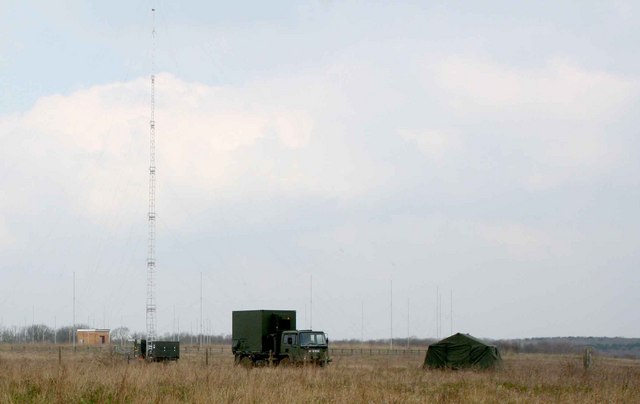
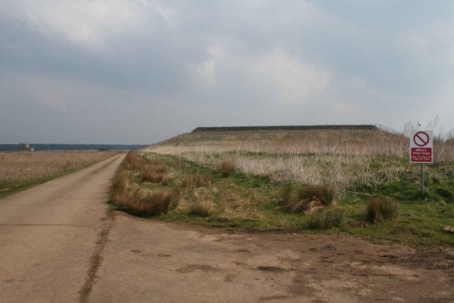
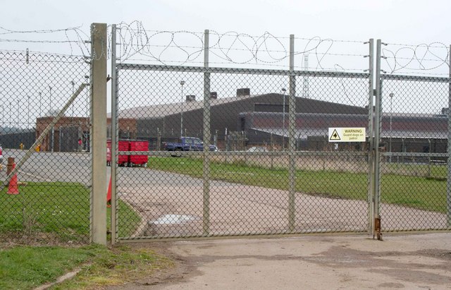
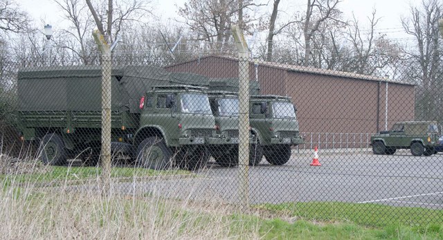
Beadlow Images

Images are sourced within 2km of 52.033405/-0.389859 or Grid Reference TL1038. Thanks to Geograph Open Source API. All images are credited.

River Flit, Beadlow, Clophill, Beds a tributary of the River Ivel; view E towards Chicksands.
River Flit, Beadlow, Clophill, Beds
a tributary of the River Ivel; view E towards Chicksands.
Upper Alders, Flit valley, Chicksands, Beds View NNE from near the A507 Ampthill Road across set-aside land.
Upper Alders, Flit valley, Chicksands, Beds
View NNE from near the A507 Ampthill Road across set-aside land.
Hotel, Beadlow This hotel is next to a golf course by the A507. I'm not sure if the hotel is actually open as it seemed a little deserted.
Hotel, Beadlow
This hotel is next to a golf course by the A507. I'm not sure if the hotel is actually open as it seemed a little deserted.
Cainhoe Manor Farm, Gravenhurst, Beds – entrance to the farmyard from Clophill Road.
Cainhoe Manor Farm, Gravenhurst, Beds
– entrance to the farmyard from Clophill Road.
Ministry of Defence facility MOD generator truck, tent and radio transmitter masts 84m above sea level.  To the right is a firing range.
Ministry of Defence facility
MOD generator truck, tent and radio transmitter masts 84m above sea level. To the right is a firing range.
Firing Range Keep out when red flag is flying.  You can just see the flag behind and you could hear the gunfire.
Firing Range
Keep out when red flag is flying. You can just see the flag behind and you could hear the gunfire.
Military facility Some kind of military facility in Chicksands
Military facility
Some kind of military facility in Chicksands
Footpath Sign Bedfordshire County Council Footpath sign
Footpath Sign
Bedfordshire County Council Footpath sign
Barn Conversions Barn conversions at Speedsdairy Farm.  Note the clay tiles on the main buildings and the black timber weatherboarding and pantiles on the subservient buildings.  No chimneys, not many windows and conservation rooflights - keep the planners content.
Barn Conversions
Barn conversions at Speedsdairy Farm. Note the clay tiles on the main buildings and the black timber weatherboarding and pantiles on the subservient buildings. No chimneys, not many windows and conservation rooflights - keep the planners content.
Military vehicles at Chicksands Bedford trucks parked at this military installation at Chicksands
Military vehicles at Chicksands
Bedford trucks parked at this military installation at Chicksands
Ditch feature
Ditch feature
Road towards Beadlow
Depot next to Beadlow
Quarry entrance
Quarry entrance
Drainage feature
Drainage feature
Small stream / drain
Farm track near Campton
Disused farmland
Disused farmland
Show me another place!

Beadlow is located at Grid Ref: TL1038 (Lat: 52.033405, Lng: -0.389859)

Unitary Authority: Central Bedfordshire

Police Authority: Bedfordshire

What 3 Words

///recipient.business.masses. Near Chicksands, Bedfordshire

Nearby Locations

Beadlow

Related Wikis

Beadlow Priory

Beadlow Priory was a monastic foundation established between 1140 and 1146 by Robert D'Albini for a community of Benedictine monks. == History == Around...

Woburn Sands Formation

The Woburn Sands Formation is a geological formation in England. Part of the Lower Greensand Group, it is the only unit of the group where it occurs, and...

Beadlow

Beadlow is a hamlet in the Central Bedfordshire district of Bedfordshire, England. At the 2011 Census the population of the hamlet was included in the...

Mid Bedfordshire (UK Parliament constituency)

Mid Bedfordshire is a constituency represented in the House of Commons of the UK Parliament by Alistair Strathern of the Labour Party since a 2023 by...

Nearby Amenities

Located within 500m of 52.033405,-0.389859
Beadlow
Place: hamlet
Wikidata: Q1520644
Lat/Long: 52.034333/-0.3905638
Beadlow Manor
Tourism: hotel
Lat/Long: 52.0298259/-0.3854479
Power: pole
Lat/Long: 52.0342164/-0.3952101
Power: pole
Lat/Long: 52.0335498/-0.3939012
Power: pole
Lat/Long: 52.0329706/-0.3927988
Power: pole
Lat/Long: 52.0331306/-0.3917366
Power: pole
Lat/Long: 52.0332536/-0.3907214
Power: pole
Lat/Long: 52.0331306/-0.3904223
Power: pole
Lat/Long: 52.0332626/-0.389678
Power: pole
Lat/Long: 52.0335135/-0.387952
Power: pole
Lat/Long: 52.0337758/-0.3862193
Power: pole
Lat/Long: 52.0342989/-0.3853637
Power: pole
Lat/Long: 52.0348236/-0.3845269
Power: pole
Lat/Long: 52.0341817/-0.3840655
Power: pole
Lat/Long: 52.0337082/-0.3851786
Power: pole
Lat/Long: 52.0331966/-0.3863749
Power: pole
Lat/Long: 52.0325778/-0.3878796
Power: pole
Lat/Long: 52.0319508/-0.3893816
Power: pole
Lat/Long: 52.0311769/-0.3905484
Power: pole
Lat/Long: 52.0303897/-0.3917286
Power: pole
Lat/Long: 52.0296042/-0.3929248
The data included in this document is from www.openstreetmap.org. The data is made available under ODbL.

Have you been to Beadlow?

Leave your review of Beadlow below (or comments, questions and feedback).