Cairn Head

Coastal Feature, Headland, Point in Wigtownshire

Scotland

Cairn Head

Overgrazing cattle? I have never seen so many cows in such a small field!
Overgrazing cattle? Credit: Russel Wills

Cairn Head is a prominent coastal feature located in Wigtownshire, a region in southwest Scotland. It is a headland that extends out into the North Channel, which separates Scotland and Northern Ireland. This geographical landmark is situated near the village of Port William and offers breathtaking panoramic views of the surrounding coastal areas.

The headland is characterized by its rugged cliffs, which rise dramatically from the sea, providing a stunning backdrop to the picturesque landscape. The cliffs are composed of sedimentary rocks, such as sandstone and shale, which have been shaped by years of erosion from the relentless waves and winds. This erosion has created several fascinating rock formations and caves along the coastline, adding to the allure and intrigue of Cairn Head.

The headland is also home to a diverse range of wildlife, making it a popular spot for nature enthusiasts and birdwatchers. Seabirds, including puffins, gannets, and guillemots, can be seen nesting on the cliffs during the breeding season, while seals can often be spotted basking on the rocks below.

Access to Cairn Head is relatively easy, with a footpath leading from Port William to the headland. The path offers a pleasant walk through unspoiled coastal scenery, and there are several vantage points along the way that provide excellent views of the North Channel and the surrounding coastline.

Overall, Cairn Head is a captivating coastal feature that combines natural beauty, geological interest, and abundant wildlife. It is a must-visit destination for anyone looking to experience the stunning coastal landscapes of Wigtownshire.

If you have any feedback on the listing, please let us know in the comments section below.
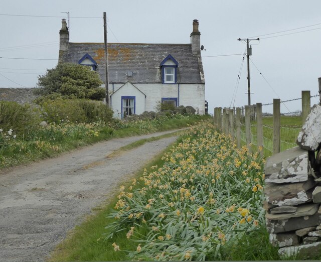
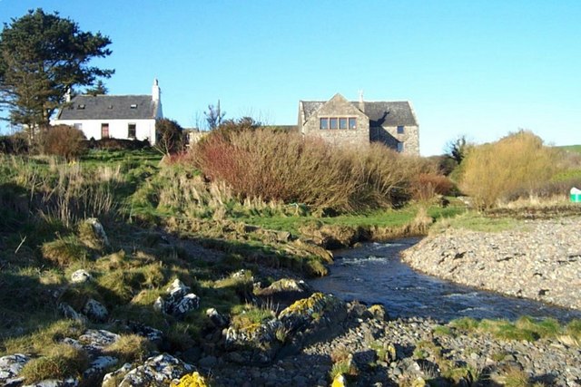
Cairn Head Images

Images are sourced within 2km of 54.717609/-4.3512201 or Grid Reference NX4838. Thanks to Geograph Open Source API. All images are credited.

Overgrazing cattle? I have never seen so many cows in such a small field!
Overgrazing cattle?
I have never seen so many cows in such a small field!
Cairnhead On Portyerrock Bay which is just over the hill.
Cairnhead
On Portyerrock Bay which is just over the hill.
Portyerrock Bay See how the bay has remnants of the Mulberry Harbour of WW2.
<span class="nowrap"><a title="https://www.youtube.com/watch?v=d4QswCbNfzU" rel="nofollow ugc noopener" href="https://www.youtube.com/watch?v=d4QswCbNfzU">Link</a><img style="margin-left:2px;" alt="External link" title="External link - shift click to open in new window" src="https://s1.geograph.org.uk/img/external.png" width="10" height="10"/></span>
Portyerrock Bay
See how the bay has remnants of the Mulberry Harbour of WW2. LinkExternal link
Sheddock Overlooking Wigtown Bay.
Sheddock
Overlooking Wigtown Bay.
The road to Whithorn And the turn off to Garlieston.
The road to Whithorn
And the turn off to Garlieston.
Rowing up, Sheddock Newly mown grass being raked ready for the forage harvester or round baler.
Rowing up, Sheddock
Newly mown grass being raked ready for the forage harvester or round baler.
Towards Portyerrock B7063
Towards Portyerrock
B7063
Rough grazing, Portyerrock Between road and sea.
Rough grazing, Portyerrock
Between road and sea.
B7063, Portyerrock
B7063, Portyerrock
Towards Stannock Near Isle Farm on the B7063.
Towards Stannock
Near Isle Farm on the B7063.
B7063, Isle Farm
B7063, Isle Farm
Fields near Stein Head South of Isle Farm, Isle of Whithorn.
Fields near Stein Head
South of Isle Farm, Isle of Whithorn.
Fields near Stein Head South of Isle Farm, Isle of Whithorn.
Fields near Stein Head
South of Isle Farm, Isle of Whithorn.
Stein Head View from The Cairn, Isle of Whithorn.
Stein Head
View from The Cairn, Isle of Whithorn.
Stein Head trig Looking N from position
Stein Head trig
Looking N from position
Towards Isle of Whithorn from Stein Head Looking SSW from position
Towards Isle of Whithorn from Stein Head
Looking SSW from position
Portyerrock Mill and Mill Cottage A glorious spot in Wigtownshire
Portyerrock Mill and Mill Cottage
A glorious spot in Wigtownshire
Across the Bay at the Isle of Whithorn towards Stein Head
Show me another place!

Cairn Head is located at Grid Ref: NX4838 (Lat: 54.717609, Lng: -4.3512201)

Unitary Authority: Dumfries and Galloway

Police Authority: Dumfries and Galloway

What 3 Words

///soda.yield.filled. Near Whithorn, Dumfries & Galloway

Related Wikis

Isle of Whithorn

Isle of Whithorn (Port Rosnait in Gaelic) is one of the most southerly villages and seaports in Scotland, lying on the coast north east of Burrow Head...

Candida Casa

Candida Casa was the name given to the church established by St Ninian in Whithorn, Galloway, southern Scotland, in the mid fifth century AD. The name...

Whithorn

Whithorn (Scots pronunciation: [ˈʍɪthorn], Taigh Mhàrtainn in modern Gaelic), is a royal burgh in the historic county of Wigtownshire in Dumfries and Galloway...

Whithorn Priory

Whithorn Priory was a medieval Scottish monastery that also served as a cathedral, located at 6 Bruce Street in Whithorn, Wigtownshire, Dumfries and Galloway...

Nearby Amenities

Located within 500m of 54.717609,-4.3512201
Source: PGS
Lat/Long: 54.713366/-4.349249
Source: PGS
Lat/Long: 54.713873/-4.349708
Source: PGS
Lat/Long: 54.714124/-4.350159
Source: PGS
Lat/Long: 54.714887/-4.350627
Source: PGS
Lat/Long: 54.7150895/-4.3512975
Source: PGS
Lat/Long: 54.7152711/-4.3519133
Source: PGS
Lat/Long: 54.7154477/-4.3523951
Source: PGS
Lat/Long: 54.7156528/-4.3524509
Source: PGS
Lat/Long: 54.7157873/-4.3519487
Source: PGS
Lat/Long: 54.7159323/-4.35132
Source: PGS
Lat/Long: 54.7161052/-4.3509649
Source: PGS
Lat/Long: 54.716168/-4.350669
Source: PGS
Lat/Long: 54.716682/-4.350465
Source: PGS
Lat/Long: 54.7169016/-4.3514198
Source: PGS
Lat/Long: 54.7172201/-4.3518704
Source: PGS
Lat/Long: 54.7172015/-4.3511258
Source: PGS
Lat/Long: 54.7174816/-4.3512321
Source: PGS
Lat/Long: 54.7178429/-4.351629
Source: PGS
Lat/Long: 54.71807/-4.352281
Source: PGS
Lat/Long: 54.7178931/-4.3540377
Source: PGS
Lat/Long: 54.7172963/-4.3548445
Source: PGS
Lat/Long: 54.7168892/-4.3553037
Source: PGS
Lat/Long: 54.7172809/-4.3565182
Source: PGS
Lat/Long: 54.7174438/-4.3567982
Source: PGS
Lat/Long: 54.7176607/-4.357252
Source: PGS
Lat/Long: 54.7176205/-4.3581994
Source: PGS
Lat/Long: 54.71731/-4.358915
Beetle pontoon
Historic: wreck
Seamark Type: wreck
Lat/Long: 54.717637/-4.3559164
The data included in this document is from www.openstreetmap.org. The data is made available under ODbL.

Have you been to Cairn Head?

Leave your review of Cairn Head below (or comments, questions and feedback).