Craig Ddu

Coastal Feature, Headland, Point in Carmarthenshire

Wales

Craig Ddu

Bend in the sea wall, Laugharne The sea wall is not straight, but has a gradual curve from the northern end and then a sharper bend.  It is an earth bank, protected by stone pitching on the seaward side.
Bend in the sea wall, Laugharne Credit: Humphrey Bolton

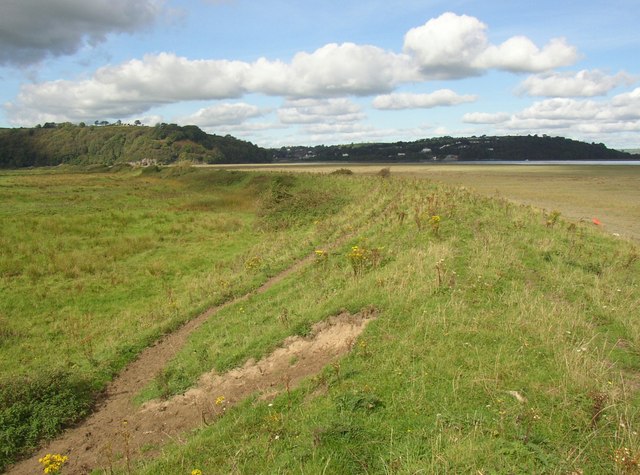
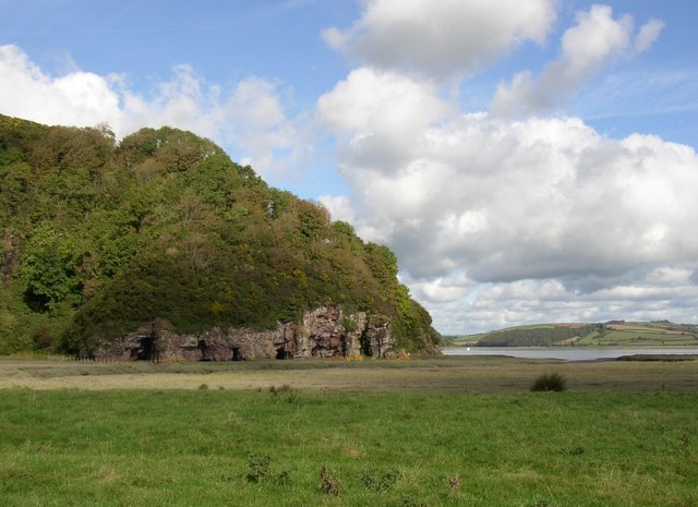
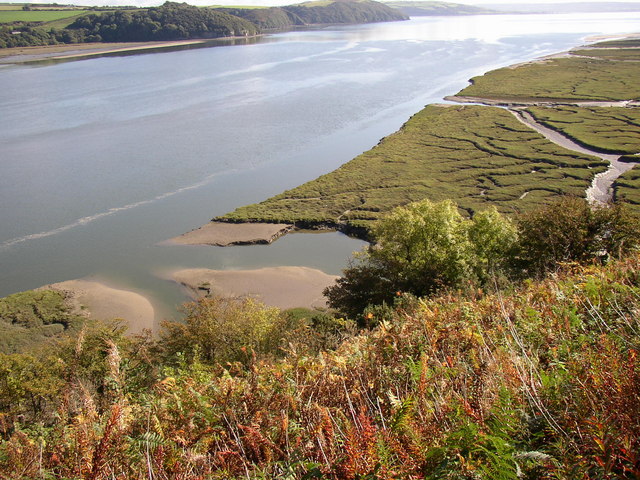
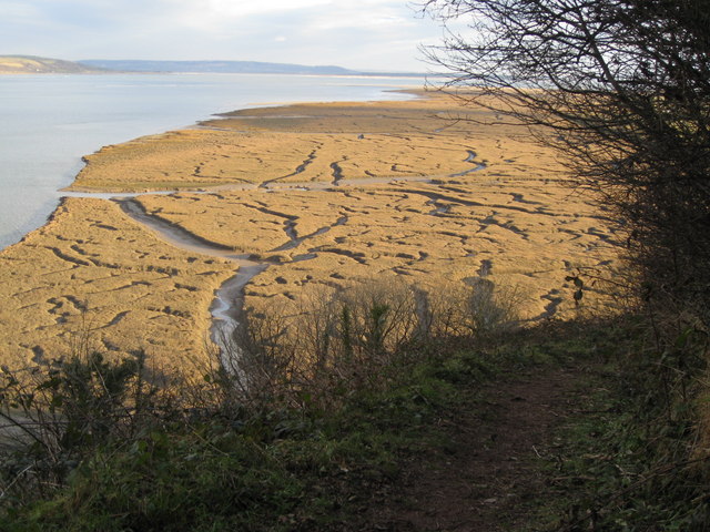
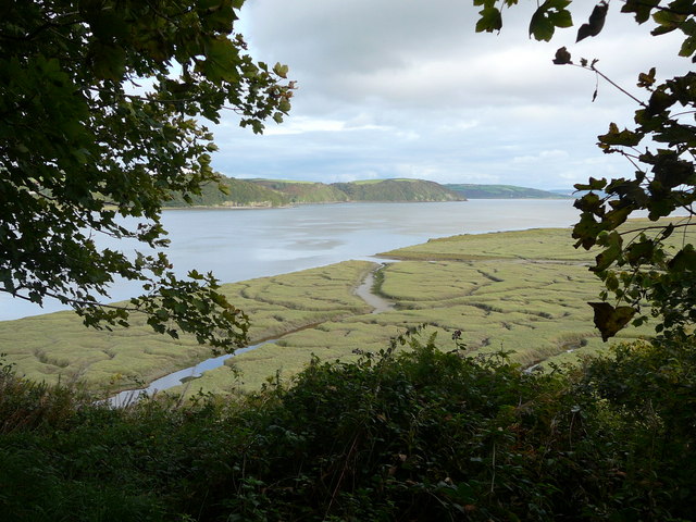
Craig Ddu is a prominent coastal feature located in Carmarthenshire, Wales. It is a headland or point that juts out into the Irish Sea, offering breathtaking views of the surrounding landscape. The name "Craig Ddu" translates to "Black Rock" in English, which is a fitting description for the dark, rocky cliffs that dominate the area.

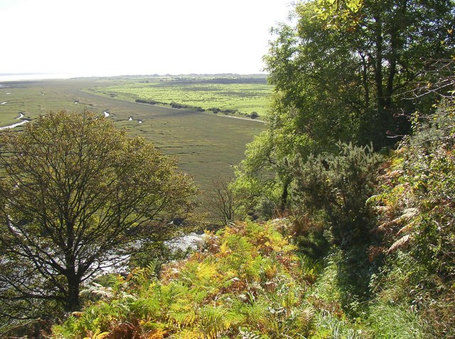
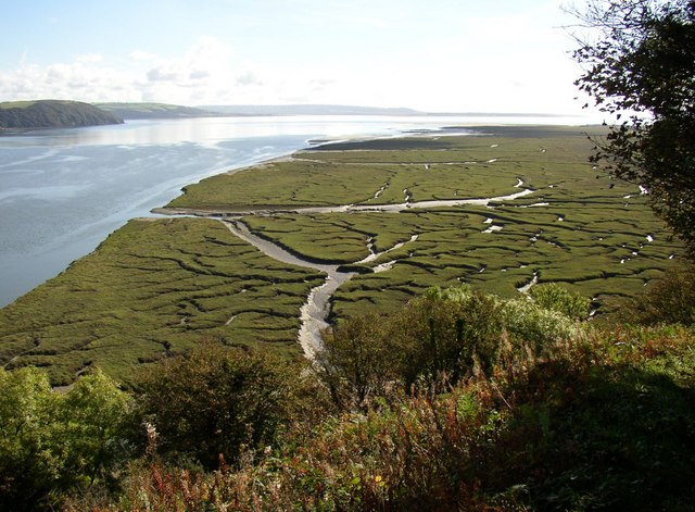
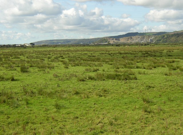
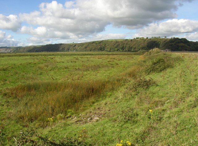
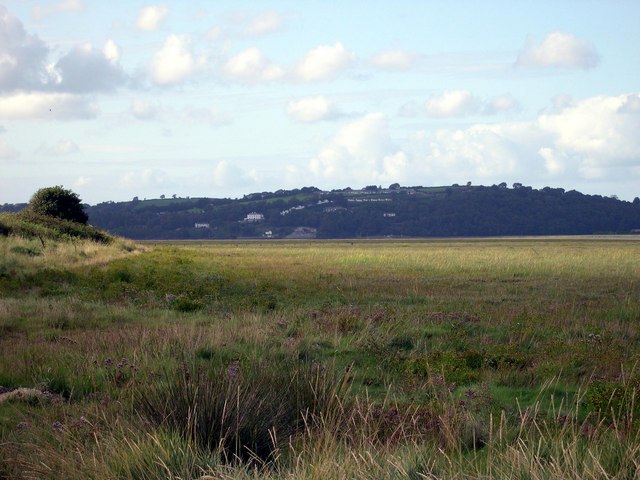
Situated near the small village of Ferryside, Craig Ddu is known for its rugged beauty and dramatic scenery. The headland is formed by the erosion of sedimentary rocks, which have been shaped by the relentless power of the crashing waves over thousands of years. This natural process has resulted in the creation of steep cliffs that rise up to 30 meters in some areas.

The headland provides a habitat for a variety of marine life, including seabirds such as gulls and cormorants. The surrounding waters are also home to a diverse range of fish species, making it a popular spot for fishing enthusiasts.

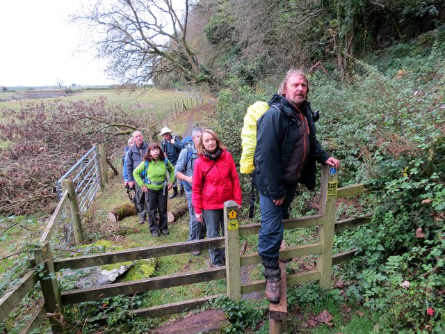
Visitors to Craig Ddu can enjoy a leisurely stroll along the coastal path, which offers stunning views of the sea and the Welsh countryside. On a clear day, it is even possible to spot the distant outline of Lundy Island, located off the coast of Devon.

Overall, Craig Ddu is a captivating coastal feature that showcases the raw power of nature and provides an idyllic escape for those seeking tranquility and natural beauty along the Carmarthenshire coastline.

If you have any feedback on the listing, please let us know in the comments section below.

Craig Ddu Images

Images are sourced within 2km of 51.76521/-4.4301505 or Grid Reference SN3210. Thanks to Geograph Open Source API. All images are credited.

Bend in the sea wall, Laugharne The sea wall is not straight, but has a gradual curve from the northern end and then a sharper bend.  It is an earth bank, protected by stone pitching on the seaward side.
Bend in the sea wall, Laugharne
The sea wall is not straight, but has a gradual curve from the northern end and then a sharper bend. It is an earth bank, protected by stone pitching on the seaward side.
Lords Park Farm, Llansteffan One of two farms owned by the National Trust down a little lane on which there is a car park.
Lords Park Farm, Llansteffan
One of two farms owned by the National Trust down a little lane on which there is a car park.
Path down from Sir John's Hill, Laugharne This leads down to East Marsh.  The boundary between the drained part and the salt marsh, formed by the sea wall, can be clearly seen in the distance.
Path down from Sir John's Hill, Laugharne
This leads down to East Marsh. The boundary between the drained part and the salt marsh, formed by the sea wall, can be clearly seen in the distance.
Headland south of Laugharne Sir John's Hill is cut short by the Taff estuary.
Headland south of Laugharne
Sir John's Hill is cut short by the Taff estuary.
Salt marsh south of Laugharne An intricate pattern of channels.
Salt marsh south of Laugharne
An intricate pattern of channels.
Mouth of Railsgate Pill, Laugharne Although Railsgate Pill is hardly more than a drainage ditch for East Marsh, it has quite a broad mouth into the Taff Estuary.
Mouth of Railsgate Pill, Laugharne
Although Railsgate Pill is hardly more than a drainage ditch for East Marsh, it has quite a broad mouth into the Taff Estuary.
Lower Marsh Laugharne Marshland drained to make pasture.  Seen from the sea wall.  There is another embankment crossing the marsh in the distance, beyond which the land is called East Marsh. The limestone quarry at Coygan can be seen in the distance, and some wind turbines on the hill.
Lower Marsh Laugharne
Marshland drained to make pasture. Seen from the sea wall. There is another embankment crossing the marsh in the distance, beyond which the land is called East Marsh. The limestone quarry at Coygan can be seen in the distance, and some wind turbines on the hill.
Pond at the bend in the sea wall, Lower Marsh, Laugharne A pond on the map, but more a patch of rushes.  Presumably at the lowest point of the field.
Pond at the bend in the sea wall, Lower Marsh, Laugharne
A pond on the map, but more a patch of rushes. Presumably at the lowest point of the field.
Lower Marsh Marsh below Laugharne. Craig Ddu in background.
Lower Marsh
Marsh below Laugharne. Craig Ddu in background.
Lower Marsh On the Taf estuary near Laugharne.
Lower Marsh
On the Taf estuary near Laugharne.
A winter view - Salt marshes south of Laugharne A popular spot for a photograph of the wonderful meanderings of the creeks across the salt marshes, but the difference in colours from summer to winter are to be appreciated here. The summer view is at <a href="https://www.geograph.org.uk/photo/596335">SN3009 : Salt marsh south of Laugharne</a>
A winter view - Salt marshes south of Laugharne
A popular spot for a photograph of the wonderful meanderings of the creeks across the salt marshes, but the difference in colours from summer to winter are to be appreciated here. The summer view is at SN3009 : Salt marsh south of Laugharne
Salt marshes bordering the western side of the River Taf
Lord's park Farm near Llansteffan
Footpath near Wharley Point This path, now in the ownership of the National Trust affords some excellent views over the Taf Estuary.
Footpath near Wharley Point
This path, now in the ownership of the National Trust affords some excellent views over the Taf Estuary.
Ger / Near Llansteffan Cerddwyr yn edmygu'r golygfeydd o Lwybr Arfordir Cymru ger Ffarm Parc yr Arglwydd.

Walkers admiring the view while walking the Wales Coastal Path near Lord's Park Farm.
Ger / Near Llansteffan
Cerddwyr yn edmygu'r golygfeydd o Lwybr Arfordir Cymru ger Ffarm Parc yr Arglwydd. Walkers admiring the view while walking the Wales Coastal Path near Lord's Park Farm.
Ger Talacharn / Near Laugharne Cerddwyr yn dilyn Llwybr Arfordir Cymru o dan Fryn Syr John ger Talacharn.

Walkers following the Wales Coastal Path below Sir John's Hill near Laugharne.
Ger Talacharn / Near Laugharne
Cerddwyr yn dilyn Llwybr Arfordir Cymru o dan Fryn Syr John ger Talacharn. Walkers following the Wales Coastal Path below Sir John's Hill near Laugharne.
Ordnance Survey Cut Mark This OS cut mark can be found on the north face of a barn at Lord's Park Farm. It marks a point 76.002m above mean sea level.
Ordnance Survey Cut Mark
This OS cut mark can be found on the north face of a barn at Lord's Park Farm. It marks a point 76.002m above mean sea level.
Ordnance Survey Cut Mark This OS cut mark can be found on the wall south of the track. It marks a point 61.877m above mean sea level.
Ordnance Survey Cut Mark
This OS cut mark can be found on the wall south of the track. It marks a point 61.877m above mean sea level.
Show me another place!

Craig Ddu is located at Grid Ref: SN3210 (Lat: 51.76521, Lng: -4.4301505)

Unitary Authority: Carmarthenshire

Police Authority: Dyfed Powys

What 3 Words

///cars.traps.riverbank. Near Llansteffan, Carmarthenshire

Related Wikis

Laugharne Castle

Laugharne Castle (Welsh: Castell Talacharn) is in Laugharne, Carmarthenshire, Wales. The castle, located on the estuary of the River Tâf, was originally...

Castle House, Laugharne

Castle House in Laugharne, Carmarthenshire, Wales, is a Grade II*–listed Georgian mansion. Described by Dylan Thomas as “the best of houses in the best...

Great House, Laugharne

The Great House in Laugharne, Carmarthenshire, Wales, is a Grade II*–listed early eighteenth century gentry residence in the Queen Anne style and is one...

Laugharne Town Hall

Laugharne Town Hall (Welsh: Neuadd y Dref Talacharn) is a municipal building in Market Street in Laugharne, Carmarthenshire, Wales. The structure, which...

Laugharne

Laugharne (Welsh: Talacharn) is a town on the south coast of Carmarthenshire, Wales, lying on the estuary of the River Tâf. The ancient borough of Laugharne...

Island House, Laugharne

Island House is a Grade II* listed, partly Tudor, sub-medieval townhouse located in Laugharne, Carmarthenshire, in southwest Wales. It sits below the...

Plas Llanstephan

Plas Llanstephan is a mansion in the county of Carmarthenshire, Wales. It is set well back from the public road among pasture fields and is reached by...

Yr Hen Gapel, Llanybri

Yr Hen Gapel (Welsh for The Old Chapel) is a now ruined religious building and scheduled ancient monument in the village of Llanybri, Carmarthenshire,...

Nearby Amenities

Located within 500m of 51.76521,-4.4301505
Source: PGS
Lat/Long: 51.7655112/-4.4366741
Source: PGS
Lat/Long: 51.7638243/-4.4359606
Source: PGS
Lat/Long: 51.7637234/-4.4358211
Source: PGS
Lat/Long: 51.7633668/-4.4344908
Source: PGS
Lat/Long: 51.7632211/-4.4333272
Source: PGS
Lat/Long: 51.7633121/-4.4329673
Source: PGS
Lat/Long: 51.7635803/-4.4319373
Source: PGS
Lat/Long: 51.7637457/-4.4297701
Source: PGS
Lat/Long: 51.7637164/-4.4280594
Source: PGS
Lat/Long: 51.7636278/-4.4264441
Source: PGS
Lat/Long: 51.7632334/-4.4260901
Source: PGS
Lat/Long: 51.7630282/-4.425103
Source: PGS
Lat/Long: 51.7628439/-4.4241053
Give Way
Direction: forward
Lat/Long: 51.7672108/-4.4276542
Direction: 145
Generator Method: photovoltaic
Generator Output Electricity: yes
Generator Solar Modules: 6
Generator Source: solar
Generator Type: solar_photovoltaic_panel
Location: roof
Power: generator
Lat/Long: 51.7680984/-4.4286141
Direction: S
Generator Method: photovoltaic
Generator Output Electricity: yes
Generator Solar Modules: 6
Generator Source: solar
Generator Type: solar_photovoltaic_panel
Location: roof
Power: generator
Tilted: yes
Lat/Long: 51.7680138/-4.4286107
Barrier: stile
Bicycle: no
Foot: designated
Horse: no
Motor Vehicle: no
Lat/Long: 51.7679301/-4.4345174
The data included in this document is from www.openstreetmap.org. The data is made available under ODbL.

Have you been to Craig Ddu?

Leave your review of Craig Ddu below (or comments, questions and feedback).