West Crinan Rock

Coastal Feature, Headland, Point in Ayrshire

Scotland

West Crinan Rock

Ardrossan Castle Construction of the castle as we know it began in the 13th century. However little is known of any buildings at the site before the Lands of Ardrossan were gifted to Richard de Barclay by the local feudal lords of the de Morvilles in the 12th century.
The lands passed into the hands of the Eglinton family following the death of the last Barclay Baron of Ardrossan without heirs.
Thereafter it transferred to John de Montgomerie through his marriage to Elizabeth, daughter of Sir Hugh Eglinton sometime after 1736.
The Montgomeries were responsible for a huge programme of reconstruction at Ardrossan Castle, which carried on well into the 15th century. It was the chief seat of the family until the time of Alexander, the first Lord Montgomery, who made Eglinton his principal residence.
Ardrossan remained a stronghold until it was finally destroyed in the 17th century, allegedly at the hands of Oliver Cromwell.
Ardrossan Castle Credit: Raibeart MacAoidh

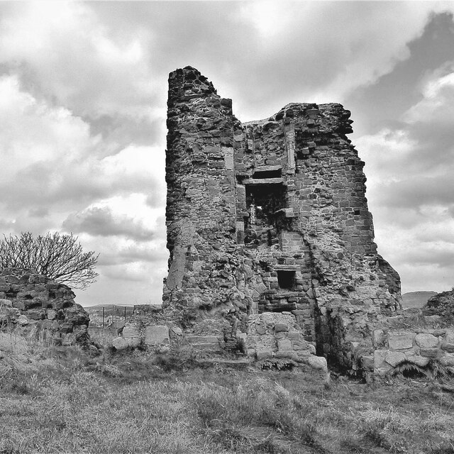
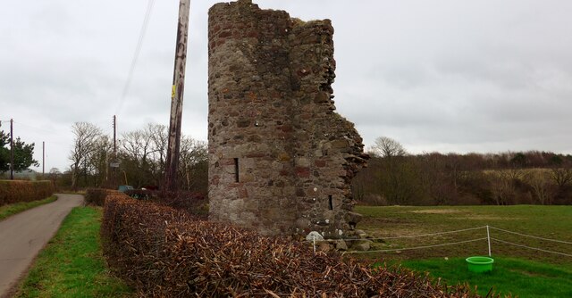
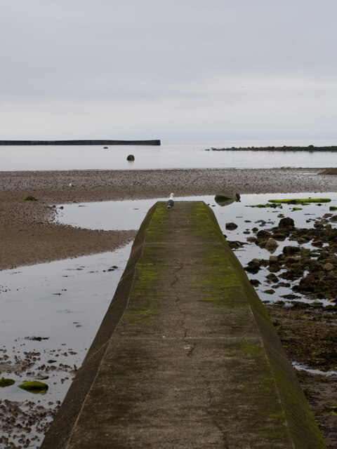
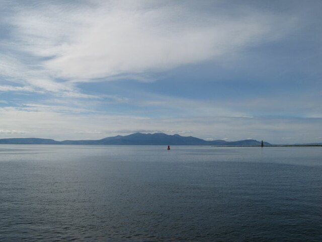
West Crinan Rock is a prominent coastal feature located in Ayrshire, Scotland. It is a headland that extends into the Firth of Clyde, forming a distinctive point along the coastline. The rock is situated at the mouth of the Crinan River, near the village of Crinan.

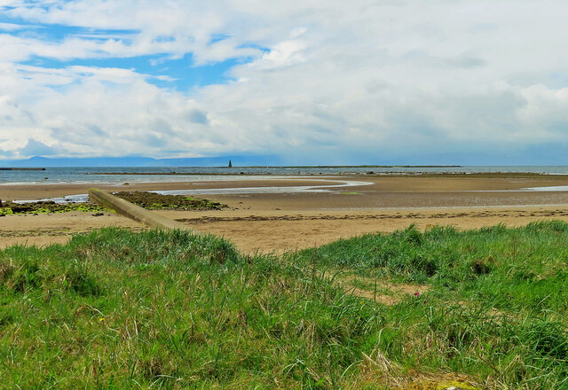
Standing at an elevation of approximately 30 meters, West Crinan Rock offers stunning panoramic views of the surrounding area. Its rugged cliffs and rocky terrain make it a picturesque landmark, attracting both locals and tourists alike. The headland is characterized by its exposed, weather-beaten appearance, which adds to its natural charm.

In addition to its aesthetic appeal, West Crinan Rock also serves a practical purpose. It acts as a natural breakwater, protecting the nearby shoreline from the powerful waves of the Firth of Clyde. This function has made it an important feature for coastal erosion management in the area.

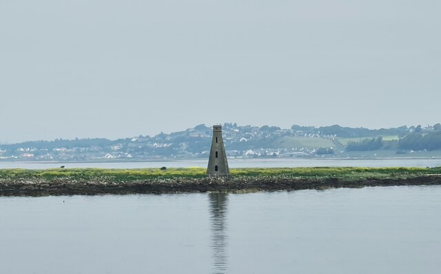
The location of West Crinan Rock is also significant in terms of wildlife. The surrounding waters are home to a diverse range of marine life, including seals, dolphins, and a variety of seabirds. This makes the headland a popular spot for birdwatching and wildlife enthusiasts.

Overall, West Crinan Rock is a captivating coastal feature that offers both natural beauty and practical functionality. Its dramatic cliffs, stunning views, and diverse wildlife make it a must-visit destination for anyone exploring the Ayrshire coastline.

If you have any feedback on the listing, please let us know in the comments section below.

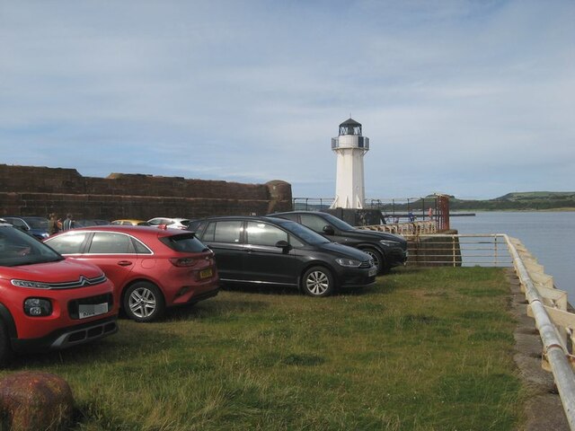
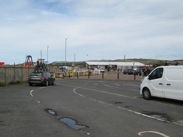
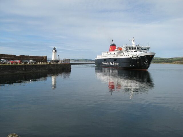
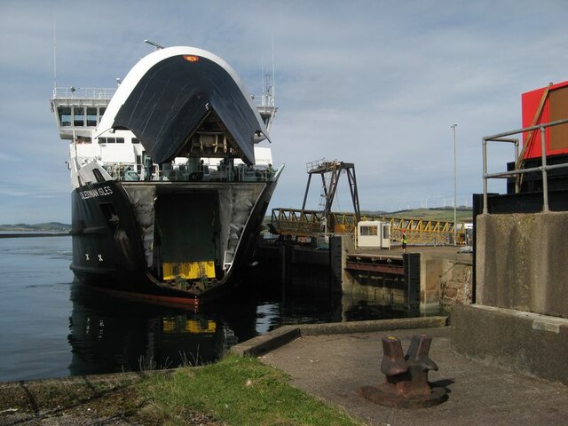
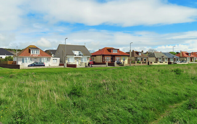
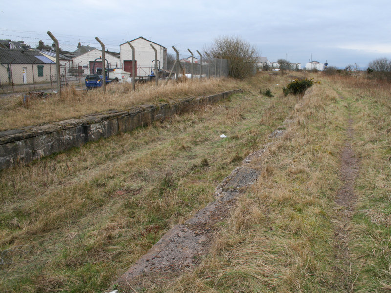
West Crinan Rock Images

Images are sourced within 2km of 55.642211/-4.831117 or Grid Reference NS2142. Thanks to Geograph Open Source API. All images are credited.

Ardrossan Castle Construction of the castle as we know it began in the 13th century. However little is known of any buildings at the site before the Lands of Ardrossan were gifted to Richard de Barclay by the local feudal lords of the de Morvilles in the 12th century.
The lands passed into the hands of the Eglinton family following the death of the last Barclay Baron of Ardrossan without heirs.
Thereafter it transferred to John de Montgomerie through his marriage to Elizabeth, daughter of Sir Hugh Eglinton sometime after 1736.
The Montgomeries were responsible for a huge programme of reconstruction at Ardrossan Castle, which carried on well into the 15th century. It was the chief seat of the family until the time of Alexander, the first Lord Montgomery, who made Eglinton his principal residence.
Ardrossan remained a stronghold until it was finally destroyed in the 17th century, allegedly at the hands of Oliver Cromwell.
Ardrossan Castle
Construction of the castle as we know it began in the 13th century. However little is known of any buildings at the site before the Lands of Ardrossan were gifted to Richard de Barclay by the local feudal lords of the de Morvilles in the 12th century. The lands passed into the hands of the Eglinton family following the death of the last Barclay Baron of Ardrossan without heirs. Thereafter it transferred to John de Montgomerie through his marriage to Elizabeth, daughter of Sir Hugh Eglinton sometime after 1736. The Montgomeries were responsible for a huge programme of reconstruction at Ardrossan Castle, which carried on well into the 15th century. It was the chief seat of the family until the time of Alexander, the first Lord Montgomery, who made Eglinton his principal residence. Ardrossan remained a stronghold until it was finally destroyed in the 17th century, allegedly at the hands of Oliver Cromwell.
All that remains of Montfode Castle See also <a title="https://www.geograph.org.uk/photo/5969420" href="https://www.geograph.org.uk/photo/5969420">Link</a>
All that remains of Montfode Castle
See also Link
Boat yard
Boat yard
Harbour entrance
Harbour entrance
Seagull on Outflow
Seagull on Outflow
Entrance for Arran Ferry at Ardrossan
Caledonian MacBrayne's Ardossan terminal
Beacon on Horse Isle
Lighthouse and long-stay parking A view of the harbour wall and parking area. The condition of the sea wall is a matter of concern, and is expected to form part of the works on upgrading the harbour facilities in readiness for the new vessel.
Lighthouse and long-stay parking
A view of the harbour wall and parking area. The condition of the sea wall is a matter of concern, and is expected to form part of the works on upgrading the harbour facilities in readiness for the new vessel.
Vehicle lanes and ferry terminal building Ferry facilities at Ardrossan harbour. This area is expected to be re-modelled for extra capacity and speed of loading when the new ferry takes up the service.
Vehicle lanes and ferry terminal building
Ferry facilities at Ardrossan harbour. This area is expected to be re-modelled for extra capacity and speed of loading when the new ferry takes up the service.
MV Caledonian Isles The ferry from Brodick on Arran enters the harbour at Ardrossan.
MV Caledonian Isles
The ferry from Brodick on Arran enters the harbour at Ardrossan.
MV Caledonian Isles docking The ferry on approach to the linkspan with bow-visor raised.
MV Caledonian Isles docking
The ferry on approach to the linkspan with bow-visor raised.
Arran view An atmospheric, afternoon view of Arran from the harbour lighthouse. Navigation markers and the Horse Isle Shelves can be seen near to the shore.
Arran view
An atmospheric, afternoon view of Arran from the harbour lighthouse. Navigation markers and the Horse Isle Shelves can be seen near to the shore.
Old milestone This milestone was probably erected for the tollroad from Irvine to Ardrossan and Greenock.  The eroded legend on this face may read Ardrossan/½/Largs/12½.  It is on South Crescent Road at the junction with South Beach Road.
Old milestone
This milestone was probably erected for the tollroad from Irvine to Ardrossan and Greenock. The eroded legend on this face may read Ardrossan/½/Largs/12½. It is on South Crescent Road at the junction with South Beach Road.
Old milestone This is the left face of the milestone on South Crescent Road.   The legend which can just be discerned is Irvine/8½/Kilwinning/4¾/Saltcoats/1.
Old milestone
This is the left face of the milestone on South Crescent Road. The legend which can just be discerned is Irvine/8½/Kilwinning/4¾/Saltcoats/1.
Old milestone On North Bay on Montgomerie Road near the junction of Caledonia Road is this very eroded toll road milestone.   Until 2008 it was sited at the Shell Bridge.   After roadworks it was reset at its current position.   This right-hand face has a very eroded Largs 11/Greenock 25 although the bench mark is clear.   The left face has Irvine/9½/Kilwinning/5½/Saltcoats/2.
Old milestone
On North Bay on Montgomerie Road near the junction of Caledonia Road is this very eroded toll road milestone. Until 2008 it was sited at the Shell Bridge. After roadworks it was reset at its current position. This right-hand face has a very eroded Largs 11/Greenock 25 although the bench mark is clear. The left face has Irvine/9½/Kilwinning/5½/Saltcoats/2.
North Crescent Road Shoreline bungalows on the outskirts of Ardrossan.
North Crescent Road
Shoreline bungalows on the outskirts of Ardrossan.
Towards Horse Island Looking out across Ardrossan's North Bay towards Horse Isle and its Martello Tower.
Towards Horse Island
Looking out across Ardrossan's North Bay towards Horse Isle and its Martello Tower.
Show me another place!

West Crinan Rock is located at Grid Ref: NS2142 (Lat: 55.642211, Lng: -4.831117)

Unitary Authority: North Ayrshire

Police Authority: Ayrshire

What 3 Words

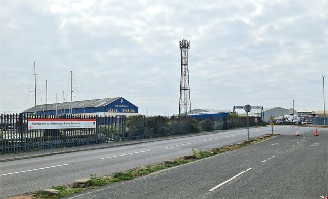
///trim.ocean.apple. Near Ardrossan, North Ayrshire

Related Wikis

Ardrossan Winton Pier railway station

Ardrossan Winton Pier railway station served the town of Ardrossan and its harbour, North Ayrshire, Scotland. The station allowed train passengers to link...

Ardrossan Montgomerie Pier railway station

Ardrossan Montgomerie Pier railway station was a railway station serving the town of Ardrossan, North Ayrshire, Scotland as part of the Lanarkshire and...

Ardrossan Harbour railway station

Ardrossan Harbour railway station is one of three remaining railway stations in the town of Ardrossan, North Ayrshire, Scotland. The station is managed...

Horse Isle

Horse Isle (Scottish Gaelic: Eilean nan Each) is an uninhabited island located in the Firth of Clyde, Scotland near the seaside town of Ardrossan. It is...

Ardrossan North railway station

Ardrossan North railway station was a railway station serving the town of Ardrossan, North Ayrshire, Scotland as part of the Lanarkshire and Ayrshire Railway...

Ardrossan Town railway station

Ardrossan Town railway station is one of three remaining in the town of Ardrossan, North Ayrshire, Scotland. It is one of the oldest operational railway...

Ardrossan Civic Centre

Ardrossan Civic Centre is a municipal building in Glasgow Street, Ardrossan, North Ayrshire, Scotland. The building, which is largely used as a community...

Ardrossan

Ardrossan (; from Scottish Gaelic Àird Rosain 'headland of the small promontory') is a town on the North Ayrshire coast in southwestern Scotland. The...

Nearby Amenities

Located within 500m of 55.642211,-4.831117
Seamark Light Character: Fl
Seamark Light Colour: red
Seamark Light Height: 7
Seamark Light Period: 5
Seamark Light Range: 5
Seamark Light Reference: A 4536
Seamark Type: light_minor
Source: US NGA Pub. 114. 2011-05-26.
Lat/Long: 55.642098/-4.8272342
Seamark Light 1 Character: Iso
Seamark Light 1 Colour: green
Seamark Light 1 Height: 11
Seamark Light 1 Period: 4
Seamark Light 1 Range: 9
Seamark Light 1 Sector End: 35
Seamark Light 1 Sector Start: 317
Seamark Light 2 Character: Iso
Seamark Light 2 Colour: white
Seamark Light 2 Height: 11
Seamark Light 2 Period: 4
Seamark Light 2 Range: 9
Seamark Light 2 Sector End: 317
Seamark Light 2 Sector Start: 35
Seamark Light Reference: A 4538
Seamark Type: light_minor
Source: US NGA Pub. 114. 2011-05-26.
Lat/Long: 55.6411362/-4.8260855
Arran Berth
Waterway: dock
Lat/Long: 55.6404535/-4.8243458
The data included in this document is from www.openstreetmap.org. The data is made available under ODbL.

Have you been to West Crinan Rock?

Leave your review of West Crinan Rock below (or comments, questions and feedback).