Longnor

Settlement in Staffordshire Staffordshire Moorlands

England

Longnor

Access Lane leading to Folds End Farm Adopted by the Manifold Trail long distance footpath, this access lane heads off the High Street in Longnor towards Folds End Farm
Access Lane leading to Folds End Farm Credit: Chris Heaton

Longnor is a charming village located in the Staffordshire Moorlands district of Staffordshire, England. Situated within the picturesque Peak District National Park, this rural settlement offers stunning natural beauty and a tranquil atmosphere. With a population of around 500 residents, Longnor retains a small and close-knit community feel.

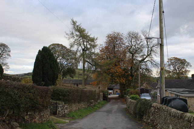
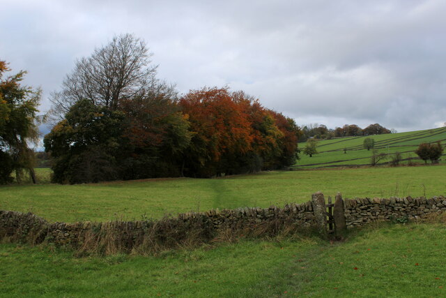
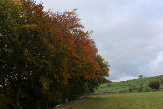
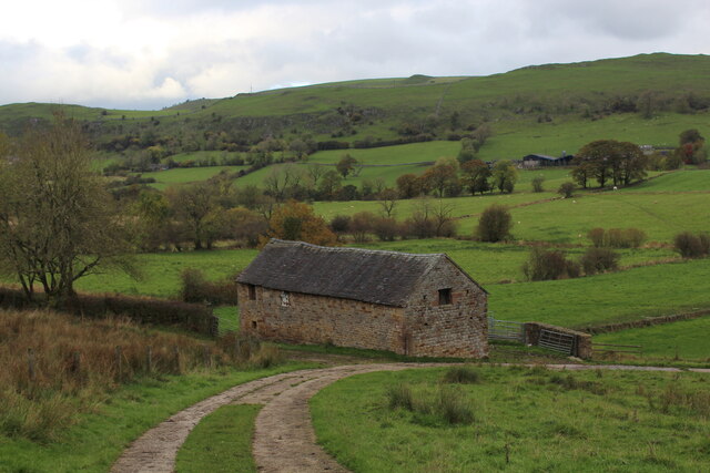
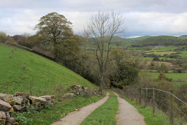
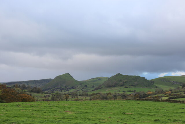
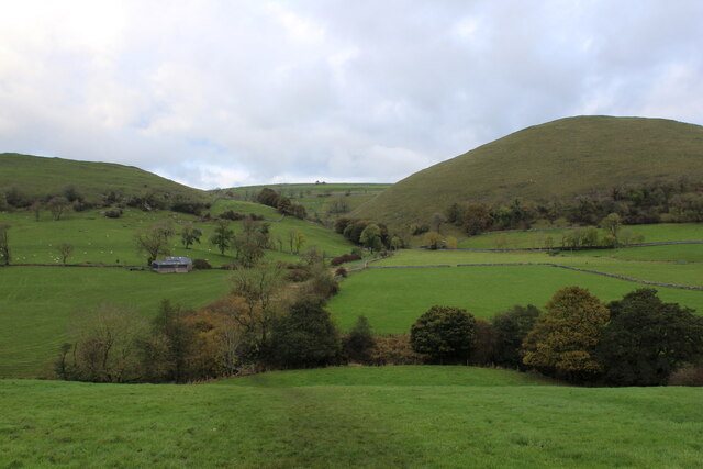
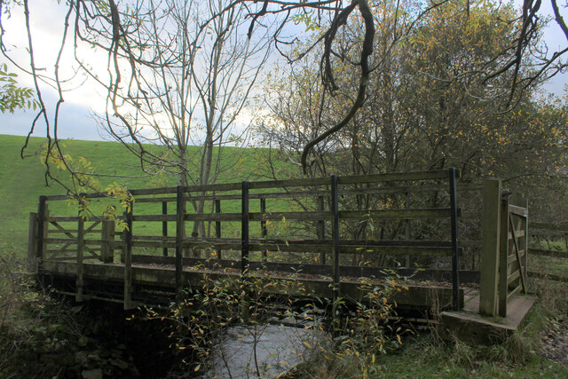
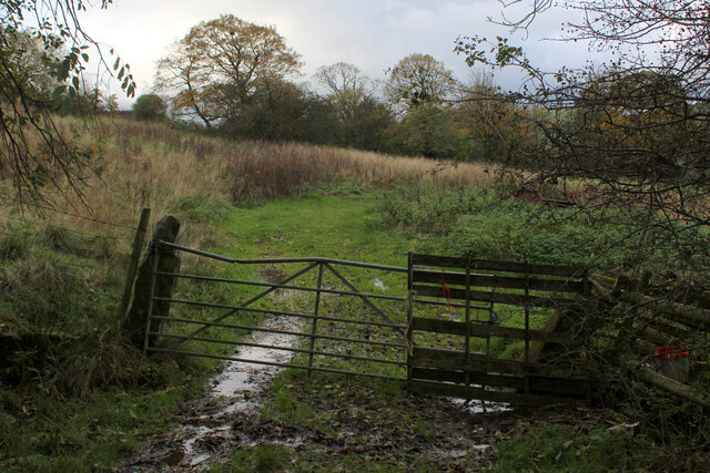
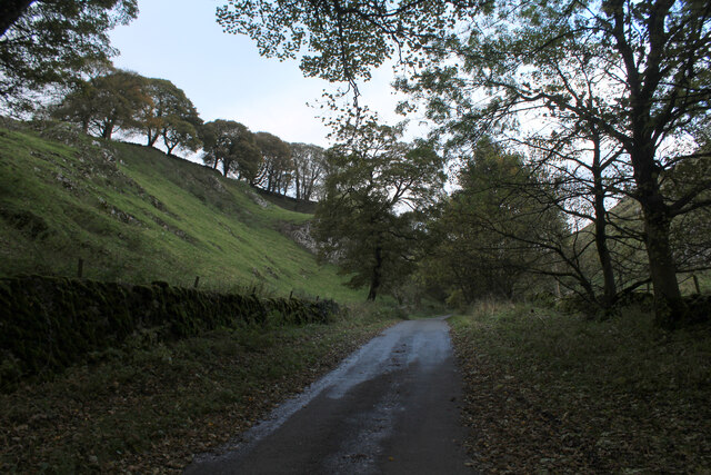
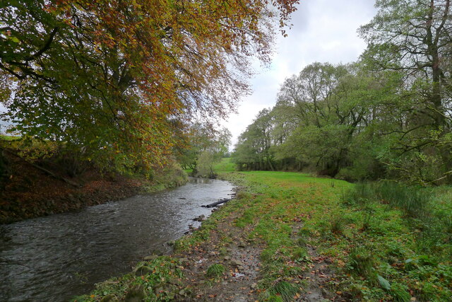
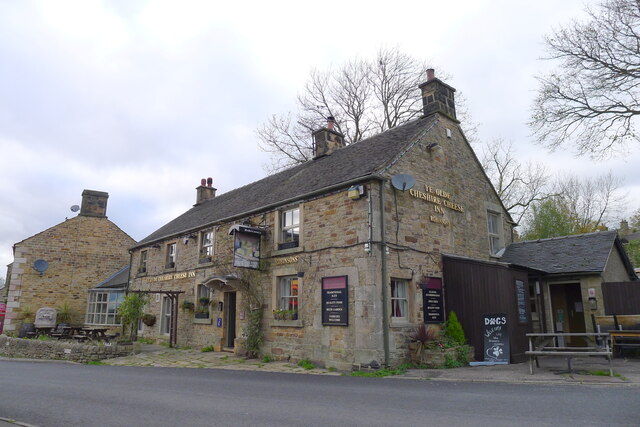
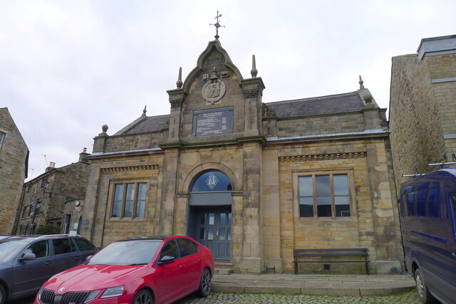
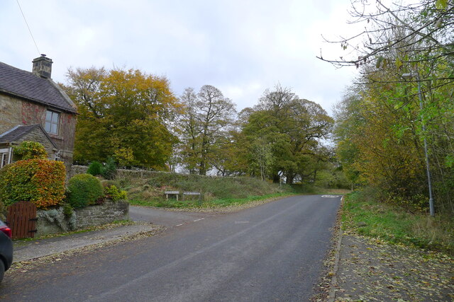
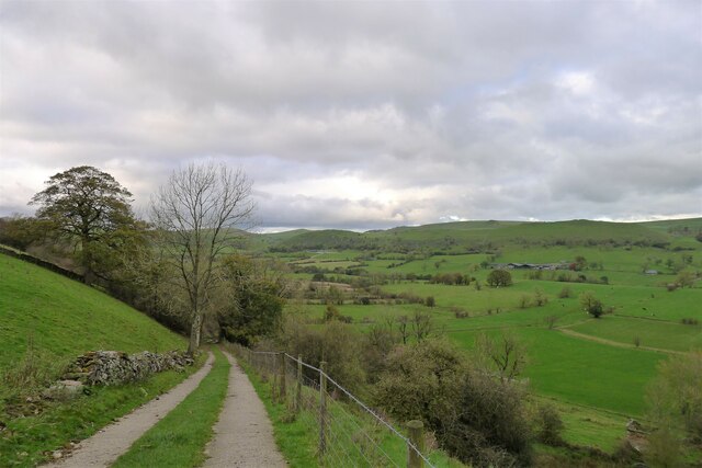
The village is known for its idyllic setting, nestled between rolling hills and surrounded by verdant farmland. The River Manifold flows nearby, adding to the village's scenic allure. Longnor's architecture showcases a mix of historic buildings, including traditional stone cottages and quaint farmhouses, giving it a distinctive rural character.

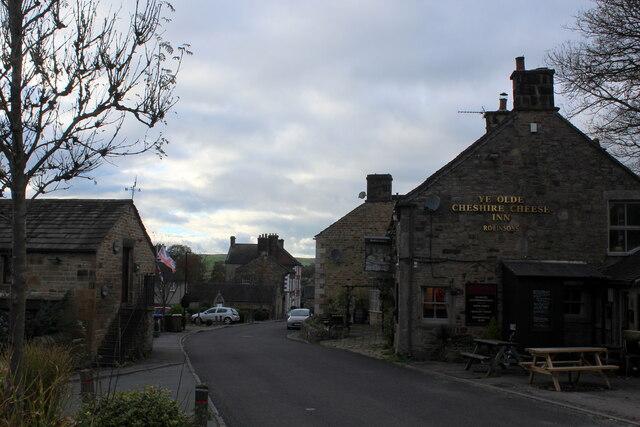
The village is home to several local amenities, including a primary school, a post office, a village hall, and a few shops and pubs. Longnor is also famous for its weekly market, held every Tuesday, which attracts both locals and visitors alike. The market offers a range of fresh produce, crafts, and local products, contributing to the village's vibrant community spirit.

Longnor is a popular destination for outdoor enthusiasts, offering numerous opportunities for walking, cycling, and exploring the surrounding countryside. The nearby Manifold Trail, a former railway line, provides a scenic route for walkers and cyclists to enjoy the stunning Peak District landscape.

Overall, Longnor is a charming rural village that offers a peaceful retreat from the hustle and bustle of city life. With its natural beauty, welcoming community, and range of outdoor activities, it remains an attractive destination for visitors seeking a taste of traditional English countryside living.

If you have any feedback on the listing, please let us know in the comments section below.

Longnor Images

Images are sourced within 2km of 53.181965/-1.8696886 or Grid Reference SK0864. Thanks to Geograph Open Source API. All images are credited.

Access Lane leading to Folds End Farm Adopted by the Manifold Trail long distance footpath, this access lane heads off the High Street in Longnor towards Folds End Farm
Access Lane leading to Folds End Farm
Adopted by the Manifold Trail long distance footpath, this access lane heads off the High Street in Longnor towards Folds End Farm
The Farmyard at Folds End The Manifold Trail long distance footpath passes through here
The Farmyard at Folds End
The Manifold Trail long distance footpath passes through here
Manifold Trail South of Longnor Long Distance Footpath that starts at Manifold Head near the village of Flash, following the river downstream through Longnor, Brund, Hulme End, Ilam to its confluence with the River Dove - a distance of 23 miles.
Manifold Trail South of Longnor
Long Distance Footpath that starts at Manifold Head near the village of Flash, following the river downstream through Longnor, Brund, Hulme End, Ilam to its confluence with the River Dove - a distance of 23 miles.
Line of Trees beside the River Manifold The Manifold Trail passes by these trees, south of Longnor Village
Line of Trees beside the River Manifold
The Manifold Trail passes by these trees, south of Longnor Village
High Street, Longnor
Barn in Upper Dovedale Passed by on Green Lane, traversing across the Dove Valley.
Barn in Upper Dovedale
Passed by on Green Lane, traversing across the Dove Valley.
Descending from Top o' th' Edge Descending into the Dove Valley from Longnor
Descending from Top o' th' Edge
Descending into the Dove Valley from Longnor
Looking up Dovedale Looking towards the upper reaches of the Dove Valley, with the distinctive lines of Chrome Hill clearly visible.
Looking up Dovedale
Looking towards the upper reaches of the Dove Valley, with the distinctive lines of Chrome Hill clearly visible.
Crossing Dovedale Traversing the breadth of Dovedale on Green Lane
Crossing Dovedale
Traversing the breadth of Dovedale on Green Lane
Beggar's Bridge Wooden bridge spanning the River Dove - crossing the county boundary between Staffordshire and Derbyshire
Beggar's Bridge
Wooden bridge spanning the River Dove - crossing the county boundary between Staffordshire and Derbyshire
Rough Pasture near Underhill Farm
Following the Lane to Earl Sterndale The lane in the deep shadows between the heights of High Wheeldon and Aldery Cliff.
Following the Lane to Earl Sterndale
The lane in the deep shadows between the heights of High Wheeldon and Aldery Cliff.
The Manifold trail leaving Lower Boothlow Farm
The River Manifold below Longnor Straightening of the river channel (deliberately reducing natural bends), in the upper sections of the Manifold, has reduced its value as a fishery habitat <span class="nowrap"><a title="https://www.wildtrout.org/assets/reports/Manifold_DCAC_2019_comp.pdf" rel="nofollow ugc noopener" href="https://www.wildtrout.org/assets/reports/Manifold_DCAC_2019_comp.pdf">Link</a><img style="margin-left:2px;" alt="External link" title="External link - shift click to open in new window" src="https://s1.geograph.org.uk/img/external.png" width="10" height="10"/></span>
The River Manifold below Longnor
Straightening of the river channel (deliberately reducing natural bends), in the upper sections of the Manifold, has reduced its value as a fishery habitat LinkExternal link
Ye Olde Cheshire Cheese Inn, Longnor
The Market Hall, Longnor Dated 1873. "Of eclectic style ..." <span class="nowrap"><a title="https://historicengland.org.uk/listing/the-list/list-entry/1262213" rel="nofollow ugc noopener" href="https://historicengland.org.uk/listing/the-list/list-entry/1262213">Link</a><img style="margin-left:2px;" alt="External link" title="External link - shift click to open in new window" src="https://s1.geograph.org.uk/img/external.png" width="10" height="10"/></span>
The Market Hall, Longnor
Dated 1873. "Of eclectic style ..." LinkExternal link
High Street leading east out of Longnor Longnor sits on a prominent ridge between the valleys of the River Manifold and the River Dove. The lane to the left, Dove Ridge, leads to Top o' th' Edge, an escarpment overlooking the Dove valley.
High Street leading east out of Longnor
Longnor sits on a prominent ridge between the valleys of the River Manifold and the River Dove. The lane to the left, Dove Ridge, leads to Top o' th' Edge, an escarpment overlooking the Dove valley.
Track down to the Dove valley from Top o' th' Edge, Longnor Longnor (to the left) sits atop a ridge of sandstone ('millstone grit'); the Dove flows through softer shale.
Track down to the Dove valley from Top o' th' Edge, Longnor
Longnor (to the left) sits atop a ridge of sandstone ('millstone grit'); the Dove flows through softer shale.
Show me another place!

Longnor is located at Grid Ref: SK0864 (Lat: 53.181965, Lng: -1.8696886)

Administrative County: Staffordshire

District: Staffordshire Moorlands

Police Authority: Staffordshire

What 3 Words

///axed.cabs.book. Near Buxton, Derbyshire

Nearby Locations

Longnor

Related Wikis

St Bartholomew's Church, Longnor

The Church of St Bartholomew is a Grade II* listed Anglican church in the village of Longnor in north-east Staffordshire. It was built in the late 18th...

Longnor, Staffordshire

Longnor is a village in the Staffordshire Peak District, England. The settlement dates from early times, the first recorded church building being in the...

Crowdecote

Crowdecote (sometimes spelled Crowdicote) is a small village in Derbyshire, England. It is situated on the border between Derbyshire and Staffordshire...

High Wheeldon

High Wheeldon is a distinctive dome-shaped hill near the Staffordshire border in Hartington Middle Quarter civil parish, Derbyshire, in the Peak District...

Nearby Amenities

Located within 500m of 53.181965,-1.8696886
Longnor
Place: village
Wikidata: Q2490600
Lat/Long: 53.1820373/-1.8688432
Pub
Ye Olde Cheshire Cheese
Addr Postcode: SK17 0NS
Addr Street: High Street
Fhrs Id: 1259485
Source: survey
Source Addr: FHRS Open Data
Toilets: yes
Toilets Wheelchair: yes
Wheelchair: limited
Lat/Long: 53.1811993/-1.8675511
Merchants House Kitchen
Description: Closed
Disused Amenity: restaurant
Source: survey
Lat/Long: 53.1814789/-1.8686364
Cafe
Manifold Tea Room
Note: ? moribund
Source: survey
Lat/Long: 53.1812405/-1.868408
The Grapes
Description: Closed
Disused Amenity: pub
Source: survey
Toilets Wheelchair: no
Wheelchair: no
Lat/Long: 53.1814551/-1.8684409
Public Bookcase
Booth: K6
Covered: booth
Disused Amenity: telephone
Man Made: telephone_box
Public Bookcase Type: phone_box
Source: survey
Lat/Long: 53.1811638/-1.8680183
Post Box
Ele: 286.596680
Post Box Type: wall
Ref: SK17 107
Royal Cypher: EIIR
Royal Cypher Wikidata: Q33102113
Source: GPS
Lat/Long: 53.1811528/-1.8679599
Post Office
Longnor Post Office
Addr Country: GB
Addr Postcode: SK17 0NS
Brand: Post Office
Brand Wikidata: Q1783168
Contact Website: https://www.postoffice.co.uk/branch-finder/3274322/longnor
Ref Pol Id: 12941
Lat/Long: 53.1811813/-1.8678659
Toilets
Source: survey
Lat/Long: 53.1814887/-1.8687684
Harpur-Crewe Arms
Note: No longer a pub
Source: survey
Tourism: guest_house
Lat/Long: 53.1811257/-1.868804
Fire Station
Longnor Community Fire Station
Source: survey
Lat/Long: 53.1826223/-1.8708223
Bus Stop
Bus: yes
Ele: 257.997559
Note: no bus stop sign, but timetable on nearby post
Public Transport: platform
Shelter: yes
Source: GPS
Lat/Long: 53.1811645/-1.8691669
The Grapes PH
Naptan AtcoCode: 3800C810600
Naptan Bearing: W
Naptan BusStopType: CUS
Naptan CommonName: The Grapes PH
Naptan Indicator: Opp
Naptan Landmark: The Grapes PH
Naptan Street: Market Place
Naptan Verified: no
Source: naptan_import
Lat/Long: 53.1812214/-1.8687398
Market Place
Naptan AtcoCode: 3800C810601
Naptan Bearing: E
Naptan BusStopType: CUS
Naptan CommonName: Market Place
Naptan Indicator: Adj
Naptan Landmark: Market Place
Naptan Street: High St
Naptan Verified: no
Source: naptan_import
Lat/Long: 53.1813182/-1.8685578
Bus Stop
Market Place
Bus: yes
Naptan AtcoCode: 3800C820401
Naptan Bearing: N
Naptan CommonName: Market Place
Naptan Indicator: Adj
Naptan Landmark: Market Place
Naptan Street: Warslow Rd
Naptan Verified: no
Public Transport: platform
Source: naptan_import
Lat/Long: 53.1811885/-1.8688567
Market Place
Naptan AtcoCode: 3800C820402
Naptan Bearing: S
Naptan BusStopType: CUS
Naptan CommonName: Market Place
Naptan Indicator: Opp
Naptan Landmark: Market Place
Naptan Street: Warlsow Rd
Naptan Verified: no
Source: naptan_import
Lat/Long: 53.1813333/-1.8686884
Cafe
Cobbles Coffee Shop
Source: survey
Source Name: survey
Lat/Long: 53.1814628/-1.8689035
Barrier: stile
Material: wood
Stile: stepover
Lat/Long: 53.1846611/-1.8695645
Barrier: stile
Source: survey
Lat/Long: 53.1834508/-1.8694072
Barrier: stile
Material: stone
Source: survey;gps
Stile: stepover
Lat/Long: 53.1800627/-1.8646578
Barrier: stile
Material: stone
Source: survey;bing
Stile: squeezer
Lat/Long: 53.1820348/-1.8758437
Barrier: stile
Source: survey;bing;gps
Stile: squeezer
Lat/Long: 53.1823367/-1.8769653
Barrier: stile
Material: stone
Source: survey;gps
Stile: stepover
Lat/Long: 53.183029/-1.868004
Addr Housenumber: 6
Lat/Long: 53.1832457/-1.8695116
Addr Housenumber: 8
Lat/Long: 53.1833152/-1.8695107
Barrier: stile
Material: stone
Source: survey;gps
Stile: squeezer
Lat/Long: 53.1800123/-1.8711615
Barrier: stile
Material: stone
Source: survey;gps
Stile: squeezer
Lat/Long: 53.1801835/-1.8692714
Barrier: stile
Material: wood
Source: survey;gps
Stile: stepover
Lat/Long: 53.1801969/-1.8689642
Addr Housenumber: 6
Lat/Long: 53.1812879/-1.8666635
Addr Housenumber: 7
Lat/Long: 53.1812932/-1.8665814
Addr Housename: Magpie Cottage
Lat/Long: 53.1818182/-1.8674987
Addr Housename: Ruby Cottage
Lat/Long: 53.1817953/-1.8674474
Addr Housename: The Cottage
Lat/Long: 53.1817655/-1.8673846
Defibrillator
Access: yes
Check Date: 2023-03-10
Defibrillator Location: On left hand wall just inside entrance leading to women's toilet.
Emergency: defibrillator
Indoor: no
Lat/Long: 53.1814696/-1.8687433
Barrier: stile
Material: wood
Source: survey;gps
Stile: stepover
Lat/Long: 53.1833672/-1.8671104
Addr Housename: Mount Pleasant
Lat/Long: 53.1821095/-1.8657441
Barrier: stile
Material: wood
Source: survey;gps
Stile: stepover
Lat/Long: 53.1833408/-1.8662847
General Store
Shop: convenience
Lat/Long: 53.1814708/-1.8690653
The data included in this document is from www.openstreetmap.org. The data is made available under ODbL.

Have you been to Longnor?

Leave your review of Longnor below (or comments, questions and feedback).