Brandy Craig

Coastal Feature, Headland, Point in Ayrshire

Scotland

Brandy Craig

Looking NE to Kennedy's Pass
Looking NE to Kennedy's Pass Credit: andrew daws

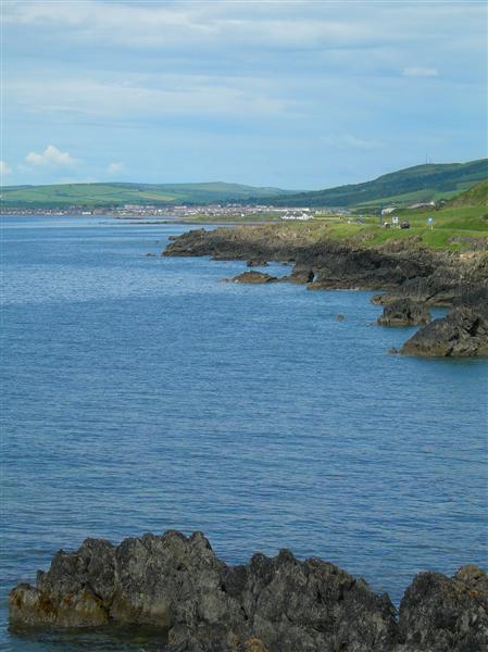
Brandy Craig is a prominent coastal feature located in the county of Ayrshire, Scotland. Situated on the southwest coast, it is a well-known headland that juts out into the North Atlantic Ocean. The name "Brandy Craig" is derived from the Scottish Gaelic "Bràigh na Creige," which translates to "slope of the rock."

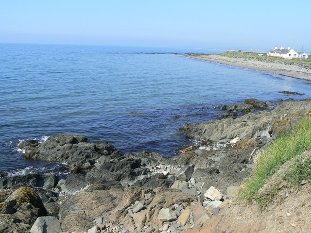
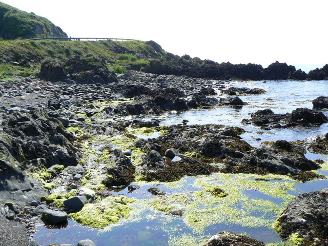
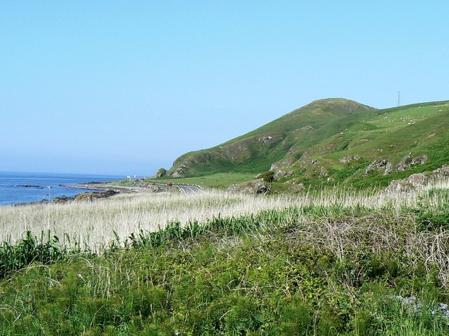
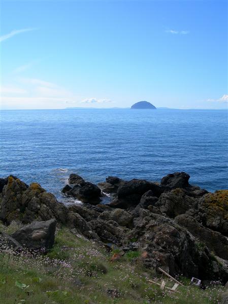
This stunning coastal point is characterized by its rugged and dramatic cliffs that tower above the crashing waves below. The cliffs are composed of sandstone and limestone, which have been shaped and eroded by the relentless force of the ocean over thousands of years. This erosion has created several caves and sea stacks that add to the natural beauty of the area.

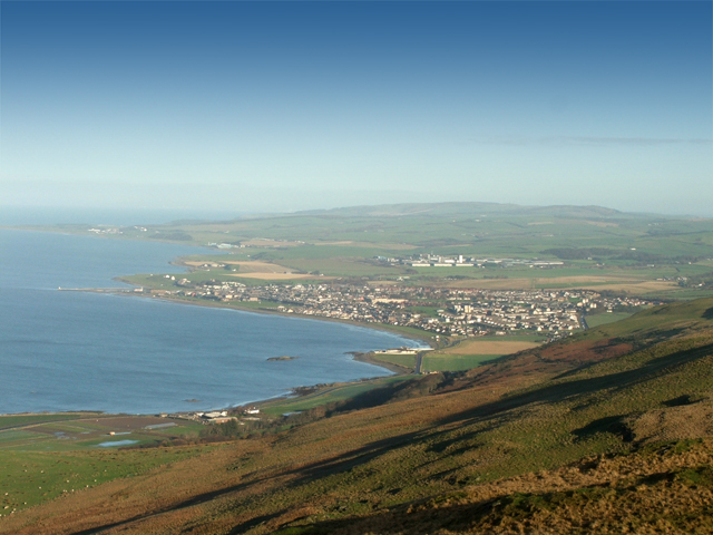
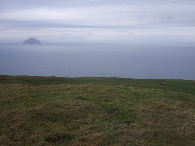
Brandy Craig offers breathtaking panoramic views of the surrounding coastline and the vast expanse of the Atlantic Ocean. On clear days, visitors can see as far as the Isle of Arran to the southwest and the Mull of Kintyre to the south. The headland is a popular destination for hikers, nature enthusiasts, and photographers who are drawn to its picturesque landscapes and abundant wildlife.

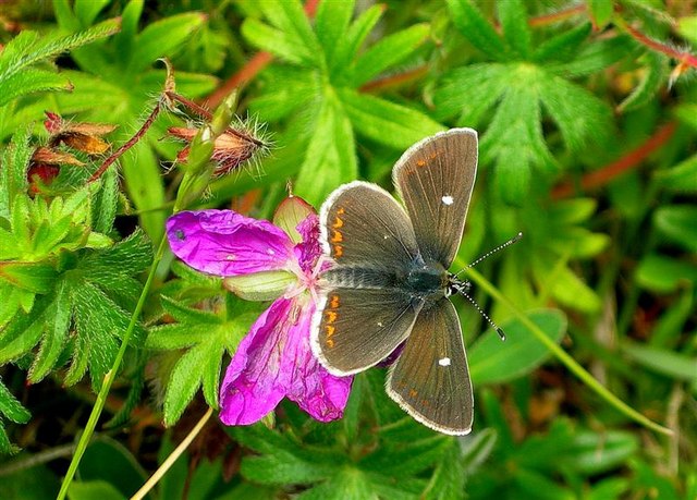
The area surrounding Brandy Craig is rich in biodiversity, with various species of seabirds, such as gulls and kittiwakes, nesting on the cliffs. Visitors may also spot seals and dolphins swimming in the waters below. The headland is also home to a diverse range of plant life, including heather, gorse, and wildflowers.

Overall, Brandy Craig is a stunning coastal feature that offers visitors a chance to immerse themselves in the natural beauty of Ayrshire's coastal landscapes, while also providing a glimpse into the region's geological and ecological history.

If you have any feedback on the listing, please let us know in the comments section below.

Brandy Craig Images

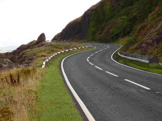
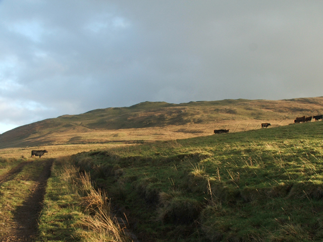
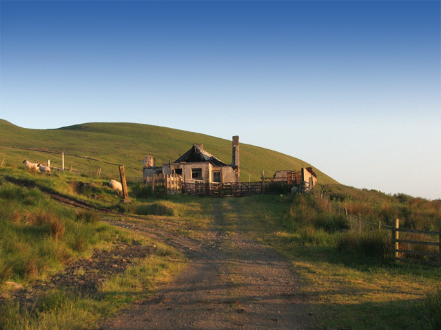
Images are sourced within 2km of 55.194541/-4.9129651 or Grid Reference NX1492. Thanks to Geograph Open Source API. All images are credited.

Looking NE to Kennedy's Pass
View from the summit of Grey Hill Looking Northwards over Girvan and up the Ayrshire coast. Turnberry is the last headland in this picture. Enjoy
View from the summit of Grey Hill
Looking Northwards over Girvan and up the Ayrshire coast. Turnberry is the last headland in this picture. Enjoy
Grey Hill A view looking up to the Grey Hill from the west
Grey Hill
A view looking up to the Grey Hill from the west
Kilranny House Kilranny house, below the Grey Hill and above Kennedy's Pass. The house is now a ruin.
Kilranny House
Kilranny house, below the Grey Hill and above Kennedy's Pass. The house is now a ruin.
Ardwell Bay On the coast south of Girvan.
Ardwell Bay
On the coast south of Girvan.
Rocky coastline The guard rails above the rocks are on the A77 trunk road near Kennedy's Pass.
Rocky coastline
The guard rails above the rocks are on the A77 trunk road near Kennedy's Pass.
Sea coast south of Kennedy's Pass Looking north, with the A77 trunk road just visible centre right.
Sea coast south of Kennedy's Pass
Looking north, with the A77 trunk road just visible centre right.
Cliffs near Stockenray The road in the foreground is the A77(T).
Cliffs near Stockenray
The road in the foreground is the A77(T).
Pinbain Burn SSSI This is a Site of Special Scientific Interest, with a wonderful range of plants and animal life on limestone rock.
Pinbain Burn SSSI
This is a Site of Special Scientific Interest, with a wonderful range of plants and animal life on limestone rock.
Bloody Cranesbill Bloody Cranesbill (Geranium sanguineum) at the Pinbain Burn SSSI.  The flowers are 25-30mm wide.  The plant takes its name from the seed-pod, which is shaped something like a crane's bill.  Bloody Cranesbill grows in dry grassy places, on lime.
Bloody Cranesbill
Bloody Cranesbill (Geranium sanguineum) at the Pinbain Burn SSSI. The flowers are 25-30mm wide. The plant takes its name from the seed-pod, which is shaped something like a crane's bill. Bloody Cranesbill grows in dry grassy places, on lime.
Common Spotted Orchid At the Pinbain burn SSSI, Common Spotted Orchid (Dactylorhiza fuchsii) - I think!  Orchids are not easy to identify!
Common Spotted Orchid
At the Pinbain burn SSSI, Common Spotted Orchid (Dactylorhiza fuchsii) - I think! Orchids are not easy to identify!
Northern Brown Argus The Northern Brown Argus (Aricia artaxerxes) on Bloody Cranesbill at the Pinbain Burn SSSI.  This attractive small butterfly (only about an inch wide) shows a conspicuous white spot in the centre of each upper forewing, with a series of orange crescents round the edges.  It's a very local butterfly in Scotland, now reduced to a number of scattered sites.  (Source:  RSNC Guide to Butterflies of the British Isles, by JA Thomas)
Northern Brown Argus
The Northern Brown Argus (Aricia artaxerxes) on Bloody Cranesbill at the Pinbain Burn SSSI. This attractive small butterfly (only about an inch wide) shows a conspicuous white spot in the centre of each upper forewing, with a series of orange crescents round the edges. It's a very local butterfly in Scotland, now reduced to a number of scattered sites. (Source: RSNC Guide to Butterflies of the British Isles, by JA Thomas)
Spot The Insect A tiny grasshopper at the Pinbain Burn SSSI.
Spot The Insect
A tiny grasshopper at the Pinbain Burn SSSI.
Pinbain Burn at the A77 Looking out to the Firth of Clyde, with Ailsa Craig and the Mull of Kintyre in the distance.
Pinbain Burn at the A77
Looking out to the Firth of Clyde, with Ailsa Craig and the Mull of Kintyre in the distance.
Towards Lendalfoot Looking along the post-glacial raised beach, with Lendalfoot in the distance.
Towards Lendalfoot
Looking along the post-glacial raised beach, with Lendalfoot in the distance.
Towards Girvan Looking along south Ayrshire's spectacular rocky coastline towards Girvan on a fine June afternoon.
Towards Girvan
Looking along south Ayrshire's spectacular rocky coastline towards Girvan on a fine June afternoon.
Clyde View Looking towards Ailsa Craig and the Mull of Kintyre from south Ayrshire's rocky coastline to the south of Girvan.
Clyde View
Looking towards Ailsa Craig and the Mull of Kintyre from south Ayrshire's rocky coastline to the south of Girvan.
Summit of Kilranny Hill Looking west towards Ailsa Craig
Summit of Kilranny Hill
Looking west towards Ailsa Craig
Show me another place!

Brandy Craig is located at Grid Ref: NX1492 (Lat: 55.194541, Lng: -4.9129651)

Unitary Authority: South Ayrshire

Police Authority: Ayrshire

What 3 Words

///culling.limiting.gross. Near Girvan, South Ayrshire

Nearby Locations

Pinbain Hill Brandy Craig

Related Wikis

Russian cruiser Varyag (1899)

Varyag (Russian: Варя́г) sometimes also spelled Variag, was a Russian protected cruiser. Varyag became famous for her crew's stoicism at the Battle of...

Ardmillan Castle

Ardmillan Castle is a ruinous Scottish castle dating from the late 16th century. It lies on the A77 on the edge of the Firth of Clyde south of Girvan....

Lendalfoot

Lendalfoot is a small village located on Carleton Bay, parish of Colmonell in the old district of Carrick, now South Ayrshire, about six miles (ten kilometres...

Dumbarton Collegiate Church

The Collegiate Church of St Mary, Dumbarton, Scotland, was founded in about 1453 by Isabella, Countess of Lennox and Duchess of Albany. During the medieval...

Nearby Amenities

Located within 500m of 55.194541,-4.9129651
Created By: almien_coastlines
Lat/Long: 55.196326/-4.913393
Created By: almien_coastlines
Lat/Long: 55.194773/-4.914439
Parking
Source: survey
Lat/Long: 55.1955308/-4.9135504
Power: pole
Lat/Long: 55.190412/-4.9135781
Power: pole
Lat/Long: 55.1909812/-4.9124658
Power: pole
Lat/Long: 55.1915719/-4.911304
Power: pole
Lat/Long: 55.1921518/-4.910194
Power: pole
Lat/Long: 55.1928888/-4.9095567
Power: pole
Lat/Long: 55.1936164/-4.9089452
Power: pole
Lat/Long: 55.1943614/-4.9083267
Power: pole
Lat/Long: 55.1950822/-4.9077012
Power: pole
Lat/Long: 55.1958057/-4.9071109
Power: pole
Lat/Long: 55.1965467/-4.9064995
Power: pole
Lat/Long: 55.1972258/-4.9066617
The data included in this document is from www.openstreetmap.org. The data is made available under ODbL.

Have you been to Brandy Craig?

Leave your review of Brandy Craig below (or comments, questions and feedback).