Black Rock

Coastal Feature, Headland, Point in Cornwall

England

Black Rock

On the coastal path at Cleave A sea fog completely obscuring the view over the cliff edge.
On the coastal path at Cleave Credit: David Martin

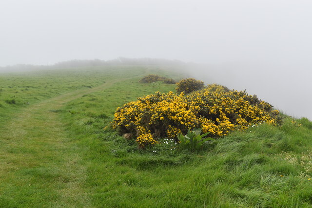
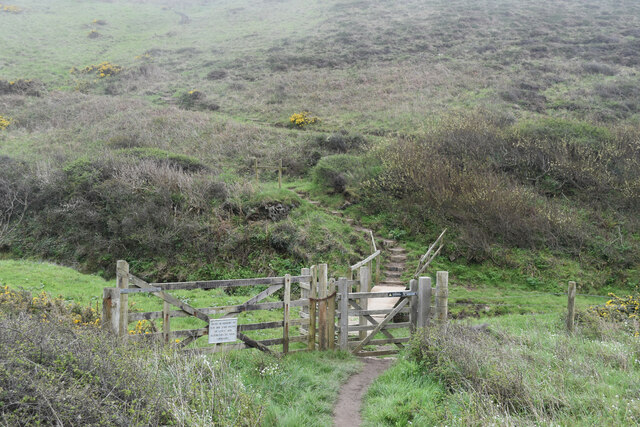
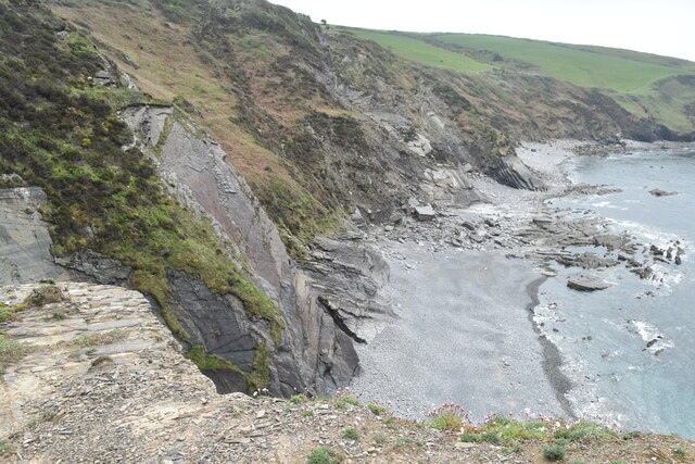
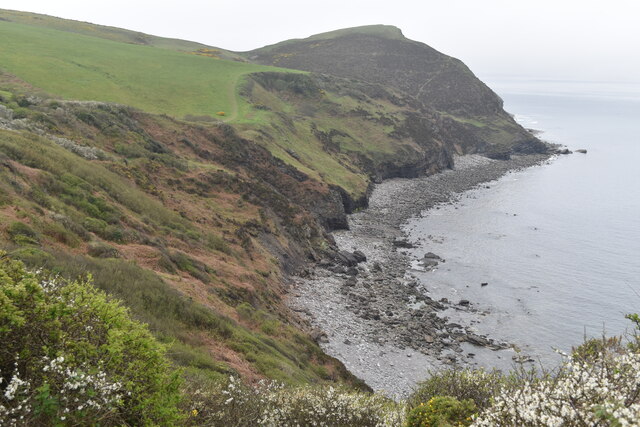
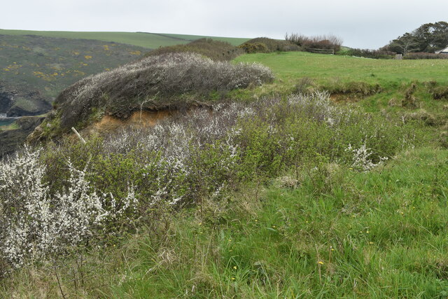
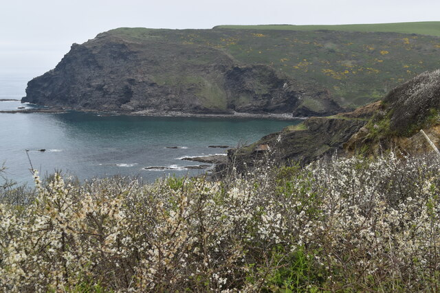
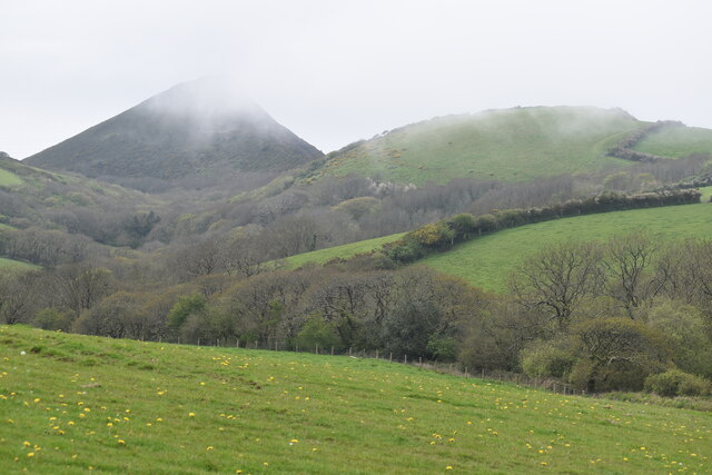
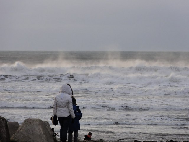
Black Rock is a prominent coastal feature located in Cornwall, England. Situated on the southern coast, it is a headland that juts out into the Atlantic Ocean, forming a distinctive point along the coastline. This picturesque area is renowned for its rugged beauty, offering stunning views of the surrounding sea and cliffs.

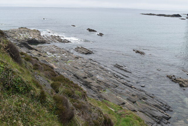
The headland itself is characterized by a large black rock formation that gives it its name. This imposing rock, composed of dark-colored granite, stands tall and proud against the crashing waves. Its unique appearance and dramatic contrast with the blue waters make it a popular attraction for visitors and photographers alike.

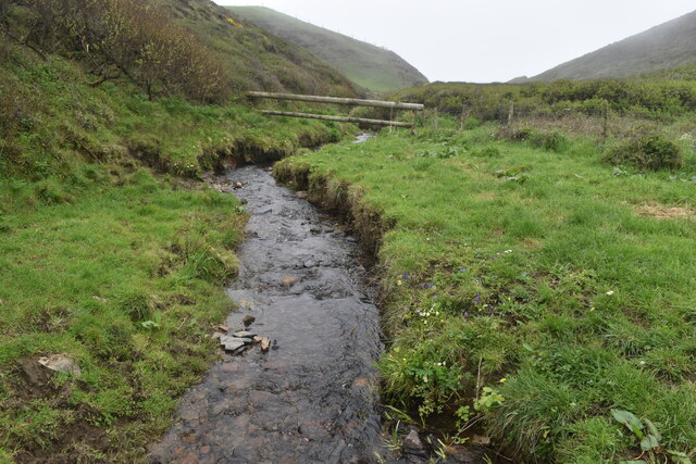
Black Rock is also known for its rich biodiversity and natural heritage. The headland is home to various species of seabirds, including gulls, cormorants, and puffins, making it a haven for birdwatchers. The surrounding waters are teeming with marine life, with seals often spotted basking on nearby rocks.

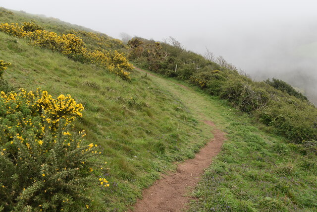
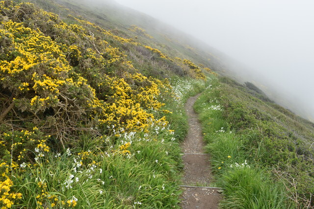
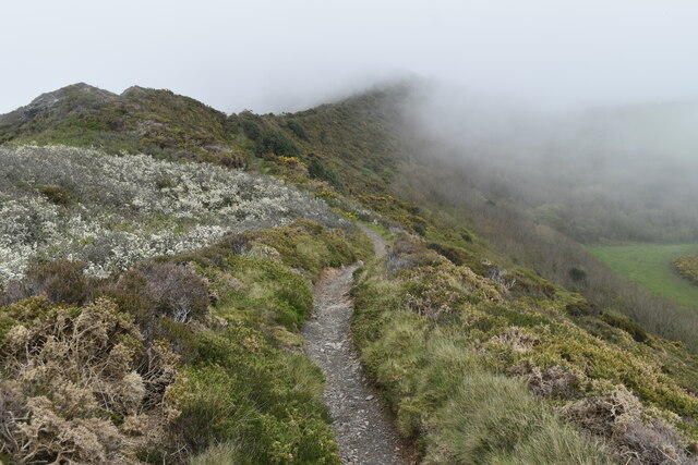
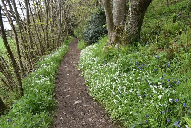
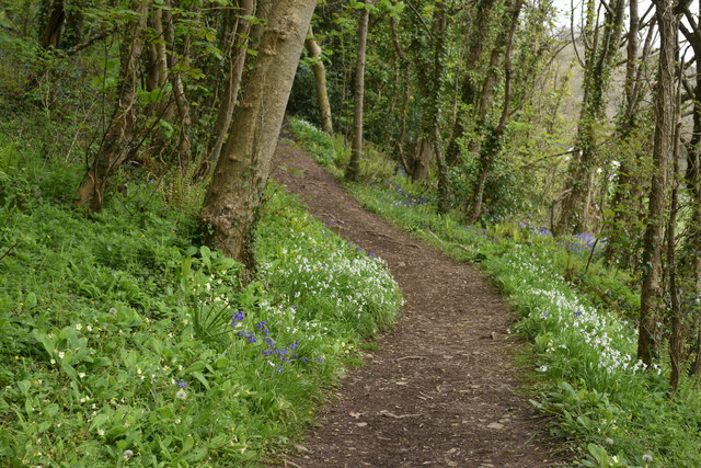
For outdoor enthusiasts, Black Rock offers a range of activities. The rugged coastline provides excellent opportunities for hiking and walking, with several trails leading to breathtaking viewpoints. Additionally, the surrounding waters are popular for swimming, surfing, and fishing.

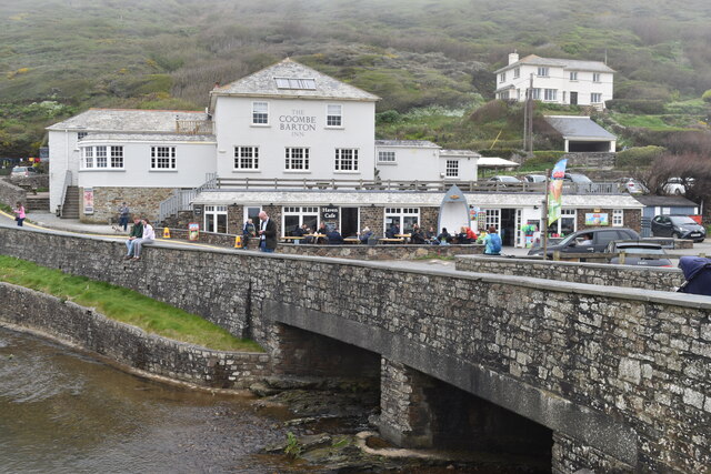
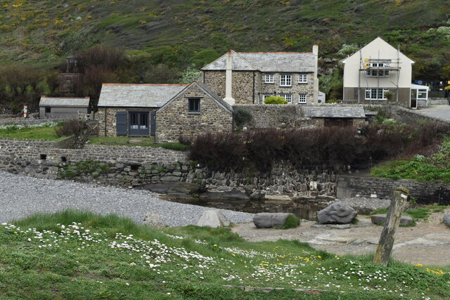
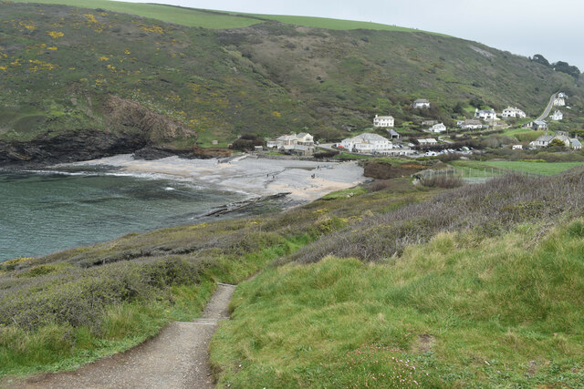
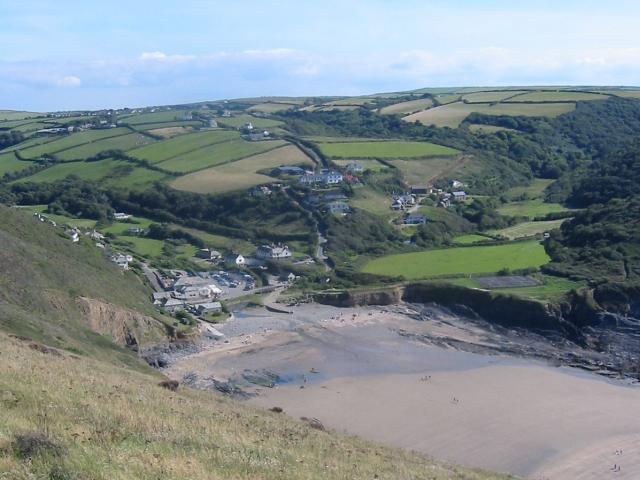
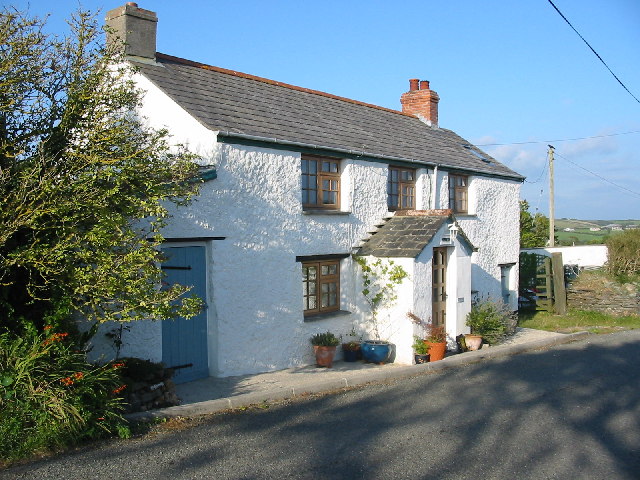
Visitors can also explore the nearby coastal village, which boasts charming cottages, charming cafes, and local shops. The village serves as a gateway to Black Rock, welcoming tourists and providing essential amenities.

In summary, Black Rock in Cornwall is a stunning coastal feature that showcases the beauty of the region. With its unique rock formation, diverse wildlife, and outdoor activities, it is a must-visit destination for nature lovers and adventure seekers.

If you have any feedback on the listing, please let us know in the comments section below.

Black Rock Images

Images are sourced within 2km of 50.744144/-4.6392242 or Grid Reference SX1397. Thanks to Geograph Open Source API. All images are credited.

On the coastal path at Cleave A sea fog completely obscuring the view over the cliff edge.
On the coastal path at Cleave
A sea fog completely obscuring the view over the cliff edge.
On the coastal path near Cleave The path turns briefly inland in order to descend onto the ridge leading to Castle Point.
On the coastal path near Cleave
The path turns briefly inland in order to descend onto the ridge leading to Castle Point.
On the coastal path above Crackington Haven Sea fog obscures the view of the village below.
On the coastal path above Crackington Haven
Sea fog obscures the view of the village below.
On the ridge between Castle Point and Cleave Here looking inland, away from the Castle Point summit.
On the ridge between Castle Point and Cleave
Here looking inland, away from the Castle Point summit.
Footbridge carrying coastal path over stream below Castle Point
Stream in valley south of Castle Point This stream descends over a waterfall onto Little Barton Strand.
Stream in valley south of Castle Point
This stream descends over a waterfall onto Little Barton Strand.
The Coombe Barton Inn, Crackington Haven
Houses overlooking the river mouth, Crackington Haven
Coast southwest of Bray's Point
Wave-cut platform beneath Bray's Point
Crackington Haven
Crackington Haven
Cliffs leading to Cambeak Cambeak is a prominent headland seen from many points between Bude and Boscastle.
Cliffs leading to Cambeak
Cambeak is a prominent headland seen from many points between Bude and Boscastle.
Clifftop field southwest of Crackington Haven The coast path passes through this field around a sizeable landslip which has left fenceposts dangling in mid-air.
Clifftop field southwest of Crackington Haven
The coast path passes through this field around a sizeable landslip which has left fenceposts dangling in mid-air.
Pencannow Point, seen across the mouth of Crackington Haven
Footpath in valley near Congdons Bridge
Path climbing valley side near Congdons Bridge
Sea fog rising over coastal summits near Cleave The South West Coast Path crosses most of the skyline in this image, which includes both <a href="https://www.geograph.org.uk/photo/7473489">SX1597 : On the coastal path near Cleave</a> and <a href="https://www.geograph.org.uk/photo/7473498">SX1497 : On the ridge between Castle Point and Cleave</a>. 100m cliffs drop away on the far side.
Sea fog rising over coastal summits near Cleave
The South West Coast Path crosses most of the skyline in this image, which includes both SX1597 : On the coastal path near Cleave and SX1497 : On the ridge between Castle Point and Cleave. 100m cliffs drop away on the far side.
Watching the Waves It's late afternoon on a chilly but sunny Winter Sunday and there are a good number of people here taking on board the spectacular scenery of Crackington Haven.
Watching the Waves
It's late afternoon on a chilly but sunny Winter Sunday and there are a good number of people here taking on board the spectacular scenery of Crackington Haven.
Show me another place!

Black Rock is located at Grid Ref: SX1397 (Lat: 50.744144, Lng: -4.6392242)

Unitary Authority: Cornwall

Police Authority: Devon and Cornwall

What 3 Words

///dictation.bottle.resemble. Near Jacobstow, Cornwall

Related Wikis

Crackington Haven

Crackington Haven (Cornish: Porthkragen, meaning "sandstone cove") is a coastal village in Cornwall, England, United Kingdom. It is in the civil parish...

St Gennys

St Gennys (Standard Written Form: S. Gwynnas) is a coastal civil parish and small settlement in north Cornwall, England, United Kingdom. The village of...

Mineshope

Mineshope is a hamlet in the parish of St Gennys, Cornwall, England. == References ==

Sweets, Cornwall

Sweets is a hamlet between Middle Crackington and Higher Crackington in north Cornwall, England, United Kingdom. == References ==

Nearby Amenities

Located within 500m of 50.744144,-4.6392242
Source: PGS
Lat/Long: 50.745681/-4.6397528
Source: PGS
Lat/Long: 50.74448/-4.6389616
Source: PGS
Lat/Long: 50.744423/-4.6389156
Source: PGS
Lat/Long: 50.7425426/-4.6342314
Source: PGS
Lat/Long: 50.7424379/-4.6338784
Source: PGS
Lat/Long: 50.7420824/-4.6335689
Source: PGS
Lat/Long: 50.7414751/-4.6335305
Barrier: kissing_gate
Lat/Long: 50.744658/-4.6341591
Barrier: kissing_gate
Lat/Long: 50.7447673/-4.6334795
Barrier: kissing_gate
Lat/Long: 50.7406084/-4.6356875
Source: PGS
Lat/Long: 50.7411173/-4.6341206
Source: PGS
Lat/Long: 50.740842/-4.634824
Source: PGS
Lat/Long: 50.7408953/-4.6344035
Source: PGS
Lat/Long: 50.74083/-4.635631
Bench
Backrest: no
Lat/Long: 50.7434318/-4.6341152
Barrier: kissing_gate
Lat/Long: 50.744537/-4.6358868
Bench
Backrest: yes
Survey Date: 2023-02-05
Lat/Long: 50.7444698/-4.6358519
Bench
Backrest: yes
Material: wood
Seats: 2
Lat/Long: 50.7404111/-4.6369862
Bench
Backrest: no
Lat/Long: 50.7402855/-4.6371857
Bench
Backrest: yes
Survey Date: 2023-01-21
Lat/Long: 50.7407786/-4.6355064
Bench
Backrest: yes
Survey Date: 2023-02-05
Lat/Long: 50.7425628/-4.6331391
Bench
Backrest: yes
Survey Date: 2023-02-05
Lat/Long: 50.7418321/-4.6335924
Bench
Backrest: yes
Survey Date: 2023-02-05
Lat/Long: 50.7417617/-4.6336162
Bench
Backrest: no
Survey Date: 2023-02-05
Lat/Long: 50.744571/-4.6377141
Pencannow Point
Alt Name: Penkenna Point
Tourism: viewpoint
Lat/Long: 50.7445295/-4.637692
Barrier: kissing_gate
Lat/Long: 50.7454462/-4.633214
The data included in this document is from www.openstreetmap.org. The data is made available under ODbL.

Have you been to Black Rock?

Leave your review of Black Rock below (or comments, questions and feedback).