Blue Bonnet

Coastal Feature, Headland, Point in Wigtownshire

Scotland

Blue Bonnet

Sea Cave, North end of Cairgarroch Bay
Sea Cave, North end of Cairgarroch Bay Credit: Tony Page

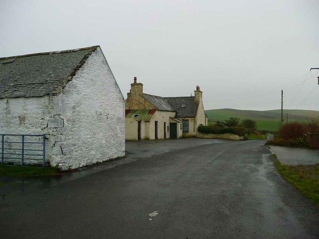
Blue Bonnet is a picturesque coastal feature located in Wigtownshire, a region in southwest Scotland. It is a prominent headland that juts out into the sea, forming a distinct point along the coastline. Blue Bonnet is known for its stunning natural beauty and rugged landscape, attracting visitors and nature enthusiasts from far and wide.

The headland is characterized by its towering cliffs, which offer breathtaking panoramic views of the surrounding ocean and the nearby coastline. These cliffs, composed of sedimentary rocks, have been shaped over thousands of years by the relentless pounding of the waves, resulting in dramatic formations and sea caves along the base.

The name "Blue Bonnet" is thought to have been derived from the abundance of vibrant blue wildflowers that bloom on the headland during certain times of the year, creating a colorful spectacle against the backdrop of the rugged cliffs and the deep blue sea.

Blue Bonnet is also home to a diverse range of bird species, including nesting seabirds such as gulls, fulmars, and kittiwakes. Visitors can often spot these graceful creatures soaring above the cliffs, adding to the enchanting atmosphere of the location.

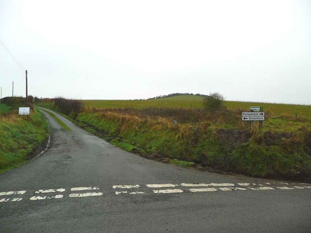
Accessible via a coastal path, Blue Bonnet offers a tranquil retreat for walkers and hikers who wish to explore its natural wonders. The path meanders along the headland, providing numerous vantage points for visitors to soak in the awe-inspiring vistas and observe the abundant wildlife.

Overall, Blue Bonnet is a must-visit destination for those seeking an escape into the beauty of nature. Its rugged cliffs, stunning sea views, and diverse wildlife make it a truly remarkable coastal feature in Wigtownshire.

If you have any feedback on the listing, please let us know in the comments section below.

Blue Bonnet Images

Images are sourced within 2km of 54.803749/-5.0482734 or Grid Reference NX0449. Thanks to Geograph Open Source API. All images are credited.

Sea Cave, North end of Cairgarroch Bay
Cairngarroch
Cairngarroch
West Cairngarroch roadend
Stoneykirk Aviation Museum Exhibition room.
Stoneykirk Aviation Museum
Exhibition room.
Stoneykirk Aviation Museum Exhibition room showing map of Woomera in Australia.
Stoneykirk Aviation Museum
Exhibition room showing map of Woomera in Australia.
Stoneykirk Aviation Museum Showing information on the Vulcan Bomber.
Stoneykirk Aviation Museum
Showing information on the Vulcan Bomber.
Stoneykirk Aviation Museum Exhibition room showing WRAF No1. Dress Uniform.
Stoneykirk Aviation Museum
Exhibition room showing WRAF No1. Dress Uniform.
Stoneykirk Aviation Museum Exhibition room.
Stoneykirk Aviation Museum
Exhibition room.
Stoneykirk Aviation Museum Information panel on the Vulcan Bomber.
Stoneykirk Aviation Museum
Information panel on the Vulcan Bomber.
De Havilland Comet Engineer's Panel At the Stoneykirk Aviation Museum.
De Havilland Comet Engineer's Panel
At the Stoneykirk Aviation Museum.
Procedural Trainer At the Stoneykirk Aviation Museum.
Procedural Trainer
At the Stoneykirk Aviation Museum.
Air Traffic Control Instruments at the Stoneykirk Aviation Museum.
Air Traffic Control
Instruments at the Stoneykirk Aviation Museum.
Test Equipment At the Stoneykirk Aviation Museum.
Test Equipment
At the Stoneykirk Aviation Museum.
Tail from a 1000 lb Bomb At the Stoneykirk Aviation Museum.
Tail from a 1000 lb Bomb
At the Stoneykirk Aviation Museum.
Russian Headgear At the Stoneykirk Aviation Museum.
Russian Headgear
At the Stoneykirk Aviation Museum.
History of Avro Vulcan XA 903 At Stoneykirk Aviation Museum.
History of Avro Vulcan XA 903
At Stoneykirk Aviation Museum.
Stoneykirk Aviation Museum Exhibition room.
Stoneykirk Aviation Museum
Exhibition room.
Local Aviation History At Stoneykirk Aviation Museum.
Local Aviation History
At Stoneykirk Aviation Museum.
Show me another place!

Blue Bonnet is located at Grid Ref: NX0449 (Lat: 54.803749, Lng: -5.0482734)

Unitary Authority: Dumfries and Galloway

Police Authority: Dumfries and Galloway

What 3 Words

///chaos.valued.chimp. Near Stranraer, Dumfries & Galloway

Related Wikis

Knockinaam Lodge

Knockinaam Lodge is a hotel and restaurant located about 3.5 miles South of Portpatrick, Dumfries & Galloway, Scotland. As of 2008, the restaurant holds...

Colfin railway station

Colfin railway station, located in Wigtownshire, Scotland, between Portpatrick and Stranraer, was a station on the Portpatrick and Wigtownshire Joint Railway...

Clachanmore

Clachanmore is a village in the South Rhins of Galloway near Ardwell in the south west of Scotland. It has also been known as Low Ardwell.The name of the...

Dunskey Castle

Dunskey Castle is a ruined, 12th-century tower house or castle, located 0.5 miles (0.80 km) south of the village of Portpatrick, Rhinns, Wigtownshire,...

Doon Castle Broch

Doon Castle Broch is an iron-age broch located in Dumfries and Galloway, Scotland (grid reference NX 06702 44683). == Location == The Broch is located...

Stoneykirk

Stoneykirk (Scottish Gaelic: Eaglais Steafain) is an area and a village in the heart of the Rhins of Galloway, Wigtownshire, in the administrative council...

Dunskey

Dunskey Estate (also known as Portree Estate) is north of Portpatrick on the west coast of Scotland. The B-listed mansion dates from the start of the twentieth...

Portpatrick railway station

Portpatrick railway station was a railway station serving the village of Portpatrick, Dumfries & Galloway, Scotland. Opened in 1862 the station served...

Nearby Amenities

Located within 500m of 54.803749,-5.0482734
Created By: dmgroom_coastlines
Source: PGS
Lat/Long: 54.807254/-5.052179
Created By: dmgroom_coastlines
Source: PGS
Lat/Long: 54.80649/-5.051918
Created By: dmgroom_coastlines
Source: PGS
Lat/Long: 54.806505/-5.051032
Created By: dmgroom_coastlines
Source: PGS
Lat/Long: 54.805733/-5.051215
Created By: dmgroom_coastlines
Source: PGS
Lat/Long: 54.805221/-5.051189
Created By: dmgroom_coastlines
Source: PGS
Lat/Long: 54.805096/-5.050961
Created By: dmgroom_coastlines
Source: PGS
Lat/Long: 54.805126/-5.049188
Created By: dmgroom_coastlines
Source: PGS
Lat/Long: 54.805262/-5.048752
Created By: dmgroom_coastlines
Source: PGS
Lat/Long: 54.804747/-5.048948
Created By: dmgroom_coastlines
Source: PGS
Lat/Long: 54.804491/-5.048935
Created By: dmgroom_coastlines
Source: PGS
Lat/Long: 54.803986/-5.048466
Created By: dmgroom_coastlines
Source: PGS
Lat/Long: 54.803861/-5.048237
Created By: dmgroom_coastlines
Source: PGS
Lat/Long: 54.803738/-5.04801
Created By: dmgroom_coastlines
Source: PGS
Lat/Long: 54.803613/-5.047781
Created By: dmgroom_coastlines
Source: PGS
Lat/Long: 54.80362/-5.047338
Created By: dmgroom_coastlines
Source: PGS
Lat/Long: 54.803756/-5.046902
Created By: dmgroom_coastlines
Source: PGS
Lat/Long: 54.803248/-5.046655
Created By: dmgroom_coastlines
Source: PGS
Lat/Long: 54.803124/-5.046426
Created By: dmgroom_coastlines
Source: PGS
Lat/Long: 54.803139/-5.04554
Created By: dmgroom_coastlines
Source: PGS
Lat/Long: 54.803146/-5.045097
Created By: dmgroom_coastlines
Source: PGS
Lat/Long: 54.802905/-5.044198
Created By: dmgroom_coastlines
Source: PGS
Lat/Long: 54.802781/-5.043971
Created By: dmgroom_coastlines
Source: PGS
Lat/Long: 54.802277/-5.043502
Created By: dmgroom_coastlines
Source: PGS
Lat/Long: 54.802152/-5.043273
Created By: dmgroom_coastlines
Source: PGS
Lat/Long: 54.802028/-5.043046
Created By: dmgroom_coastlines
Source: PGS
Lat/Long: 54.801524/-5.042577
Created By: dmgroom_coastlines
Source: PGS
Lat/Long: 54.801399/-5.042348
Created By: dmgroom_coastlines
Source: PGS
Lat/Long: 54.801275/-5.042121
The data included in this document is from www.openstreetmap.org. The data is made available under ODbL.

Have you been to Blue Bonnet?

Leave your review of Blue Bonnet below (or comments, questions and feedback).