An Cnap
Coastal Feature, Headland, Point in Argyllshire
Scotland
An Cnap

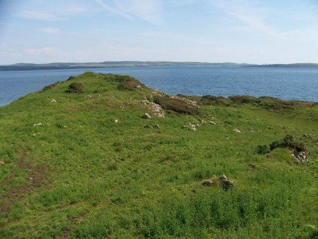
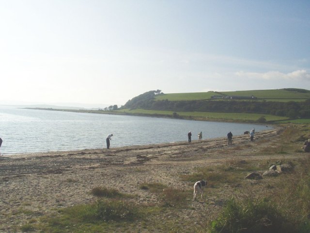
An Cnap is a prominent headland located in Argyllshire, Scotland. Situated on the western coast of the country, it is known for its stunning natural beauty and picturesque coastal views. With its rugged cliffs and rocky terrain, An Cnap stands as a striking feature along the coastline.
This headland is characterized by its distinctive shape, resembling a pointed finger jutting out into the sea. Rising to an elevation of approximately 200 meters, it offers breathtaking panoramic vistas of the surrounding area, including the vast expanse of the Atlantic Ocean and the nearby islands.
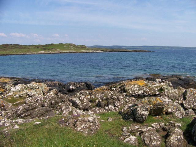
The geology of An Cnap is predominantly composed of ancient sedimentary rocks, with layers of sandstone and shale evident in the exposed cliffs. This geological composition contributes to the headland's unique appearance and provides a rich habitat for various forms of marine life.
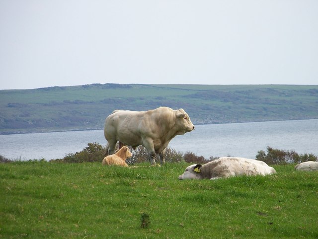
The coastal area around An Cnap is also home to an abundance of wildlife, making it a popular destination for nature enthusiasts and birdwatchers. Seabirds such as gannets, puffins, and kittiwakes can often be spotted nesting along the cliffs, while seals and dolphins can occasionally be seen swimming in the waters below.
Visitors to An Cnap can access the headland via a well-maintained footpath, which winds its way through heather-covered moorland and offers breathtaking views along the way. The area is also a popular spot for hiking and photography, with its dramatic landscapes providing ample opportunities for outdoor exploration and capturing stunning images of the Scottish coastline.
Overall, An Cnap is a captivating coastal feature that showcases the rugged beauty and natural wonders of Argyllshire, drawing visitors from near and far to experience its breathtaking scenery and diverse wildlife.
If you have any feedback on the listing, please let us know in the comments section below.
An Cnap Images
Images are sourced within 2km of 55.840486/-5.2024234 or Grid Reference NR9965. Thanks to Geograph Open Source API. All images are credited.


An Cnap is located at Grid Ref: NR9965 (Lat: 55.840486, Lng: -5.2024234)
Unitary Authority: Argyll and Bute
Police Authority: Argyll and West Dunbartonshire
What 3 Words
///bends.chairs.pits. Near Port Bannatyne, Argyll & Bute
Nearby Locations
Related Wikis

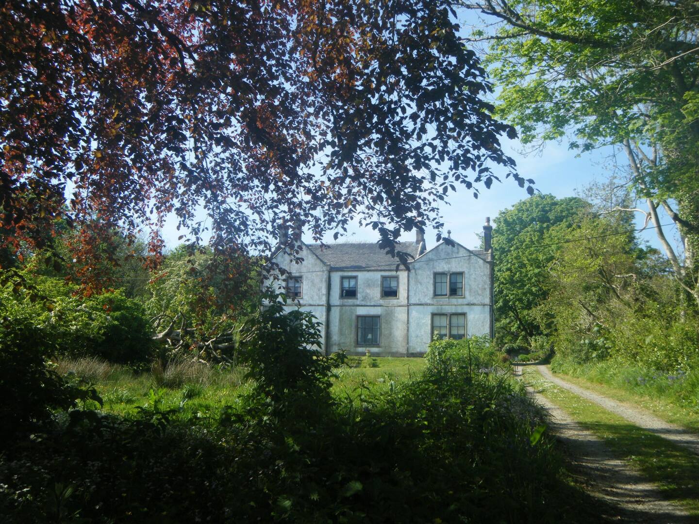
Ardlamont House
Ardlamont House is a Georgian estate house lying at the tip of the Cowal peninsula, 5.5 kilometres (3.4 mi) south of Kames, in Argyll, Scotland. The house...
Ettrick Bay
Ettrick Bay is a wide, tidal, sandy coastal embayment with a chord of 1 mile (2 km), on a 218° bearing, located on the west coast of the Isle of Bute in...
St Colmac Manse
St Colmac Manse (also known as Cnoc an Raer) is an historic building in St Colmac on the Isle of Bute, Scotland. Dating to around 1835, it was the clergy...

Isle of Bute
The Isle of Bute (Scots: Buit; Scottish Gaelic: Eilean Bhòid or An t-Eilean Bòdach), known as Bute (), is an island in the Firth of Clyde in Scotland,...
Nearby Amenities
Located within 500m of 55.840486,-5.2024234Have you been to An Cnap?
Leave your review of An Cnap below (or comments, questions and feedback).