Am Brideun

Coastal Feature, Headland, Point in Argyllshire

Scotland

Am Brideun

Trig point above Ardlamont Point Looking over the Kyles of Bute and Inchmarnock Island
Trig point above Ardlamont Point Credit: John Ferguson

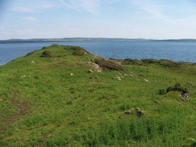
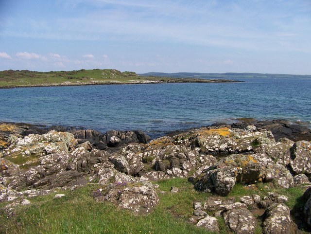
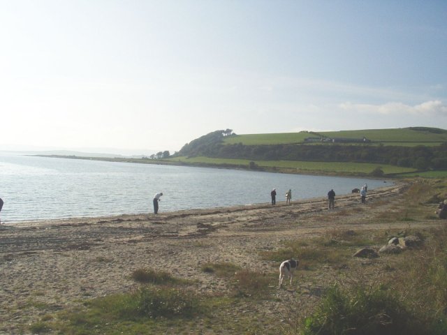
Am Brideun is a stunning coastal feature located in Argyllshire, Scotland. It is a headland that juts out into the mesmerizing waters of the Atlantic Ocean, providing breathtaking views and an incredible natural setting. Situated on the western coast of Scotland, Am Brideun is known for its rugged cliffs, pristine beaches, and abundant wildlife.

The headland is characterized by its dramatic rocky landscape, which is a result of millions of years of erosion by the powerful waves crashing against the shore. The cliffs rise high above the ocean, offering panoramic vistas of the surrounding coastal scenery. Visitors to Am Brideun can witness the raw power of the Atlantic as it relentlessly pounds the rocks below.

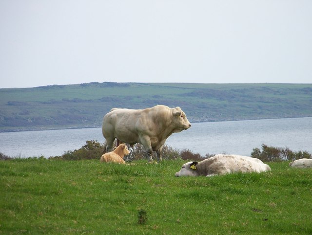
The area is a haven for nature enthusiasts, with a rich diversity of flora and fauna. Seabirds such as gannets, puffins, and cormorants can be spotted nesting along the cliffs, while seals and dolphins can often be seen playing in the waters. The headland is also home to various species of wildflowers and grasses, creating a colorful and vibrant landscape.

Access to Am Brideun is relatively easy, with well-maintained footpaths and trails leading to the headland. Hikers can enjoy a leisurely stroll along the coastline, taking in the breathtaking views and immersing themselves in the tranquility of the surroundings. The area is also popular for fishing, with anglers attracted by the abundance of marine life in the waters.

Am Brideun is a true gem of Argyllshire, offering visitors a chance to experience the untouched beauty of Scotland's coastline. Whether it's the rugged cliffs, the pristine beaches, or the diverse wildlife, this coastal headland is a must-visit destination for anyone seeking a connection with nature and a glimpse of Scotland's untamed coastal beauty.

If you have any feedback on the listing, please let us know in the comments section below.

Am Brideun Images

Images are sourced within 2km of 55.826928/-5.2017714 or Grid Reference NR9963. Thanks to Geograph Open Source API. All images are credited.

Trig point above Ardlamont Point Looking over the Kyles of Bute and Inchmarnock Island
Trig point above Ardlamont Point
Looking over the Kyles of Bute and Inchmarnock Island
Kyles of Bute
Kyles of Bute
Recently harvested grassland land at Point Farm
The cup and ring marked rock is in a cattle field
That's not a cow! After deciding it was safe to visit the cup and ring marked rock, this beast appeared on the horizon
That's not a cow!
After deciding it was safe to visit the cup and ring marked rock, this beast appeared on the horizon
Dun nam Muileach
Dun nam Muileach
Port a' Ghobhlain
Port a' Ghobhlain
The cup and ring marked rock It takes a little imagination to see cup and ring marks on the rock
The cup and ring marked rock
It takes a little imagination to see cup and ring marks on the rock
Ardlamont Point As viewed from the SD Oronsay on a beautiful sunny afternoon.
Ardlamont Point
As viewed from the SD Oronsay on a beautiful sunny afternoon.
Sailing Past Ardlamont Point Yachts heading south down the Kyles of Bute and past Ardlamont Point.
Sailing Past Ardlamont Point
Yachts heading south down the Kyles of Bute and past Ardlamont Point.
Ruined cottage, Point Farm
Fields and woods near Ardlamont
Ardlamont Point (west) The southernmost point of the Cowal peninsula turns out to be a real disappointment. Instead of a dramatic headland, I was confronted with this cow-induced morass. The point in the middle distance is actually the westernmost of two headlands and lies in <a href="https://www.geograph.org.uk/gridref/NR9863">NR9863</a>. Kintyre can be seen in cloud on the far side of Loch Fyne.
Ardlamont Point (west)
The southernmost point of the Cowal peninsula turns out to be a real disappointment. Instead of a dramatic headland, I was confronted with this cow-induced morass. The point in the middle distance is actually the westernmost of two headlands and lies in NR9863. Kintyre can be seen in cloud on the far side of Loch Fyne.
Ardlamont Point (west) The westernmost of two headlands at the southern tip of the Cowal peninsula. Inaccessible by landunless you are prepared to sink up to your ankles or deeper in cow muck. The Kintyre coast can be seen on the far side of Loch Fyne.
Ardlamont Point (west)
The westernmost of two headlands at the southern tip of the Cowal peninsula. Inaccessible by landunless you are prepared to sink up to your ankles or deeper in cow muck. The Kintyre coast can be seen on the far side of Loch Fyne.
Cup and ring marked stone, Ardlamont Set in a field well churned up by livestock.
Cup and ring marked stone, Ardlamont
Set in a field well churned up by livestock.
Ardlamont Point (west) The southernmost point of the Cowal peninsula turns out to be a real disappointment. Instead of a dramatic headland, this muddy track leads down to a cow-induced morass. The point in the middle distance is actually the westernmost of two headlands and lies in <a href="https://www.geograph.org.uk/gridref/NR9863">NR9863</a>. Kintyre can be seen in cloud to the right on the far side of Loch Fyne. Further away and to the left is the Isle of Arran.
Ardlamont Point (west)
The southernmost point of the Cowal peninsula turns out to be a real disappointment. Instead of a dramatic headland, this muddy track leads down to a cow-induced morass. The point in the middle distance is actually the westernmost of two headlands and lies in NR9863. Kintyre can be seen in cloud to the right on the far side of Loch Fyne. Further away and to the left is the Isle of Arran.
Camp Cottage and the Kyles of Bute Looking across to the Isle of Bute from the Ardlamont peninsula in Cowal.
Camp Cottage and the Kyles of Bute
Looking across to the Isle of Bute from the Ardlamont peninsula in Cowal.
Sheep, Ardlamont Cowal grazing land.
Sheep, Ardlamont
Cowal grazing land.
Show me another place!

Am Brideun is located at Grid Ref: NR9963 (Lat: 55.826928, Lng: -5.2017714)

Unitary Authority: Argyll and Bute

Police Authority: Argyll and West Dunbartonshire

What 3 Words

///resettle.fire.cringes. Near Port Bannatyne, Argyll & Bute

Related Wikis

Ardlamont House

Ardlamont House is a Georgian estate house lying at the tip of the Cowal peninsula, 5.5 kilometres (3.4 mi) south of Kames, in Argyll, Scotland. The house...

Ettrick Bay

Ettrick Bay is a wide, tidal, sandy coastal embayment with a chord of 1 mile (2 km), on a 218° bearing, located on the west coast of the Isle of Bute in...

Inchmarnock

Inchmarnock (Scottish Gaelic: Innis Mheàrnaig) is an island at the northern end of the Sound of Bute in the Firth of Clyde, on the west coast of Scotland...

Isle of Bute

The Isle of Bute (Scots: Buit; Scottish Gaelic: Eilean Bhòid or An t-Eilean Bòdach), known as Bute (), is an island in the Firth of Clyde in Scotland,...

Nearby Amenities

Located within 500m of 55.826928,-5.2017714
Created By: dmgroom_coastlines
Source: PGS
Lat/Long: 55.825716/-5.208553
Source: PGS
Lat/Long: 55.8258615/-5.2075039
Source: PGS
Lat/Long: 55.8257189/-5.2070293
Source: PGS
Lat/Long: 55.8255845/-5.2066969
Source: PGS
Lat/Long: 55.8259539/-5.2062181
Source: PGS
Lat/Long: 55.8263002/-5.204933
Created By: dmgroom_coastlines
Source: PGS
Lat/Long: 55.826433/-5.204271
Source: PGS
Lat/Long: 55.8269704/-5.2039674
Source: PGS
Lat/Long: 55.8272614/-5.2044856
Source: PGS
Lat/Long: 55.8274769/-5.2048502
Source: PGS
Lat/Long: 55.8277598/-5.2041956
Source: PGS
Lat/Long: 55.8279498/-5.2038735
Created By: dmgroom_coastlines
Source: PGS
Lat/Long: 55.828497/-5.203478
Created By: dmgroom_coastlines
Source: PGS
Lat/Long: 55.829269/-5.203293
Created By: dmgroom_coastlines
Source: PGS
Lat/Long: 55.829285/-5.202384
Created By: dmgroom_coastlines
Source: PGS
Lat/Long: 55.829797/-5.202413
Created By: dmgroom_coastlines
Source: PGS
Lat/Long: 55.829941/-5.201511
Created By: dmgroom_coastlines
Source: PGS
Lat/Long: 55.830085/-5.200609
Created By: dmgroom_coastlines
Source: PGS
Lat/Long: 55.830857/-5.200425
The data included in this document is from www.openstreetmap.org. The data is made available under ODbL.

Have you been to Am Brideun?

Leave your review of Am Brideun below (or comments, questions and feedback).