Longbridge Deverill

Settlement in Wiltshire

England

Longbridge Deverill

Bridleway heading towards Brixton Deverill Bridleway squeezed between high hedges - a challenge for horse riders
Bridleway heading towards Brixton Deverill Credit: Chris Heaton

Longbridge Deverill is a small village located in the county of Wiltshire, England. Situated approximately 4 miles southeast of Warminster, it lies in the picturesque Deverill Valley, surrounded by rolling hills and lush countryside. The village is part of the civil parish of Deverill, which also includes the neighboring villages of Hill Deverill and Brixton Deverill.

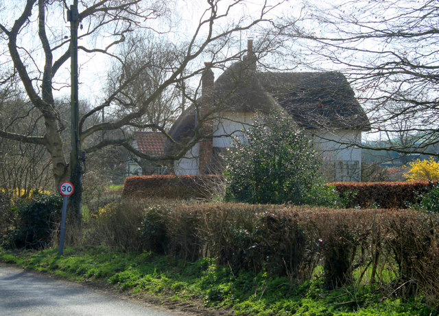
With a population of around 500 residents, Longbridge Deverill is a close-knit community known for its peaceful atmosphere and charming rural setting. The village is characterized by its traditional stone houses, many of which date back several centuries, adding to its historic appeal. The centerpiece of the village is the All Saints Church, a Grade I listed building that dates back to the 13th century, featuring stunning architectural details and a rich history.

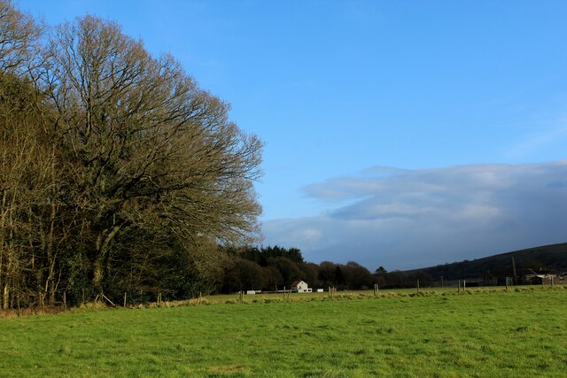
Longbridge Deverill benefits from its proximity to the River Wylye, which runs through the village, providing scenic walks and recreational activities for both residents and visitors. The surrounding countryside offers ample opportunities for outdoor pursuits such as hiking, cycling, and fishing.

Though small in size, Longbridge Deverill offers essential amenities to its residents, including a village hall and a local pub, which serves as a hub for social gatherings and community events. The village also has a primary school, ensuring educational facilities for young families.

Overall, Longbridge Deverill is a charming and idyllic village that offers a tranquil countryside lifestyle, making it an attractive place to live for those seeking a peaceful retreat away from the hustle and bustle of urban life.

If you have any feedback on the listing, please let us know in the comments section below.

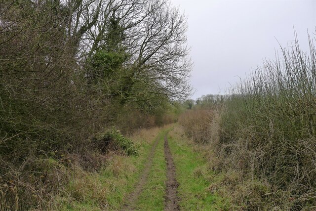
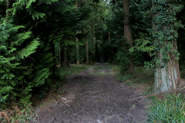
Longbridge Deverill Images

Images are sourced within 2km of 51.166449/-2.190618 or Grid Reference ST8640. Thanks to Geograph Open Source API. All images are credited.

Bridleway heading towards Brixton Deverill Bridleway squeezed between high hedges - a challenge for horse riders
Bridleway heading towards Brixton Deverill
Bridleway squeezed between high hedges - a challenge for horse riders
Track descending towards Brixton Deverill Bridleway on the flanks of Brims Down, descending into the Wylye Valley
Track descending towards Brixton Deverill
Bridleway on the flanks of Brims Down, descending into the Wylye Valley
Outbuildings at Woodcombe Farm
Bridleway south from Wing farm Heading towards Brims Down
Bridleway south from Wing farm
Heading towards Brims Down
Bridleway into the Wylye Valley On the flank of Brims Down, approaching Woodcombe Farm
Bridleway into the Wylye Valley
On the flank of Brims Down, approaching Woodcombe Farm
Farmland, Longbridge Deverill In a view from the footpath above Field Barn Farm, the distant trees are at Haycombe Hill Farm and a combe on Cow Down is in the middle distance.
Farmland, Longbridge Deverill
In a view from the footpath above Field Barn Farm, the distant trees are at Haycombe Hill Farm and a combe on Cow Down is in the middle distance.
Longbridge Deverill : Lord's Hill A350 Looking along the A350.
Longbridge Deverill : Lord's Hill A350
Looking along the A350.
2012 : A350 heading north west to Longbridge Deverill About half way down Lord's Hill, a glimpse of Longbridge Deverill over the rise to the right.
The A350 continues north avoiding Warminster on the bypass.
2012 : A350 heading north west to Longbridge Deverill
About half way down Lord's Hill, a glimpse of Longbridge Deverill over the rise to the right. The A350 continues north avoiding Warminster on the bypass.
2012 : The first and last house in Brixton Deverill Seen from the B3095 approaching from the north.
2012 : The first and last house in Brixton Deverill
Seen from the B3095 approaching from the north.
2012 : West from the A350 near the bottom of Lord's Hill Field Barn Farm can be seen among the trees to the right. Brims Down is further over to the left.
2012 : West from the A350 near the bottom of Lord's Hill
Field Barn Farm can be seen among the trees to the right. Brims Down is further over to the left.
2012 : B3095 heading north leaving Brixton Deverill One mile to Hill Deverill and Longbridge Deverill.

"The name Deverill refers to the River Deverill which flows through the whole valley. It rises to the west of Kingston and flows north, passing through the six villages. At Crockerton it meets the Shearwater stream and becomes the River Wylye. The name Deverill literally means ‘diving rill’. There are points along its route where it peters out and flows underground, hence the disappearing rill or stream."
The above was copied from <span class="nowrap"><a title="http://history.wiltshire.gov.uk/community/getcom.php?id=128" rel="nofollow ugc noopener" href="http://history.wiltshire.gov.uk/community/getcom.php?id=128">Link</a><img style="margin-left:2px;" alt="External link" title="External link - shift click to open in new window" src="https://s1.geograph.org.uk/img/external.png" width="10" height="10"/></span>
2012 : B3095 heading north leaving Brixton Deverill
One mile to Hill Deverill and Longbridge Deverill. "The name Deverill refers to the River Deverill which flows through the whole valley. It rises to the west of Kingston and flows north, passing through the six villages. At Crockerton it meets the Shearwater stream and becomes the River Wylye. The name Deverill literally means ‘diving rill’. There are points along its route where it peters out and flows underground, hence the disappearing rill or stream." The above was copied from LinkExternal link
Brixton Deverill from the north
Track in Southleigh Wood
Edge of Southleigh Wood Southern edge of the woods
Edge of Southleigh Wood
Southern edge of the woods
Sand Hill Farm Farming operation in Longbridge Deverill
Sand Hill Farm
Farming operation in Longbridge Deverill
Church of St. Peter and St. Paul, Longbridge Deverill Grade II Listed building dating back to the 11th Century, with later additions culminating with restoration in the 1800s.
Church of St. Peter and St. Paul, Longbridge Deverill
Grade II Listed building dating back to the 11th Century, with later additions culminating with restoration in the 1800s.
Longbridge Deverill Village Hall Former schoolhouse located on the main A350 in Longbridge Deverill
Longbridge Deverill Village Hall
Former schoolhouse located on the main A350 in Longbridge Deverill
Sand Street, Longbridge Deverill
Show me another place!

Longbridge Deverill is located at Grid Ref: ST8640 (Lat: 51.166449, Lng: -2.190618)

Unitary Authority: Wiltshire

Police Authority: Wiltshire

What 3 Words

///droplet.withdrew.knees. Near Bishopstrow, Wiltshire

Related Wikis

Longbridge Deverill

Longbridge Deverill is a village and civil parish about 2.5 miles (4.0 km) south of Warminster in Wiltshire, England. It is on the A350 primary route which...

Shearwater (lake)

Shearwater (or Shear Water) is a man-made freshwater lake near Crockerton village, about 2+1⁄4 miles (3.6 km) southwest of the town of Warminster in Wiltshire...

Brixton Deverill

Brixton Deverill is a small village and civil parish about 4 miles (6.4 km) south of Warminster in Wiltshire, England. The parish is in the Deverill Valley...

Sutton Veny

Sutton Veny is a village and civil parish in the Wylye valley, to the southeast of the town of Warminster in Wiltshire, England; the village is about 3...

Nearby Amenities

Located within 500m of 51.166449,-2.190618
Longbridge Deverill
Place: village
Lat/Long: 51.1668315/-2.1889513
Post Box
Brand: Royal Mail
Brand Wikidata: Q638098
Brand Wikipedia: en:Royal Mail
Mapillary: 808833296481190
Operator: Royal Mail
Operator Wikidata: Q638098
Post Box Type: pillar
Ref: BA12 43
Survey Date: 2021-08-07
Lat/Long: 51.1665434/-2.1884485
Barrier: kissing_gate
Lat/Long: 51.1701768/-2.1895347
Hill Deverill
Place: village
Lat/Long: 51.1633922/-2.1888226
Barrier: stile
Lat/Long: 51.1622824/-2.190328
Pub
The George Inn
Food: yes
Website: https://www.the-georgeinn.co.uk/
Lat/Long: 51.166626/-2.1890255
Fuel
Longbridge Deverill Service Station
Brand: BP
Brand Wikidata: Q152057
Brand Wikipedia: en:BP
Website: https://map.bp.com/en-GB/GB/petrol-station/warminster/longbridge-deverill-s-stn/4207
Lat/Long: 51.1666897/-2.1884246
Barrier: stile
Lat/Long: 51.167603/-2.1851058
Barrier: kissing_gate
Lat/Long: 51.1663252/-2.1838805
Barrier: kissing_gate
Lat/Long: 51.1703893/-2.1909805
Ford: yes
Lat/Long: 51.163391/-2.1880847
Sand Street
Place: locality
Lat/Long: 51.1677335/-2.1861
Charging Station
Capacity: 2
Operator: InstaVolt
Operator Wikidata: Q111173904
Output: 50kW
Lat/Long: 51.1668767/-2.1884306
The data included in this document is from www.openstreetmap.org. The data is made available under ODbL.

Have you been to Longbridge Deverill?

Leave your review of Longbridge Deverill below (or comments, questions and feedback).