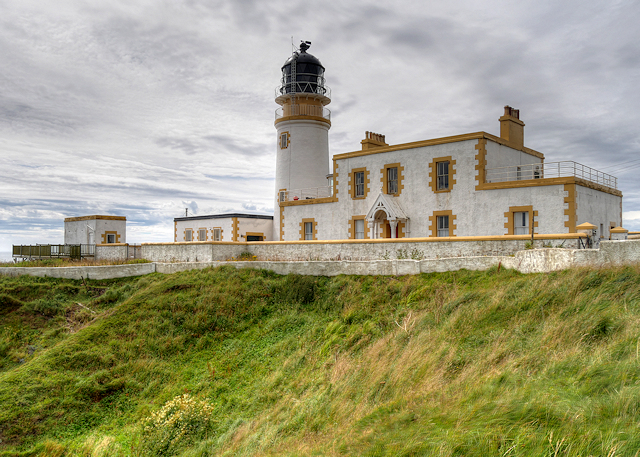
Black Stot

Coastal Feature, Headland, Point in Wigtownshire

Scotland

Black Stot

Galdenoch Castle Built in the 16th-century by the Agnews of Lochnaw, the castle is said to have been the scene of poltergeist activity. According to the legend, the spirit was finally laid to rest by the singing of a minister.
Galdenoch Castle Credit: Leslie Barrie

Black Stot is a prominent headland located in Wigtownshire, a region in southwestern Scotland. Situated along the picturesque coastline, this coastal feature is known for its striking cliffs, diverse wildlife, and stunning views of the Irish Sea. The name "Black Stot" is derived from the Scottish term for a male cow, reflecting the dark and rugged appearance of the headland.

Rising to an impressive height of approximately 150 feet, Black Stot offers a commanding presence along the coastline. The cliffs are composed of a mix of sedimentary rocks, including sandstone and shale, which have been shaped by centuries of erosion from the crashing waves and coastal winds.

The headland is home to a diverse range of wildlife, making it a popular spot for nature enthusiasts and birdwatchers. Visitors may spot various seabirds, including guillemots, kittiwakes, and razorbills, nesting along the cliffs. Common seals can often be seen lounging on the rocks, while dolphins and porpoises occasionally make appearances offshore.

Black Stot is also cherished for its scenic views, with panoramic vistas of the surrounding coastline and the Irish Sea. On clear days, the headland offers breathtaking sunsets, making it a favorite spot for photographers and romantics alike.

Access to Black Stot is relatively easy, with a well-maintained footpath leading visitors to the headland. The area is also part of a designated nature reserve, ensuring the protection and preservation of its natural beauty for future generations to enjoy.

If you have any feedback on the listing, please let us know in the comments section below.

Black Stot Images

Images are sourced within 2km of 54.912088/-5.1831211 or Grid Reference NW9662. Thanks to Geograph Open Source API. All images are credited.

Galdenoch Castle Built in the 16th-century by the Agnews of Lochnaw, the castle is said to have been the scene of poltergeist activity. According to the legend, the spirit was finally laid to rest by the singing of a minister.
Galdenoch Castle
Built in the 16th-century by the Agnews of Lochnaw, the castle is said to have been the scene of poltergeist activity. According to the legend, the spirit was finally laid to rest by the singing of a minister.
Galdenoch Castle
Galdenoch Castle
Stone Seating at Galdenoch
Galdenoch Castle
Galdenoch Castle
Galdenoch Castle
Galdenoch Castle
Galdenoch Castle
Galdenoch Castle
Galdenoch Castle
Galdenoch Castle
Road to the B738
Road to the B738
Galdenoch Castle
Galdenoch Castle
Galdenoch Castle
Galdenoch Castle
Farmland near Galdenoch Castle With a ford.
Farmland near Galdenoch Castle
With a ford.
Footpath to Loch More
Farmland at Meikle Galdenoch
The Green Burn at Galdenoch On the right is Galdenoch castle.
The Green Burn at Galdenoch
On the right is Galdenoch castle.
Road to Galdenoch Castle Which can be seen straight ahead.
Road to Galdenoch Castle
Which can be seen straight ahead.
Road to the B738 from Galdenoch Castle
Show me another place!

Black Stot is located at Grid Ref: NW9662 (Lat: 54.912088, Lng: -5.1831211)

Unitary Authority: Dumfries and Galloway

Police Authority: Dumfries and Galloway

What 3 Words

///situates.economics.finely. Near Stranraer, Dumfries & Galloway

Related Wikis

Galdenoch Castle

Galdenoch Castle is a tower house near the Scottish village of Leswalt in the Council Area Dumfries and Galloway . The ruin is listed as a Scheduled Monument...

Killantringan Lighthouse

Killantringan Lighthouse is a lighthouse located near Portpatrick in Dumfries and Galloway, south-west Scotland. The light came into operation in 1900...

Leswalt

Leswalt (Scottish Gaelic: Lios Uillt) is a village and civil parish in Dumfries and Galloway, south-west Scotland. It lies between Portpatrick and Stranraer...

MV Craigantlet

MV Craigantlet was a German-owned, Cyprus-registered container ship operated on time-charter by Cawoods Containers Ltd of Belfast. She ran aground on 26...

Nearby Amenities

Located within 500m of 54.912088,-5.1831211
Created By: dmgroom_coastlines
Source: PGS
Lat/Long: 54.915863/-5.18489
Created By: dmgroom_coastlines
Source: PGS
Lat/Long: 54.914335/-5.184362
Created By: dmgroom_coastlines
Source: PGS
Lat/Long: 54.914211/-5.184132
Created By: dmgroom_coastlines
Source: PGS
Lat/Long: 54.914087/-5.183904
Created By: dmgroom_coastlines
Source: PGS
Lat/Long: 54.913831/-5.18389
Created By: dmgroom_coastlines
Source: PGS
Lat/Long: 54.913576/-5.183876
Created By: dmgroom_coastlines
Source: PGS
Lat/Long: 54.913451/-5.183646
Created By: dmgroom_coastlines
Source: PGS
Lat/Long: 54.913328/-5.183418
Created By: dmgroom_coastlines
Source: PGS
Lat/Long: 54.912816/-5.183391
Created By: dmgroom_coastlines
Source: PGS
Lat/Long: 54.91256/-5.183377
Created By: dmgroom_coastlines
Source: PGS
Lat/Long: 54.911796/-5.183112
Created By: dmgroom_coastlines
Source: PGS
Lat/Long: 54.911812/-5.182224
Created By: dmgroom_coastlines
Source: PGS
Lat/Long: 54.911552/-5.182433
Created By: dmgroom_coastlines
Source: PGS
Lat/Long: 54.911296/-5.182419
Created By: dmgroom_coastlines
Source: PGS
Lat/Long: 54.910536/-5.181933
Created By: dmgroom_coastlines
Source: PGS
Lat/Long: 54.909517/-5.181655
Created By: dmgroom_coastlines
Source: PGS
Lat/Long: 54.909533/-5.180767
Created By: dmgroom_coastlines
Source: PGS
Lat/Long: 54.909273/-5.180976
Created By: dmgroom_coastlines
Source: PGS
Lat/Long: 54.908501/-5.181155
Created By: dmgroom_coastlines
Source: PGS
Lat/Long: 54.908533/-5.179378
Created By: dmgroom_coastlines
Source: PGS
Lat/Long: 54.908273/-5.179588
The data included in this document is from www.openstreetmap.org. The data is made available under ODbL.

Have you been to Black Stot?

Leave your review of Black Stot below (or comments, questions and feedback).