Round Hole

Coastal Feature, Headland, Point in Cornwall

England

Round Hole

Padstow Airfield The remains of Padstow Airfield, it was operational from March 1918 to 1919.
Padstow Airfield Credit: Tony Houlihan

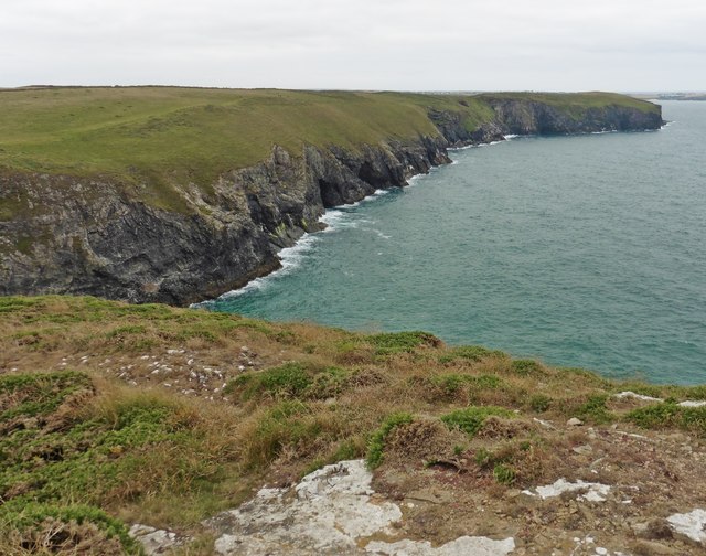
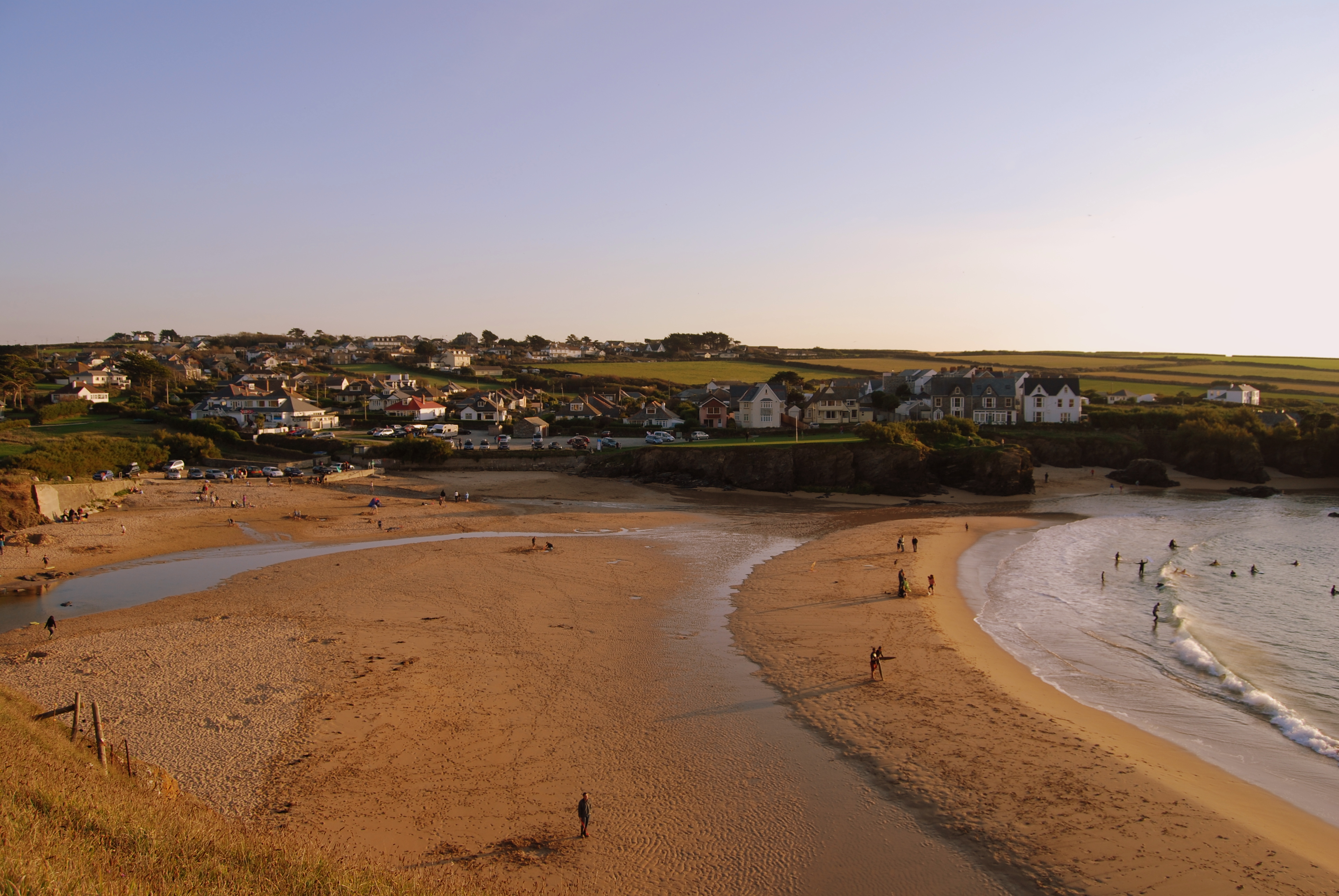
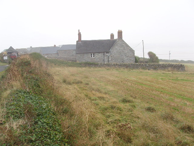
Round Hole is a prominent coastal feature located in Cornwall, England. Situated on the southern coast of England, this headland is famed for its stunning cliffs and unique geological formations. The area is part of the Cornwall Area of Outstanding Natural Beauty, attracting both locals and tourists alike.

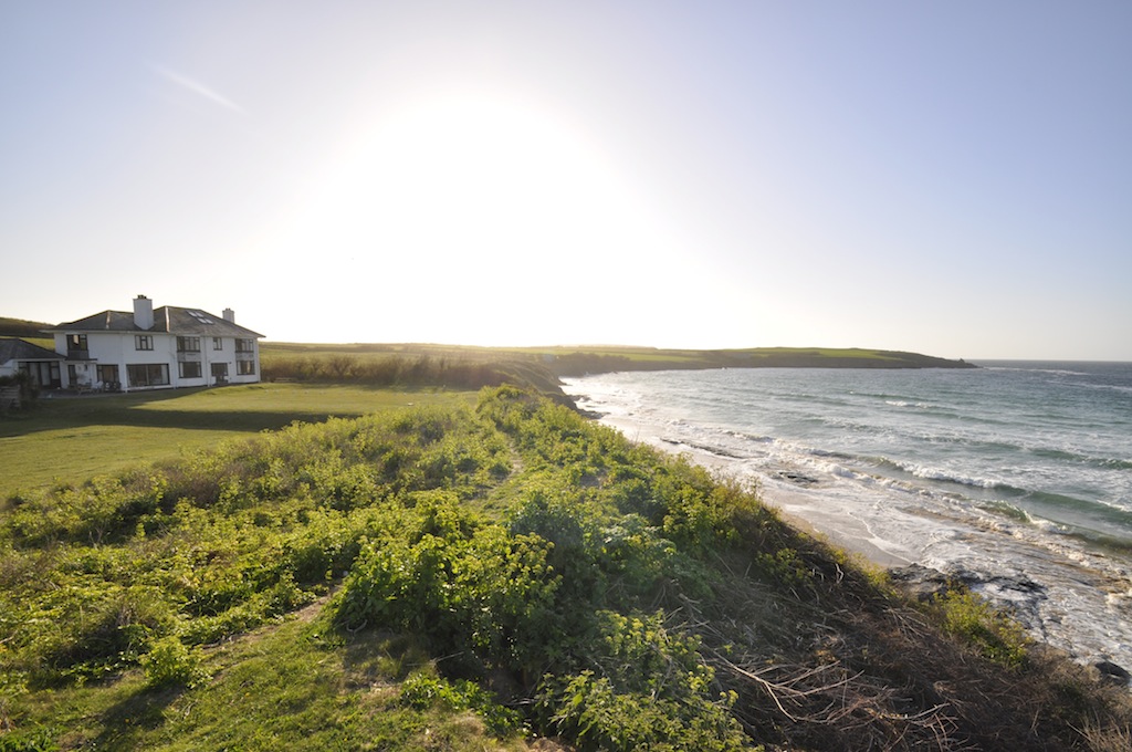
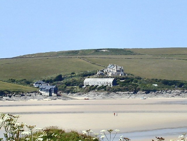
Standing tall at approximately 100 meters, Round Hole is a striking headland that juts out into the Celtic Sea, forming a distinctive point along the coastline. The headland is characterized by its rugged cliffs, which have been carved over centuries by the relentless waves of the sea. These cliffs offer breathtaking views of the surrounding landscape and are a popular spot for photographers and nature enthusiasts.

What sets Round Hole apart from other coastal features is its namesake - a large round hole that has been eroded into the cliffs. This natural phenomenon, believed to have been formed by the relentless pounding of the sea against the rock, serves as an iconic landmark for the area. Visitors can witness the power of nature as they observe the waves crashing through the hole, creating a mesmerizing spectacle.

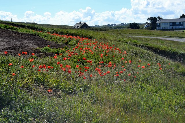
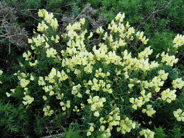
Round Hole is also home to a diverse array of wildlife. The cliffs provide nesting grounds for various seabirds, including puffins, razorbills, and guillemots. The surrounding waters are inhabited by seals and dolphins, adding to the area's natural beauty and charm.

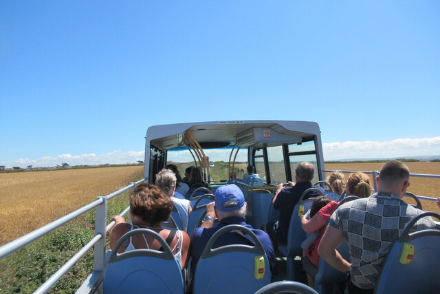
Accessible by foot, Round Hole offers a range of walking trails that allow visitors to explore the headland and its surrounding areas. The nearby coastal path provides panoramic views of the sea and Cornwall's picturesque coastline, making it a popular destination for hikers and nature lovers.

In conclusion, Round Hole in Cornwall is a captivating coastal feature known for its dramatic cliffs, unique geological formations, and abundant wildlife. Its natural beauty and accessibility make it a must-visit destination for anyone exploring the stunning landscapes of Cornwall.

If you have any feedback on the listing, please let us know in the comments section below.

Round Hole Images

Images are sourced within 2km of 50.548203/-4.9794461 or Grid Reference SW8976. Thanks to Geograph Open Source API. All images are credited.

Padstow Airfield The remains of Padstow Airfield, it was operational from March 1918 to 1919.
Padstow Airfield
The remains of Padstow Airfield, it was operational from March 1918 to 1919.
The road to Trevose Head
Harlyn Bay beach
Harlyn Bay beach
View from the Atlantic Coaster bus shortly after Harlyn Bay
Former Wesleyan Methodist Chapel
Trevone Church (1958) Saint Saviour
Trevone Church (1958)
Saint Saviour
Porthmissen Poppies On the coastal path.
Porthmissen Poppies
On the coastal path.
Trevone Bay Rocky beach.
Trevone Bay
Rocky beach.
Harlyn Bay-Harlyn Bridge Small River.
Harlyn Bay-Harlyn Bridge
Small River.
Summer Evening at the Well Parc, Trevone, 2003 The garden at the rear of the Well Parc Public House in Trevone, Cornwall, at about 8.50pm on a summer evening.  Trevose Head is visible on the horizon.
Summer Evening at the Well Parc, Trevone, 2003
The garden at the rear of the Well Parc Public House in Trevone, Cornwall, at about 8.50pm on a summer evening. Trevose Head is visible on the horizon.
Dog walker, Harlyn Bay Dog walker silhouetted in the afternoon sun on the beach at Harlyn Bay.
Dog walker, Harlyn Bay
Dog walker silhouetted in the afternoon sun on the beach at Harlyn Bay.
Grazing cattle near Gunver Head
Middle Merope Island
Cliffs, south of Gunver Head
Wild Snapdragon, on Gunver Head
Gunver Head
Gunver Head
Rough day at Newtrain Bay, Trevone near Padstow
Trevone Bay near Padstow
Show me another place!

Round Hole is located at Grid Ref: SW8976 (Lat: 50.548203, Lng: -4.9794461)

Unitary Authority: Cornwall

Police Authority: Devon and Cornwall

What 3 Words

///letters.dugouts.shorthand. Near Padstow, Cornwall

Related Wikis

Trevone

Trevone (Cornish: Treavon, meaning river farm) is a seaside village and bay (Cornish: Porth Musyn, meaning Musun cove) near Padstow in Cornwall, England...

Crugmeer

Crugmeer (Cornish: Krugmeur, great barrow) is a hamlet in north Cornwall, England, United Kingdom. It is situated one-and-a-half miles (2 kilometres) from...

Harlyn

Harlyn (Cornish: ar-Lyn, meaning facing a pool) is a small village on the north coast of Cornwall, England, United Kingdom. It is situated inland from...

Treator

Treator is a hamlet west of Padstow, Cornwall, England, United Kingdom.It was the birthplace of Sir Goldsworthy Gurney (1793–1875), a surgeon, chemist...

Tregirls

Tregirls (Cornish: Tregryllas, meaning farmstead of the ruins of an ancient dwelling) is a farmstead in Cornwall, United Kingdom. It is situated approximately...

Lellizzick

Lellizzick (Cornish: Lan Wolesyk, meaning Woledic's church enclosure) is a farmstead settlement in north Cornwall, England. It is situated approximately...

Hawker's Cove, Cornwall

Hawker's Cove is a small coastal settlement in north Cornwall, England, United Kingdom. It is situated one-and-a-half miles (2 kilometres) north of Padstow...

St Merryn

St Merryn (Cornish: S. Meryn) is a civil parish and village in north Cornwall, England, United Kingdom. It is about 3.5 miles (5.6 km) south of the fishing...

Nearby Amenities

Located within 500m of 50.548203,-4.9794461
Source: PGS
Lat/Long: 50.5481697/-4.9815919
Source: PGS
Lat/Long: 50.5479924/-4.9815811
Source: PGS
Lat/Long: 50.5478765/-4.9815275
Source: PGS
Lat/Long: 50.547297/-4.9801971
Source: PGS
Lat/Long: 50.5472289/-4.980004
Source: PGS
Lat/Long: 50.5470925/-4.9797572
Source: PGS
Lat/Long: 50.5469562/-4.9791028
Source: PGS
Lat/Long: 50.5467175/-4.9780728
Source: PGS
Lat/Long: 50.546438/-4.9774505
Source: PGS
Lat/Long: 50.5458244/-4.9775256
Source: PGS
Lat/Long: 50.545354/-4.9776973
Source: PGS
Lat/Long: 50.5453436/-4.9779028
Source: PGS
Lat/Long: 50.5453709/-4.9780718
Source: PGS
Lat/Long: 50.5454017/-4.978223
Source: PGS
Lat/Long: 50.545354/-4.9786951
Source: PGS
Lat/Long: 50.5452796/-4.9792728
Source: PGS
Lat/Long: 50.5454691/-4.9794823
Source: PGS
Lat/Long: 50.5456821/-4.9801384
Source: PGS
Lat/Long: 50.5443245/-4.9807228
Source: PGS
Lat/Long: 50.5440021/-4.9808724
Bus Stop
Trevone Bay Car Park
Bus: yes
Naptan AtcoCode: 0800COA10424
Naptan Bearing: SE
Naptan CommonName: Trevone Bay Car Park
Naptan Crossing: Trevone Road
Naptan NaptanCode: cordapgw
Naptan Street: Beach Road
Naptan Verified: no
Public Transport: platform
Source: naptan_import
Lat/Long: 50.5448981/-4.9774538
Parking
Access: yes
Fee: yes
Parking: surface
Payment Contactless: yes
Payment Credit Cards: yes
Source: OS_OpenData_StreetView
Lat/Long: 50.5450654/-4.9773532
Barrier: stile
Material: stone
Step Count: 6
Stile: stepover
Lat/Long: 50.5468109/-4.9777731
Bench
Backrest: yes
Lat/Long: 50.5451049/-4.979046
Bench
Backrest: yes
Lat/Long: 50.5446741/-4.9795741
Waste Basket
Survey Date: 2022-12-03
Lat/Long: 50.5447161/-4.9795506
Bench
Backrest: yes
Survey Date: 2022-12-03
Lat/Long: 50.5458564/-4.9768848
Phone
Emergency: phone
Survey Date: 2022-12-03
Lat/Long: 50.5455497/-4.9768378
Life Ring
Emergency: life_ring
Survey Date: 2022-12-03
Lat/Long: 50.54555/-4.9768533
Life Ring
Emergency: life_ring
Survey Date: 2022-12-03
Lat/Long: 50.5452345/-4.9776313
Bench
Backrest: yes
Survey Date: 2022-12-03
Lat/Long: 50.5446522/-4.9796342
Defibrillator
Emergency: defibrillator
Indoor: no
Survey Date: 2022-12-03
Lat/Long: 50.5447091/-4.9765975
Fire Hydrant
Emergency: fire_hydrant
Fire Hydrant Type: underground
Survey Date: 2022-12-03
Lat/Long: 50.5445796/-4.9762589
Post Box
Brand: Royal Mail
Brand Wikidata: Q638098
Collection Times: Mo-Fr 09:00; Sa 07:00
Operator: Royal Mail
Operator Wikidata: Q638098
Post Box Mounting: brick_pillar
Post Box Type: wall
Ref: PL28 26D
Royal Cypher: EIIR
Royal Cypher Wikidata: Q33102113
Survey Date: 2022-12-03
Lat/Long: 50.5447218/-4.9768006
The data included in this document is from www.openstreetmap.org. The data is made available under ODbL.

Have you been to Round Hole?

Leave your review of Round Hole below (or comments, questions and feedback).