Leac Dhubh

Coastal Feature, Headland, Point in Ross-shire

Scotland

Leac Dhubh

Beach at Slaggan Bay
Beach at Slaggan Bay Credit: Graeme Yuill

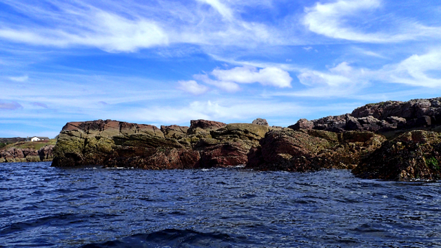
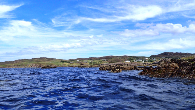
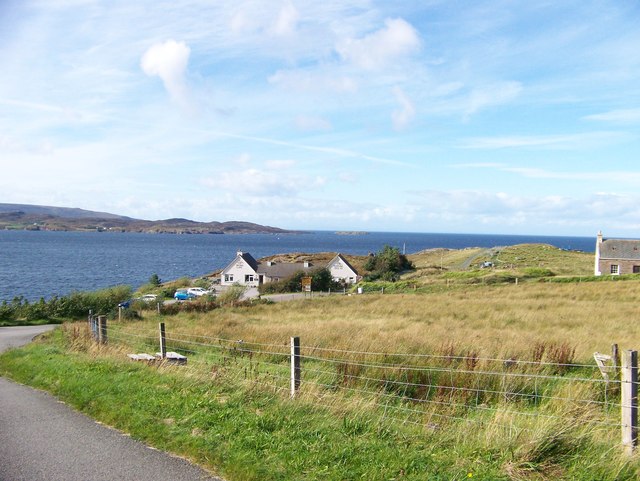
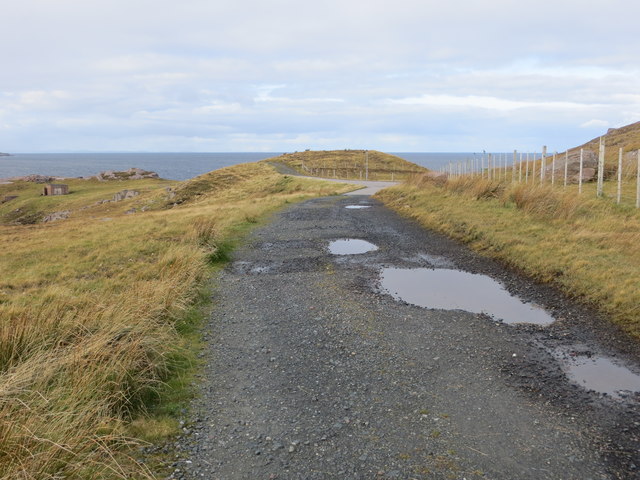
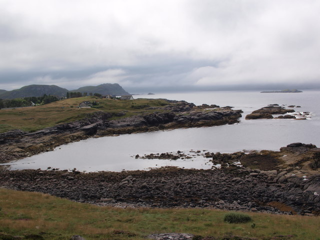
Leac Dhubh is a prominent coastal feature located in Ross-shire, Scotland. This headland, also known as a point, is situated along the rugged and picturesque coastline of the Scottish Highlands. With its striking cliffs and breathtaking views, Leac Dhubh offers visitors a mesmerizing glimpse into the natural beauty of the region.

The headland is characterized by its steep and jagged cliffs, which rise dramatically from the sea, providing a spectacular vantage point for nature enthusiasts. These cliffs are composed of various rock formations, including sandstone and granite, which have been shaped by centuries of erosion caused by the crashing waves of the North Atlantic Ocean.

Leac Dhubh is also home to a diverse array of wildlife. The headland serves as an important breeding ground for seabirds, including puffins, razorbills, and guillemots. Visitors can often spot these magnificent creatures soaring above the cliffs or nesting in the crevices.

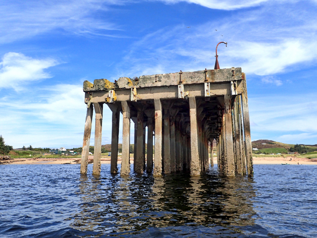
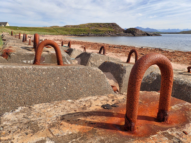
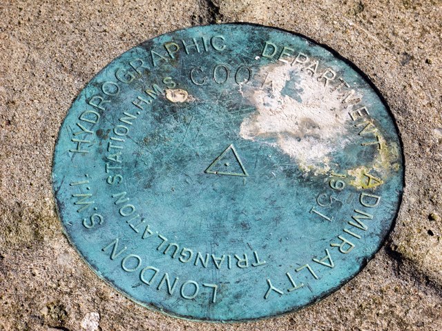
In addition to its natural beauty, Leac Dhubh also holds historical significance. The headland was once a strategic lookout point during various conflicts that took place in the area. Ruins of ancient fortifications can still be seen atop the cliffs, serving as a reminder of the region's rich history.

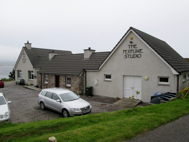
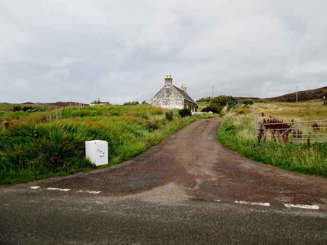
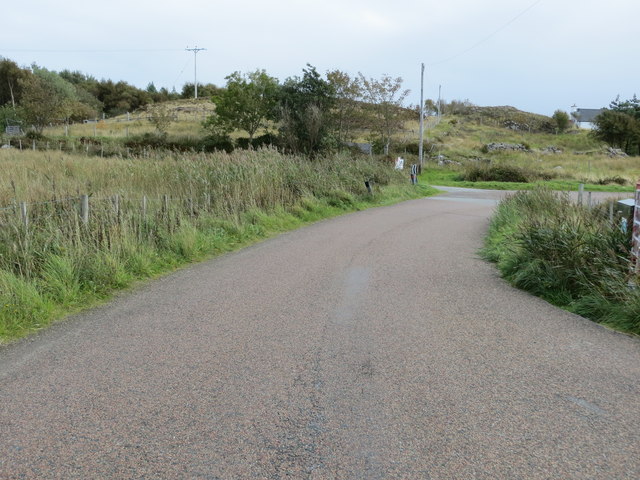
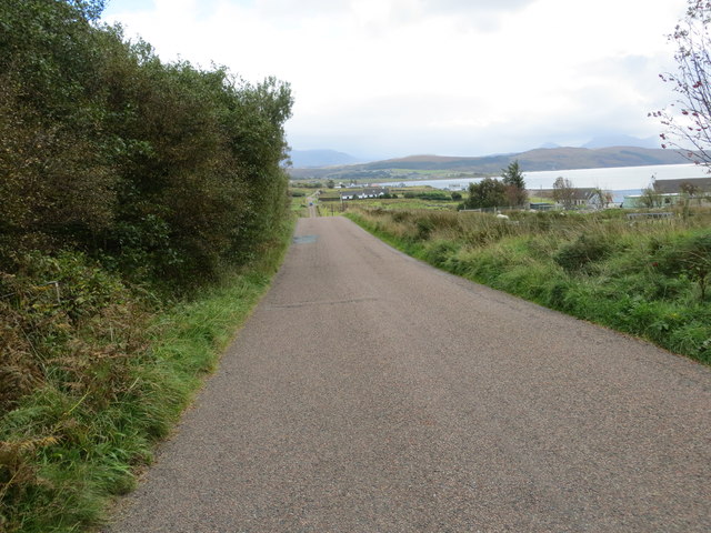
Access to Leac Dhubh is relatively easy, with a well-maintained path leading visitors to the headland. Once there, visitors can explore the area on foot, taking in the awe-inspiring views and immersing themselves in the tranquility of the Scottish Highlands.

If you have any feedback on the listing, please let us know in the comments section below.

Leac Dhubh Images

Images are sourced within 2km of 57.868783/-5.6458529 or Grid Reference NG8392. Thanks to Geograph Open Source API. All images are credited.

Beach at Slaggan Bay
Rubh' a' Choin
Rubh' a' Choin
Sgeirean Mòra
Sgeirean Mòra
Remains of Jetty, Mellon Charles I first visited Loch Ewe in 2013 and was amazed on discovering its role in World War II. An unassuming role modestly portrayed in a few information boards scattered around its coast. WW2 remains abound, anti aircraft gun emplacements, military buildings and foundations. Loch Ewe is a deep sea loch and during the war it was used to muster merchant shipping in relative safety before heading off with vital supplies to Murmansk in war torn Russia, in what has become known as the Arctic Convoys. The convoys, of up to 40 ships with Navy escorts, sailed close to the Arctic pack ice in an attempt to avoid German U Boats. Many were unsuccessful.

To protect the ships while in Loch Ewe an anti submarine net or boom was laid across the loch at its narrowest point, about 3km. Barrage balloons and anti aircraft guns provided protection against airborne attack. During the war military personnel outnumbered the local population by 3:1.

Mellon Charles was the Boom Defence Depot. The most visible remains is this concrete jetty forming an island that has been adopted by a colony of terns which took to divebombing us as we paddled past.

The seas around Mellon Charles are particularly rich in marine life and have been designated by the Scottish Wildlife Trust as part of their Snorkel Trail. Yet in spite this accolade the beach was exceptionally quiet. Golden sands but marred only by a thick tide mark of drying kelp. Only one other car arrived, an ex-serviceman looking up old haunts. He was stationed here for two weeks in 1972 as part of the Royal Marines Arctic warfare section.
Remains of Jetty, Mellon Charles
I first visited Loch Ewe in 2013 and was amazed on discovering its role in World War II. An unassuming role modestly portrayed in a few information boards scattered around its coast. WW2 remains abound, anti aircraft gun emplacements, military buildings and foundations. Loch Ewe is a deep sea loch and during the war it was used to muster merchant shipping in relative safety before heading off with vital supplies to Murmansk in war torn Russia, in what has become known as the Arctic Convoys. The convoys, of up to 40 ships with Navy escorts, sailed close to the Arctic pack ice in an attempt to avoid German U Boats. Many were unsuccessful. To protect the ships while in Loch Ewe an anti submarine net or boom was laid across the loch at its narrowest point, about 3km. Barrage balloons and anti aircraft guns provided protection against airborne attack. During the war military personnel outnumbered the local population by 3:1. Mellon Charles was the Boom Defence Depot. The most visible remains is this concrete jetty forming an island that has been adopted by a colony of terns which took to divebombing us as we paddled past. The seas around Mellon Charles are particularly rich in marine life and have been designated by the Scottish Wildlife Trust as part of their Snorkel Trail. Yet in spite this accolade the beach was exceptionally quiet. Golden sands but marred only by a thick tide mark of drying kelp. Only one other car arrived, an ex-serviceman looking up old haunts. He was stationed here for two weeks in 1972 as part of the Royal Marines Arctic warfare section.
Mellon Charles Beach
The Perfume Studio at Mellon Charles
Farm track north of the Perfume Studio
Remains of World War II defences at Leacan Donna
Rubha Mor peninsula above Mellon Charles The fine view to the south from a small sandstone outcrop above the scattered houses of Mellon Charles on Loch Ewe.
Rubha Mor peninsula above Mellon Charles
The fine view to the south from a small sandstone outcrop above the scattered houses of Mellon Charles on Loch Ewe.
Hydrographic Survey Pillar, Ploc an t-Slagain This survey pillar is situated on a small hill above Slaggan Bay at the eastern entrance to Loch Ewe. The turquoise water of Slaggan Bay is visible and the ruins of Slaggan village are situated on the low ground to the east of the bay, with Loch an t-Slaggain beyond and An Teallach on the skyline.
Hydrographic Survey Pillar, Ploc an t-Slagain
This survey pillar is situated on a small hill above Slaggan Bay at the eastern entrance to Loch Ewe. The turquoise water of Slaggan Bay is visible and the ruins of Slaggan village are situated on the low ground to the east of the bay, with Loch an t-Slaggain beyond and An Teallach on the skyline.
Hydrographic Survey Pillar, Ploc an t-Slagain The plate inscription reads:- 'Hydrographic Department Admiralty London S.W.1. 
Triangulation Station. H.M.S.Cook 1951'. HMS Cook was a Bay-class Frigate which was surveyed along the west coast of Scotland for 4 years between 1951-1954 before heading for the Pacific. See <a href="https://www.geograph.org.uk/photo/5730661">NG8393 : Hydrographic Survey Pillar, Ploc an t-Slagain</a> for a view of the pillar.
Hydrographic Survey Pillar, Ploc an t-Slagain
The plate inscription reads:- 'Hydrographic Department Admiralty London S.W.1. Triangulation Station. H.M.S.Cook 1951'. HMS Cook was a Bay-class Frigate which was surveyed along the west coast of Scotland for 4 years between 1951-1954 before heading for the Pacific. See NG8393 : Hydrographic Survey Pillar, Ploc an t-Slagain for a view of the pillar.
Rocks on Ploc an t-Slagain This slab of rock shows signs of glacial striation, perhaps by the large boulders which rest on it.
Rocks on Ploc an t-Slagain
This slab of rock shows signs of glacial striation, perhaps by the large boulders which rest on it.
Perfume  Studio  Mellon  Charles At the end of the minor road from Aultbea, but well worth the trip for an excellent lunch in the cafe
Perfume Studio Mellon Charles
At the end of the minor road from Aultbea, but well worth the trip for an excellent lunch in the cafe
Minor  road  to  crofts The fridge at the roadside says Hen, Duck and Quail eggs, I did not investigate
Minor road to crofts
The fridge at the roadside says Hen, Duck and Quail eggs, I did not investigate
Road at Mellon Charles Looking south-eastward.
Road at Mellon Charles
Looking south-eastward.
Track at Ploc Leacan Donna Looking north-westward.
Track at Ploc Leacan Donna
Looking north-westward.
Road between Mellon Charles and Ormiscaig Looking south-eastward.
Road between Mellon Charles and Ormiscaig
Looking south-eastward.
Camus nan Gobhar The picture looks south across this wee bay from just behind the Perfume Studio, on a day of sunshine between low clouds.
Camus nan Gobhar
The picture looks south across this wee bay from just behind the Perfume Studio, on a day of sunshine between low clouds.
Show me another place!

Leac Dhubh is located at Grid Ref: NG8392 (Lat: 57.868783, Lng: -5.6458529)

Unitary Authority: Highland

Police Authority: Highlands and Islands

What 3 Words

///civil.mops.engrossed. Near Gairloch, Highland

Related Wikis

Mellon Charles

Mellon Charles (Scottish Gaelic: Meallan Theàrlaich) is a remote crofting village on the north east shore of Loch Ewe near Gairloch in Wester Ross, in...

Ormiscaig

Ormiscaig (Scottish Gaelic: Ormasgaig) is a remote crofting village on the north east shore of Loch Ewe in Achnasheen, Ross-shire, Scottish Highlands and...

Rubha Mòr

Rubha Mòr is a remote peninsula in west Scotland, in the western region of Ross and Cromarty. The peninsula stretches from Greenstone Point in the north...

Cove, Highland

Cove is a remote hamlet located on the northwestern shore of the sea loch Loch Ewe, and 8 mi (13 km) northwest of Poolewe in Ross-shire, Scottish Highlands...

Nearby Amenities

Located within 500m of 57.868783,-5.6458529
Source: PGS
Lat/Long: 57.8728892/-5.6492083
Source: PGS
Lat/Long: 57.8724992/-5.6494532
Source: PGS
Lat/Long: 57.8720168/-5.6488993
Created By: almien_coastlines
Source: PGS
Lat/Long: 57.872211/-5.648571
Source: PGS
Lat/Long: 57.8715404/-5.6483335
Source: PGS
Lat/Long: 57.8713661/-5.6473455
Source: PGS
Lat/Long: 57.8713654/-5.6476823
Source: PGS
Lat/Long: 57.8713179/-5.6481
Source: PGS
Lat/Long: 57.8710488/-5.645129
Source: PGS
Lat/Long: 57.8707787/-5.6448675
Source: PGS
Lat/Long: 57.8698895/-5.6449208
Source: PGS
Lat/Long: 57.8692844/-5.6455701
Source: PGS
Lat/Long: 57.8691529/-5.645666
Source: PGS
Lat/Long: 57.8683185/-5.6462049
Source: PGS
Lat/Long: 57.8681403/-5.6466236
Source: PGS
Lat/Long: 57.86798/-5.646746
Source: PGS
Lat/Long: 57.8673842/-5.6464949
Source: PGS
Lat/Long: 57.8664334/-5.6472544
Source: PGS
Lat/Long: 57.8659077/-5.6467673
Source: PGS
Lat/Long: 57.8659351/-5.6465563
Source: PGS
Lat/Long: 57.8657917/-5.6445354
Source: PGS
Lat/Long: 57.8655867/-5.644185
Source: PGS
Lat/Long: 57.8651262/-5.6438377
Source: PGS
Lat/Long: 57.8650862/-5.6436657
Source: PGS
Lat/Long: 57.8649715/-5.642448
The data included in this document is from www.openstreetmap.org. The data is made available under ODbL.

Have you been to Leac Dhubh?

Leave your review of Leac Dhubh below (or comments, questions and feedback).