Cams Rock

Coastal Feature, Headland, Point in Argyllshire

Scotland

Cams Rock

Summit, Barr Treshtil
Summit, Barr Treshtil Credit: Richard Webb

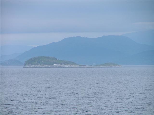
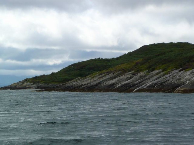
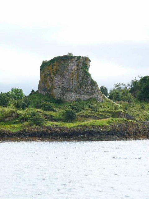
Cams Rock is a prominent coastal feature located in Argyllshire, Scotland. Situated on the west coast of the country, it is specifically found in the region of Argyll and Bute. Cams Rock is a headland that extends into the sea, forming a distinctive point along the rugged coastline.

The headland is characterized by its rocky terrain, with large boulders and cliffs that overlook the crashing waves of the Atlantic Ocean. The geology of the area consists mainly of ancient sedimentary rocks, which have been shaped by years of erosion from the relentless sea.

Cams Rock offers breathtaking views of the surrounding landscape, with its elevated position providing panoramic vistas of the ocean and the neighboring coastline. The area is also known for its diverse wildlife, with seabirds such as gannets and fulmars often seen nesting on the cliffs. Visitors may also be lucky enough to spot seals or dolphins swimming in the waters below.

Access to Cams Rock is relatively easy, with a well-maintained walking path leading to the headland. Hiking enthusiasts can enjoy a leisurely stroll along the coastal trail, taking in the picturesque scenery along the way. The area is popular with outdoor enthusiasts and nature lovers, providing ample opportunities for photography, birdwatching, and peaceful contemplation of the stunning surroundings.

Overall, Cams Rock is a striking coastal feature that showcases the natural beauty of Argyllshire. Its rugged cliffs, panoramic views, and diverse wildlife make it a must-visit destination for those exploring the Scottish coastline.

If you have any feedback on the listing, please let us know in the comments section below.

Cams Rock Images

Images are sourced within 2km of 56.480519/-5.5162695 or Grid Reference NM8337. Thanks to Geograph Open Source API. All images are credited.

Summit, Barr Treshtil
Limestone pavement, Barr Treshtil
View of Loch Fiart The very scenic southern end of Lismore with two limestone ridges.
View of Loch Fiart
The very scenic southern end of Lismore with two limestone ridges.
Creag Island View from Lismore with Cruachan and Beinn Bhuidhe in the background.
Creag Island
View from Lismore with Cruachan and Beinn Bhuidhe in the background.
Kilcheran, Lismore
Kilcheran, Lismore
Road near Kilcheran Loch
Creag Island and Pladda Island Separate islands at high tide. Seen from the Mull ferry at approx. NM831324.
Creag Island and Pladda Island
Separate islands at high tide. Seen from the Mull ferry at approx. NM831324.
Eilean na Cloiche, Lynn of Lorn Evening sun
Eilean na Cloiche, Lynn of Lorn
Evening sun
The main road on Lismore The B8045 runs almost the whole length of the island of Lismore, from north-east to south-west.  The island is mainly agricultural land, as can be seen from the piles of silage bales at the roadside.
The main road on Lismore
The B8045 runs almost the whole length of the island of Lismore, from north-east to south-west. The island is mainly agricultural land, as can be seen from the piles of silage bales at the roadside.
East coast of Lismore View over rough grazing land in the southern half of the island of Lismore, towards the Kilcheran Islands in the stretch of water known as the Lynn of Lorn, which separates Lismore from the mainland.
East coast of Lismore
View over rough grazing land in the southern half of the island of Lismore, towards the Kilcheran Islands in the stretch of water known as the Lynn of Lorn, which separates Lismore from the mainland.
Ruined cottage at Kilcheran This ruin sits at the foot of a limestone cliff.  Lismore is unusual, for the Scottish Highlands and Islands, in being made up mainly of limestone.
Ruined cottage at Kilcheran
This ruin sits at the foot of a limestone cliff. Lismore is unusual, for the Scottish Highlands and Islands, in being made up mainly of limestone.
Kilcheran Loch "Kilcheran" is an anglicisation of "Cill Chiarain" and remembers a Celtic monk called Ciaran.
Kilcheran Loch
"Kilcheran" is an anglicisation of "Cill Chiarain" and remembers a Celtic monk called Ciaran.
Eilean na Cloiche to Eilean Dubh The picture shows the back to back beach connection of Eilean na Cloiche and Eilean Duhb viewed from the north west. These seal nursery islets (on the south side of the joining spit are more rocky and sheltered, and so ideal for the breeding seals, but on the north side we see this lovely clean beach). The beach and islets are 1km off and roughly half way down the south east shore of the Island of Lismore. Note also the green hills of Lismore and the mountains of Mull behind in the distance.
Eilean na Cloiche to Eilean Dubh
The picture shows the back to back beach connection of Eilean na Cloiche and Eilean Duhb viewed from the north west. These seal nursery islets (on the south side of the joining spit are more rocky and sheltered, and so ideal for the breeding seals, but on the north side we see this lovely clean beach). The beach and islets are 1km off and roughly half way down the south east shore of the Island of Lismore. Note also the green hills of Lismore and the mountains of Mull behind in the distance.
Rocky edge of Pladda One of the Creag Islands, lying in the Lynn of Lorne.
Rocky edge of Pladda
One of the Creag Islands, lying in the Lynn of Lorne.
Sandbar joining Eilean na Cloiche to Eilean Dubh Taken on a dull and rainy day - like much of the summer of 2008!
Sandbar joining Eilean na Cloiche to Eilean Dubh
Taken on a dull and rainy day - like much of the summer of 2008!
The anchorage at Eilean na Cloiche The sandbar joining Eilean na Cloiche to Eilean Dubh can clearly be seen.  The bar is so low that it would give little protection to this anchorage in a strong south-westerly.
The anchorage at Eilean na Cloiche
The sandbar joining Eilean na Cloiche to Eilean Dubh can clearly be seen. The bar is so low that it would give little protection to this anchorage in a strong south-westerly.
Strange rock tower on Eilean na Cloiche From a distance this rock formation looks distinctly man-made.  On closer approach it is a large rock tower, perhaps 40 to 50 feet high but not clearly shown on the OS mapping.
Strange rock tower on Eilean na Cloiche
From a distance this rock formation looks distinctly man-made. On closer approach it is a large rock tower, perhaps 40 to 50 feet high but not clearly shown on the OS mapping.
Small beach on Eilean nan Gamhna
Show me another place!

Cams Rock is located at Grid Ref: NM8337 (Lat: 56.480519, Lng: -5.5162695)

Unitary Authority: Argyll and Bute

Police Authority: Argyll and West Dunbartonshire

What 3 Words

///solder.flotation.shifts. Near Oban, Argyll & Bute

Related Wikis

Creag Island

Creag Island is an island in Scotland. It is located in Argyll and Bute council area, in the northwestern part of the country, 600 km northwest of the...

Lismore Seminary

Lismore Seminary was situated in Kilcheran House on the island of Lismore in the Inner Hebrides part of Argyll, Scotland. It served as a seminary for the...

Achanduin Castle

Achanduin Castle, (also known as Achadun Castle and Acha-Dun), is a castle, now in ruins, located about 5.0 kilometres (3.1 mi) west of Achnacroish on...

Achnacroish

Achnacroish (Scottish Gaelic: Achadh na Croise) is a hamlet on the Scottish island of Lismore. The harbour serves the ferry between Lismore and Oban.The...

Lismore, Scotland

Lismore (Scottish Gaelic: Lios Mòr, pronounced [ʎis̪ ˈmoːɾ] possibly meaning "great enclosure" or "garden") is an island of some 2,351 hectares (9.1 square...

Bernera Island

Bernera Island (Scottish Gaelic: Beàrnaraigh) or simply Bernera is a tidal island off Lismore, in Argyll, Scotland. == History == In the 6th century, Bernera...

Scottish Association for Marine Science

The Scottish Association for Marine Science (SAMS) is one of Europe's leading marine science research organisations, one of the oldest oceanographic organisations...

Maiden Island

Maiden Island is a small uninhabited island at the mouth of Oban Bay on the west coast of Scotland. == Geography == Maiden Island lies just off the coast...

Related Videos

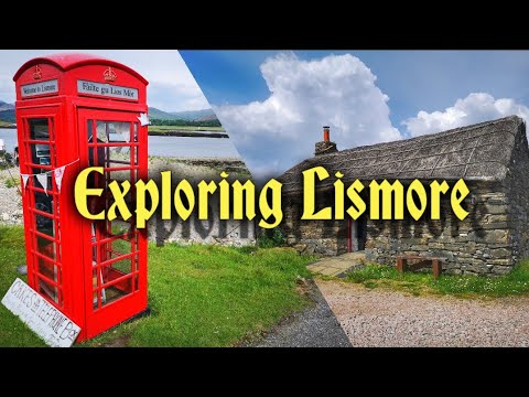
CalMac ferry: Oban to a picturesque Scottish island | Scottish Summer 8 | 4k

Join us on a day trip from Oban to a lovely Scottish island. ☺️ 00:00 Ferry 00:38 Island Tour 15:01 Outro & Walking Route This ...

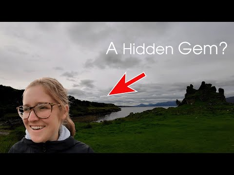
Exploring the Isle of Lismore, Scotland

Nicola and I head off for a relexing break to the Isle of Lismore. We catch the ferry from Oban to Achnacroish on Lismore. We stay ...

Choosing the right kind of steel in a marine environment

Shot on a beautiful day on the island of Lismore, Scotland. This jetty has galvanised steel, mild steel and #stainlesssteel they each ...

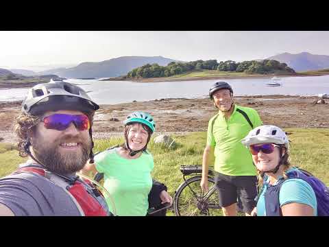
Lismore - ebike tour

Awesome tour round lismore on ebikes, seeing all the sights on an amazing sunny Day.

Have you been to Cams Rock?

Leave your review of Cams Rock below (or comments, questions and feedback).