Geodh' a' Bhodaich

Coastal Feature, Headland, Point in Ross-shire

Scotland

Geodh' a' Bhodaich

Beach at Slaggan Bay
Beach at Slaggan Bay Credit: Graeme Yuill

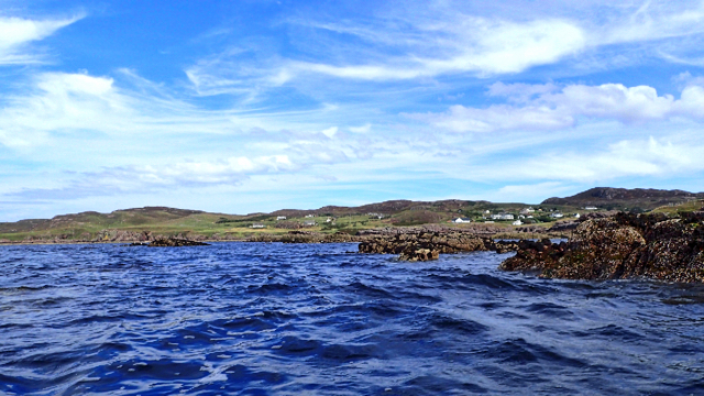
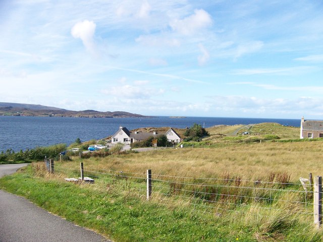
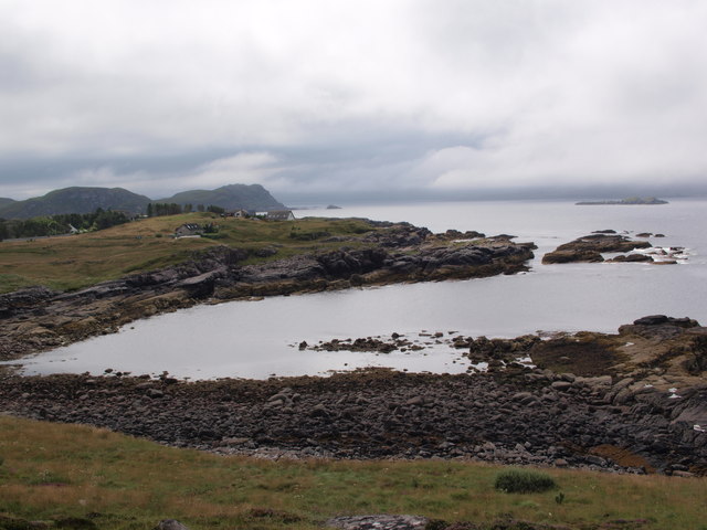
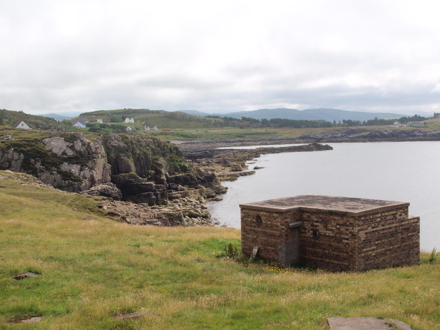
Geodh' a' Bhodaich, located in Ross-shire, Scotland, is a prominent coastal feature that is known for its rugged beauty and stunning views. This headland juts out into the sea, offering panoramic vistas of the surrounding coastline and the open ocean beyond. The name "Geodh' a' Bhodaich" translates to "Old Man's Bay" in English, a fitting moniker for this ancient and weathered point.

The headland is characterized by steep cliffs that plunge dramatically into the sea below, creating a dramatic and imposing landscape. The rocky shoreline is dotted with caves and coves, providing habitat for a variety of marine life and seabirds. Visitors to Geodh' a' Bhodaich can explore the rugged terrain on foot, taking in the breathtaking views and experiencing the wild beauty of the Scottish coast.

Geodh' a' Bhodaich is a popular destination for hikers, photographers, and nature enthusiasts seeking a taste of the untamed beauty of the Scottish Highlands. The headland is also a site of historical significance, with ancient ruins and archaeological remains scattered throughout the area, offering a glimpse into the region's rich past.

If you have any feedback on the listing, please let us know in the comments section below.

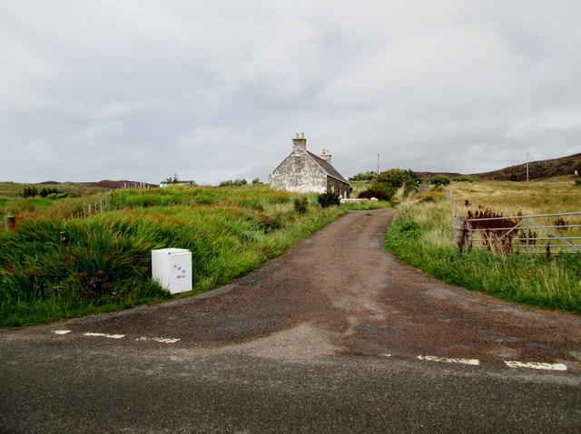
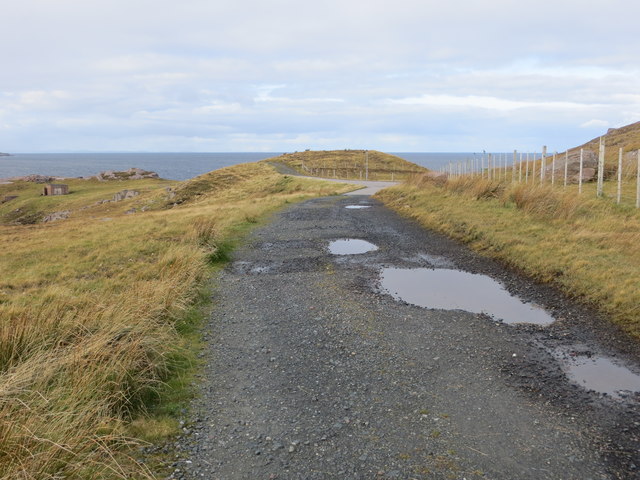
Geodh' a' Bhodaich Images

Images are sourced within 2km of 57.876348/-5.6531665 or Grid Reference NG8393. Thanks to Geograph Open Source API. All images are credited.

Beach at Slaggan Bay
Sgeirean Mòra
Sgeirean Mòra
The Perfume Studio at Mellon Charles
Farm track north of the Perfume Studio
Remains of World War II defences at Leacan Donna
Rubha Mor peninsula above Mellon Charles The fine view to the south from a small sandstone outcrop above the scattered houses of Mellon Charles on Loch Ewe.
Rubha Mor peninsula above Mellon Charles
The fine view to the south from a small sandstone outcrop above the scattered houses of Mellon Charles on Loch Ewe.
Hydrographic Survey Pillar, Ploc an t-Slagain This survey pillar is situated on a small hill above Slaggan Bay at the eastern entrance to Loch Ewe. The turquoise water of Slaggan Bay is visible and the ruins of Slaggan village are situated on the low ground to the east of the bay, with Loch an t-Slaggain beyond and An Teallach on the skyline.
Hydrographic Survey Pillar, Ploc an t-Slagain
This survey pillar is situated on a small hill above Slaggan Bay at the eastern entrance to Loch Ewe. The turquoise water of Slaggan Bay is visible and the ruins of Slaggan village are situated on the low ground to the east of the bay, with Loch an t-Slaggain beyond and An Teallach on the skyline.
Hydrographic Survey Pillar, Ploc an t-Slagain The plate inscription reads:- 'Hydrographic Department Admiralty London S.W.1. 
Triangulation Station. H.M.S.Cook 1951'. HMS Cook was a Bay-class Frigate which was surveyed along the west coast of Scotland for 4 years between 1951-1954 before heading for the Pacific. See <a href="https://www.geograph.org.uk/photo/5730661">NG8393 : Hydrographic Survey Pillar, Ploc an t-Slagain</a> for a view of the pillar.
Hydrographic Survey Pillar, Ploc an t-Slagain
The plate inscription reads:- 'Hydrographic Department Admiralty London S.W.1. Triangulation Station. H.M.S.Cook 1951'. HMS Cook was a Bay-class Frigate which was surveyed along the west coast of Scotland for 4 years between 1951-1954 before heading for the Pacific. See NG8393 : Hydrographic Survey Pillar, Ploc an t-Slagain for a view of the pillar.
Rocks on Ploc an t-Slagain This slab of rock shows signs of glacial striation, perhaps by the large boulders which rest on it.
Rocks on Ploc an t-Slagain
This slab of rock shows signs of glacial striation, perhaps by the large boulders which rest on it.
Perfume  Studio  Mellon  Charles At the end of the minor road from Aultbea, but well worth the trip for an excellent lunch in the cafe
Perfume Studio Mellon Charles
At the end of the minor road from Aultbea, but well worth the trip for an excellent lunch in the cafe
Minor  road  to  crofts The fridge at the roadside says Hen, Duck and Quail eggs, I did not investigate
Minor road to crofts
The fridge at the roadside says Hen, Duck and Quail eggs, I did not investigate
Track at Ploc Leacan Donna Looking north-westward.
Track at Ploc Leacan Donna
Looking north-westward.
Camus nan Gobhar The picture looks south across this wee bay from just behind the Perfume Studio, on a day of sunshine between low clouds.
Camus nan Gobhar
The picture looks south across this wee bay from just behind the Perfume Studio, on a day of sunshine between low clouds.
Looking south from Leacan Donna The hut in the foreground is one of the buildings also seen in <a href="https://www.geograph.org.uk/photo/5132570">NG8392 : Remains of World War II defences at Leacan Donna</a>, apparently dating from WWII. Another has disintegrated.
Looking south from Leacan Donna
The hut in the foreground is one of the buildings also seen in NG8392 : Remains of World War II defences at Leacan Donna, apparently dating from WWII. Another has disintegrated.
Coastline north of Leacan Donna
The end of the road at Mellon Charles The Perfume Studio is nearly the last building on this road.
The end of the road at Mellon Charles
The Perfume Studio is nearly the last building on this road.
Gables of a cottage This isolated cottage burned down c.1945 and has remained derelict since.
Gables of a cottage
This isolated cottage burned down c.1945 and has remained derelict since.
Track to Slaggan The track provides access across open moorland to the ruined settlement of Slaggan and the beach at Slaggan Bay.
Track to Slaggan
The track provides access across open moorland to the ruined settlement of Slaggan and the beach at Slaggan Bay.
Show me another place!

Geodh' a' Bhodaich is located at Grid Ref: NG8393 (Lat: 57.876348, Lng: -5.6531665)

Unitary Authority: Highland

Police Authority: Highlands and Islands

What 3 Words

///buggy.blueberry.plant. Near Gairloch, Highland

Related Wikis

Mellon Charles

Mellon Charles (Scottish Gaelic: Meallan Theàrlaich) is a remote crofting village on the north east shore of Loch Ewe near Gairloch in Wester Ross, in...

Rubha Mòr

Rubha Mòr is a remote peninsula in west Scotland, in the western region of Ross and Cromarty. The peninsula stretches from Greenstone Point in the north...

Ormiscaig

Ormiscaig (Scottish Gaelic: Ormasgaig) is a remote crofting village on the north east shore of Loch Ewe in Achnasheen, Ross-shire, Scottish Highlands and...

Cove, Highland

Cove is a remote hamlet located on the northwestern shore of the sea loch Loch Ewe, and 8 mi (13 km) northwest of Poolewe in Ross-shire, Scottish Highlands...

Nearby Amenities

Located within 500m of 57.876348,-5.6531665
Source: PGS
Lat/Long: 57.8801931/-5.6552731
Source: PGS
Lat/Long: 57.8801132/-5.655631
Source: PGS
Lat/Long: 57.8799424/-5.6555819
Source: PGS
Lat/Long: 57.8793076/-5.6558571
Source: PGS
Lat/Long: 57.8789041/-5.6560619
Source: PGS
Lat/Long: 57.878305/-5.6559859
Source: PGS
Lat/Long: 57.8778253/-5.6556456
Source: PGS
Lat/Long: 57.8775823/-5.6556278
Source: PGS
Lat/Long: 57.8768719/-5.6548413
Source: PGS
Lat/Long: 57.8764097/-5.6544816
Created By: almien_coastlines
Source: PGS
Lat/Long: 57.876335/-5.653441
Source: PGS
Lat/Long: 57.8763643/-5.6531562
Source: PGS
Lat/Long: 57.8761747/-5.6533179
Source: PGS
Lat/Long: 57.8754071/-5.6511642
Source: PGS
Lat/Long: 57.8745567/-5.6508133
Source: PGS
Lat/Long: 57.8745003/-5.6503932
Created By: almien_coastlines
Source: PGS
Lat/Long: 57.874482/-5.65018
Source: PGS
Lat/Long: 57.8743731/-5.650333
Source: PGS
Lat/Long: 57.8742581/-5.6499595
Source: PGS
Lat/Long: 57.874123/-5.6503337
Source: PGS
Lat/Long: 57.8740257/-5.6502631
Source: PGS
Lat/Long: 57.8737381/-5.6506207
Source: PGS
Lat/Long: 57.8731749/-5.6496012
Source: PGS
Lat/Long: 57.8732858/-5.6494189
Source: PGS
Lat/Long: 57.8728892/-5.6492083
Source: PGS
Lat/Long: 57.8724992/-5.6494532
The data included in this document is from www.openstreetmap.org. The data is made available under ODbL.

Have you been to Geodh' a' Bhodaich?

Leave your review of Geodh' a' Bhodaich below (or comments, questions and feedback).