Rubha a' Chamais Bhàin

Coastal Feature, Headland, Point in Argyllshire

Scotland

Rubha a' Chamais Bhàin

Glensanda quarry View, past Lismore, from Eriska.
Glensanda quarry Credit: Richard Webb

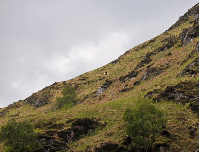
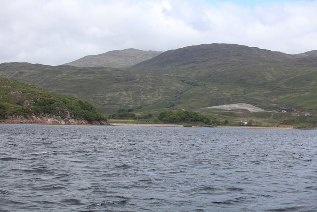
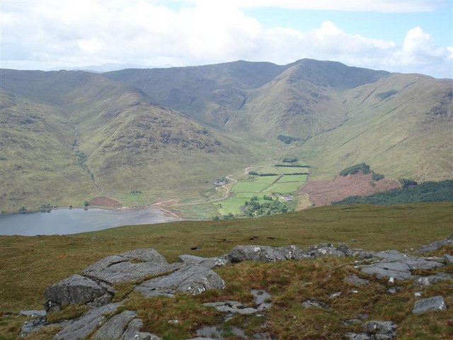
Rubha a' Chamais Bhàin is a picturesque headland located in Argyllshire, Scotland. Known for its stunning coastal views and rugged cliffs, this prominent feature juts out into the Atlantic Ocean, offering visitors a unique vantage point to take in the surrounding natural beauty.

The name Rubha a' Chamais Bhàin translates to "Headland of the White Bay" in Gaelic, a nod to the pristine sandy beaches that can be found along its coastline. The headland is also home to a variety of wildlife, including seabirds such as puffins and guillemots, making it a popular spot for birdwatching enthusiasts.

Visitors to Rubha a' Chamais Bhàin can enjoy leisurely walks along the cliffside paths, taking in the panoramic views of the ocean and surrounding countryside. The area is also a great spot for picnicking, fishing, and photography, with plenty of opportunities to capture the natural beauty of the Scottish coastline.

Overall, Rubha a' Chamais Bhàin is a must-visit destination for nature lovers and outdoor enthusiasts looking to explore the rugged and unspoiled landscapes of Argyllshire.

If you have any feedback on the listing, please let us know in the comments section below.

Rubha a' Chamais Bhàin Images

Images are sourced within 2km of 56.568477/-5.5325953 or Grid Reference NM8347. Thanks to Geograph Open Source API. All images are credited.

Glensanda quarry View, past Lismore, from Eriska.
Glensanda quarry
View, past Lismore, from Eriska.
Aggregate ship reversing towards jetty at Glensanda Taken from rocks near Uamh a' Choilich, the ship seemed to fill the horizon. Huge automated-unloading ships like this are a regular feature on Loch Linnhe.
Aggregate ship reversing towards jetty at Glensanda
Taken from rocks near Uamh a' Choilich, the ship seemed to fill the horizon. Huge automated-unloading ships like this are a regular feature on Loch Linnhe.
Glensanda Quarry - (1) With the large cargo vessel Yeoman Bridge loading stone.
Glensanda Quarry - (1)
With the large cargo vessel Yeoman Bridge loading stone.
Glensanda Quarry - (2) Yeoman Bridge loading stone at the Glensanda Quarry terminal.
Glensanda Quarry - (2)
Yeoman Bridge loading stone at the Glensanda Quarry terminal.
Castle at Port a Chasteil The super quarry dwarfs the castle.
Castle at Port a Chasteil
The super quarry dwarfs the castle.
Glensanda quarry jetty, Loch Linnhe Yeoman's Glensanda superquarry is one of the largest in Europe.
Glensanda quarry jetty, Loch Linnhe
Yeoman's Glensanda superquarry is one of the largest in Europe.
Sea Eagle Unremarkable photo of a hillside except in the centre is a sea eagle.
Sea Eagle
Unremarkable photo of a hillside except in the centre is a sea eagle.
Unwelcome guest Sea Eagle being sent on his way
Unwelcome guest
Sea Eagle being sent on his way
Bracken and heath at Lower Glensanda
Quarry car park Glensanda
Glensanda Jetty Jetty with personnel boat Lady Heather and quarry in background
Glensanda Jetty
Jetty with personnel boat Lady Heather and quarry in background
Glensanda from Glas Dhruim on Lismore Glensanda from Lismore with Loch Linnhe in the foreground looking WNW.
Glensanda from Glas Dhruim on Lismore
Glensanda from Lismore with Loch Linnhe in the foreground looking WNW.
A big granite quarry
Glensanda and Camas Torr na Dùile
Glensanda and Port a' Chaisteil To the right of the picture you can see Glensanda Castle.
There is no road access to Glensanda; the only access is from the sea.
For more details see: <span class="nowrap"><a title="http://en.wikipedia.org/wiki/Glensanda" rel="nofollow ugc noopener" href="http://en.wikipedia.org/wiki/Glensanda">Link</a><img style="margin-left:2px;" alt="External link" title="External link - shift click to open in new window" src="https://s1.geograph.org.uk/img/external.png" width="10" height="10"/></span>
Glensanda and Port a' Chaisteil
To the right of the picture you can see Glensanda Castle. There is no road access to Glensanda; the only access is from the sea. For more details see: LinkExternal link
Glensanda Super Quarry This is one of the largest quarries in the UK.  Rock from it was used in the building of the Channel Tunnel.  There is no road or track to it: material is extracted by sea.  There is also a small airstrip.

For more details see <span class="nowrap"><a title="http://en.wikipedia.org/wiki/Glensanda#Glensanda_Super_Quarry" rel="nofollow ugc noopener" href="http://en.wikipedia.org/wiki/Glensanda#Glensanda_Super_Quarry">Link</a><img style="margin-left:2px;" alt="External link" title="External link - shift click to open in new window" src="https://s1.geograph.org.uk/img/external.png" width="10" height="10"/></span>
Glensanda Super Quarry
This is one of the largest quarries in the UK. Rock from it was used in the building of the Channel Tunnel. There is no road or track to it: material is extracted by sea. There is also a small airstrip. For more details see LinkExternal link
Yeoman Bontrup at the Glensanda Super Quarry The Glensanda Quarry is one of the largest quarries in the UK, it is owned by the Foster Yeoman group. For more details see: 
<span class="nowrap"><a title="http://en.wikipedia.org/wiki/Foster_Yeoman" rel="nofollow ugc noopener" href="http://en.wikipedia.org/wiki/Foster_Yeoman">Link</a><img style="margin-left:2px;" alt="External link" title="External link - shift click to open in new window" src="https://s1.geograph.org.uk/img/external.png" width="10" height="10"/></span>

The ship that is berthed there is the Yeoman Bontrup, it has a deadweight of 96,000 tonnes (total weight when loaded) for more details see:
<span class="nowrap"><a title="http://www.shipspotting.com/modules/myalbum/photo-1101908-YEOMAN+BONTRUP" rel="nofollow ugc noopener" href="http://www.shipspotting.com/modules/myalbum/photo-1101908-YEOMAN+BONTRUP">Link</a><img style="margin-left:2px;" alt="External link" title="External link - shift click to open in new window" src="https://s1.geograph.org.uk/img/external.png" width="10" height="10"/></span>
Yeoman Bontrup at the Glensanda Super Quarry
The Glensanda Quarry is one of the largest quarries in the UK, it is owned by the Foster Yeoman group. For more details see: LinkExternal link The ship that is berthed there is the Yeoman Bontrup, it has a deadweight of 96,000 tonnes (total weight when loaded) for more details see: LinkExternal link
Yeoman Bontrup This is the aftermath of the explosion on the 02/07/10.  Myself and 3 work mates were called to stop it sinking after tugs attempted to put the fire out. I was working night-shifts. We were pumping water out about 150 tonnes per hour.
Yeoman Bontrup
This is the aftermath of the explosion on the 02/07/10. Myself and 3 work mates were called to stop it sinking after tugs attempted to put the fire out. I was working night-shifts. We were pumping water out about 150 tonnes per hour.
Show me another place!

Rubha a' Chamais Bhàin is located at Grid Ref: NM8347 (Lat: 56.568477, Lng: -5.5325953)

Unitary Authority: Highland

Police Authority: Highlands and Islands

What 3 Words

///fruitcake.shocks.dent. Near Craignure, Argyll & Bute

Nearby Locations

Rubha a' Chamais Bhàin

Related Wikis

Glensanda

Glensanda (Old Norse, the glen of the sandy river) was a Viking settlement at the mouth of Glen Sanda on the Morvern peninsula within south west Lochaber...

Castle Coeffin

Castle Coeffin is a ruin on the island of Lismore, an island in Loch Linnhe, in Argyll, on the west coast of Scotland. It stands on a promontory on the...

St Moluag's Cathedral, Lismore

St Moluag's Cathedral is located on the Scottish island of Lismore just off the coast of Oban. As a congregation of the Church of Scotland, which is Presbyterian...

Beinn Mheadhoin (Morvern)

Beinn Mheadhoin (739 m) is a mountain in the Northwest Highlands of Scotland. It is located in the Morvern area of Lochaber. A peak of various ridges with...

Nearby Amenities

Located within 500m of 56.568477,-5.5325953
Power: pole
Lat/Long: 56.5713228/-5.5347115
Power: pole
Lat/Long: 56.5708317/-5.5377651
Power: pole
Lat/Long: 56.5718193/-5.5338496
Power: pole
Lat/Long: 56.5723767/-5.5328407
Power: pole
Lat/Long: 56.572808/-5.5320687
Power: pole
Lat/Long: 56.5714637/-5.5350055
Power: pole
Lat/Long: 56.5709523/-5.5378124
Power: pole
Lat/Long: 56.5710513/-5.5373008
Seamark Light Category: vertical
Seamark Light Character: F
Seamark Light Colour: red
Seamark Light Height: 5
Seamark Light Multiple: 2
Seamark Light Range: 3
Seamark Light Reference: A 4151
Seamark Type: light_minor
Source: US NGA Pub. 114. 2011-05-26.
Lat/Long: 56.56505/-5.5377333
Seamark Light Character: Fl
Seamark Light Colour: red
Seamark Light Height: 5
Seamark Light Period: 3
Seamark Light Range: 4
Seamark Light Reference: A 4150.2
Seamark Type: light_minor
Source: US NGA Pub. 114. 2011-05-26.
Lat/Long: 56.56845/-5.53175
Seamark Light Character: Fl
Seamark Light Colour: red
Seamark Light Height: 5
Seamark Light Period: 3
Seamark Light Range: 4
Seamark Light Reference: A 4150
Seamark Type: light_minor
Source: US NGA Pub. 114. 2011-05-26.
Lat/Long: 56.5678167/-5.5328833
The data included in this document is from www.openstreetmap.org. The data is made available under ODbL.

Have you been to Rubha a' Chamais Bhàin?

Leave your review of Rubha a' Chamais Bhàin below (or comments, questions and feedback).