Howney Rock

Coastal Feature, Headland, Point in Pembrokeshire

Wales

Howney Rock

Mill Haven
Mill Haven Credit: Deborah Tilley

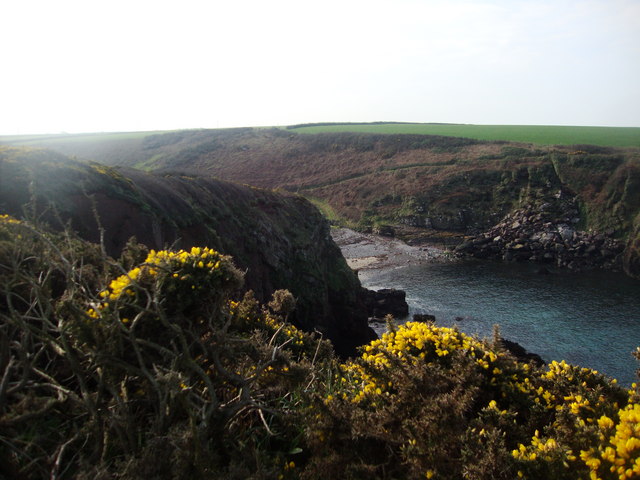
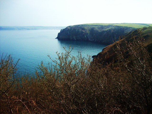
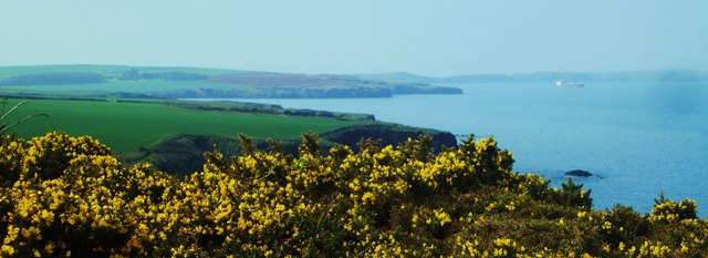
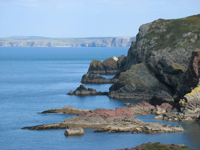
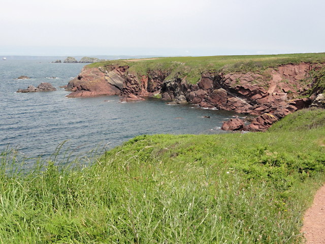
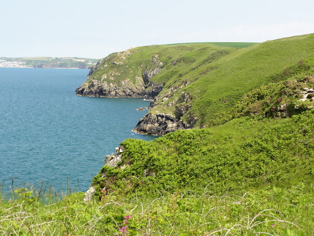
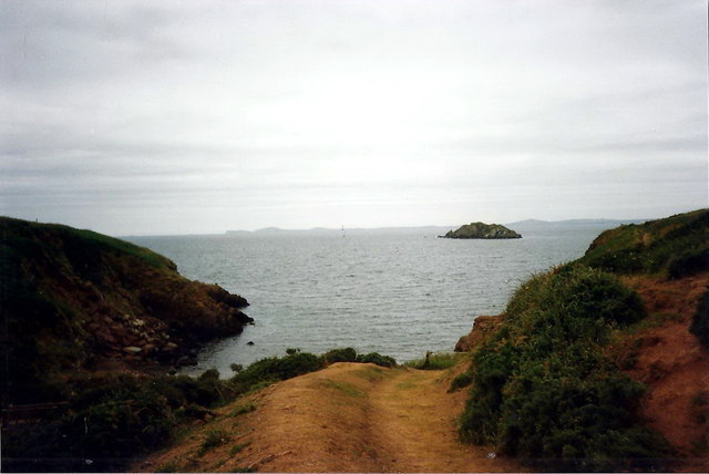
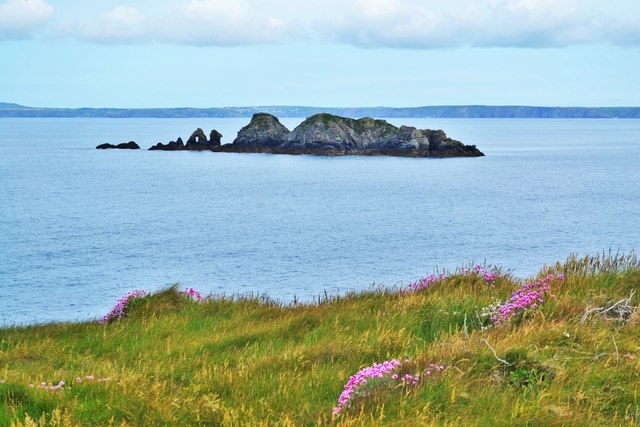
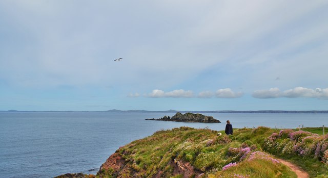
Howney Rock is a prominent coastal feature located in Pembrokeshire, Wales. Situated on the rugged and picturesque coastline, this headland marks the northernmost point of the county. It is a popular destination for locals and tourists due to its stunning views and unique geological characteristics.

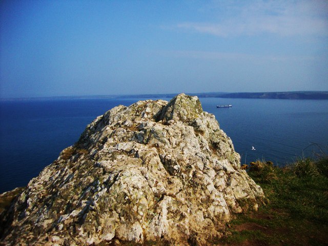
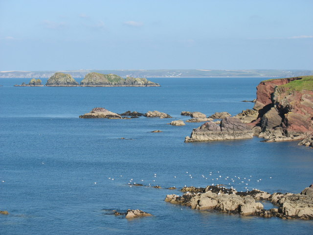
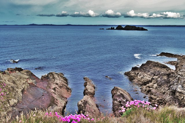
At around 100 feet in height, Howney Rock offers a commanding vantage point from which to admire the surrounding landscape. Its sheer cliffs are made up of layers of sedimentary rock, displaying a variety of colors and textures. The rock face is a testament to millions of years of geological activity, with evidence of ancient sea levels and geological processes evident.

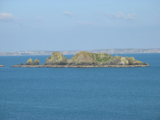
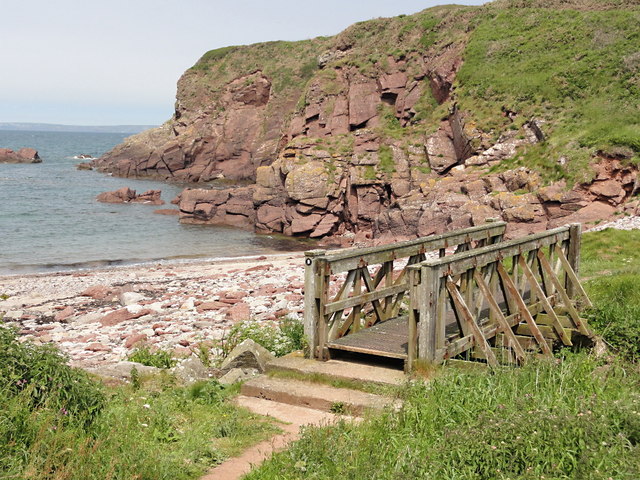
The headland is also home to a diverse range of flora and fauna. The exposed cliffs provide nesting sites for seabirds such as guillemots and razorbills, while the surrounding heathland supports a variety of plant species including heather and gorse. The area is designated as a Site of Special Scientific Interest (SSSI) due to its ecological importance.

Howney Rock is easily accessible for visitors, with a well-maintained footpath leading to the summit. From this elevated position, visitors can enjoy panoramic views of the surrounding coastline, including the nearby Pembrokeshire Coast National Park. On a clear day, it is even possible to catch a glimpse of the distant Preseli Hills to the east.

In conclusion, Howney Rock is a captivating coastal feature in Pembrokeshire, offering a combination of natural beauty, geological interest, and diverse wildlife. It is a must-visit location for nature enthusiasts and those seeking to immerse themselves in the stunning coastal landscapes of Wales.

If you have any feedback on the listing, please let us know in the comments section below.

Howney Rock Images

Images are sourced within 2km of 51.772476/-5.1603098 or Grid Reference SM8212. Thanks to Geograph Open Source API. All images are credited.

Mill Haven
Mill Haven
Rocky outcrop at Ticklas Point Looking over the bay towards Broad Haven and Nolton Haven.
Rocky outcrop at Ticklas Point
Looking over the bay towards Broad Haven and Nolton Haven.
Looking to Borough Head Viewed across the cove known as Holywell.
Looking to Borough Head
Viewed across the cove known as Holywell.
Lane to Broadmoor Farm
View to Nab Head Looking across the bay to Huntsmans Leap and the tip of Nab Head, an important Mesolithic flint working site (which was considerably inland during that era). Seen from the path above Mill Haven.
View to Nab Head
Looking across the bay to Huntsmans Leap and the tip of Nab Head, an important Mesolithic flint working site (which was considerably inland during that era). Seen from the path above Mill Haven.
Pembrokeshire coast near Halfway Rock The prominent islands on the left, about 1.5 kilometres away, are Stack Rocks.
Pembrokeshire coast near Halfway Rock
The prominent islands on the left, about 1.5 kilometres away, are Stack Rocks.
Stack Rocks In the distance, about 12 kilometres away, the village of Solva is seen on the left.
Stack Rocks
In the distance, about 12 kilometres away, the village of Solva is seen on the left.
The Pembrokeshire Coast Path west of Mill Haven This sculpture, the 'rock with the hole', is about 300 metres west of Mill Haven. Looking through the hole, it seemed to be aligned with Carnllundain <a href="https://www.geograph.org.uk/gridref/SM6923">SM6923</a>, the high point of Ramsey Island about 16km away, but the alignment was not precise enough for me to tell whether it was deliberate or accidental.
The Pembrokeshire Coast Path west of Mill Haven
This sculpture, the 'rock with the hole', is about 300 metres west of Mill Haven. Looking through the hole, it seemed to be aligned with Carnllundain SM6923, the high point of Ramsey Island about 16km away, but the alignment was not precise enough for me to tell whether it was deliberate or accidental.
Pembrokeshire coast near Mill Haven
Barn covered in creepers at Upper Ripperston Farm Looking west towards St Brides.
Barn covered in creepers at Upper Ripperston Farm
Looking west towards St Brides.
Warey Haven Looking over low sandstone cliffs.
Warey Haven
Looking over low sandstone cliffs.
Mill Haven An empty pebble beach flanked by red sandstone cliffs.
Mill Haven
An empty pebble beach flanked by red sandstone cliffs.
Looking Towards Ticklas Point A view of the coastal slope looking east towards the buttress of Ticklas Point.
Looking Towards Ticklas Point
A view of the coastal slope looking east towards the buttress of Ticklas Point.
The Coast Path to Borough Head Nice level walking on the approach to Borough Head.
The Coast Path to Borough Head
Nice level walking on the approach to Borough Head.
Mill Haven Llwybr cyhoeddus yn arwain at Mill Haven. Stack Rocks yw enw'r creigiau mas yn y mor. 

A public footpath heading towards Mill Haven. The rocks in the distance are known as Stack Rocks.
Mill Haven
Llwybr cyhoeddus yn arwain at Mill Haven. Stack Rocks yw enw'r creigiau mas yn y mor. A public footpath heading towards Mill Haven. The rocks in the distance are known as Stack Rocks.
Coast Path Near Mill Haven Looking northwest across St Brides Bay with Stack Rocks visible nearby
Coast Path Near Mill Haven
Looking northwest across St Brides Bay with Stack Rocks visible nearby
Stack Rocks Viewed from Halfway Rock
Stack Rocks
Viewed from Halfway Rock
Stack Rocks From The Coast Path The paths are bursting with pink thrift at this time of year
Stack Rocks From The Coast Path
The paths are bursting with pink thrift at this time of year
Show me another place!

Howney Rock is located at Grid Ref: SM8212 (Lat: 51.772476, Lng: -5.1603098)

Unitary Authority: Pembrokeshire

Police Authority: Dyfed Powys

What 3 Words

///expel.rescuer.assess. Near Broad Haven, Pembrokeshire

Nearby Locations

Ticklas Point Howney Rock

Related Wikis

RAF Talbenny

Royal Air Force Talbenny, or more simply RAF Talbenny, is a former Royal Air Force station located 5.6 miles (9.0 km) north west of Milford Haven, Pembrokeshire...

St Brides

St Brides (Welsh: Sain Ffraid) is a parish and small coastal village in Pembrokeshire, Wales, at the south of St Brides Bay, about 1+1⁄2 miles (2.4 km...
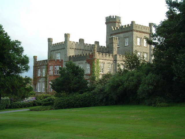
St Brides Castle

St Brides Castle is a 19th-century castellated baronial-style mansion in the parish of St Brides and the community of Marloes and St Brides, Pembrokeshire...

Marloes and St Brides

Marloes and St. Brides (Welsh: Marloes a Sain Ffraid) is a community in the West Wales county of Pembrokeshire. The main settlements are the villages of...

Have you been to Howney Rock?

Leave your review of Howney Rock below (or comments, questions and feedback).