Geodh' Mòr
Coastal Feature, Headland, Point in Ross-shire
Scotland
Geodh' Mòr
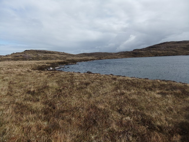
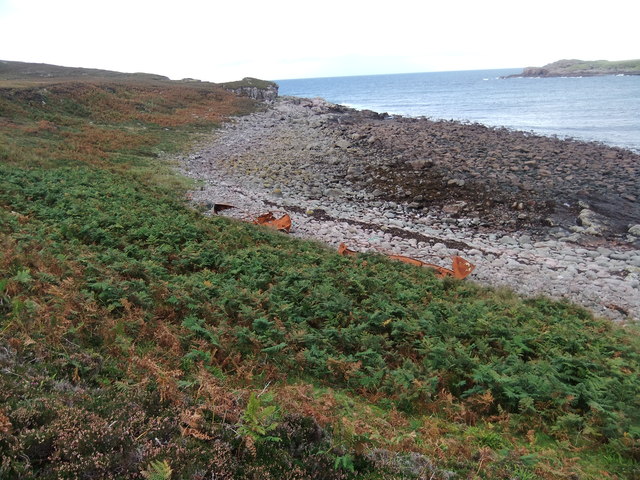
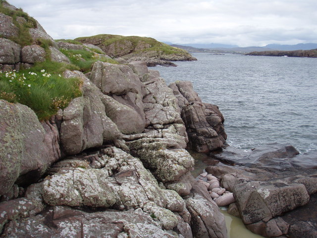
Geodh' Mòr is a coastal feature located in Ross-shire, Scotland. This headland juts out into the North Sea, offering stunning views of the surrounding coastline and sea. Geodh' Mòr is known for its rugged cliffs and rocky shoreline, which provide habitat for a variety of seabirds and marine life.
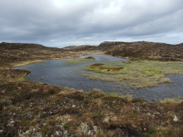
The headland is a popular destination for hikers and nature enthusiasts, who come to explore the dramatic landscape and observe the wildlife that calls Geodh' Mòr home. Visitors can enjoy walking along the coastal path that runs along the edge of the headland, taking in the panoramic views of the sea and nearby islands.
Geodh' Mòr is also a great spot for birdwatching, with species such as puffins, guillemots, and razorbills commonly seen in the area. The headland is designated as a Site of Special Scientific Interest (SSSI), recognizing its importance for biodiversity and conservation.
Overall, Geodh' Mòr is a picturesque and ecologically rich coastal feature that offers visitors a chance to experience the natural beauty of the Scottish coastline.
If you have any feedback on the listing, please let us know in the comments section below.
Geodh' Mòr Images
Images are sourced within 2km of 57.864752/-5.6839057 or Grid Reference NG8192. Thanks to Geograph Open Source API. All images are credited.
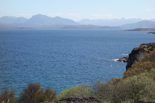
![Sgeir Gorma The coastline at Caolas an Fhuraidh with the reef of Sgeir Gorma in the foreground and the islet of Eilean Furadh Beag further out. Along the horizon are an array of diatant mountains, including [l-r] Arkle, Quinag, Suilven, canisp, Stac Pollaidh, Cul Mor and Ben Mor Coigach.](https://s2.geograph.org.uk/photos/92/70/927022_e6012895.jpg)
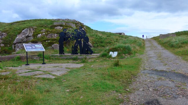
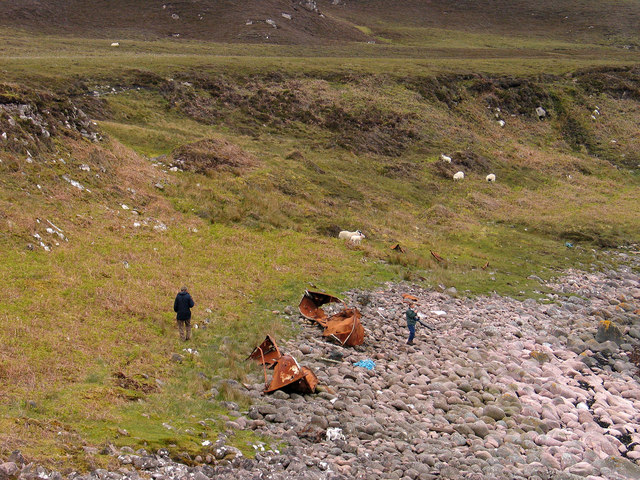
![Shipwreck memorial A memorial to the crew of the USS William H Welch which foundered on nearby rocks in the early hours of Saturday 26th February 1944. The ship was caught in a fierce northerly gale and blizzard, missed the entrance to Loch Ewe and hit rocks on Eilean Furadh Mor [the island seen offshore]. Of a crew of 74, only 12 survived, the lucky ones being swept ashore by huge seas. The memorial also list those who came to help, including local people who walked across open boggy moorland with blankets, hot drinks etc for the survivors.](https://s3.geograph.org.uk/photos/92/72/927215_e5ba4882.jpg)


Geodh' Mòr is located at Grid Ref: NG8192 (Lat: 57.864752, Lng: -5.6839057)
Unitary Authority: Highland
Police Authority: Highlands and Islands
What 3 Words
///paces.burden.factoring. Near Gairloch, Highland
Nearby Locations
Related Wikis

Cove, Highland
Cove is a remote hamlet located on the northwestern shore of the sea loch Loch Ewe, and 8 mi (13 km) northwest of Poolewe in Ross-shire, Scottish Highlands...

Mellon Charles
Mellon Charles (Scottish Gaelic: Meallan Theàrlaich) is a remote crofting village on the north east shore of Loch Ewe near Gairloch in Wester Ross, in...

Ormiscaig
Ormiscaig (Scottish Gaelic: Ormasgaig) is a remote crofting village on the north east shore of Loch Ewe in Achnasheen, Ross-shire, Scottish Highlands and...

Loch Ewe
Loch Ewe (Scottish Gaelic: Loch Iùbh) is a sea loch in the region of Wester Ross in the Northwest Highlands of Scotland. The shores are inhabited by a...
Nearby Amenities
Located within 500m of 57.864752,-5.6839057Have you been to Geodh' Mòr?
Leave your review of Geodh' Mòr below (or comments, questions and feedback).