The Reine

Coastal Feature, Headland, Point in Argyllshire

Scotland

The Reine

Sanda Island Seen from the summit of The Bastard at the south-east of Kintyre.

On the left is Glunimore Island, and Sheep Island is in front of Sanda Island. In the distance are the hills of North Antrim.
Sanda Island Credit: Michael Earnshaw

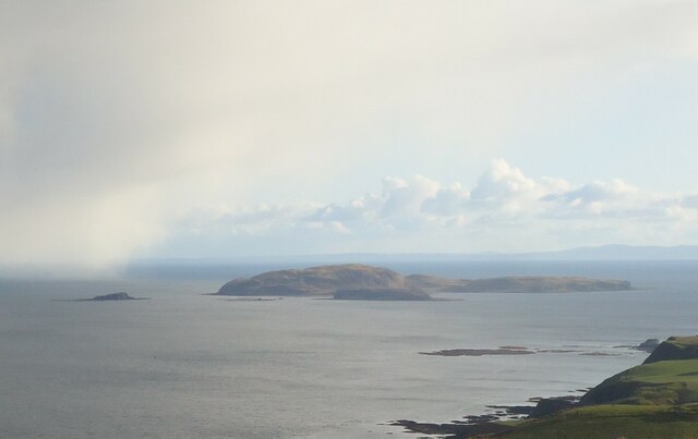
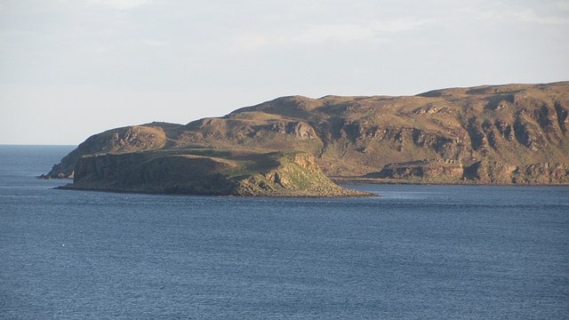
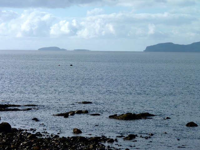
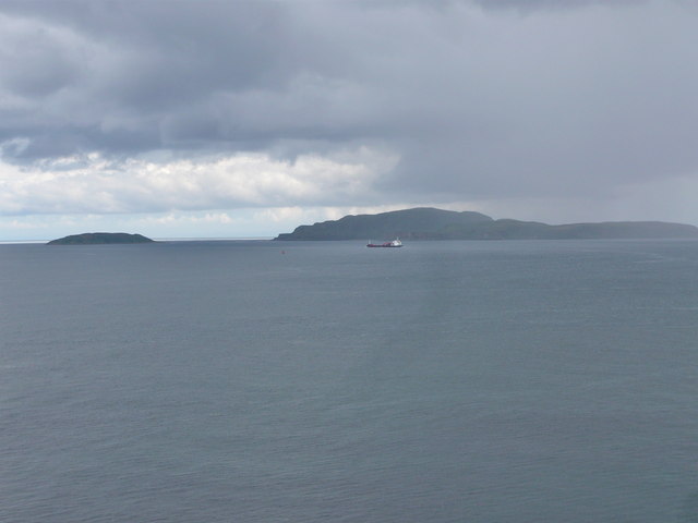
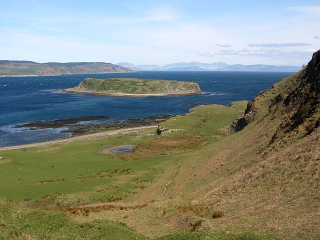
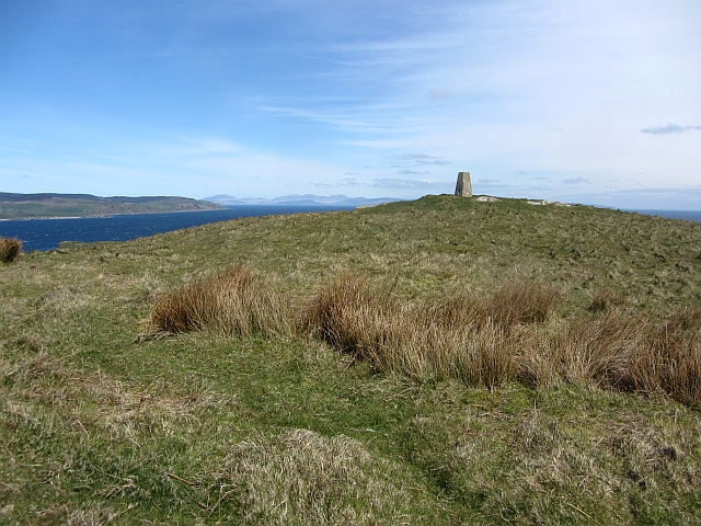
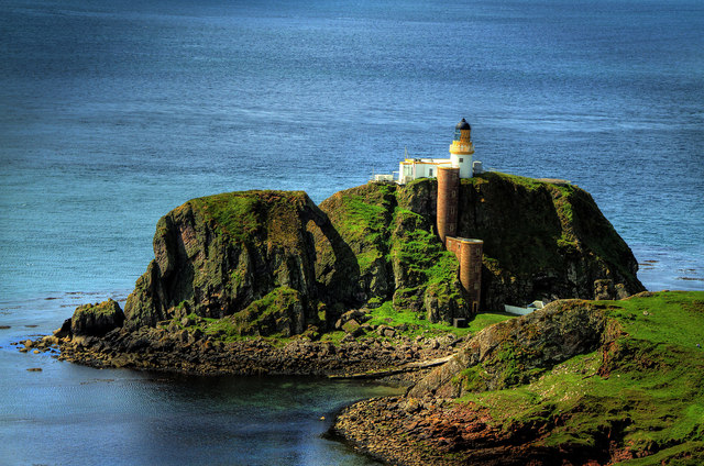
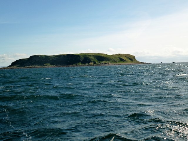
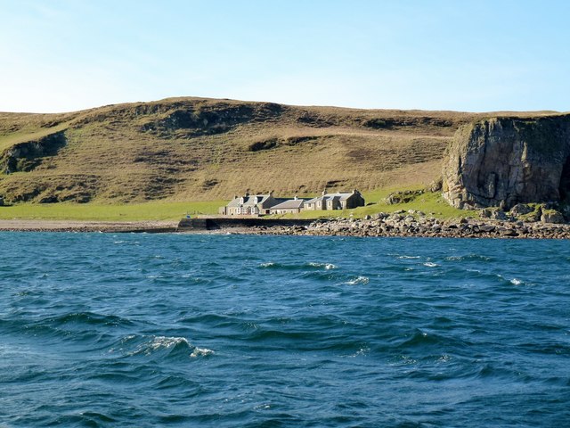
The Reine, located in Argyllshire, is a prominent coastal feature that is known for its stunning headland and picturesque point. Situated along the western coast of Scotland, this natural formation boasts breathtaking views of the surrounding landscape and the vast Atlantic Ocean.

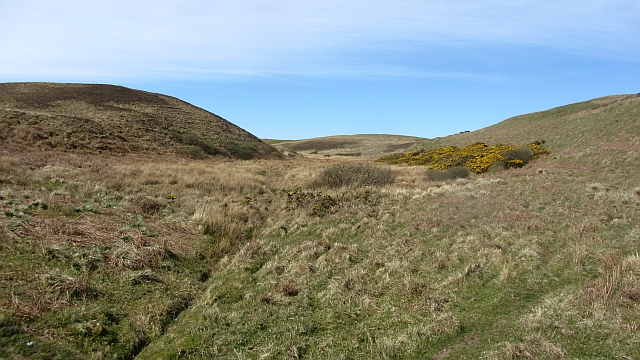
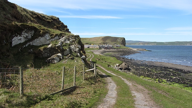
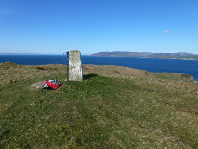
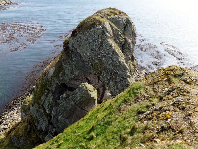
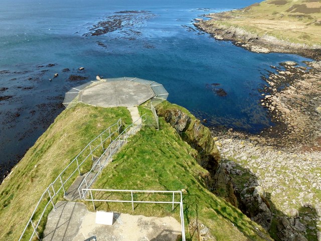
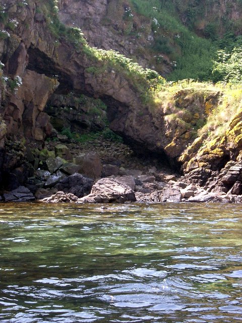
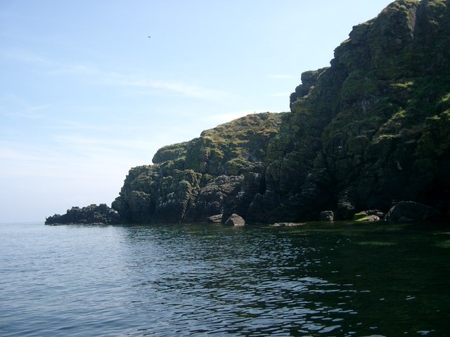
The Reine is characterized by its rugged cliffs and rocky terrain, which provide a dramatic backdrop against the crashing waves of the sea. The headland, extending out into the ocean, offers an impressive vantage point to witness the power and beauty of the coastal environment. Its elevation allows visitors to enjoy panoramic vistas of the coastline, with the green hills and mountains of Argyllshire adding to the scenic allure.

The point of The Reine serves as a popular spot for nature enthusiasts and photographers, who flock to capture its awe-inspiring landscapes. The area is teeming with diverse wildlife, including seabirds such as gannets, puffins, and cormorants, which can be observed in their natural habitat. The Reine also provides opportunities for outdoor activities such as hiking, birdwatching, and coastal walks, further enhancing its appeal to visitors.

Given its remote location, The Reine offers a sense of tranquility and a chance to escape the hustle and bustle of everyday life. Its untouched beauty and unspoiled surroundings make it an ideal destination for those seeking solace in nature. Whether it's marveling at the breathtaking views, exploring the rugged coastline, or immersing oneself in the rich biodiversity, The Reine is undoubtedly a coastal feature that captivates all who have the privilege to visit.

If you have any feedback on the listing, please let us know in the comments section below.

The Reine Images

Images are sourced within 2km of 55.28575/-5.5722712 or Grid Reference NR7304. Thanks to Geograph Open Source API. All images are credited.

Sanda Island Seen from the summit of The Bastard at the south-east of Kintyre.

On the left is Glunimore Island, and Sheep Island is in front of Sanda Island. In the distance are the hills of North Antrim.
Sanda Island
Seen from the summit of The Bastard at the south-east of Kintyre. On the left is Glunimore Island, and Sheep Island is in front of Sanda Island. In the distance are the hills of North Antrim.
Prince Edward's Rock and Sanda Lighthouse Viewed from the north. The alternative way to the lighthouse is by helicopter.
Prince Edward's Rock and Sanda Lighthouse
Viewed from the north. The alternative way to the lighthouse is by helicopter.
Sheep Island A small island off Sanda (background).
Sheep Island
A small island off Sanda (background).
Sanda Island Seen from Blackwaterfoot are Sanda island and the Mull of Kintyre.
Sanda Island
Seen from Blackwaterfoot are Sanda island and the Mull of Kintyre.
Sanda and Sheep Island Photographed from Dunaverty Rock
Sanda and Sheep Island
Photographed from Dunaverty Rock
Wetland, Sanda A damp area between two low hills.
Wetland, Sanda
A damp area between two low hills.
Lighthouse buildings, Sanda Redundant lighthouse buildings on a raised beach between the bulk of Sanda and a once offshore rock which hosts the lighthouse. The lighthouse is reached by a 200 step spiral staircase on the outside of the rock.
Lighthouse buildings, Sanda
Redundant lighthouse buildings on a raised beach between the bulk of Sanda and a once offshore rock which hosts the lighthouse. The lighthouse is reached by a 200 step spiral staircase on the outside of the rock.
Sanda and Sheep Island View from the western side of Sanda's hill towards to offlying Sheep Island.
Sanda and Sheep Island
View from the western side of Sanda's hill towards to offlying Sheep Island.
Sanda, the triangulation pillar The highest point on the island.
Sanda, the triangulation pillar
The highest point on the island.
Patterson's Rock A drying reef off the east of Sanda. It is only visible at low water and is marked by a buoy.
Patterson's Rock
A drying reef off the east of Sanda. It is only visible at low water and is marked by a buoy.
Lighthouse road, Sanda A well surfaced road crosses Sanda from the pier (and pub) to the lighthouse.
Lighthouse road, Sanda
A well surfaced road crosses Sanda from the pier (and pub) to the lighthouse.
Blue sheep, Sanda A blue sheep greets visitors to the very welcoming island of Sanda. The azure backed wooly is gazing towards Glunimore Island, one of several rocks worth missing in the area.
Blue sheep, Sanda
A blue sheep greets visitors to the very welcoming island of Sanda. The azure backed wooly is gazing towards Glunimore Island, one of several rocks worth missing in the area.
Sanda Lighthouse and Elephant Rock The southernmost point of the island.
Sanda Lighthouse and Elephant Rock
The southernmost point of the island.
Trig Point Sanda Island Looking north at the trig point and onward view.
Trig Point Sanda Island
Looking north at the trig point and onward view.
Sheep Island Near Sanda Island Photo of Sheep Island from RIB on way from Campbeltown to Sanda Island.
Sheep Island Near Sanda Island
Photo of Sheep Island from RIB on way from Campbeltown to Sanda Island.
Sanda Island Slipway Looking from our RIB to our landing point on Sanda Island.
Sanda Island Slipway
Looking from our RIB to our landing point on Sanda Island.
Top Of Elephant Rock This is the top of Elephant Rock as seen from near the top of Sanda Island Lighthouse. The trunk of Elephant Rock forms a dramatic natural arch. We were so lucky to find the lighthouse open and to be allowed to explore inside and outside the tall lighthouse. Prince Edward Rock where the lighthouse is based is a recently discovered P30.
Top Of Elephant Rock
This is the top of Elephant Rock as seen from near the top of Sanda Island Lighthouse. The trunk of Elephant Rock forms a dramatic natural arch. We were so lucky to find the lighthouse open and to be allowed to explore inside and outside the tall lighthouse. Prince Edward Rock where the lighthouse is based is a recently discovered P30.
Helipad at Sanda Island Lighthouse A view west from high up on Sanda Island Lighthouse across the helipad.
Helipad at Sanda Island Lighthouse
A view west from high up on Sanda Island Lighthouse across the helipad.
Show me another place!

The Reine is located at Grid Ref: NR7304 (Lat: 55.28575, Lng: -5.5722712)

Unitary Authority: Argyll and Bute

Police Authority: Argyll and West Dunbartonshire

What 3 Words

///skirting.snore.spines. Near Campbeltown, Argyll & Bute

Related Wikis

Sheep Island, Argyll

Sheep Island is a small uninhabited island situated off the southern tip of the Kintyre peninsula in Scotland. Sheep Island, along with Sanda Island and...

Sanda Island

Sanda Island (Scottish Gaelic: Sandaigh) is a small island in Argyll and Bute, Scotland, off the southern tip of the Kintyre peninsula, near Southend and...

Glunimore Island

Glunimore Island is an uninhabited island around 3 miles (5 kilometres) southeast of the Kintyre peninsula, Scotland. It lies alongside Sanda Island and...

Macharioch Motte

Macharioch Motte is the remains of a motte-and-bailey castle situated in a field near the farm of Macharioch in Kintyre, Argyll and Bute, Scotland. �...

Have you been to The Reine?

Leave your review of The Reine below (or comments, questions and feedback).