Beinn na Bèiste

Cliff, Slope in Argyllshire

Scotland

Beinn na Bèiste

Sanda Island Seen from the summit of The Bastard at the south-east of Kintyre.

On the left is Glunimore Island, and Sheep Island is in front of Sanda Island. In the distance are the hills of North Antrim.
Sanda Island Credit: Michael Earnshaw

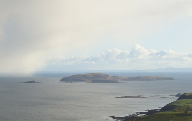
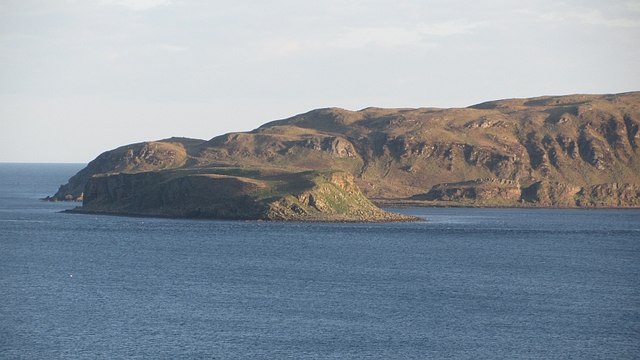
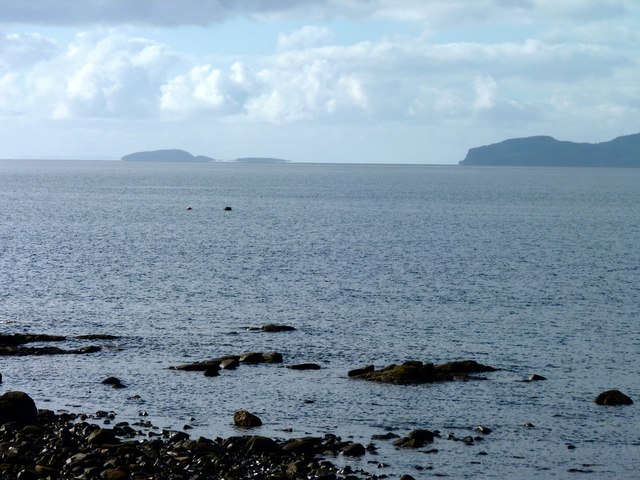
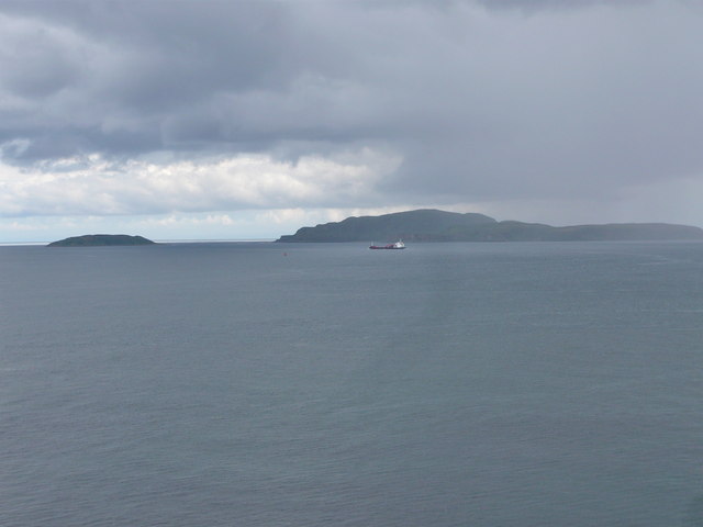
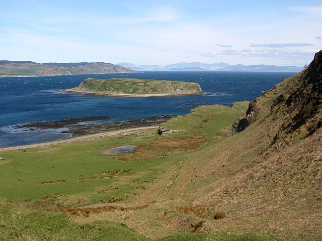
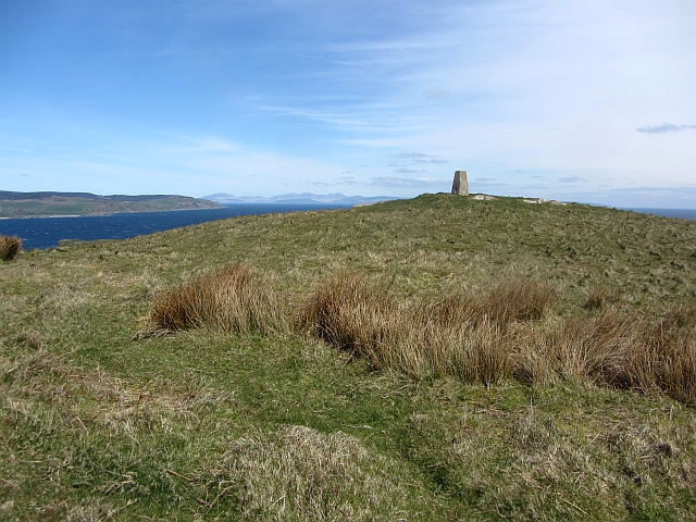
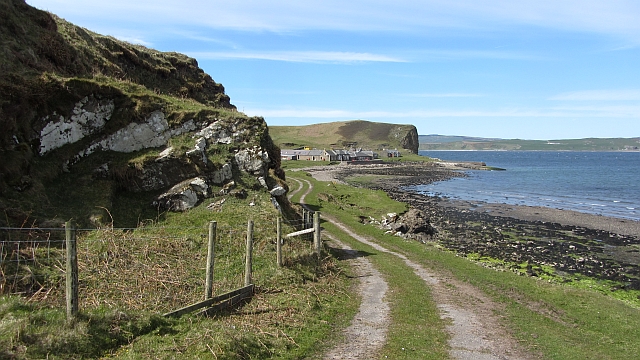
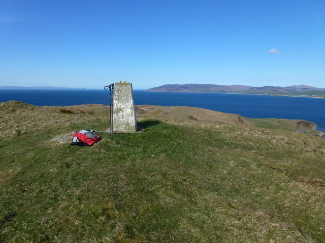
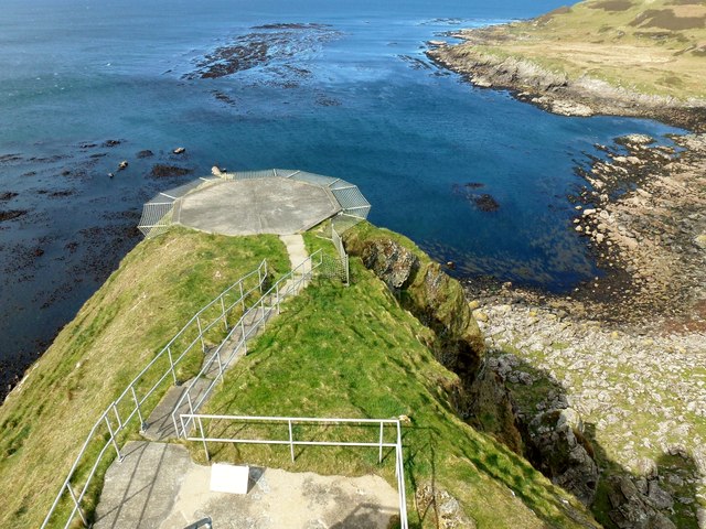
Beinn na Bèiste is a prominent geographical feature located in Argyllshire, Scotland. It is an impressive cliff that stretches along the western coast of the region, offering breathtaking views of the surrounding landscape.

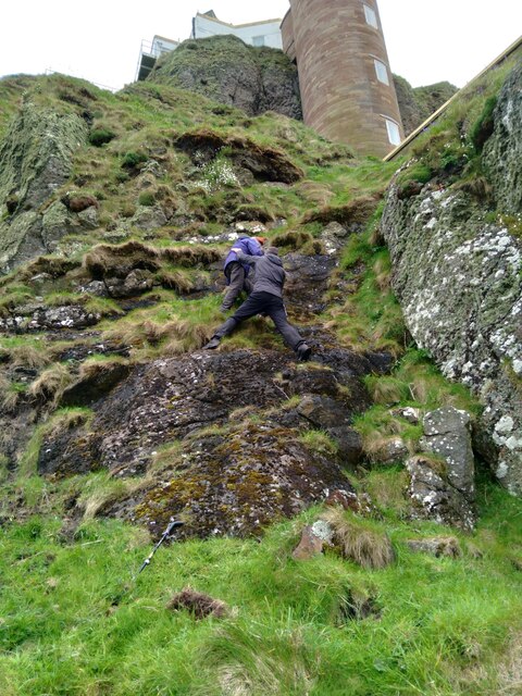
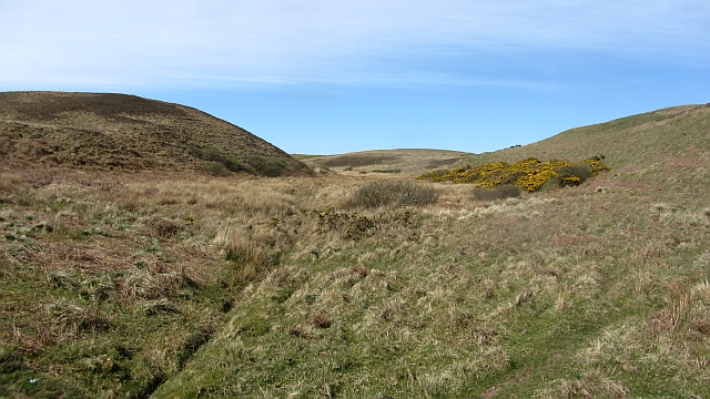
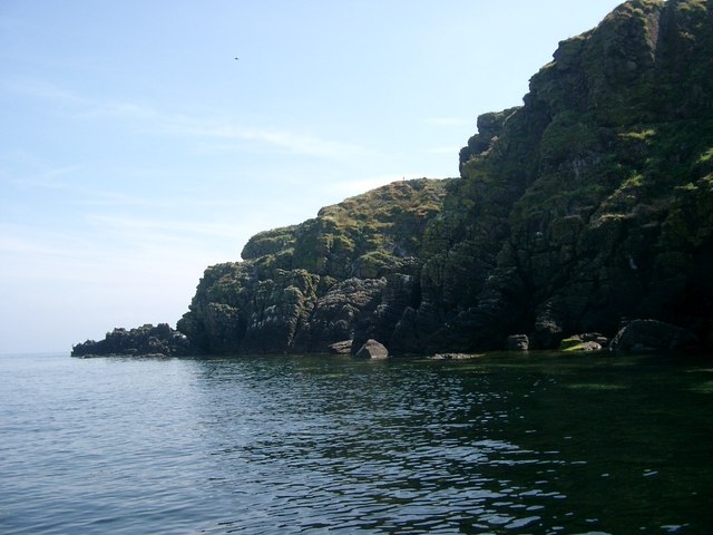
Rising to a height of approximately 400 meters, Beinn na Bèiste is a striking presence amidst the rugged terrain of Argyllshire. Its steep slopes are covered in lush vegetation, providing a vibrant contrast to the deep blue waters of the nearby Loch Fyne. The cliff's imposing presence makes it a popular destination for hikers and outdoor enthusiasts, offering challenging trails and rewarding panoramas.

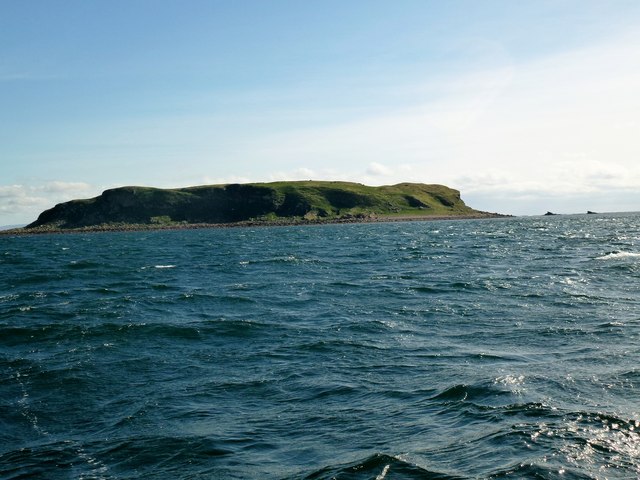
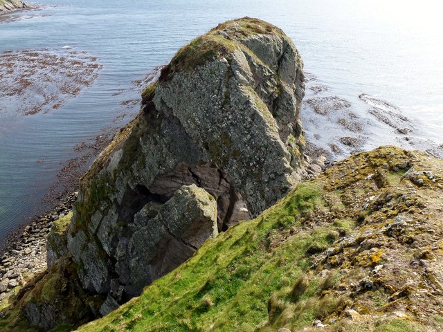
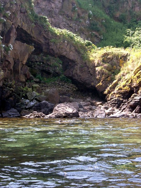
The geological formation of Beinn na Bèiste is the result of millions of years of natural processes. It is believed to be composed primarily of ancient sedimentary rocks, which have been shaped and sculpted by the forces of erosion. Over time, the relentless action of wind, water, and ice has carved out the cliff's distinctive features, creating a dramatic and awe-inspiring landscape.

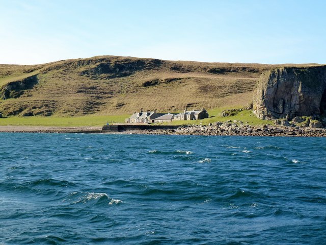
The area surrounding Beinn na Bèiste is also rich in biodiversity, providing a habitat for various plant and animal species. The cliff's rocky ledges and crevices offer nesting sites for seabirds such as puffins and cormorants, while the surrounding woodlands are home to a diverse range of flora and fauna.

Overall, Beinn na Bèiste is a natural wonder that showcases the beauty and power of Scotland's landscapes. Whether admired from afar or explored up close, this magnificent cliff is sure to leave a lasting impression on all who visit.

If you have any feedback on the listing, please let us know in the comments section below.

Beinn na Bèiste Images

Images are sourced within 2km of 55.284321/-5.5749943 or Grid Reference NR7304. Thanks to Geograph Open Source API. All images are credited.

Sanda Island Seen from the summit of The Bastard at the south-east of Kintyre.

On the left is Glunimore Island, and Sheep Island is in front of Sanda Island. In the distance are the hills of North Antrim.
Sanda Island
Seen from the summit of The Bastard at the south-east of Kintyre. On the left is Glunimore Island, and Sheep Island is in front of Sanda Island. In the distance are the hills of North Antrim.
Prince Edward's Rock and Sanda Lighthouse Viewed from the north. The alternative way to the lighthouse is by helicopter.
Prince Edward's Rock and Sanda Lighthouse
Viewed from the north. The alternative way to the lighthouse is by helicopter.
Sheep Island A small island off Sanda (background).
Sheep Island
A small island off Sanda (background).
Sanda Island Seen from Blackwaterfoot are Sanda island and the Mull of Kintyre.
Sanda Island
Seen from Blackwaterfoot are Sanda island and the Mull of Kintyre.
Sanda and Sheep Island Photographed from Dunaverty Rock
Sanda and Sheep Island
Photographed from Dunaverty Rock
Wetland, Sanda A damp area between two low hills.
Wetland, Sanda
A damp area between two low hills.
Lighthouse buildings, Sanda Redundant lighthouse buildings on a raised beach between the bulk of Sanda and a once offshore rock which hosts the lighthouse. The lighthouse is reached by a 200 step spiral staircase on the outside of the rock.
Lighthouse buildings, Sanda
Redundant lighthouse buildings on a raised beach between the bulk of Sanda and a once offshore rock which hosts the lighthouse. The lighthouse is reached by a 200 step spiral staircase on the outside of the rock.
Sanda and Sheep Island View from the western side of Sanda's hill towards to offlying Sheep Island.
Sanda and Sheep Island
View from the western side of Sanda's hill towards to offlying Sheep Island.
Sanda, the triangulation pillar The highest point on the island.
Sanda, the triangulation pillar
The highest point on the island.
Lighthouse road, Sanda A well surfaced road crosses Sanda from the pier (and pub) to the lighthouse.
Lighthouse road, Sanda
A well surfaced road crosses Sanda from the pier (and pub) to the lighthouse.
Blue sheep, Sanda A blue sheep greets visitors to the very welcoming island of Sanda. The azure backed wooly is gazing towards Glunimore Island, one of several rocks worth missing in the area.
Blue sheep, Sanda
A blue sheep greets visitors to the very welcoming island of Sanda. The azure backed wooly is gazing towards Glunimore Island, one of several rocks worth missing in the area.
Sanda Lighthouse and Elephant Rock The southernmost point of the island.
Sanda Lighthouse and Elephant Rock
The southernmost point of the island.
Trig Point Sanda Island Looking north at the trig point and onward view.
Trig Point Sanda Island
Looking north at the trig point and onward view.
Sheep Island Near Sanda Island Photo of Sheep Island from RIB on way from Campbeltown to Sanda Island.
Sheep Island Near Sanda Island
Photo of Sheep Island from RIB on way from Campbeltown to Sanda Island.
Sanda Island Slipway Looking from our RIB to our landing point on Sanda Island.
Sanda Island Slipway
Looking from our RIB to our landing point on Sanda Island.
Top Of Elephant Rock This is the top of Elephant Rock as seen from near the top of Sanda Island Lighthouse. The trunk of Elephant Rock forms a dramatic natural arch. We were so lucky to find the lighthouse open and to be allowed to explore inside and outside the tall lighthouse. Prince Edward Rock where the lighthouse is based is a recently discovered P30.
Top Of Elephant Rock
This is the top of Elephant Rock as seen from near the top of Sanda Island Lighthouse. The trunk of Elephant Rock forms a dramatic natural arch. We were so lucky to find the lighthouse open and to be allowed to explore inside and outside the tall lighthouse. Prince Edward Rock where the lighthouse is based is a recently discovered P30.
Helipad at Sanda Island Lighthouse A view west from high up on Sanda Island Lighthouse across the helipad.
Helipad at Sanda Island Lighthouse
A view west from high up on Sanda Island Lighthouse across the helipad.
Pier View And Sheep Island The Sanda Island Hotel and Restaurant has four lovely red outdoor seats where you can take in the view across to the pier, Sheep Island and the mainland.
Pier View And Sheep Island
The Sanda Island Hotel and Restaurant has four lovely red outdoor seats where you can take in the view across to the pier, Sheep Island and the mainland.
Show me another place!

Beinn na Bèiste is located at Grid Ref: NR7304 (Lat: 55.284321, Lng: -5.5749943)

Unitary Authority: Argyll and Bute

Police Authority: Argyll and West Dunbartonshire

What 3 Words

///otters.batches.clerk. Near Campbeltown, Argyll & Bute

Related Wikis

Sanda Island

Sanda Island (Scottish Gaelic: Sandaigh) is a small island in Argyll and Bute, Scotland, off the southern tip of the Kintyre peninsula, near Southend and...

Sheep Island, Argyll

Sheep Island is a small uninhabited island situated off the southern tip of the Kintyre peninsula in Scotland. Sheep Island, along with Sanda Island and...

Glunimore Island

Glunimore Island is an uninhabited island around 3 miles (5 kilometres) southeast of the Kintyre peninsula, Scotland. It lies alongside Sanda Island and...

Macharioch Motte

Macharioch Motte is the remains of a motte-and-bailey castle situated in a field near the farm of Macharioch in Kintyre, Argyll and Bute, Scotland. �...

Nearby Amenities

Located within 500m of 55.284321,-5.5749943
Sanda
Ele: 123
Natural: peak
Lat/Long: 55.2805115/-5.5759153
The data included in this document is from www.openstreetmap.org. The data is made available under ODbL.

Have you been to Beinn na Bèiste?

Leave your review of Beinn na Bèiste below (or comments, questions and feedback).