Bodha an Tàillir

Coastal Feature, Headland, Point in Argyllshire

Scotland

Bodha an Tàillir

Pedestrians at Croggan A stroll beside the sea. See also <a href="https://www.geograph.org.uk/photo/393942">NM7027 : Traffic jam in Croggan !</a>
Pedestrians at Croggan Credit: Des Blenkinsopp

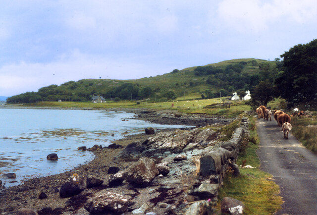
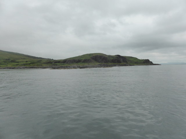
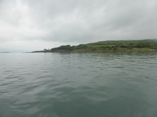
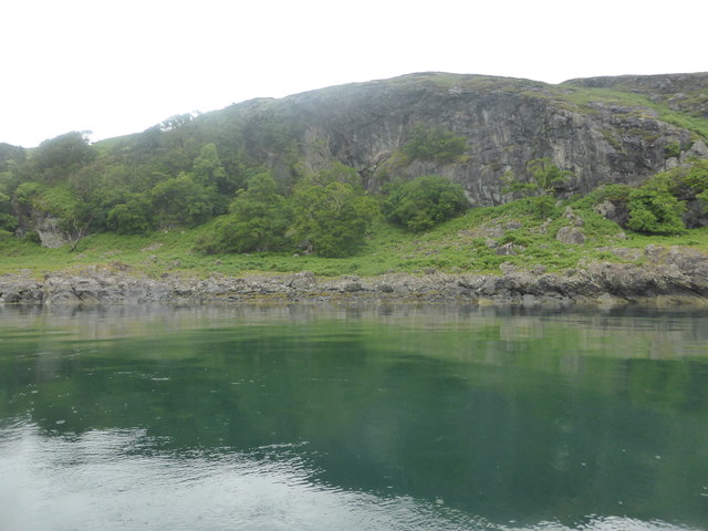
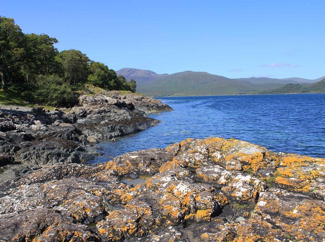
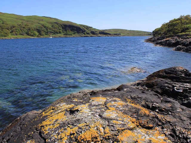
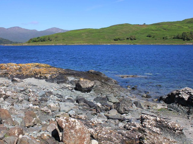
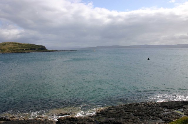
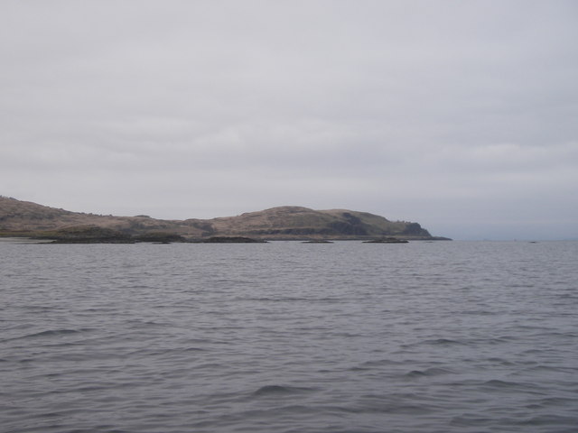
Bodha an Tàillir, located in Argyllshire, is a captivating coastal headland and point situated on the western coast of Scotland. Known for its breathtaking natural beauty and rich history, it draws visitors with its picturesque landscapes and intriguing geological formations.

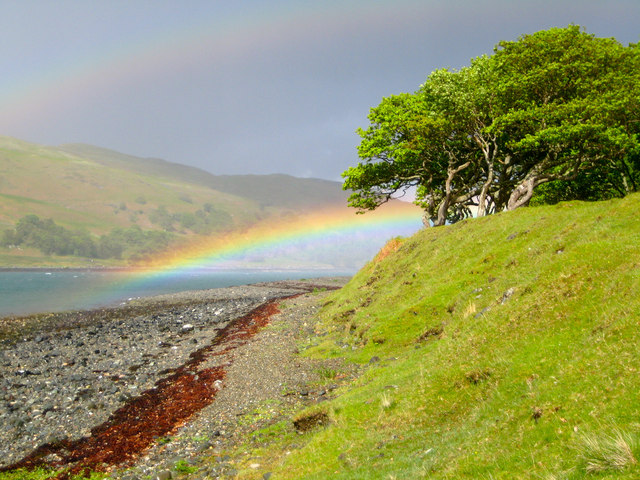
Standing tall against the crashing waves of the Atlantic Ocean, Bodha an Tàillir boasts rugged cliffs that offer panoramic views of the surrounding area. The headland is characterized by its jagged edges and dramatic rock formations, which have been sculpted over millions of years by the relentless forces of wind and water. These geological wonders make it a popular spot for both nature enthusiasts and photographers.

Bodha an Tàillir is also steeped in history, with evidence of human presence dating back thousands of years. On the headland, ancient ruins and standing stones can be found, serving as a reminder of the area's rich cultural heritage. Visitors can explore these historical remnants and imagine the lives of those who once inhabited this coastal region.

In addition to its natural and historical significance, Bodha an Tàillir is a haven for wildlife. The headland is home to a diverse range of bird species, including guillemots, razorbills, and puffins, making it a popular spot for birdwatching. Marine life such as seals and dolphins can also be spotted in the waters surrounding the headland.

Overall, Bodha an Tàillir is a captivating coastal feature that offers a unique combination of natural beauty, historical significance, and abundant wildlife. Whether it's exploring the cliffs, immersing in the area's rich history, or simply enjoying the breathtaking views, visitors to Bodha an Tàillir are sure to be enchanted by its charm.

If you have any feedback on the listing, please let us know in the comments section below.

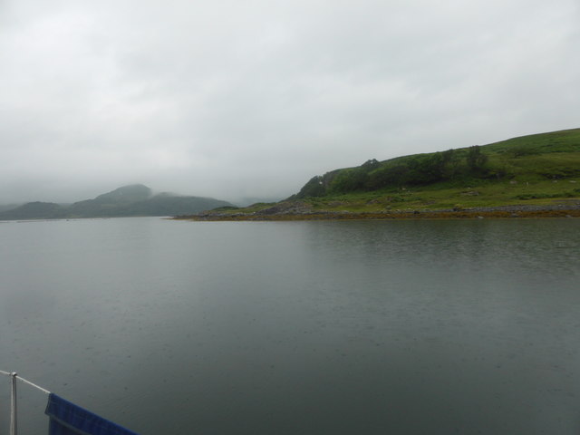
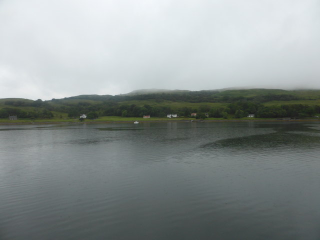
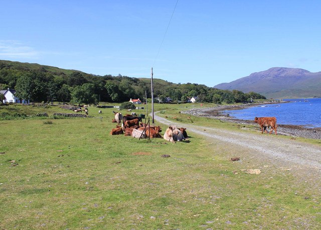
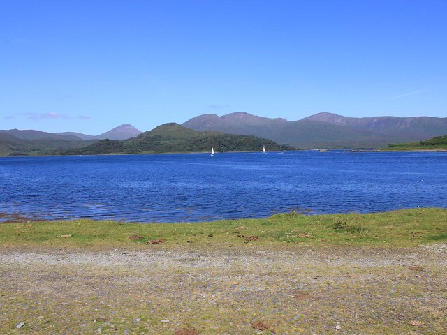
Bodha an Tàillir Images

Images are sourced within 2km of 56.37832/-5.6893966 or Grid Reference NM7226. Thanks to Geograph Open Source API. All images are credited.

Pedestrians at Croggan A stroll beside the sea. See also <a href="https://www.geograph.org.uk/photo/393942">NM7027 : Traffic jam in Croggan !</a>
Pedestrians at Croggan
A stroll beside the sea. See also NM7027 : Traffic jam in Croggan !
Ceum na h-Aon Bho The name seems to refer to this line of cliffs on, I think, a raised beach.
Ceum na h-Aon Bho
The name seems to refer to this line of cliffs on, I think, a raised beach.
Rubha nan Sailthean
Rubha nan Sailthean
Crags at Grob a' Cuthaich
Uamhag Labhruinn
Uamhag Labhruinn
Croggan from Loch Spelve
Crogan, Mull From the end of the metalled road.
Crogan, Mull
From the end of the metalled road.
Crogan, Mull Looking NW from the end of the metalled road across Loch Spelve. The peninsula in the middle distance is Cruach Ardura, and the land on the right is Rubha na Cille.
Crogan, Mull
Looking NW from the end of the metalled road across Loch Spelve. The peninsula in the middle distance is Cruach Ardura, and the land on the right is Rubha na Cille.
Entrance to Loch Spelve Looking west towards Croggan.
Entrance to Loch Spelve
Looking west towards Croggan.
Entrance to Loch Spelve Looking east towards the Firth of Lorn.
Entrance to Loch Spelve
Looking east towards the Firth of Lorn.
Entrance to Loch Spelve Looking NNW across the entrance.
Entrance to Loch Spelve
Looking NNW across the entrance.
Rubha na Faoilin Looking ENE across the mouth of Loch Spelve from Rubha nan Sailthean towards Rubha na Faoilin.
Rubha na Faoilin
Looking ENE across the mouth of Loch Spelve from Rubha nan Sailthean towards Rubha na Faoilin.
The Schoolhouse Croggan View showing front and back doors.
The Schoolhouse Croggan
View showing front and back doors.
The Schoolhouse Croggan Viewed from the W showing the old school room behind and the lounge and bedrooms.
The Schoolhouse Croggan
Viewed from the W showing the old school room behind and the lounge and bedrooms.
Rainbow over Loch Spleve Croggan How this cheered us up after a soaking!
Rainbow over Loch Spleve Croggan
How this cheered us up after a soaking!
Loch Spelve Entrance to Loch Spelve near Croggan
Loch Spelve
Entrance to Loch Spelve near Croggan
Ruined croft  and tree Gualachaolish ruined croft overlooks Croggan across the entrance to Loch Spelve
Ruined croft and tree
Gualachaolish ruined croft overlooks Croggan across the entrance to Loch Spelve
Skerries off Port nan Crullach, Mull
Show me another place!

Bodha an Tàillir is located at Grid Ref: NM7226 (Lat: 56.37832, Lng: -5.6893966)

Unitary Authority: Argyll and Bute

Police Authority: Argyll and West Dunbartonshire

What 3 Words

///managed.innocence.inspects. Near Craignure, Argyll & Bute

Related Wikis

Croggan

Croggan is a small scattered settlement on the Loch Spelve sea loch, in the south of the Isle of Mull, Argyll and Bute, Scotland. It is located in the...

Loch Spelve

Loch Spelve is a sea loch on the southeast coast of the Isle of Mull, off the west coast of Scotland. It is almost landlocked with a relatively narrow...

Loch Don

Loch Don is a sea loch on the east coast of the Isle of Mull, off the west coast of Scotland. It is an intricately shaped loch opening onto the Firth of...

Lochdon Free Church

The Lochdon Free Church is a place of worship of the Free Church of Scotland in Lochdon on the Isle of Mull, Scotland. The church was built in 1852....

Nearby Amenities

Located within 500m of 56.37832,-5.6893966
Source: PGS
Lat/Long: 56.3824739/-5.691217
Created By: dmgroom_coastlines
Source: PGS
Lat/Long: 56.382363/-5.69152
Created By: dmgroom_coastlines
Source: PGS
Lat/Long: 56.382108/-5.691502
Source: PGS
Lat/Long: 56.3817668/-5.6908452
Created By: dmgroom_coastlines
Source: PGS
Lat/Long: 56.38136/-5.690526
Source: PGS
Lat/Long: 56.3811224/-5.6903279
Source: PGS
Lat/Long: 56.3807912/-5.6903117
Source: PGS
Lat/Long: 56.3799677/-5.6900854
Source: PGS
Lat/Long: 56.3798155/-5.6895357
Source: PGS
Lat/Long: 56.3795918/-5.6891801
Source: PGS
Lat/Long: 56.3793769/-5.6893417
Source: PGS
Lat/Long: 56.3791532/-5.6896974
Source: PGS
Lat/Long: 56.3789044/-5.6896337
Source: PGS
Lat/Long: 56.3785534/-5.6891154
Source: PGS
Lat/Long: 56.3783117/-5.6890992
Source: PGS
Lat/Long: 56.378079/-5.6897459
Source: PGS
Lat/Long: 56.3778642/-5.6900531
Source: PGS
Lat/Long: 56.3775688/-5.6901824
Source: PGS
Lat/Long: 56.3772555/-5.6905704
Created By: dmgroom_coastlines
Source: PGS
Lat/Long: 56.377002/-5.69068
Created By: dmgroom_coastlines
Source: PGS
Lat/Long: 56.376491/-5.690644
Created By: dmgroom_coastlines
Source: PGS
Lat/Long: 56.375713/-5.691051
Created By: dmgroom_coastlines
Source: PGS
Lat/Long: 56.375458/-5.691033
Source: PGS
Lat/Long: 56.375295/-5.6911362
Source: PGS
Lat/Long: 56.3752778/-5.691726
Source: PGS
Lat/Long: 56.3753523/-5.6921088
Source: PGS
Lat/Long: 56.3755815/-5.6921191
Source: PGS
Lat/Long: 56.3757992/-5.6918294
Source: PGS
Lat/Long: 56.3761544/-5.6920053
Created By: dmgroom_coastlines
Source: PGS
Lat/Long: 56.376327/-5.692248
Source: PGS
Lat/Long: 56.3761945/-5.6929365
Source: PGS
Lat/Long: 56.3759768/-5.6934538
Source: PGS
Lat/Long: 56.375719/-5.6941056
Source: PGS
Lat/Long: 56.3755414/-5.694354
Source: PGS
Lat/Long: 56.3752606/-5.694654
Source: PGS
Lat/Long: 56.3750372/-5.6945505
Source: PGS
Lat/Long: 56.378689/-5.689644
The data included in this document is from www.openstreetmap.org. The data is made available under ODbL.

Have you been to Bodha an Tàillir?

Leave your review of Bodha an Tàillir below (or comments, questions and feedback).