Bàrr Sligeig

Coastal Feature, Headland, Point in Argyllshire

Scotland

Bàrr Sligeig

Cottage on Lunga On the east coast of this Slate Island, in the Sound of Luing. There is also a larger house <a href="https://www.geograph.org.uk/photo/6932677">NM7108 : House on the Slate Island of Lunga</a>, obscured by the rock behind the cottage.
Cottage on Lunga Credit: M J Richardson

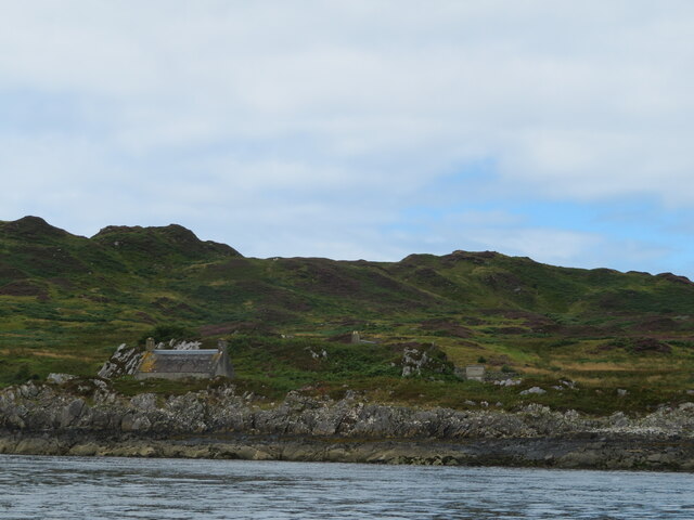
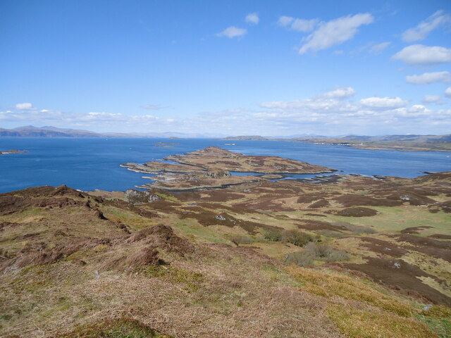
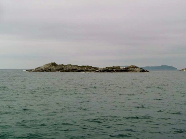
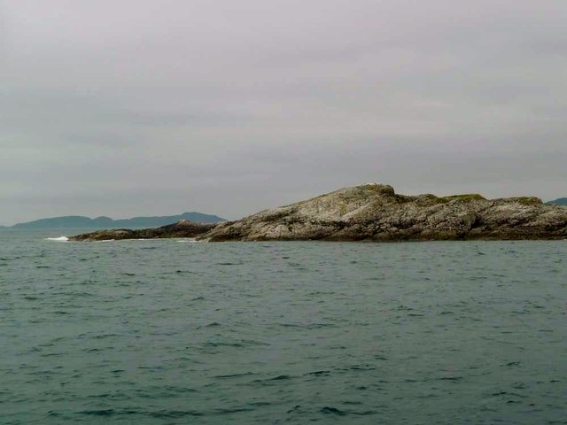
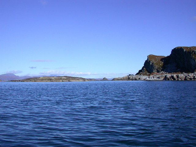
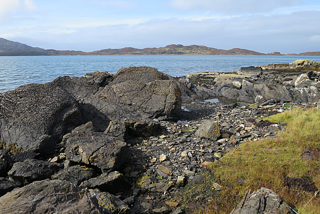
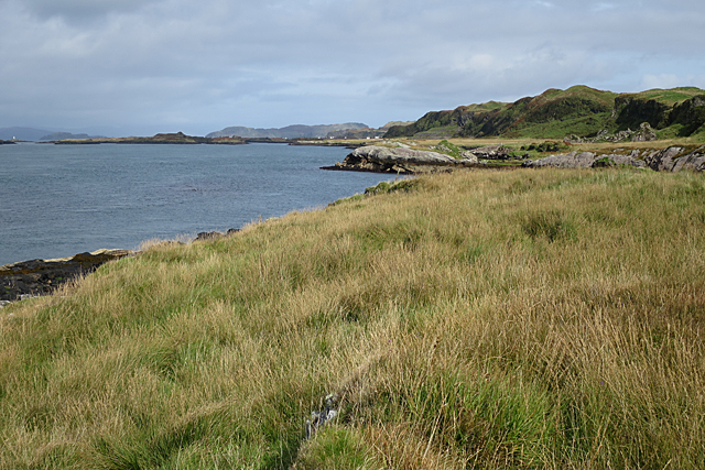
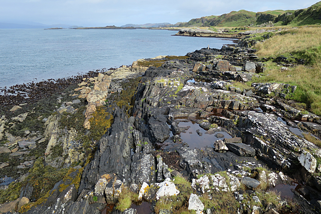
Bàrr Sligeig is a prominent coastal feature located in Argyllshire, Scotland. It is a headland that juts out into the sea, forming a point that offers stunning panoramic views of the surrounding landscape. The name Bàrr Sligeig is derived from Scottish Gaelic, with "Bàrr" meaning "top" or "summit" and "Sligeig" referring to a type of coastal landscape.

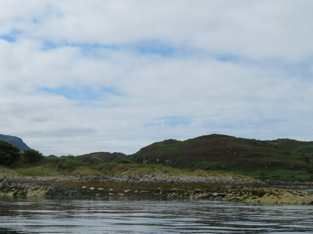
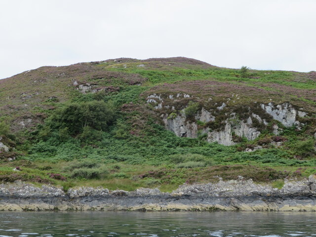
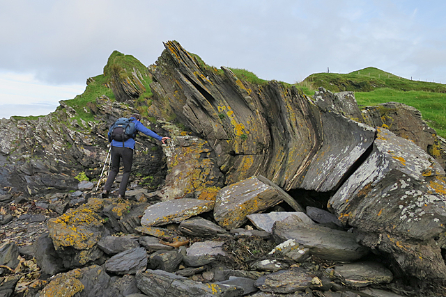
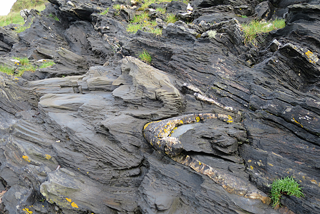
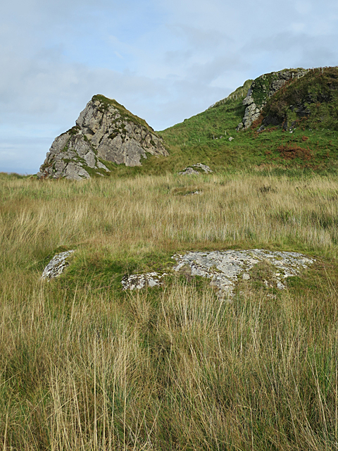
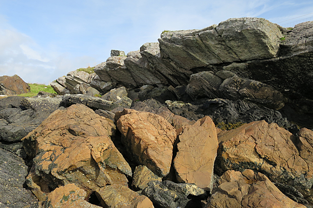
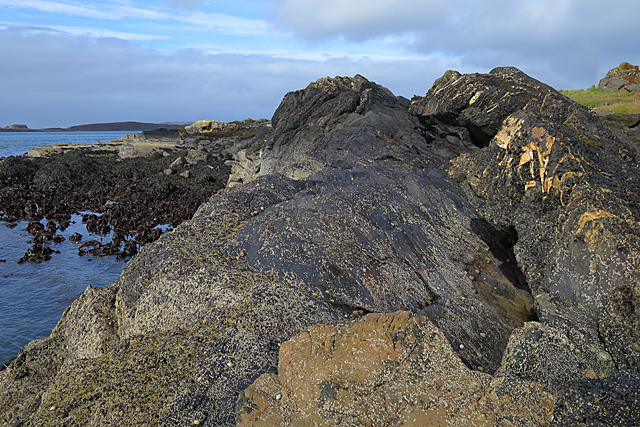
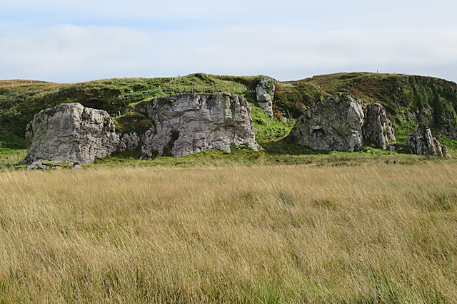
Situated in a region known for its rugged beauty, Bàrr Sligeig stands as a testament to the raw power of nature. The headland is characterized by sheer cliffs that plunge dramatically into the sea, creating an awe-inspiring sight. These cliffs are composed of ancient rock formations, showcasing the geological history of the area.

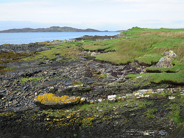
The headland is renowned for its biodiversity, boasting a rich variety of plant and animal life. The rugged terrain provides a habitat for numerous bird species, including seabirds such as gannets and puffins. Visitors to Bàrr Sligeig can often witness these birds soaring overhead or nesting on the cliffs.

Access to Bàrr Sligeig is possible via a coastal path that winds its way along the headland. This path offers an exhilarating hike, allowing visitors to fully appreciate the grandeur of the landscape. The route is not overly challenging, but sturdy footwear and caution are recommended due to the uneven terrain.

Bàrr Sligeig is a popular destination for nature enthusiasts and photographers, who flock to capture its stunning vistas and observe the diverse wildlife. Its unspoiled beauty and tranquil atmosphere make it a truly remarkable coastal feature in Argyllshire.

If you have any feedback on the listing, please let us know in the comments section below.

Bàrr Sligeig Images

Images are sourced within 2km of 56.219364/-5.6929075 or Grid Reference NM7109. Thanks to Geograph Open Source API. All images are credited.

Cottage on Lunga On the east coast of this Slate Island, in the Sound of Luing. There is also a larger house <a href="https://www.geograph.org.uk/photo/6932677">NM7108 : House on the Slate Island of Lunga</a>, obscured by the rock behind the cottage.
Cottage on Lunga
On the east coast of this Slate Island, in the Sound of Luing. There is also a larger house NM7108 : House on the Slate Island of Lunga, obscured by the rock behind the cottage.
House on the Slate Island of Lunga Seen from the Sound of Luing.
House on the Slate Island of Lunga
Seen from the Sound of Luing.
Seals on Eilean nan Ceann Both Atlantic Grey seals and Common seals were hauled out.
Seals on Eilean nan Ceann
Both Atlantic Grey seals and Common seals were hauled out.
Barr Sligeig, on Lunga At 49 m, one of the higher points of Lunga; Bidein na h-Iolaire, at 100 m, is the highest. The rock would appear to be relatively soft - note the undercut at what would be the high tide mark?
Barr Sligeig, on Lunga
At 49 m, one of the higher points of Lunga; Bidein na h-Iolaire, at 100 m, is the highest. The rock would appear to be relatively soft - note the undercut at what would be the high tide mark?
Looking north from Lunga island summit In the foreground are two separate, but tidal islands, Eilean Iosal and Rubha Fiola. Further away can be seen Inch Island in the Firth of Lorn, and Seil to its right.
Looking north from Lunga island summit
In the foreground are two separate, but tidal islands, Eilean Iosal and Rubha Fiola. Further away can be seen Inch Island in the Firth of Lorn, and Seil to its right.
Liath Sgeir A skerry lying off the Black Isles.
Liath Sgeir
A skerry lying off the Black Isles.
Liath Sgeir A skerry lying off the Black Isles.
Liath Sgeir
A skerry lying off the Black Isles.
Northern tip of Guirasdeal Guirasdeal looking North to Lunga (right) and the black isle (left).
Northern tip of Guirasdeal
Guirasdeal looking North to Lunga (right) and the black isle (left).
Shore north of Black Mill Bay Most of the rock here is slate, but the rock covered with yellow lichen is part of a much deformed bed of sandstone. The distant island is Lunga.
Shore north of Black Mill Bay
Most of the rock here is slate, but the rock covered with yellow lichen is part of a much deformed bed of sandstone. The distant island is Lunga.
Recumbent Fold The curving rock is the remnant of the hinge of a fold in metamorphosed sandstone. The fold has been overturned to lie horizontally. Sedimentary features in the sandstone indicate that the rocks are younging to the east, or in other words the rocks on the left here are older than the rock on the right, and the whole pile has been rotated about 90º and complexly folded by tectonic movements.
Recumbent Fold
The curving rock is the remnant of the hinge of a fold in metamorphosed sandstone. The fold has been overturned to lie horizontally. Sedimentary features in the sandstone indicate that the rocks are younging to the east, or in other words the rocks on the left here are older than the rock on the right, and the whole pile has been rotated about 90º and complexly folded by tectonic movements.
Folds Back-to-back Folds here are picked out by the sandstone bed which is pale in colour and has yellow lichen on it. Above it is a similar fold in the opposite direction in the slate. The slate is cleaved so that it looks as if it is made up of a sheaf of thin leaves. The cleavage is perpendicular to the direction of the force that caused the folding, and it is termed axial planar cleavage because it is in the hinge of the fold. If you look at the darker rock above the folds, you can see lots of tiny folds. Small folds like these on the limbs of larger folds are called parasitic folds.
Folds Back-to-back
Folds here are picked out by the sandstone bed which is pale in colour and has yellow lichen on it. Above it is a similar fold in the opposite direction in the slate. The slate is cleaved so that it looks as if it is made up of a sheaf of thin leaves. The cleavage is perpendicular to the direction of the force that caused the folding, and it is termed axial planar cleavage because it is in the hinge of the fold. If you look at the darker rock above the folds, you can see lots of tiny folds. Small folds like these on the limbs of larger folds are called parasitic folds.
Felsic Intrusion Felsic rock is igneous rock that is low in iron and magnesium and high in silica. It is usually pale in colour. Here at Black Mill Bay the Easdale Slates are cut by several sheets of felsic rock, and the outcrop in the foreground is part of the largest of these. It continues beneath the vegetation to form the Cobblers of Lorn, one of which is the conical rock just left of centre a little further north.
Felsic Intrusion
Felsic rock is igneous rock that is low in iron and magnesium and high in silica. It is usually pale in colour. Here at Black Mill Bay the Easdale Slates are cut by several sheets of felsic rock, and the outcrop in the foreground is part of the largest of these. It continues beneath the vegetation to form the Cobblers of Lorn, one of which is the conical rock just left of centre a little further north.
Coast of Luing The rocks on the shore here are principally Easdale Slate. The pock-marked surface of the largest blocks is probably the result of molluscs boring holes in the surface. In the background is the island of Lunga.
Coast of Luing
The rocks on the shore here are principally Easdale Slate. The pock-marked surface of the largest blocks is probably the result of molluscs boring holes in the surface. In the background is the island of Lunga.
Dyke and Dolostone The reddish boulders in the foreground are composed of dolostone, which is a type of limestone in which some of the calcium has been replaced by magnesium. Above them is a dark layer of slate, and on top is a felsic sheet. Felsic rocks are igneous rocks that contain little or no iron or magnesium, but are rich in feldspar and silica. They are usually pale in colour.
Dyke and Dolostone
The reddish boulders in the foreground are composed of dolostone, which is a type of limestone in which some of the calcium has been replaced by magnesium. Above them is a dark layer of slate, and on top is a felsic sheet. Felsic rocks are igneous rocks that contain little or no iron or magnesium, but are rich in feldspar and silica. They are usually pale in colour.
Mostly Slate The almost black rock is Easdale Slate, with lots of pale veins, probably of calcite. In the foreground is a block of dolostone, a type of limestone in which some of the calcium has been replaced by magnesium.
Mostly Slate
The almost black rock is Easdale Slate, with lots of pale veins, probably of calcite. In the foreground is a block of dolostone, a type of limestone in which some of the calcium has been replaced by magnesium.
Raised Beach Raised beaches are a feature of much of the coast of Scotland, and especially noticeable in parts of Argyll. They occur when sea level falls fairly rapidly relative to the level of the land, leaving former shores high and dry. You can see that there is a level area between the low cliffs and the present shore right up the length of the coast here.
Raised Beach
Raised beaches are a feature of much of the coast of Scotland, and especially noticeable in parts of Argyll. They occur when sea level falls fairly rapidly relative to the level of the land, leaving former shores high and dry. You can see that there is a level area between the low cliffs and the present shore right up the length of the coast here.
The Cobblers of Lorn The row of rock stacks at the shoreward side of the raised beach is a prominent feature of the west coast of Luing, and a useful landmark for sailors. They are parts of a thick sheet of felsic rock that has been intruded into the Easdale Slates which are the commonest type of rock in this area. Felsic rock is pale-coloured igneous rock which is low in iron and magnesium but high in feldspar and silica. The felsic sheet was eroded into stacks by the action of the sea when the relative level of the sea was higher, and what is now grassland was the shore. Compare with <a href="https://www.geograph.org.uk/photo/168924">NM7209 : The Cobblers of Lorne</a>.
The Cobblers of Lorn
The row of rock stacks at the shoreward side of the raised beach is a prominent feature of the west coast of Luing, and a useful landmark for sailors. They are parts of a thick sheet of felsic rock that has been intruded into the Easdale Slates which are the commonest type of rock in this area. Felsic rock is pale-coloured igneous rock which is low in iron and magnesium but high in feldspar and silica. The felsic sheet was eroded into stacks by the action of the sea when the relative level of the sea was higher, and what is now grassland was the shore. Compare with NM7209 : The Cobblers of Lorne.
Fold on the Foreshore The rock pool occupies the eroded hinge zone of a fold in the Easdale Slate. You can just about make out the curve of the beds round the fold.
Fold on the Foreshore
The rock pool occupies the eroded hinge zone of a fold in the Easdale Slate. You can just about make out the curve of the beds round the fold.
Show me another place!

Bàrr Sligeig is located at Grid Ref: NM7109 (Lat: 56.219364, Lng: -5.6929075)

Unitary Authority: Argyll and Bute

Police Authority: Argyll and West Dunbartonshire

What 3 Words

///lousy.flipper.became. Near Lochbuie, Argyll & Bute

Related Wikis

Lunga, Firth of Lorn

Lunga is one of the Slate Islands in the Firth of Lorn in Argyll and Bute, Scotland. The "Grey Dog" tidal race, which runs in the sea channel to the south...

Scarba, Lunga and the Garvellachs National Scenic Area

Scarba, Lunga and the Garvellachs is the name of one of the 40 national scenic areas of Scotland. The designated area covers the islands of Scarba, Lunga...

Eilean Dubh Mòr

Eilean Dubh Mòr (Scottish Gaelic: big black island) is an uninhabited island in the Inner Hebrides of Scotland. It lies at the mouth of the Firth of Lorn...

Luing

Luing ( LING; Scottish Gaelic: Luinn) is one of the Slate Islands, Firth of Lorn, in the west of Argyll in Scotland, about 16 miles (26 km) south of Oban...

Have you been to Bàrr Sligeig?

Leave your review of Bàrr Sligeig below (or comments, questions and feedback).