Gourach

Coastal Feature, Headland, Point in Argyllshire

Scotland

Gourach

Coastal scene by the B8024 Looking south past West Loch Tarbert (the inlet on the left) to the southern part of Kintyre.
Coastal scene by the B8024 Credit: Gordon Brown

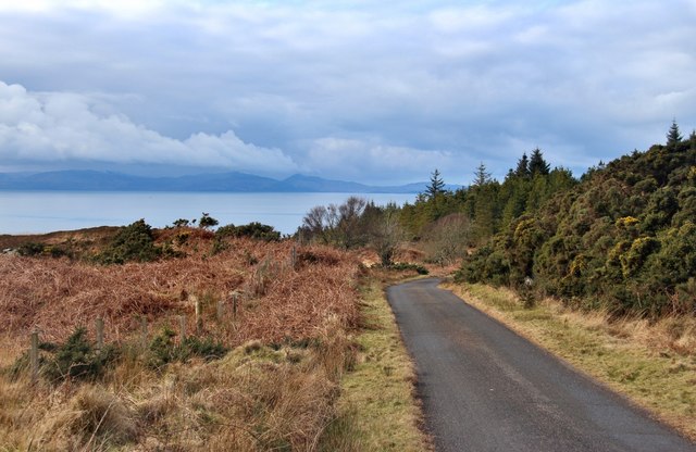
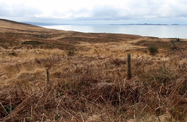
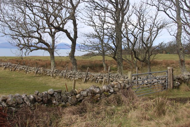
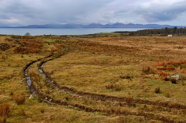
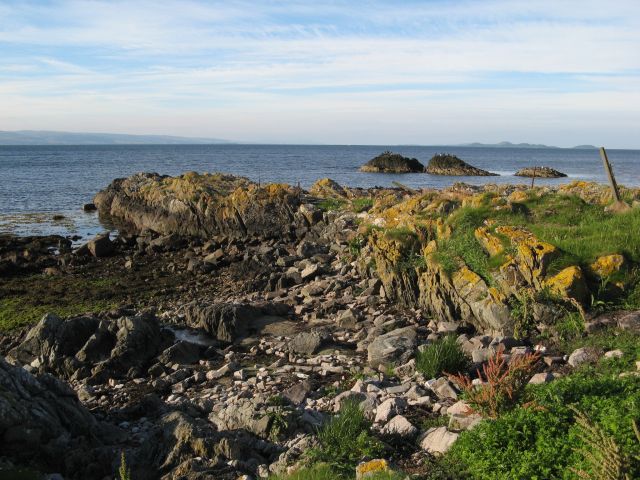
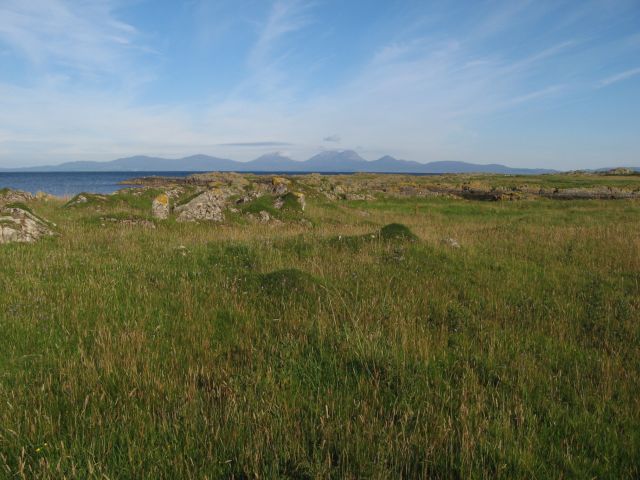
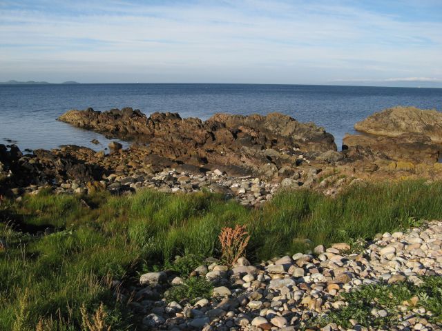
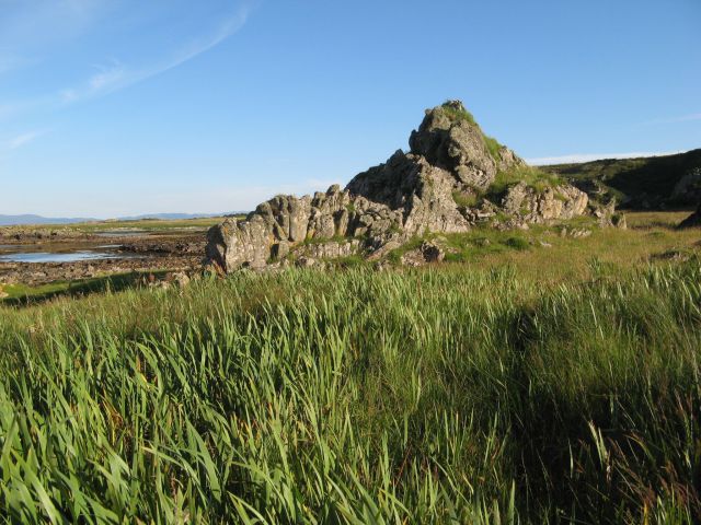
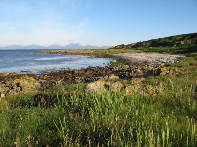
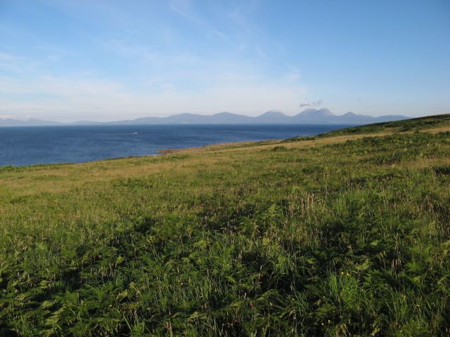
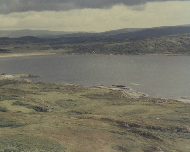
Gourach is a prominent headland located in Argyllshire, Scotland. Situated along the picturesque coastline, it extends into the Atlantic Ocean, offering stunning views of the surrounding landscape. The headland is known for its rugged terrain, consisting of steep cliffs that tower above the crashing waves below.

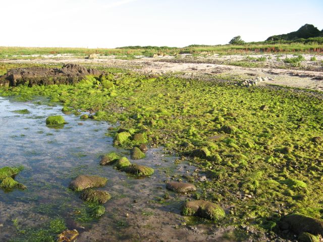
The geology of Gourach is primarily composed of metamorphic rocks, which have been shaped and eroded by the powerful forces of the ocean over centuries. This has resulted in the formation of several sea caves and arches along the headland, adding to its dramatic appeal.

The vegetation on Gourach is diverse and abundant, with a range of plant species that thrive in the coastal environment. Visitors can expect to see vibrant wildflowers, including sea pinks and thrift, as well as various types of grasses and mosses that cling to the rocky surfaces.

The headland is home to a variety of bird species, making it a popular spot for birdwatching. Visitors may spot seabirds such as gannets, fulmars, and kittiwakes, as well as the occasional peregrine falcon soaring overhead. The surrounding waters are also rich in marine life, with seals and dolphins occasionally spotted by lucky observers.

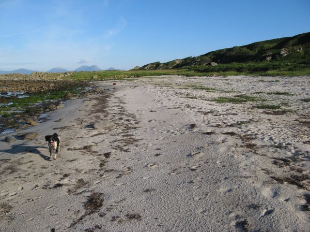
Access to Gourach is possible via a coastal path that winds along the edge of the headland, offering panoramic views of the coastline and the vast expanse of the Atlantic Ocean. The path is relatively challenging, with steep sections and uneven terrain, but the breathtaking scenery makes it well worth the effort.

Overall, Gourach is a captivating coastal feature that showcases the raw beauty and natural diversity of Argyllshire's coastline. Its rugged cliffs, sea caves, and abundant wildlife make it a must-visit destination for nature lovers and outdoor enthusiasts alike.

If you have any feedback on the listing, please let us know in the comments section below.
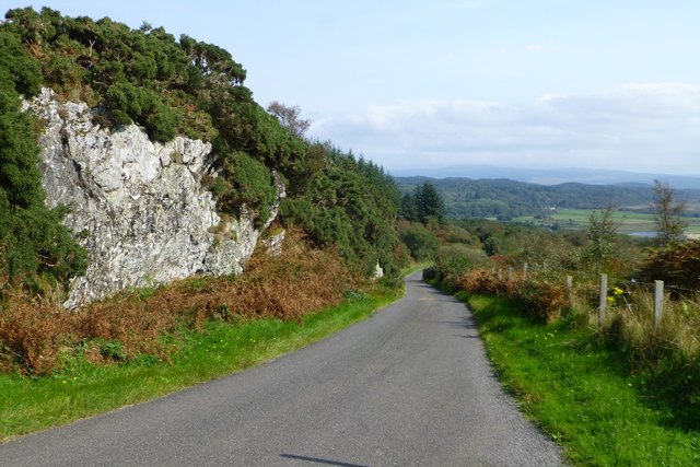
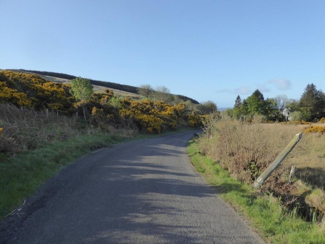
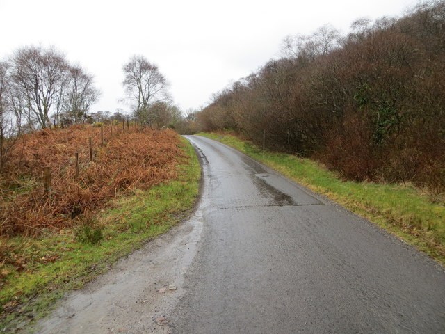
Gourach Images

Images are sourced within 2km of 55.793618/-5.6535017 or Grid Reference NR7161. Thanks to Geograph Open Source API. All images are credited.

Coastal scene by the B8024 Looking south past West Loch Tarbert (the inlet on the left) to the southern part of Kintyre.
Coastal scene by the B8024
Looking south past West Loch Tarbert (the inlet on the left) to the southern part of Kintyre.
Islay comes into view from the B8024
Moorland above Rubha Cruitiridh
Stone dykes at Tiretigan Snow-capped Paps of Jura through the trees.
Stone dykes at Tiretigan
Snow-capped Paps of Jura through the trees.
Farm track at Keppoch Island of Jura across the sea.
Farm track at Keppoch
Island of Jura across the sea.
Rubha an Righ Offshore rocks and a small promontory are formed by a particularly resistant outcrop of Dalradian schist. The population of cormorants on this coast is remarkable, and here are a group of over one dozen sunning themselves dry.
Rubha an Righ
Offshore rocks and a small promontory are formed by a particularly resistant outcrop of Dalradian schist. The population of cormorants on this coast is remarkable, and here are a group of over one dozen sunning themselves dry.
Erosion platform with Jura Pasture on the wave-cut platform stretches out for a significant distance below the relict cliff-line. This level is referred to as the Main Rock Platform and is a pronounced landscape feature throughout the Hebrides, arising through marine erosion at a time when relative sea level was higher than today. Debate continues regarding the age and origin of this feature, whose simplest explanation lies in the rebound of the land surface after the load of ice was lifted after de-glaciation. The profile of distant Jura fills the horizon.
Erosion platform with Jura
Pasture on the wave-cut platform stretches out for a significant distance below the relict cliff-line. This level is referred to as the Main Rock Platform and is a pronounced landscape feature throughout the Hebrides, arising through marine erosion at a time when relative sea level was higher than today. Debate continues regarding the age and origin of this feature, whose simplest explanation lies in the rebound of the land surface after the load of ice was lifted after de-glaciation. The profile of distant Jura fills the horizon.
Seaweed, Port na Gaillinn Luxuriant growth of very bright green seaweed on the upper shore of Port na Gaillinn. I believe that the seaweed is one of the Enteromorpha species, but it needs a closer look to be certain.
Seaweed, Port na Gaillinn
Luxuriant growth of very bright green seaweed on the upper shore of Port na Gaillinn. I believe that the seaweed is one of the Enteromorpha species, but it needs a closer look to be certain.
Promontory of schist Resistant beds of Dalradian schist finger out into the sea. There is a pronounced storm beach above the normal tide line, which makes walking difficult when weeds have grown over and hidden the surface. Gigha and Islay creep into the horizon, the latter with a surprising layer of cloud over its hills.
Promontory of schist
Resistant beds of Dalradian schist finger out into the sea. There is a pronounced storm beach above the normal tide line, which makes walking difficult when weeds have grown over and hidden the surface. Gigha and Islay creep into the horizon, the latter with a surprising layer of cloud over its hills.
Relict sea-stack At one time this prominent rock would have been a small rocky island lying some distance from a shore with rocky cliffs, but relative lowering of sea level has left it stranded. It is one of several such features on this stretch of the Main Rock Platform, a 'fossilised' landscape feature well known in the Hebrides (see also <a href="https://www.geograph.org.uk/photo/5097312">NR7062 : Erosion platform with Jura</a>). In the background can be seen both the extending platform and the relict cliff line. The sodden ground here supports a thick growth of Flag Iris and it is not easy walking.
Relict sea-stack
At one time this prominent rock would have been a small rocky island lying some distance from a shore with rocky cliffs, but relative lowering of sea level has left it stranded. It is one of several such features on this stretch of the Main Rock Platform, a 'fossilised' landscape feature well known in the Hebrides (see also NR7062 : Erosion platform with Jura). In the background can be seen both the extending platform and the relict cliff line. The sodden ground here supports a thick growth of Flag Iris and it is not easy walking.
Sandy shore, Port Mòr A fine little bay below the relict cliff line which lies in shadow at this early-morning hour. Such is the importance of access to such locations that a small track makes its way down the cliffs from the road.
Sandy shore, Port Mòr
A fine little bay below the relict cliff line which lies in shadow at this early-morning hour. Such is the importance of access to such locations that a small track makes its way down the cliffs from the road.
Port Mòr A beautiful bay with a horizon filled by the distant island of Jura. There is another sandy bay without a name to the south-west of this little headland. The bay is developed in the Main rock Platform (see <a href="https://www.geograph.org.uk/photo/5097312">NR7062 : Erosion platform with Jura</a>), whose relict cliffs are well displayed here.
Port Mòr
A beautiful bay with a horizon filled by the distant island of Jura. There is another sandy bay without a name to the south-west of this little headland. The bay is developed in the Main rock Platform (see NR7062 : Erosion platform with Jura), whose relict cliffs are well displayed here.
Improved grazing A wide meadow spreads out below the road, but above the steep and high relict cliff line. Jura looks magnificent on the morning horizon.
Improved grazing
A wide meadow spreads out below the road, but above the steep and high relict cliff line. Jura looks magnificent on the morning horizon.
Exposed rock face Beside the B8024
Exposed rock face
Beside the B8024
B8024 at Gortan Choirill
Sheep dip at Keppoch
A view across the foreshore This is one of the better days on this holiday as it was not raining and we were heading for the yellow sandy beach in the distance. The position of the camera point is my best guess after so long as there is not a lot to allow accurate positioning.

Taken on film in 1985.
A view across the foreshore
This is one of the better days on this holiday as it was not raining and we were heading for the yellow sandy beach in the distance. The position of the camera point is my best guess after so long as there is not a lot to allow accurate positioning. Taken on film in 1985.
Road (B8024) near to Creag Stars Looking south-westward.
Road (B8024) near to Creag Stars
Looking south-westward.
Show me another place!

Gourach is located at Grid Ref: NR7161 (Lat: 55.793618, Lng: -5.6535017)

Unitary Authority: Argyll and Bute

Police Authority: Argyll and West Dunbartonshire

What 3 Words

///polar.geese.distract. Near Tarbert, Argyll & Bute

Related Wikis

Kilberry Castle

Kilberry Castle is a Category B listed country house near Kilberry in South Knapdale in the county of Argyll, in western Scotland on the shores of the...

Kilberry

Kilberry (Scottish Gaelic: Cill Bheiridh) is a village in Argyll and Bute, Scotland. It is close to the western coast of the district of Knapdale. Kilberry...

Kilcalmonell

The parish of Kilcalmonell is situated in Argyll and Bute, Scotland. It extends from Clachan, in Kintyre to Kilberry, in Knapdale. == References == W....

Ardpatrick, Argyll

Ardpatrick (Scottish Gaelic: Àird Phàdraig) is a village at the southwestern extremity of the Knapdale, Argyll, Scotland. The village is built along the...

Nearby Amenities

Located within 500m of 55.793618,-5.6535017
Power: pole
Lat/Long: 55.795141/-5.6465016
Power: pole
Lat/Long: 55.7965486/-5.6474365
Passing Place
Lat/Long: 55.7943157/-5.6474861
Passing Place
Lat/Long: 55.7954287/-5.6498069
The data included in this document is from www.openstreetmap.org. The data is made available under ODbL.

Have you been to Gourach?

Leave your review of Gourach below (or comments, questions and feedback).