Creag na Speireig

Coastal Feature, Headland, Point in Inverness-shire

Scotland

Creag na Speireig

House at Laggan
House at Laggan Credit: Steven Brown

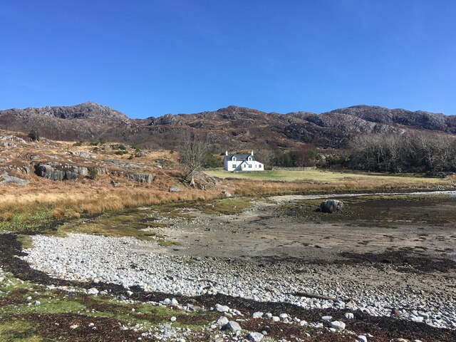
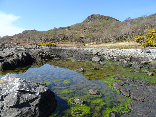
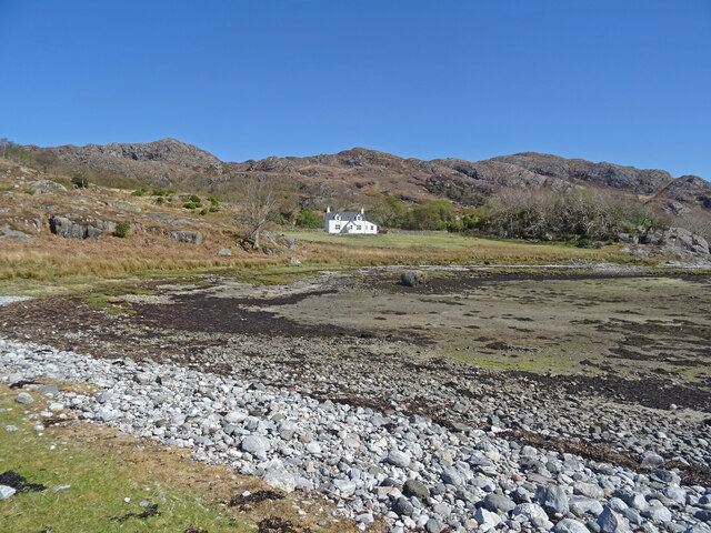
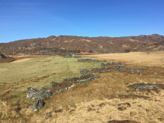
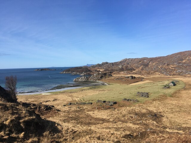
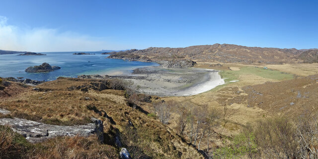
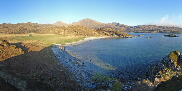
Creag na Speireig is a prominent headland located in Inverness-shire, Scotland. Situated along the coastline, this rocky point juts out into the North Sea, offering stunning views of the surrounding landscape. The headland is characterized by rugged cliffs that rise dramatically from the sea, creating a picturesque and dramatic backdrop.

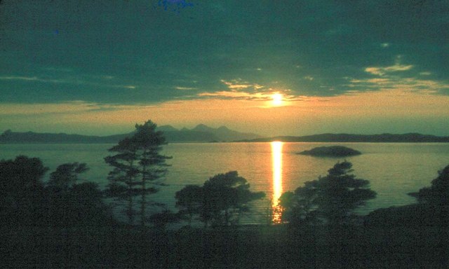
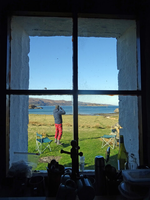
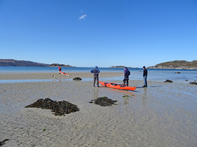
At the top of Creag na Speireig, visitors can enjoy panoramic views of the sea and coastline, making it a popular spot for sightseeing and photography. The headland is also home to a variety of wildlife, including seabirds and marine life, making it a great destination for birdwatching and nature enthusiasts.

The rocky terrain of Creag na Speireig provides a unique and challenging environment for hikers and climbers, with opportunities for exploring the rugged coastline and discovering hidden coves and caves. The headland is also a popular spot for fishing, with ample opportunities to catch a variety of fish species in the surrounding waters.

Overall, Creag na Speireig is a beautiful and diverse coastal feature in Inverness-shire, offering visitors a chance to immerse themselves in the natural beauty and rugged charm of the Scottish coastline.

If you have any feedback on the listing, please let us know in the comments section below.

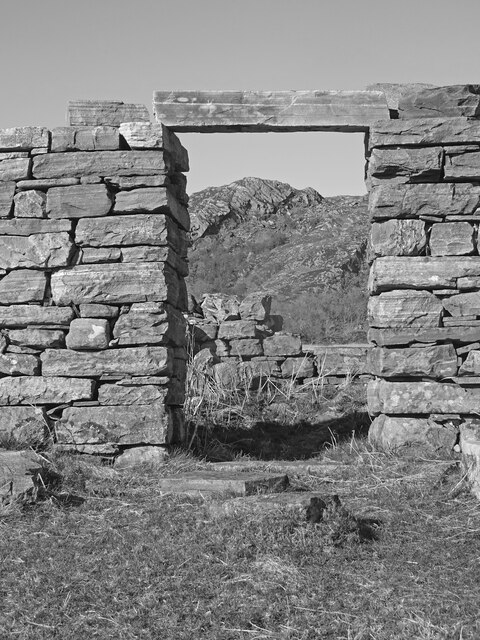
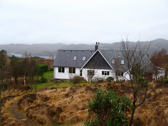
Creag na Speireig Images

Images are sourced within 2km of 56.845089/-5.7603437 or Grid Reference NM7078. Thanks to Geograph Open Source API. All images are credited.

House at Laggan
House at Laggan
Road near Roshven
Road near Roshven
A861, Roshven
A861, Roshven
Jetty on Loch Ailort
Ardnish Coastal Scenery Lovely coastal scenery on the Ardnish peninsula near Laggan. Great for a potter about and beachcoming on a warm spring day.
Ardnish Coastal Scenery
Lovely coastal scenery on the Ardnish peninsula near Laggan. Great for a potter about and beachcoming on a warm spring day.
Digital Detox Laggan cottage on the Ardnish peninsula, available for weekly rent from the estate, and described as 'one of the most remote/best off-grid holiday or digital detox cottages in the UK'.
Certainly it is stunning scenery around and the cottage is only accessible really by boat - it is a hard walk otherwise.
Details:-
<span class="nowrap"><a title="https://www.ardnish.org/laggan/" rel="nofollow ugc noopener" href="https://www.ardnish.org/laggan/">Link</a><img style="margin-left:2px;" alt="External link" title="External link - shift click to open in new window" src="https://s1.geograph.org.uk/img/external.png" width="10" height="10"/></span>
Digital Detox
Laggan cottage on the Ardnish peninsula, available for weekly rent from the estate, and described as 'one of the most remote/best off-grid holiday or digital detox cottages in the UK'. Certainly it is stunning scenery around and the cottage is only accessible really by boat - it is a hard walk otherwise. Details:- LinkExternal link
"The Square" south-west of Cooper's Knowe. Taken in the early 1980s by my father Gordon Stewart.
"The Square" south-west of Cooper's Knowe.
Taken in the early 1980s by my father Gordon Stewart.
Roshven: postbox № PH38 105 A small postbox alongside the A861, serving this straggling village.
Roshven: postbox № PH38 105
A small postbox alongside the A861, serving this straggling village.
Hebridean sunset at Roshven Night falls over Rum and Eigg
Hebridean sunset at Roshven
Night falls over Rum and Eigg
Peanmeanach ruins
Peanmeanach ruins
Peanmeanach ruins, and bothy
Bothy Life Some of the many artefacts inside the bothy of Peanmeanach, now a private bothy run by the estate on the Ardnish peninsula. The guitar certainly came in handy later on after a few drams!
Bothy Life
Some of the many artefacts inside the bothy of Peanmeanach, now a private bothy run by the estate on the Ardnish peninsula. The guitar certainly came in handy later on after a few drams!
Sartorial Elegance Bothy dweller in finest tartan trews contemplates the view out to Loch Ailort and Moidart. As seen through the window in Peanmeanach Bothy.
Sartorial Elegance
Bothy dweller in finest tartan trews contemplates the view out to Loch Ailort and Moidart. As seen through the window in Peanmeanach Bothy.
Low Tide Launch Low tide at the little bay at Peanmeanach in glorious spring weather. The kayaks are being launched to get more supplies for a 3 night stay at Peanmeanach Bothy.
Low Tide Launch
Low tide at the little bay at Peanmeanach in glorious spring weather. The kayaks are being launched to get more supplies for a 3 night stay at Peanmeanach Bothy.
Peanmeanach Panorama Above the little bay at the former settlement of Peanmeanach looking west from a small hill at the east of the bay. You can just see the bothy at right of picture, while Eigg can be seen to the left.
The clouds at left are actually smoke from wildfires which raged for 2 days above the settlement of Glenuig.
Peanmeanach Panorama
Above the little bay at the former settlement of Peanmeanach looking west from a small hill at the east of the bay. You can just see the bothy at right of picture, while Eigg can be seen to the left. The clouds at left are actually smoke from wildfires which raged for 2 days above the settlement of Glenuig.
Peanmeanach Bothy Formerly an MBA bothy which was getting heavily overused - and abused - is now locked but bookable for parties of up to 6 - it was originally the schoolmistress’ house - though the school was around the bay at Glasnacardoch:-
<span class="nowrap"><a title="https://www.ardnish.org/bothy/" rel="nofollow ugc noopener" href="https://www.ardnish.org/bothy/">Link</a><img style="margin-left:2px;" alt="External link" title="External link - shift click to open in new window" src="https://s1.geograph.org.uk/img/external.png" width="10" height="10"/></span>
Just behind the bothy can be seen the fine peak of Rois Bheinn - a Corbett.
Peanmeanach Bothy
Formerly an MBA bothy which was getting heavily overused - and abused - is now locked but bookable for parties of up to 6 - it was originally the schoolmistress’ house - though the school was around the bay at Glasnacardoch:- LinkExternal link Just behind the bothy can be seen the fine peak of Rois Bheinn - a Corbett.
Peanmeanach and Moidart Peanmeanach, Loch Ailort and the hills of Moidart from the west.
Peanmeanach and Moidart
Peanmeanach, Loch Ailort and the hills of Moidart from the west.
Ruins of Peanmeanach One of the abandoned houses at Peanmeanach on the Ardnish peninsula with one of the low hills seen through the still intact doorway. It is thought Peanmeanach was finally abandoned in the 1930's
Ruins of Peanmeanach
One of the abandoned houses at Peanmeanach on the Ardnish peninsula with one of the low hills seen through the still intact doorway. It is thought Peanmeanach was finally abandoned in the 1930's
Show me another place!

Creag na Speireig is located at Grid Ref: NM7078 (Lat: 56.845089, Lng: -5.7603437)

Unitary Authority: Highland

Police Authority: Highlands and Islands

What 3 Words

///savers.shred.caller. Near Arisaig, Highland

Related Wikis

Roshven

Roshven (Scottish Gaelic: Roisbheinn) is a township located on the eastern shoreline of Loch Ailort, in Lochaber, in the council area of Highland, Scotland...

Loch Ailort

Loch Ailort ( lokh EYE-lərt; Scottish Gaelic: Loch Ailleart) is a sea loch in Morar, Lochaber, Highland, Scotland. Loch Ailort is a shallow, V-shaped...

Alisary

Alisary is a tiny settlement in Highland, Scotland.

Glenuig

Glenuig ( glen-OO-ig, Scottish Gaelic: Ghlìnn-Ùige) is a small village in Moidart, Lochaber, Highland, on the west coast of Scotland. It is around 30 miles...

Nearby Amenities

Located within 500m of 56.845089,-5.7603437
Source: PGS
Lat/Long: 56.8482693/-5.7546841
Source: PGS
Lat/Long: 56.8483938/-5.7556159
Source: PGS
Lat/Long: 56.8483651/-5.7567731
Source: PGS
Lat/Long: 56.8483434/-5.7567883
Source: PGS
Lat/Long: 56.8472538/-5.7574719
Source: PGS
Lat/Long: 56.8474532/-5.758359
Source: PGS
Lat/Long: 56.847661/-5.7591486
Source: PGS
Lat/Long: 56.8477153/-5.7607559
Source: PGS
Lat/Long: 56.8477279/-5.7621897
Source: PGS
Lat/Long: 56.8477148/-5.7624477
Source: PGS
Lat/Long: 56.8476685/-5.7629131
Source: PGS
Lat/Long: 56.8476471/-5.763713
Source: PGS
Lat/Long: 56.8476232/-5.7637475
Source: PGS
Lat/Long: 56.8467577/-5.7638158
Source: PGS
Lat/Long: 56.8464714/-5.7635963
Source: PGS
Lat/Long: 56.8440339/-5.7641564
Source: PGS
Lat/Long: 56.8438105/-5.7645553
Source: PGS
Lat/Long: 56.8436843/-5.764834
Source: PGS
Lat/Long: 56.8435407/-5.7652668
Source: PGS
Lat/Long: 56.8433346/-5.7663071
Source: PGS
Lat/Long: 56.8431736/-5.7674403
Bus Stop
Roshven Road End
Bus: yes
Local Ref: AT
Naptan AtcoCode: 6700713088
Naptan Bearing: E
Naptan CommonName: Roshven Road End
Naptan Indicator: at
Naptan Landmark: Road End
Naptan NaptanCode: 45328498
Naptan Street: A861
Naptan Verified: no
Public Transport: platform
Source: naptan_import
Lat/Long: 56.8414828/-5.7577123
Bus Stop
Roshven Road End
Bus: yes
Naptan AtcoCode: 6700713088A
Naptan Bearing: W
Naptan CommonName: Roshven Road End
Naptan Indicator: opp
Naptan Landmark: Road End
Naptan NaptanCode: 45329526
Naptan Street: A861
Naptan Verified: no
Public Transport: platform
Source: naptan_import
Lat/Long: 56.8413271/-5.7581069
Post Box
Ref: PH38 105
Source: survey
Lat/Long: 56.8424464/-5.7553326
Power: pole
Lat/Long: 56.8434698/-5.755358
Power: pole
Lat/Long: 56.8435959/-5.7569808
Power: pole
Lat/Long: 56.8435299/-5.7581878
Power: pole
Lat/Long: 56.8432629/-5.7600707
Power: pole
Lat/Long: 56.8431015/-5.761165
Power: pole
Lat/Long: 56.8423754/-5.7633188
Power: pole
Lat/Long: 56.8418399/-5.7657489
The data included in this document is from www.openstreetmap.org. The data is made available under ODbL.

Have you been to Creag na Speireig?

Leave your review of Creag na Speireig below (or comments, questions and feedback).