Geodha Ceann Dà Aoineadh

Coastal Feature, Headland, Point in Argyllshire

Scotland

Geodha Ceann Dà Aoineadh

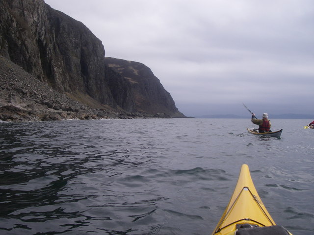
Cliffs on south east coast of Mull Near Leum na Muice Duibhe.
Viewed from the Oban to Colonsay ferry.
Cliffs on south east coast of Mull Credit: Russel Wills

The requested URL returned error: 429 Too Many Requests

If you have any feedback on the listing, please let us know in the comments section below.

Geodha Ceann Dà Aoineadh Images

Images are sourced within 2km of 56.356253/-5.7174349 or Grid Reference NM7024. Thanks to Geograph Open Source API. All images are credited.

Cliffs on south east coast of Mull Near Leum na Muice Duibhe.
Viewed from the Oban to Colonsay ferry.
Cliffs on south east coast of Mull
Near Leum na Muice Duibhe. Viewed from the Oban to Colonsay ferry.
Geodha Ceann da Aoineadh
River at Port lol bheathain
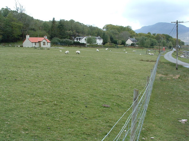
Portfield Farm
Portfield Farm
Footpath and Basalt outcrop The coastline and footpath just south of the view point.
Footpath and Basalt outcrop
The coastline and footpath just south of the view point.
Port Iol-bheathain A possible landing spot on the section of the south coast of Mull between Lochs Spelve and Buie, which becomes increasingly remote and committing as a sea kayak trip continuing further southwest. Seen here a little after high tide a day or so after neaps, in stable weather with virtually no swell, perhaps unusual for early March. Inland, an extensive patch of mainly birch woodland lies around and above the confluence of the Allt a'Chrogain Bhig and Allt na Teanga-coille.
Port Iol-bheathain
A possible landing spot on the section of the south coast of Mull between Lochs Spelve and Buie, which becomes increasingly remote and committing as a sea kayak trip continuing further southwest. Seen here a little after high tide a day or so after neaps, in stable weather with virtually no swell, perhaps unusual for early March. Inland, an extensive patch of mainly birch woodland lies around and above the confluence of the Allt a'Chrogain Bhig and Allt na Teanga-coille.
Rubha Mhàirtein Although there was only a foot or so of swell, it was surging into this small geo quite excitingly, with the occasional splash of spray thrown in the air at the back. Behind, a fossil wave-cut platform lies in front of the cliffs of Aoineadh Mhàirtein, indicating how much this bit of the island of Mull has risen by isostatic rebound since the ice age - the land has risen by more than the rise in sea level caused by melting of the ice.
Rubha Mhàirtein
Although there was only a foot or so of swell, it was surging into this small geo quite excitingly, with the occasional splash of spray thrown in the air at the back. Behind, a fossil wave-cut platform lies in front of the cliffs of Aoineadh Mhàirtein, indicating how much this bit of the island of Mull has risen by isostatic rebound since the ice age - the land has risen by more than the rise in sea level caused by melting of the ice.
Shore below Cruach na h-Airighe Although this section of coast is not inaccessible on foot, the height of the fossil wave-cut platform above current sea level leaves a rocky obstacle to any landing from a sea kayak, making it a fairly committing stretch of coast to paddle. Once landed, it would be a rough walk to escape to the minor road to Croggan.
Shore below Cruach na h-Airighe
Although this section of coast is not inaccessible on foot, the height of the fossil wave-cut platform above current sea level leaves a rocky obstacle to any landing from a sea kayak, making it a fairly committing stretch of coast to paddle. Once landed, it would be a rough walk to escape to the minor road to Croggan.
Crogan Beag Descending from <a href="https://www.geograph.org.uk/photo/1753407">NM6925 : Cruach na h-Airighe</a> by the northeast ridge, the Allt a'Chrogain Bhig starts to cut down a shallow valley to the right, leaving a slightly lower parallel ridge between the walker and the coast. The Firth of Lorn is still visible over this, in the haze. The skerry visible to the left is <a href="https://www.geograph.org.uk/photo/1616407">NM7625 : Dubh Sgeir</a>, a low rock towards the far side of the channel.
Crogan Beag
Descending from NM6925 : Cruach na h-Airighe by the northeast ridge, the Allt a'Chrogain Bhig starts to cut down a shallow valley to the right, leaving a slightly lower parallel ridge between the walker and the coast. The Firth of Lorn is still visible over this, in the haze. The skerry visible to the left is NM7625 : Dubh Sgeir, a low rock towards the far side of the channel.
Coire nan Each Although named Coire nan Each on the map, this isn't what I'd normally think of as a Corrie (excavated by a glacier from the side of a mountain), but just a shallow valley formed by the Allt Mor as it drains northeast from the slopes of Cruach na h-Airighe. The view looks down towards Loch Spelve, at about the location of Croggan, though that community is hidden by steeper slopes nearer to the loch. To the right is the rounded summit of Carn Ban, at 248m, probably about 50m higher than the photographer.
Coire nan Each
Although named Coire nan Each on the map, this isn't what I'd normally think of as a Corrie (excavated by a glacier from the side of a mountain), but just a shallow valley formed by the Allt Mor as it drains northeast from the slopes of Cruach na h-Airighe. The view looks down towards Loch Spelve, at about the location of Croggan, though that community is hidden by steeper slopes nearer to the loch. To the right is the rounded summit of Carn Ban, at 248m, probably about 50m higher than the photographer.
Allt na Teanga-coille Having descended Crogan Beag, staying above the streams draining to the southeast and the Firth of Lorn, this photograph was taken when just about to cross over the Allt na Teanga-coille onto Maol a'Chrogain, and the descent to Portfield at the end of the track which continues the line of the road beyond Croggan. The stream here descends a wooded defile, joining with the Allt a' Chrogain Bhig just before flowing into the sea at <a href="https://www.geograph.org.uk/photo/1750165">NM6924 : Port na Muice Duibhe</a>
Allt na Teanga-coille
Having descended Crogan Beag, staying above the streams draining to the southeast and the Firth of Lorn, this photograph was taken when just about to cross over the Allt na Teanga-coille onto Maol a'Chrogain, and the descent to Portfield at the end of the track which continues the line of the road beyond Croggan. The stream here descends a wooded defile, joining with the Allt a' Chrogain Bhig just before flowing into the sea at NM6924 : Port na Muice Duibhe
Port na Muice Duibhe A tiny and steep shingle beach, which offers a landing for a sea kayak only in a sea with little or no swell, but is probably the best chance of getting off the water for a couple of kilometres either side. There might be room to camp, but really you wouldn't want to get trapped here by a deterioration in the conditions.
Port na Muice Duibhe
A tiny and steep shingle beach, which offers a landing for a sea kayak only in a sea with little or no swell, but is probably the best chance of getting off the water for a couple of kilometres either side. There might be room to camp, but really you wouldn't want to get trapped here by a deterioration in the conditions.
Cliffs at Lag a' Chomhaich The cliffs at this point rise about 190m above the fossil wave-cut platform which stands just above current sea level, making any landing from the sea difficult for a long stretch of this coast, even in calm conditions. This is a remote and committing bit of coast to paddle by sea kayak, offering few landings and no easy escape on foot.

The rocks are cut by intrusions such as the prominent dike seen on the left of this view, standing proud from the cliffs because it is a harder and less easily eroded rock.
Cliffs at Lag a' Chomhaich
The cliffs at this point rise about 190m above the fossil wave-cut platform which stands just above current sea level, making any landing from the sea difficult for a long stretch of this coast, even in calm conditions. This is a remote and committing bit of coast to paddle by sea kayak, offering few landings and no easy escape on foot. The rocks are cut by intrusions such as the prominent dike seen on the left of this view, standing proud from the cliffs because it is a harder and less easily eroded rock.
Stream cuts through dike, below Maol Bàn One of many small streams falling from the cliffs of this stretch of coast on the south of Mull, this one is interesting in that it cuts through a basalt dike (turned reddish by weathering). The dike, being of a harder rock than its surroundings, is less easily eroded, and stands out on the hillside to the left of the stream, but can also be seen in the foreground right of centre. In between the two outcrops, it is buried beneath the alluvial fan of the small stream.
Stream cuts through dike, below Maol Bàn
One of many small streams falling from the cliffs of this stretch of coast on the south of Mull, this one is interesting in that it cuts through a basalt dike (turned reddish by weathering). The dike, being of a harder rock than its surroundings, is less easily eroded, and stands out on the hillside to the left of the stream, but can also be seen in the foreground right of centre. In between the two outcrops, it is buried beneath the alluvial fan of the small stream.
Lochan na Clòidheig This small lochan lies just SW of the broad col between Allt a'Chorrain and Allt na Muice Duibhe on the main ridge of the Lagan peninsula. The photo looks towards Maol Ban.
Lochan na Clòidheig
This small lochan lies just SW of the broad col between Allt a'Chorrain and Allt na Muice Duibhe on the main ridge of the Lagan peninsula. The photo looks towards Maol Ban.
Cruach na h-Airighe A somewhat pathless approach from the shores of Loch Spelve to the north led to the col to the west, from where a bit of a path developed up the WSW ridge - probably still only an animal track, I don't think this is a popular mountain, not having the distinction of appearing in anyone's tables (Munro, Corbett, etc.) as it is only 296m. However, the ridge does have good sea views to the SE, and snow on the top in March gives it at least the feel of a bigger hill. The way off the summit to the northeast was definitely a better route than the way up.
Cruach na h-Airighe
A somewhat pathless approach from the shores of Loch Spelve to the north led to the col to the west, from where a bit of a path developed up the WSW ridge - probably still only an animal track, I don't think this is a popular mountain, not having the distinction of appearing in anyone's tables (Munro, Corbett, etc.) as it is only 296m. However, the ridge does have good sea views to the SE, and snow on the top in March gives it at least the feel of a bigger hill. The way off the summit to the northeast was definitely a better route than the way up.
Moorland, Laggan Deer Forest Rough grassland near the summit of Maol Bàn. The rocky ridge is a long feature made of a more resistant igneous rock than the main bulk of the hill.
Moorland, Laggan Deer Forest
Rough grassland near the summit of Maol Bàn. The rocky ridge is a long feature made of a more resistant igneous rock than the main bulk of the hill.
Descending From Maol Ban Descending initially in a northerly direction from Maol Ban.
Descending From Maol Ban
Descending initially in a northerly direction from Maol Ban.
Show me another place!

Geodha Ceann Dà Aoineadh is located at Grid Ref: NM7024 (Lat: 56.356253, Lng: -5.7174349)

Unitary Authority: Argyll and Bute

Police Authority: Argyll and West Dunbartonshire

What 3 Words

///clockwork.shark.pints. Near Lochbuie, Argyll & Bute

Related Wikis

Croggan

Croggan is a small scattered settlement on the Loch Spelve sea loch, in the south of the Isle of Mull, Argyll and Bute, Scotland. It is located in the...

Firth of Lorn

The Firth of Lorn or Lorne (Scottish Gaelic: An Linne Latharnach) is the inlet of the sea between the south-east coast of the Isle of Mull and the mainland...

Loch Spelve

Loch Spelve is a sea loch on the southeast coast of the Isle of Mull, off the west coast of Scotland. It is almost landlocked with a relatively narrow...

Creach-Beinn (Mull)

Creach-Beinn (698 m) is a mountain in the south of the Isle of Mull, Scotland. It rises above the northern shore of Loch Spelve. A rocky mountain with...

Nearby Amenities

Located within 500m of 56.356253,-5.7174349
Created By: dmgroom_coastlines
Source: PGS
Lat/Long: 56.359619/-5.712528
Source: PGS
Lat/Long: 56.3593475/-5.7130913
Created By: dmgroom_coastlines
Source: PGS
Lat/Long: 56.359082/-5.713643
Created By: dmgroom_coastlines
Source: PGS
Lat/Long: 56.358315/-5.713588
Created By: dmgroom_coastlines
Source: PGS
Lat/Long: 56.358166/-5.7145
Created By: dmgroom_coastlines
Source: PGS
Lat/Long: 56.358034/-5.714723
Source: PGS
Lat/Long: 56.3576957/-5.7154151
Created By: dmgroom_coastlines
Source: PGS
Lat/Long: 56.357231/-5.71628
Created By: dmgroom_coastlines
Source: PGS
Lat/Long: 56.356459/-5.716456
Created By: dmgroom_coastlines
Source: PGS
Lat/Long: 56.356325/-5.716677
Created By: dmgroom_coastlines
Source: PGS
Lat/Long: 56.356305/-5.717598
Created By: dmgroom_coastlines
Source: PGS
Lat/Long: 56.356424/-5.718068
Created By: dmgroom_coastlines
Source: PGS
Lat/Long: 56.355917/-5.717802
Source: PGS
Lat/Long: 56.355947/-5.7182851
Source: PGS
Lat/Long: 56.3559241/-5.7187942
Created By: dmgroom_coastlines
Source: PGS
Lat/Long: 56.355763/-5.718944
Created By: dmgroom_coastlines
Source: PGS
Lat/Long: 56.355616/-5.719856
Created By: dmgroom_coastlines
Source: PGS
Lat/Long: 56.355099/-5.720051
Created By: dmgroom_coastlines
Source: PGS
Lat/Long: 56.354966/-5.720271
Created By: dmgroom_coastlines
Source: PGS
Lat/Long: 56.354956/-5.720732
Created By: dmgroom_coastlines
Source: PGS
Lat/Long: 56.354935/-5.721653
Created By: dmgroom_coastlines
Source: PGS
Lat/Long: 56.354925/-5.722114
Created By: dmgroom_coastlines
Source: PGS
Lat/Long: 56.354915/-5.722575
Created By: dmgroom_coastlines
Source: PGS
Lat/Long: 56.354783/-5.722797
Created By: dmgroom_coastlines
Source: PGS
Lat/Long: 56.354649/-5.723017
Created By: dmgroom_coastlines
Source: PGS
Lat/Long: 56.354363/-5.724381
The data included in this document is from www.openstreetmap.org. The data is made available under ODbL.

Have you been to Geodha Ceann Dà Aoineadh?

Leave your review of Geodha Ceann Dà Aoineadh below (or comments, questions and feedback).