Innean a' Chromain

Coastal Feature, Headland, Point in Argyllshire

Scotland

Innean a' Chromain

Old milestone There are 6 milestones with the legend stating that they are 10 miles from Campbeltown. This stone is the most southerly on the minor road south then west from Polliwilline towards Dunglass. It is near the track to Kilmashenachan.
Old milestone Credit: Jon Glew

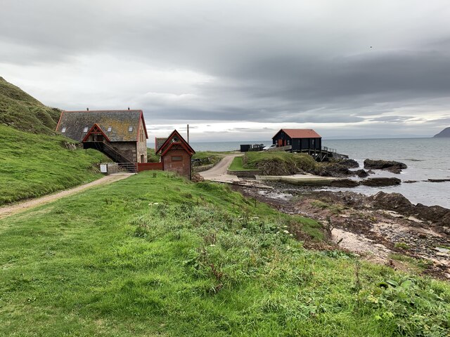
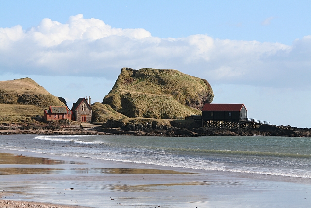
Innean a' Chromain, located in Argyllshire, is a prominent coastal feature that boasts breathtaking views and unique geological formations. This headland, also known as Crombie Point, juts out into the sea, forming a striking landmark on the western coast of Scotland.

The rugged cliffs of Innean a' Chromain are composed of ancient rock layers, with prominent bands of sandstone and shale visible along the coastline. These geological formations provide a glimpse into the region's geological history, dating back millions of years.

The headland is home to a diverse array of flora and fauna, with seabirds nesting on its steep cliffs and seals often seen basking on the nearby rocks. The surrounding waters are rich in marine life, attracting fishermen and nature enthusiasts alike.

Visitors to Innean a' Chromain can enjoy panoramic views of the sea, with the Isle of Mull and other nearby islands dotting the horizon. The headland offers a peaceful and tranquil setting, perfect for leisurely walks, picnics, or simply taking in the stunning coastal scenery.

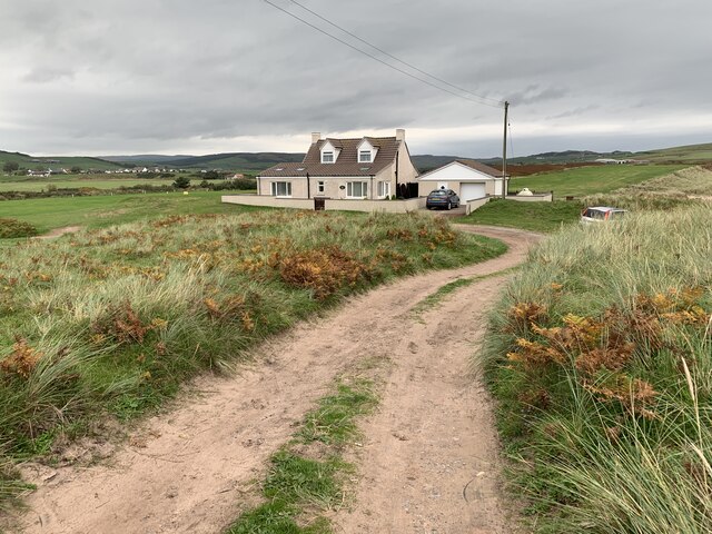
Access to Innean a' Chromain is relatively easy, with a well-maintained footpath leading to the headland from the nearby village. The area is also popular among photographers, who come to capture the dramatic cliffs, crashing waves, and vibrant sunsets.

In summary, Innean a' Chromain is a captivating coastal feature in Argyllshire, Scotland. Its striking cliffs, diverse wildlife, and panoramic views make it a must-visit destination for nature lovers and those seeking a serene coastal experience.

If you have any feedback on the listing, please let us know in the comments section below.

Innean a' Chromain Images

Images are sourced within 2km of 55.307574/-5.6204233 or Grid Reference NR7007. Thanks to Geograph Open Source API. All images are credited.

Old milestone There are 6 milestones with the legend stating that they are 10 miles from Campbeltown. This stone is the most southerly on the minor road south then west from Polliwilline towards Dunglass. It is near the track to Kilmashenachan.
Old milestone
There are 6 milestones with the legend stating that they are 10 miles from Campbeltown. This stone is the most southerly on the minor road south then west from Polliwilline towards Dunglass. It is near the track to Kilmashenachan.
Milestone, Kilbride From Campbn 10 miles.
Milestone, Kilbride
From Campbn 10 miles.
Pasture, Kilbride
Pasture, Kilbride
Minor road and Bridge crossing Conieglen Water at Mill Park Looking north-westward.
Minor road and Bridge crossing Conieglen Water at Mill Park
Looking north-westward.
Track to Kilmanshenachan Looking south-eastward. The track is also used by the Kintyre Way long distance path.
Track to Kilmanshenachan
Looking south-eastward. The track is also used by the Kintyre Way long distance path.
Minor road near to Aucharua Looking north-westward.
Minor road near to Aucharua
Looking north-westward.
Slipways in Dunaverty Bay Looking south.
Slipways in Dunaverty Bay
Looking south.
Dunaverty Cottage On the peninsula near the remains of Dunaverty Castle.
Dunaverty Cottage
On the peninsula near the remains of Dunaverty Castle.
Footbridge over Conieglen Water Near Dunaverty Castle.
Footbridge over Conieglen Water
Near Dunaverty Castle.
Dunaverty Golf Club Near Southend.
Dunaverty Golf Club
Near Southend.
Mauneroy tearoom and store In Southend.
Mauneroy tearoom and store
In Southend.
Machribeg Farm Near Southend.
Machribeg Farm
Near Southend.
Former United Presbyterian Church, Southend Category B listed. Listing reference LB18345.
Church opened in 1797. It became a United Presbyterian Church and was rebuilt in 1889 to the designs of architect Robert Hay of Glasgow. Became Church of Scotland in 1946 and named St Columba's Church. Closed in 1965.
Former United Presbyterian Church, Southend
Category B listed. Listing reference LB18345. Church opened in 1797. It became a United Presbyterian Church and was rebuilt in 1889 to the designs of architect Robert Hay of Glasgow. Became Church of Scotland in 1946 and named St Columba's Church. Closed in 1965.
Rocky foreshore on sandy beach below Kilmashenachan Mull of Kintyre, from PS Waverley
Rocky foreshore on sandy beach below Kilmashenachan
Mull of Kintyre, from PS Waverley
Milestone, Kilbride 10 miles to Campbeltown.
Milestone, Kilbride
10 miles to Campbeltown.
Minor road near Mill Park
Blasthill Farm
Blasthill Farm
Show me another place!

Innean a' Chromain is located at Grid Ref: NR7007 (Lat: 55.307574, Lng: -5.6204233)

Unitary Authority: Argyll and Bute

Police Authority: Argyll and West Dunbartonshire

What 3 Words

///prominent.decanter.football. Near Campbeltown, Argyll & Bute

Related Wikis

Dunaverty Castle

Dunaverty Castle is located at Southend at the southern end of the Kintyre peninsula in western Scotland. The site was once a fort belonging to the Clan...

Battle of Dunaverty

The Battle of Dunaverty involved a battle and the siege of Dunaverty Castle in Kintyre, Scotland, in 1647. The events involved the Covenanter Army under...

Southend, Argyll

Southend (Scottish Gaelic: Ceann mu Dheas, pronounced [ˈkʲʰaun̪ˠ mə ˈʝes̪]) is the main settlement at the southern end of the Kintyre peninsula in Argyll...

Keil Hotel

Keil Hotel is a former hotel near Southend, Kintyre in western Scotland. == History and architecture == It was constructed between 1937 and 1939 for Captain...

Nearby Amenities

Located within 500m of 55.307574,-5.6204233
Waterway: waterfall
Lat/Long: 55.3090009/-5.6131179
Power: pole
Lat/Long: 55.3112962/-5.6241957
Power: pole
Lat/Long: 55.3105402/-5.6232296
Power: pole
Lat/Long: 55.3097677/-5.6222105
Power: pole
Lat/Long: 55.3089854/-5.6212135
Power: pole
Lat/Long: 55.3082542/-5.620262
Power: pole
Lat/Long: 55.3076123/-5.6194147
Man Made: mast
Tower Type: communication
Lat/Long: 55.3074949/-5.6193373
The data included in this document is from www.openstreetmap.org. The data is made available under ODbL.

Have you been to Innean a' Chromain?

Leave your review of Innean a' Chromain below (or comments, questions and feedback).