Sgeir nan Gabhar

Coastal Feature, Headland, Point in Argyllshire

Scotland

Sgeir nan Gabhar

Port an Eag-uillt, Scarba One of the few places to land on Scarba.
Port an Eag-uillt, Scarba Credit: M J Richardson

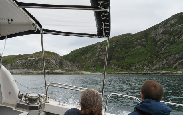
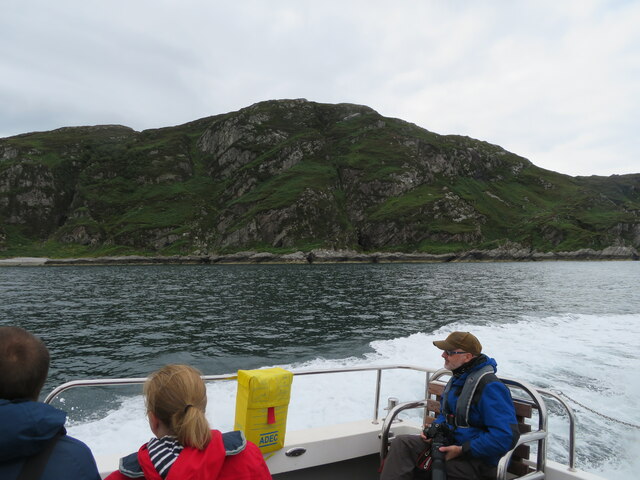
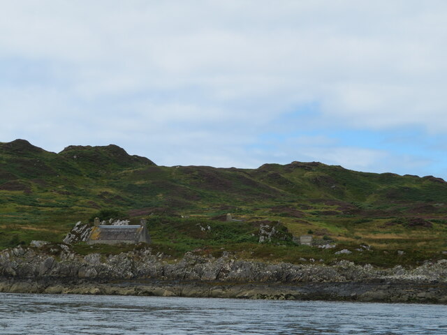
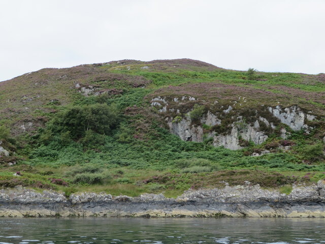
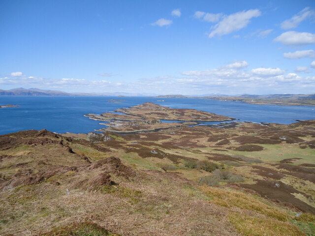
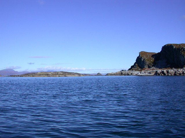
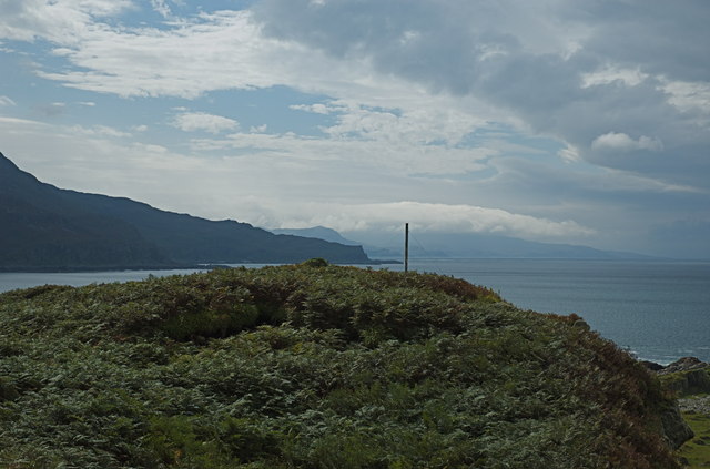
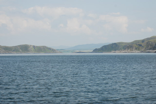
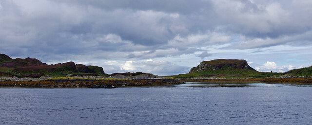
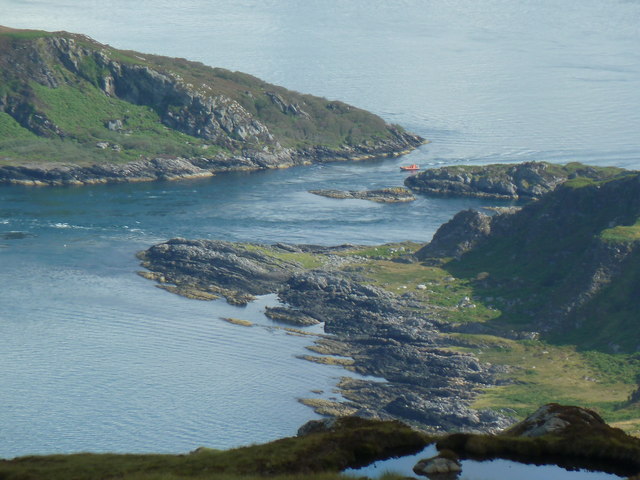
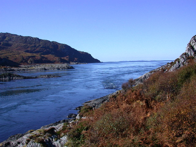
Sgeir nan Gabhar is a small rocky islet located off the coast of Argyllshire, Scotland. This coastal feature is known for its rugged terrain and unique geological formations, making it a popular destination for outdoor enthusiasts and nature lovers.

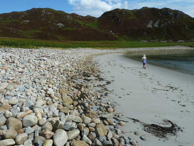
The name Sgeir nan Gabhar translates to "Rock of the Goats" in Gaelic, reflecting the presence of wild goats that inhabit the area. The islet is characterized by steep cliffs, rocky outcrops, and tidal pools, creating a diverse habitat for a variety of marine and bird species.

Sgeir nan Gabhar is also a popular spot for birdwatching, with a number of seabirds nesting on the cliffs and using the islet as a resting place during migration. The surrounding waters are teeming with marine life, making it a great spot for snorkeling and diving.

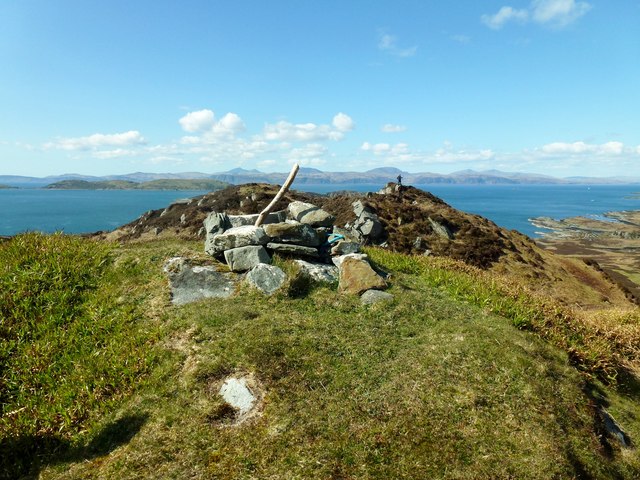
Access to Sgeir nan Gabhar is primarily by boat, with visitors able to explore the islet's rugged coastline and observe the wildlife from a safe distance. The area is also a designated nature reserve, ensuring the protection and preservation of its unique ecosystem for future generations to enjoy.

If you have any feedback on the listing, please let us know in the comments section below.

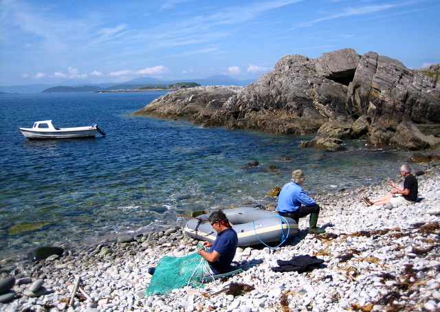
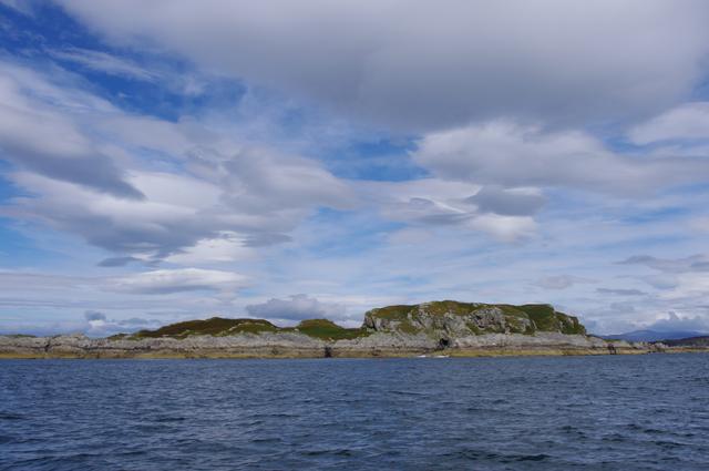
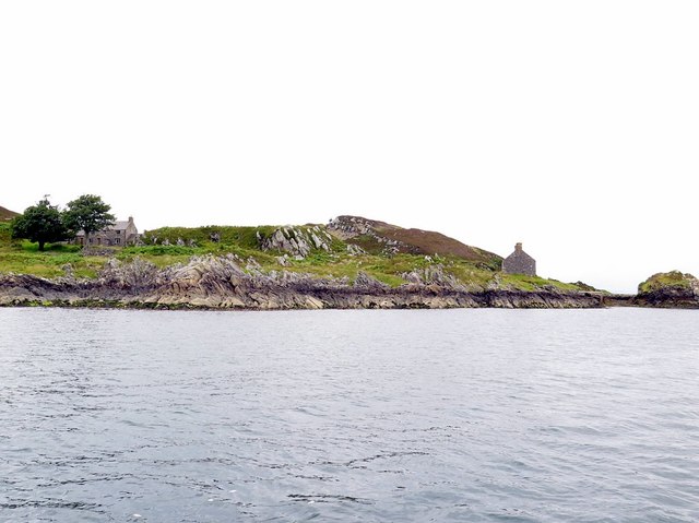
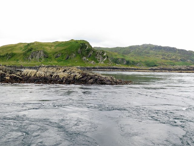
Sgeir nan Gabhar Images

Images are sourced within 2km of 56.207979/-5.7121554 or Grid Reference NM6907. Thanks to Geograph Open Source API. All images are credited.

Port an Eag-uillt, Scarba One of the few places to land on Scarba.
Port an Eag-uillt, Scarba
One of the few places to land on Scarba.
The north coast of Scarba Port an Eag-Uillt is just visible on the left.
The north coast of Scarba
Port an Eag-Uillt is just visible on the left.
Cottage on Lunga On the east coast of this Slate Island, in the Sound of Luing. There is also a larger house <a href="https://www.geograph.org.uk/photo/6932677">NM7108 : House on the Slate Island of Lunga</a>, obscured by the rock behind the cottage.
Cottage on Lunga
On the east coast of this Slate Island, in the Sound of Luing. There is also a larger house NM7108 : House on the Slate Island of Lunga, obscured by the rock behind the cottage.
House on the Slate Island of Lunga Seen from the Sound of Luing.
House on the Slate Island of Lunga
Seen from the Sound of Luing.
Barr Sligeig, on Lunga At 49 m, one of the higher points of Lunga; Bidein na h-Iolaire, at 100 m, is the highest. The rock would appear to be relatively soft - note the undercut at what would be the high tide mark?
Barr Sligeig, on Lunga
At 49 m, one of the higher points of Lunga; Bidein na h-Iolaire, at 100 m, is the highest. The rock would appear to be relatively soft - note the undercut at what would be the high tide mark?
Looking north from Lunga island summit In the foreground are two separate, but tidal islands, Eilean Iosal and Rubha Fiola. Further away can be seen Inch Island in the Firth of Lorn, and Seil to its right.
Looking north from Lunga island summit
In the foreground are two separate, but tidal islands, Eilean Iosal and Rubha Fiola. Further away can be seen Inch Island in the Firth of Lorn, and Seil to its right.
Northern tip of Guirasdeal Guirasdeal looking North to Lunga (right) and the black isle (left).
Northern tip of Guirasdeal
Guirasdeal looking North to Lunga (right) and the black isle (left).
Summit of Guirasdeal Summit of Guirasdeal, with Scarba and Jura in the distance.
Summit of Guirasdeal
Summit of Guirasdeal, with Scarba and Jura in the distance.
East towards the Grey Dogs Looking East towards the Grey Dogs - Scarba on the right, Lunga on the left.
East towards the Grey Dogs
Looking East towards the Grey Dogs - Scarba on the right, Lunga on the left.
Port an Eag-Uillt, Scarba Wonderful pebble beach on north coast of Scarba looking towards the Garvellachs and Mull.
Port an Eag-Uillt, Scarba
Wonderful pebble beach on north coast of Scarba looking towards the Garvellachs and Mull.
Guirasdeal from the SE At low water.
Guirasdeal from the SE
At low water.
Houses on east coast of Lunga Lunga is one of the Slate Islands in the Firth of Lorn. The 'Grey Dog' tidal race, which runs in the sea channel to the south, Bealach a' Choin Ghlais, reaches 8 knots in full flood. The name 'Lunga' is derived from the Old Norse for 'Isle of the Longships', but almost all other place names are Gaelic in origin.
<span class="nowrap"><a title="https://en.wikipedia.org/wiki/Lunga_(Slate_Islands)" rel="nofollow ugc noopener" href="https://en.wikipedia.org/wiki/Lunga_(Slate_Islands)">Link</a><img style="margin-left:2px;" alt="External link" title="External link - shift click to open in new window" src="https://s1.geograph.org.uk/img/external.png" width="10" height="10"/></span>
Houses on east coast of Lunga
Lunga is one of the Slate Islands in the Firth of Lorn. The 'Grey Dog' tidal race, which runs in the sea channel to the south, Bealach a' Choin Ghlais, reaches 8 knots in full flood. The name 'Lunga' is derived from the Old Norse for 'Isle of the Longships', but almost all other place names are Gaelic in origin. LinkExternal link
Incoming tide at The Grey Dogs The channel to the south of the Island of Lunga, Bealach a' Choin Ghlais (Pass of the Grey Dog), is only 200 metres wide and is scoured by the notorious 'Grey Dog' tidal race which reaches 8 knots when in full flood. According to an 1845 description:
    '... about 1 cable broad, and the stream of water during the greater part of ebb and flood rushes along the narrow pass with much violence. So great is the overfall on the current, that even during moderate tides it is impossible to force a boat through.'

This strait is sometimes called the 'Little Corryvreckan' after its greater cousin between Scarba and Jura just a few miles to the south.
<span class="nowrap"><a title="https://en.wikipedia.org/wiki/Lunga_(Slate_Islands)" rel="nofollow ugc noopener" href="https://en.wikipedia.org/wiki/Lunga_(Slate_Islands)">Link</a><img style="margin-left:2px;" alt="External link" title="External link - shift click to open in new window" src="https://s1.geograph.org.uk/img/external.png" width="10" height="10"/></span>

The place is said to be named after Bhreacan's faithful dog who having pulled the body of his master ashore after capsizing in the Corryvreckan whirlpool, then perished itself in 'Little Corryvreckan'.

It is often quoted that the Royal Navy described the Gulf of Corryvreckan as unnavigable but it appears that the warning phrase in the West Coast Pilot refers to this narrower channel:
'It is reported that the excessive rate of the tidal stream and the narrow width of the E entrance channel create an unnavigable area just S of Eilean a’ Bhealaich, an islet in the centre of the E entrance. As a result, it is inadvisable to pass through this channel, and even with local knowledge passage should only be attempted in quiet weather at slack water.'
<span class="nowrap"><a title="http://www.whirlpool-scotland.co.uk/royalnavy.html" rel="nofollow ugc noopener" href="http://www.whirlpool-scotland.co.uk/royalnavy.html">Link</a><img style="margin-left:2px;" alt="External link" title="External link - shift click to open in new window" src="https://s1.geograph.org.uk/img/external.png" width="10" height="10"/></span>
Incoming tide at The Grey Dogs
The channel to the south of the Island of Lunga, Bealach a' Choin Ghlais (Pass of the Grey Dog), is only 200 metres wide and is scoured by the notorious 'Grey Dog' tidal race which reaches 8 knots when in full flood. According to an 1845 description: '... about 1 cable broad, and the stream of water during the greater part of ebb and flood rushes along the narrow pass with much violence. So great is the overfall on the current, that even during moderate tides it is impossible to force a boat through.' This strait is sometimes called the 'Little Corryvreckan' after its greater cousin between Scarba and Jura just a few miles to the south. LinkExternal link The place is said to be named after Bhreacan's faithful dog who having pulled the body of his master ashore after capsizing in the Corryvreckan whirlpool, then perished itself in 'Little Corryvreckan'. It is often quoted that the Royal Navy described the Gulf of Corryvreckan as unnavigable but it appears that the warning phrase in the West Coast Pilot refers to this narrower channel: 'It is reported that the excessive rate of the tidal stream and the narrow width of the E entrance channel create an unnavigable area just S of Eilean a’ Bhealaich, an islet in the centre of the E entrance. As a result, it is inadvisable to pass through this channel, and even with local knowledge passage should only be attempted in quiet weather at slack water.' LinkExternal link
North end of Lunga Looking west from the Sound of Luing through the narrow strait between Lunga (left) and Fiola Meadhonach (extreme right), to Fiola an Droma (centre right).
North end of Lunga
Looking west from the Sound of Luing through the narrow strait between Lunga (left) and Fiola Meadhonach (extreme right), to Fiola an Droma (centre right).
The Grey Dogs Dinghy approaching the Grey Dogs tidal race between Scarba and Lunga
The Grey Dogs
Dinghy approaching the Grey Dogs tidal race between Scarba and Lunga
Beach at Camas a' Mhor-Fhir The ridge of Bidein na h-Iolaire appears on the skyline.  This is the highest point on Lunga and although marked on OS maps as 98m, resurveys have put its height at 100m, qualifying it a Scottish HUMP.
Beach at Camas a' Mhor-Fhir
The ridge of Bidein na h-Iolaire appears on the skyline. This is the highest point on Lunga and although marked on OS maps as 98m, resurveys have put its height at 100m, qualifying it a Scottish HUMP.
Bidein na h-Iolaire, Lunga From Scarba through a narrow channel to Camas a' Mhòr-Fhir, up the cliff and then much fun was had trying to guess which was the true summit and whether it was really a Hump or not. Smashing views however. Walked over four likely summits after tricky landing, lovely island on a calm sunny day.


Name: Bidein na h-Iolaire
Hill number: 4873
Height: 101m / 331ft
Area: 20A: Jura, Scarba and Colonsay
Class: Hu
Grid ref: NM 70665 08602
Summit feature: no feature 60m WNW of cairn
Drop: 101m
Col: Sea
Bidein na h-Iolaire, Lunga
From Scarba through a narrow channel to Camas a' Mhòr-Fhir, up the cliff and then much fun was had trying to guess which was the true summit and whether it was really a Hump or not. Smashing views however. Walked over four likely summits after tricky landing, lovely island on a calm sunny day. Name: Bidein na h-Iolaire Hill number: 4873 Height: 101m / 331ft Area: 20A: Jura, Scarba and Colonsay Class: Hu Grid ref: NM 70665 08602 Summit feature: no feature 60m WNW of cairn Drop: 101m Col: Sea
Bealach a' Choin Ghlais The Little Corryvreckan, or Grey dogs is the narrow tidal channel between the islands of Scarba and Lunga. The tide rips through here at 8 knots on Spring tides. View to the West, taken from Lunga and Scarba is on the left.
Bealach a' Choin Ghlais
The Little Corryvreckan, or Grey dogs is the narrow tidal channel between the islands of Scarba and Lunga. The tide rips through here at 8 knots on Spring tides. View to the West, taken from Lunga and Scarba is on the left.
Show me another place!

Sgeir nan Gabhar is located at Grid Ref: NM6907 (Lat: 56.207979, Lng: -5.7121554)

Unitary Authority: Argyll and Bute

Police Authority: Argyll and West Dunbartonshire

What 3 Words

///steamed.smokers.torso. Near Lochbuie, Argyll & Bute

Related Wikis

Lunga, Firth of Lorn

Lunga is one of the Slate Islands in the Firth of Lorn in Argyll and Bute, Scotland. The "Grey Dog" tidal race, which runs in the sea channel to the south...

Scarba, Lunga and the Garvellachs National Scenic Area

Scarba, Lunga and the Garvellachs is the name of one of the 40 national scenic areas of Scotland. The designated area covers the islands of Scarba, Lunga...

Eilean Dubh Mòr

Eilean Dubh Mòr (Scottish Gaelic: big black island) is an uninhabited island in the Inner Hebrides of Scotland. It lies at the mouth of the Firth of Lorn...

Scarba

Scarba (Scottish Gaelic: Sgarba) is an island, in Argyll and Bute, Scotland, just north of the much larger island of Jura. The island has not been permanently...

Nearby Amenities

Located within 500m of 56.207979,-5.7121554
Source: PGS
Lat/Long: 56.2097618/-5.7141758
The data included in this document is from www.openstreetmap.org. The data is made available under ODbL.

Have you been to Sgeir nan Gabhar?

Leave your review of Sgeir nan Gabhar below (or comments, questions and feedback).