Carraig Mhòr nam Frìth-aoineadhean

Coastal Feature, Headland, Point in Argyllshire

Scotland

Carraig Mhòr nam Frìth-aoineadhean

Bagh Gleann nam Muc The Bay of the Pig's Glen at the NW tip of Jura along with Eilean Mor and Eilean Beag, seen from An Cruachan.
Bagh Gleann nam Muc Credit: Jim Barton

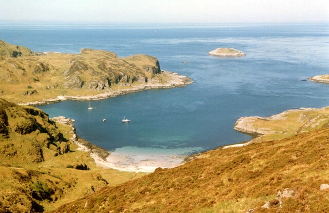
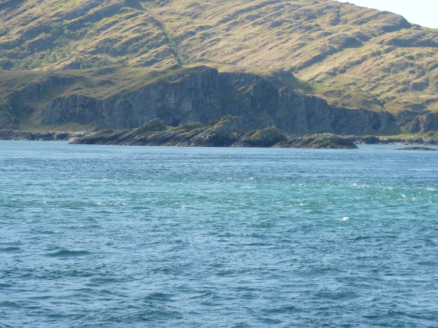
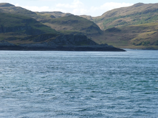
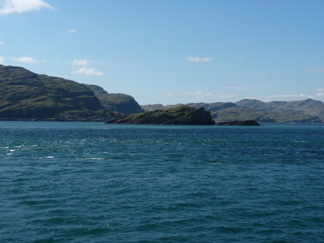
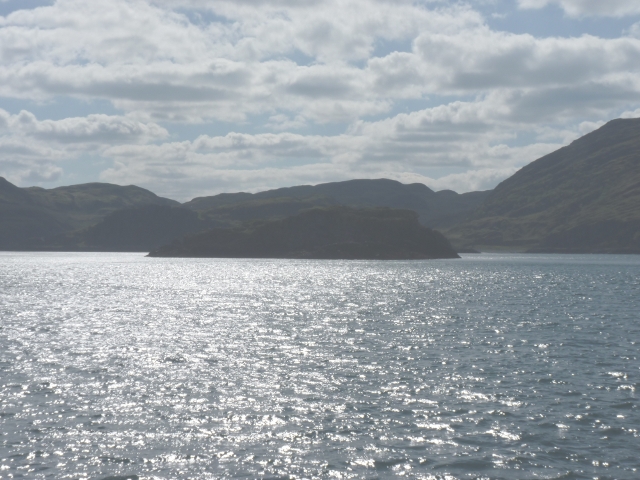
Carraig Mhòr nam Frìth-aoineadhean, located in Argyllshire, Scotland, is a stunning coastal feature that is often referred to as a headland or point. This rocky promontory juts out into the Atlantic Ocean, offering breathtaking views of the surrounding landscape.

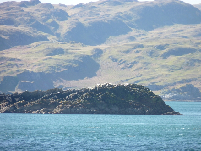
The name "Carraig Mhòr nam Frìth-aoineadhean" translates to "The Great Rock of the Seabirds" in English, which is a fitting description considering the abundant birdlife found in the area. Seabirds such as gannets, puffins, and guillemots can often be spotted nesting and fishing around the cliffs, adding to the natural beauty and charm of the place.

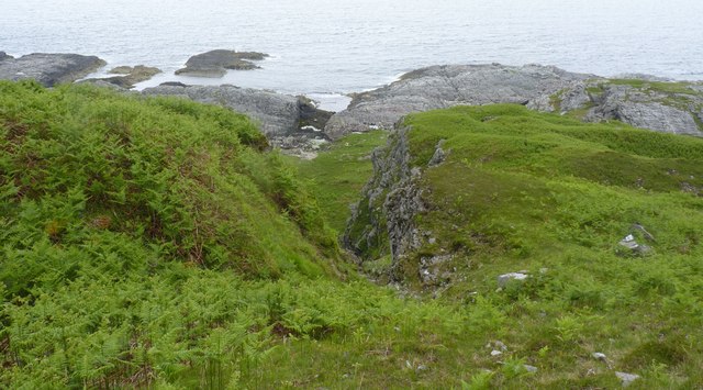
The headland is characterized by its rugged and jagged cliffs, which have been shaped by the relentless power of the ocean over countless years. These cliffs provide a dramatic backdrop for the crashing waves and create a sense of awe and wonder for visitors.

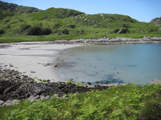
Carraig Mhòr nam Frìth-aoineadhean is a popular spot for outdoor enthusiasts and nature lovers. Hiking trails along the headland offer opportunities for exploration and discovery, allowing visitors to immerse themselves in the stunning coastal scenery. The area is also known for its diverse marine life, with sightings of seals, dolphins, and even whales being common occurrences.

For those seeking solitude and tranquility, Carraig Mhòr nam Frìth-aoineadhean provides a peaceful retreat away from the hustle and bustle of daily life. Whether one is captivated by the sight of soaring seabirds, the crashing waves, or the rugged beauty of the cliffs, this coastal feature offers an unforgettable experience for all who visit.

If you have any feedback on the listing, please let us know in the comments section below.

Carraig Mhòr nam Frìth-aoineadhean Images

Images are sourced within 2km of 56.131526/-5.748056 or Grid Reference NR6799. Thanks to Geograph Open Source API. All images are credited.

Bagh Gleann nam Muc The Bay of the Pig's Glen at the NW tip of Jura along with Eilean Mor and Eilean Beag, seen from An Cruachan.
Bagh Gleann nam Muc
The Bay of the Pig's Glen at the NW tip of Jura along with Eilean Mor and Eilean Beag, seen from An Cruachan.
Towards ruin below Cruach Eoghainn
Gleann nam Muc towards ruin
Natural arch at Glentrosdale Bay The west coast of Jura abounds with raised coastal features.
Natural arch at Glentrosdale Bay
The west coast of Jura abounds with raised coastal features.
Eilean Beag from Corryvreckan Was this the small island (what Eilean Beag means..) that George Orwell ended up stranded on with his son after getting into difficulties with the Corryvreckan whirlpool??? If not this then presumably the nearby Eilean Mòr (Big Island)
Eilean Beag from Corryvreckan
Was this the small island (what Eilean Beag means..) that George Orwell ended up stranded on with his son after getting into difficulties with the Corryvreckan whirlpool??? If not this then presumably the nearby Eilean Mòr (Big Island)
Eilean Beag with Jura beyond Islet hardly distinguishable from Jura.
Eilean Beag with Jura beyond
Islet hardly distinguishable from Jura.
Eilean Mòr from Corryvreckan From deck of the PS Waverley at slack tide: Well, you wouldn't want to go over Corryvreckan in a 1946-built steam powered paddle-steamer when the whirlpool is at its worst.
Eilean Mòr from Corryvreckan
From deck of the PS Waverley at slack tide: Well, you wouldn't want to go over Corryvreckan in a 1946-built steam powered paddle-steamer when the whirlpool is at its worst.
Guano-topped outlier of Eilean Mòr Small bit of rock favour by sea-birds, evidently, separated at high-tide from the rest of Eilean Mòr
Guano-topped outlier of Eilean Mòr
Small bit of rock favour by sea-birds, evidently, separated at high-tide from the rest of Eilean Mòr
Eilean Mòr with Jura beyond Glentrosdale Bay is the other side of Eilean Mòr. Bit washed-out as taken into sun bouncing off sea
Eilean Mòr with Jura beyond
Glentrosdale Bay is the other side of Eilean Mòr. Bit washed-out as taken into sun bouncing off sea
Bàgh Gleann nam Muc
Bàgh Gleann nam Muc
Waterfall near mouth of Glen Trosdale River, Jura
Glen Trosdale Bay, Jura A welcome sight after hours of traipsing through thick tussocks! The Hebridean Princess can just be seen in the distance - the more luxurious way to travel!
Glen Trosdale Bay, Jura
A welcome sight after hours of traipsing through thick tussocks! The Hebridean Princess can just be seen in the distance - the more luxurious way to travel!
Glen Trosdale Bay, Jura Taken from the cave at the north of the bay and therefore in a different square.
Glen Trosdale Bay, Jura
Taken from the cave at the north of the bay and therefore in a different square.
Ravine near Glen Trosdale, north Jura
Kayakers arriving at Glen Trosdale Bay, Jura Just when you think you've got the place to yourself . . .
Kayakers arriving at Glen Trosdale Bay, Jura
Just when you think you've got the place to yourself . . .
Shoreline of Bàgh Gleann na Muc Two of the many sea caves in the vicinity can be seen.
Shoreline of Bàgh Gleann na Muc
Two of the many sea caves in the vicinity can be seen.
North end of Eilean Beag Small island off the northern end of the Isle of Jura. The Isle of Scarba can be seen to the left with the Scottish mainland in the distance.
North end of Eilean Beag
Small island off the northern end of the Isle of Jura. The Isle of Scarba can be seen to the left with the Scottish mainland in the distance.
Approaching Corryvreckan A cruise ship about to cross the usually turbulent strait between Scarba and Jura. Corryvreckan can be quite a busy waterway, and when I once had a short holiday in the north of Jura, I was surprised to see how many boats went through. Corryvreckan is one of the worlds most notorious tide races.
Approaching Corryvreckan
A cruise ship about to cross the usually turbulent strait between Scarba and Jura. Corryvreckan can be quite a busy waterway, and when I once had a short holiday in the north of Jura, I was surprised to see how many boats went through. Corryvreckan is one of the worlds most notorious tide races.
Show me another place!

Carraig Mhòr nam Frìth-aoineadhean is located at Grid Ref: NR6799 (Lat: 56.131526, Lng: -5.748056)

Unitary Authority: Argyll and Bute

Police Authority: Argyll and West Dunbartonshire

What 3 Words

///motive.nitrogen.timing. Near Lochgilphead, Argyll & Bute

Related Wikis

Kinuachdrachd

Kinuachdrachd or Kinuachdrach is a place about 22 miles from Craighouse on the island of Jura, in the council area of Argyll and Bute, Scotland. It comprises...

Gulf of Corryvreckan

The Gulf of Corryvreckan (from the Gaelic Coire Bhreacain, meaning 'cauldron of the speckled seas' or 'cauldron of the plaid'), also called the Strait...

Barnhill, Jura

Barnhill is a farmhouse in the north of the island of Jura in the Scottish Inner Hebrides overlooking the Sound of Jura. It stands on the site of a larger...

Scarba

Scarba (Scottish Gaelic: Sgarba) is an island, in Argyll and Bute, Scotland, just north of the much larger island of Jura. The island has not been permanently...

Nearby Amenities

Located within 500m of 56.131526,-5.748056
Source: PGS
Lat/Long: 56.1356965/-5.7481216
Source: PGS
Lat/Long: 56.1354157/-5.748915
Source: PGS
Lat/Long: 56.1347514/-5.7492893
Source: PGS
Lat/Long: 56.1345282/-5.7491766
Source: PGS
Lat/Long: 56.1342134/-5.7490097
Source: PGS
Lat/Long: 56.1339127/-5.7488198
Source: PGS
Lat/Long: 56.1336967/-5.7485491
Source: PGS
Lat/Long: 56.1330342/-5.7487236
Source: PGS
Lat/Long: 56.1328963/-5.748457
Source: PGS
Lat/Long: 56.1326351/-5.7486577
Source: PGS
Lat/Long: 56.1322435/-5.7484141
Source: PGS
Lat/Long: 56.1316997/-5.7485492
Source: PGS
Lat/Long: 56.1315939/-5.7487156
Source: PGS
Lat/Long: 56.1314396/-5.7487469
Source: PGS
Lat/Long: 56.1311091/-5.7485346
Source: PGS
Lat/Long: 56.1310513/-5.7482661
Source: PGS
Lat/Long: 56.1311497/-5.7475409
Source: PGS
Lat/Long: 56.1296842/-5.7457187
Uirigh Ghlas
Place: locality
Source: OS_OpenData_StreetView
Lat/Long: 56.1327584/-5.7434367
Bagh Uamh Mhor Beinn nan Capull
Natural: bay
Source: OS_OpenData_StreetView
Lat/Long: 56.1301544/-5.7489783
Caigeann Mor
Mountain Pass: yes
Source: OS_OpenData_StreetView
Lat/Long: 56.1301715/-5.7439669
Carraig Mhor nam Frith-aoineadhean
Natural: rock
Source: OS_OpenData_StreetView
Lat/Long: 56.1316071/-5.7478813
Uamh Mhor Beinn nan Capull
Natural: cave_entrance
Source: OS_OpenData_StreetView
Lat/Long: 56.1313703/-5.7440902
The data included in this document is from www.openstreetmap.org. The data is made available under ODbL.

Have you been to Carraig Mhòr nam Frìth-aoineadhean?

Leave your review of Carraig Mhòr nam Frìth-aoineadhean below (or comments, questions and feedback).