Dalmahoy, Long

Settlement in Midlothian

Scotland

Dalmahoy, Long

A sad site/sight Property at Balerno, on the 'bends' on the A70, as one leaves Balerno, which has appeared to have been abandoned for some years, looks as if something is happening at last.
A sad site/sight Credit: M J Richardson

Dalmahoy is a small village located in the county of Midlothian, Scotland. Situated approximately 7 miles west of the capital city of Edinburgh, it is nestled in the picturesque countryside of the region. The village is part of the wider Dalmahoy Estate, which encompasses a historic country house hotel and golf resort.

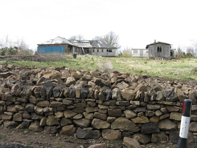
Dalmahoy village itself is a quaint and peaceful settlement, with a population of around 500 residents. It features a cluster of residential houses, many of which have traditional Scottish architectural designs. The village is surrounded by lush green fields, offering stunning views of the surrounding countryside.

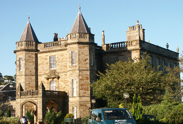
One of the main attractions in Dalmahoy is the Dalmahoy Hotel & Country Club. This grand 18th-century baronial mansion has been converted into a luxurious hotel, offering guests a unique blend of historic charm and modern amenities. The hotel boasts elegant rooms, fine dining options, and a range of leisure facilities, including a golf course, swimming pool, and spa.

The Dalmahoy Golf Course is a major draw for visitors to the area. Designed by renowned golf architect James Braid, it features two 18-hole courses that cater to both amateur and professional golfers. The courses are known for their challenging layout and beautiful surroundings, attracting golf enthusiasts from far and wide.

Overall, Dalmahoy is a tranquil village that offers a peaceful retreat from the hustle and bustle of city life. With its scenic landscapes, historic charm, and world-class amenities, it is a popular destination for tourists and locals alike.

If you have any feedback on the listing, please let us know in the comments section below.

Dalmahoy, Long Images

Images are sourced within 2km of 55.888429/-3.3765398 or Grid Reference NT1467. Thanks to Geograph Open Source API. All images are credited.

A sad site/sight Property at Balerno, on the 'bends' on the A70, as one leaves Balerno, which has appeared to have been abandoned for some years, looks as if something is happening at last.
A sad site/sight
Property at Balerno, on the 'bends' on the A70, as one leaves Balerno, which has appeared to have been abandoned for some years, looks as if something is happening at last.
Parkland trees at Easter Newton Presumably a legacy of Kirknewton House, which is shown on the map to have a large area of estate to the east.
Parkland trees at Easter Newton
Presumably a legacy of Kirknewton House, which is shown on the map to have a large area of estate to the east.
Solar panels at Easter Newton A large domestic array of solar panels adjacent to a house at Easter Newton, and protection for a newly planted hedge.
Solar panels at Easter Newton
A large domestic array of solar panels adjacent to a house at Easter Newton, and protection for a newly planted hedge.
Parkland trees near Kirknewton Near Easter Newton farm, and presumably part of the grounds of Kirknewton House at some time in the past.
Parkland trees near Kirknewton
Near Easter Newton farm, and presumably part of the grounds of Kirknewton House at some time in the past.
Energy gathering at Easter Newton Two trees [oak and beech[?]], and a bank of solar panels.
Energy gathering at Easter Newton
Two trees [oak and beech[?]], and a bank of solar panels.
Electricity sub-station at Easter Newton
Dalmahoy Hill Looking south from Long Dalmahoy Road, with heaps of 'road metal' from the quarry at the base.
Dalmahoy Hill
Looking south from Long Dalmahoy Road, with heaps of 'road metal' from the quarry at the base.
Dalmahoy Hill and Tarmac Quarry buildings The quarry is identified as Ravelrig Quarry on the current OS 1:25000 map, and is in the next square to the SE. It is a huge hole <a href="https://www.geograph.org.uk/photo/887642">NT1466 : Dalmahoy Quarry</a> and was not there when I last went up the hill in the 1970s; it is also not on the 2001 edition of the map.
Dalmahoy Hill and Tarmac Quarry buildings
The quarry is identified as Ravelrig Quarry on the current OS 1:25000 map, and is in the next square to the SE. It is a huge hole NT1466 : Dalmahoy Quarry and was not there when I last went up the hill in the 1970s; it is also not on the 2001 edition of the map.
Autumn colours, Glenbrook
Cock Burn, Glenbrook
Water of Leith, Glenbrook
Hardstanding beside the railway Marked on the map as a waste transfer station but looking hardly used now. One of the Dalmahoy quarries was filled in by a landfill site, so the waste may have all gone below the ground by now.
Hardstanding beside the railway
Marked on the map as a waste transfer station but looking hardly used now. One of the Dalmahoy quarries was filled in by a landfill site, so the waste may have all gone below the ground by now.
Railway west of Edinburgh The railway runs to Carstairs as part of the West Coast Mainline with a non electric branch heading to Glasgow via Shotts. These are two of the four routes between Glasgow and Edinburgh.
Railway west of Edinburgh
The railway runs to Carstairs as part of the West Coast Mainline with a non electric branch heading to Glasgow via Shotts. These are two of the four routes between Glasgow and Edinburgh.
A burn near Kirknewton Cattle beside a small burn, east of Kirknewton.
A burn near Kirknewton
Cattle beside a small burn, east of Kirknewton.
Dalmahoy Hill trig pillar At 246 metres above sea level on the edge of the Pentland Hills. Black Hill (one of the Pentland hills) can be seen right of shot.
Dalmahoy Hill trig pillar
At 246 metres above sea level on the edge of the Pentland Hills. Black Hill (one of the Pentland hills) can be seen right of shot.
Dalmahoy Country Club Flags outside the Hotel.
Dalmahoy Country Club
Flags outside the Hotel.
Dalmahoy Country Club Lovely double staircase to the rear of the Hotel.
Dalmahoy Country Club
Lovely double staircase to the rear of the Hotel.
Dalmahoy Country Club Statue of James Braid at the putting greens with the Hotel in the background.
Dalmahoy Country Club
Statue of James Braid at the putting greens with the Hotel in the background.
Show me another place!

Dalmahoy, Long is located at Grid Ref: NT1467 (Lat: 55.888429, Lng: -3.3765398)

Unitary Authority: City of Edinburgh

Police Authority: Edinburgh

What 3 Words

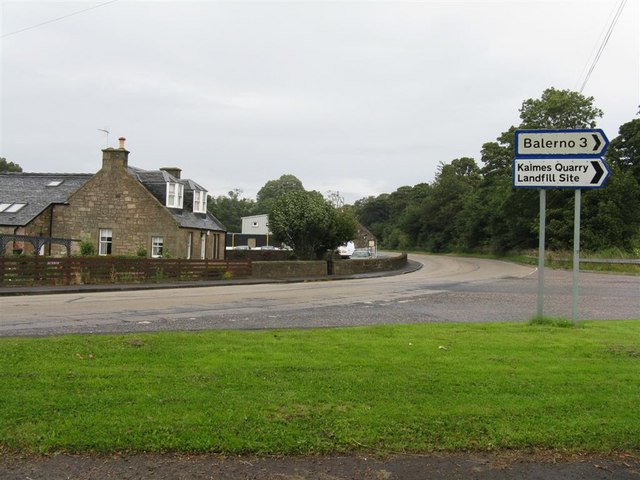
///slack.ghosts.struck. Near Balerno, Edinburgh

Related Wikis

Ravelrig Junction Platform railway station

Ravelrig Junction Platform railway station or Ravelrig Halt was originally opened in 1884 as a two platform station on the Shotts line on the edge of the...

Burnwynd

Burnwynd is a village on the border between the City of Edinburgh council area and West Lothian, Scotland. It is situated on the A71 road. Burnwynd is...

1992 Solheim Cup

The second Solheim Cup golf match took place from 2 October to 4 October 1992 at Dalmahoy Country Club, Edinburgh, Scotland. The European team beat the...

Dalmahoy

Dalmahoy (Scottish Gaelic: Dail MoThua) is a hotel and former country house near Edinburgh, Scotland. It is located off the A71 road, 3.5 kilometres (2...

Nearby Amenities

Located within 500m of 55.888429,-3.3765398
Power: tower
Lat/Long: 55.8927817/-3.3765855
Design: three-level
Power: tower
Lat/Long: 55.8903965/-3.3813673
Design: three-level
Power: tower
Lat/Long: 55.891051/-3.3772264
Design: three-level
Power: tower
Lat/Long: 55.8917003/-3.3731999
Dalmahoy Hill
Ele: 246
Natural: peak
Source: OS25k
Lat/Long: 55.8878252/-3.3839342
Barrier: stile
Lat/Long: 55.8911477/-3.3762883
The data included in this document is from www.openstreetmap.org. The data is made available under ODbL.

Have you been to Dalmahoy, Long?

Leave your review of Dalmahoy, Long below (or comments, questions and feedback).