The Gane

Coastal Feature, Headland, Point in Argyllshire

Scotland

The Gane
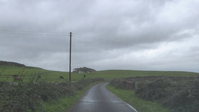
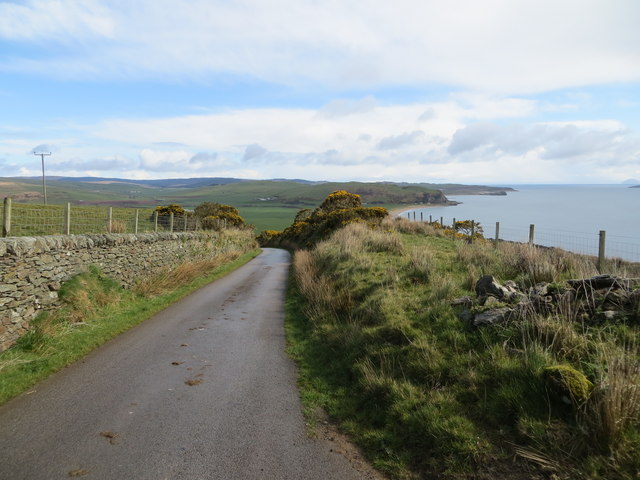
Minor road at Carskiey, Kintyre
Minor road at Carskiey, Kintyre Credit: Alpin Stewart

The requested URL returned error: 429 Too Many Requests

If you have any feedback on the listing, please let us know in the comments section below.

The Gane Images

Images are sourced within 2km of 55.29975/-5.7111405 or Grid Reference NR6406. Thanks to Geograph Open Source API. All images are credited.

Minor road at Carskiey, Kintyre
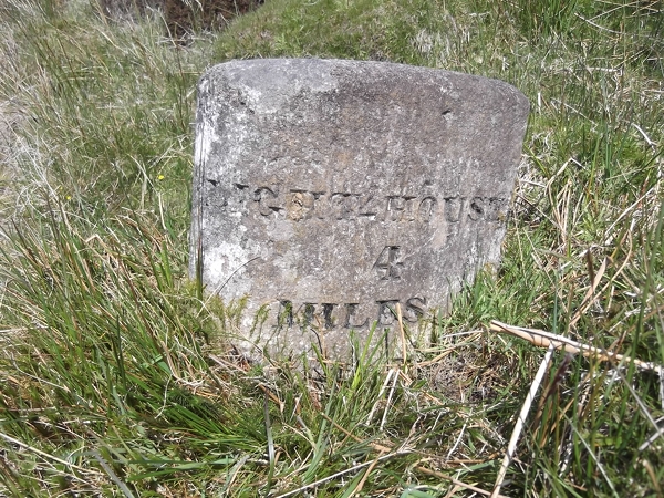
Old Milestone north west of Feorlan, Southend Parish By the UC road, in parish of Southend (Kintyre District), West of Feorlan, on banking, just West of passing place.

Inscription reads:-
: CAMPBELTOWN / 12½ : : LIGHTHOUSE / 4 : 

Surveyed

Milestone Society National ID: AB_CTKT12
Old Milestone north west of Feorlan, Southend Parish
By the UC road, in parish of Southend (Kintyre District), West of Feorlan, on banking, just West of passing place. Inscription reads:- : CAMPBELTOWN / 12½ : : LIGHTHOUSE / 4 : Surveyed Milestone Society National ID: AB_CTKT12
Wall-lined minor road approaching The Lodge at Carskey Looking south-westward.
Wall-lined minor road approaching The Lodge at Carskey
Looking south-westward.
Minor road heading down to Carskey and Carskey Bay Looking north-eastward.
Minor road heading down to Carskey and Carskey Bay
Looking north-eastward.
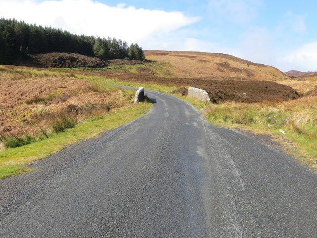
Minor road heading for the Mull of Kintyre Looking south-westward.
Minor road heading for the Mull of Kintyre
Looking south-westward.
Minor road heading towards the Mull of Kintyre cross a small bridge over Allt Breac Looking north-westward.
Minor road heading towards the Mull of Kintyre cross a small bridge over Allt Breac
Looking north-westward.
Ordnance Survey Cut Mark This can be found on the parapet wall of the road bridge spanning Allt Breac. The benchmark height has been recorded as 187.61 metres above sea level.
For more detail see : <span class="nowrap"><a title="https://www.bench-marks.org.uk/bm106626" rel="nofollow ugc noopener" href="https://www.bench-marks.org.uk/bm106626">Link</a><img style="margin-left:2px;" alt="External link" title="External link - shift click to open in new window" src="https://s1.geograph.org.uk/img/external.png" width="10" height="10"/></span>
Ordnance Survey Cut Mark
This can be found on the parapet wall of the road bridge spanning Allt Breac. The benchmark height has been recorded as 187.61 metres above sea level. For more detail see : LinkExternal link
Carskey Home Farm
Carskey Home Farm
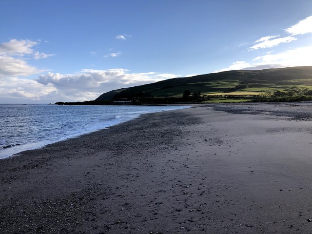
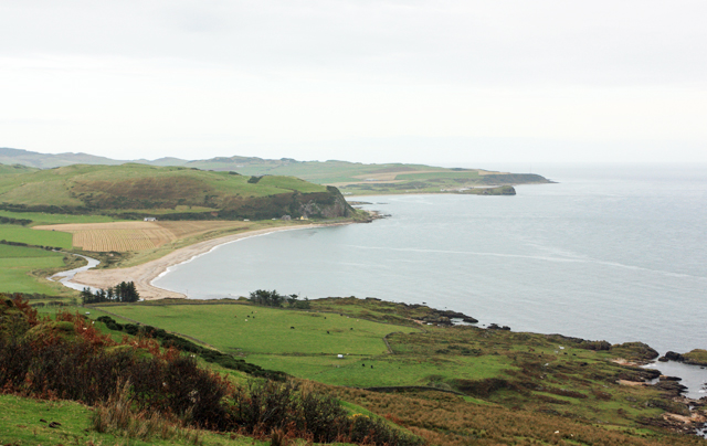
Carskey Bay View along beach late evening in June
Carskey Bay
View along beach late evening in June
Port Mean on the Kintyre peninsula Port Mean was where the supplies for the building of the lighthouse on Kintyre in the 1780s were landed.  They were hauled up the steep hillside, still a grassy track, onto what is now the metalled road.  The construction of the road and the lighthouse was the responsibility of David Stevenson and there are milestones for the 4 miles to the lighthouse and a horse drinking trough.
Port Mean on the Kintyre peninsula
Port Mean was where the supplies for the building of the lighthouse on Kintyre in the 1780s were landed. They were hauled up the steep hillside, still a grassy track, onto what is now the metalled road. The construction of the road and the lighthouse was the responsibility of David Stevenson and there are milestones for the 4 miles to the lighthouse and a horse drinking trough.
Across Glenmanuilt towards Carskey Bay The Mull of Kintyre lighthouse is linked via one narrow road to the village of Southend.  This view is available on a fine day on the final descent to the village.
Across Glenmanuilt towards Carskey Bay
The Mull of Kintyre lighthouse is linked via one narrow road to the village of Southend. This view is available on a fine day on the final descent to the village.
Small outcrop just above the shore at Borgadale Mor Point
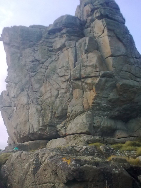
Seacliff E of Borgadale Mor Point Unclimbed for now...
Seacliff E of Borgadale Mor Point
Unclimbed for now...
Glenmanuilt Glen Glen descending from the moorland plateau at the Mull of Kintyre.
Glenmanuilt Glen
Glen descending from the moorland plateau at the Mull of Kintyre.
The Mull Road The single track road at Garvalt.
The Mull Road
The single track road at Garvalt.
Woodland, Carskiey A damp patch of woodland.
Woodland, Carskiey
A damp patch of woodland.
Sanda A view of the island from the single track road to the Mull Of Kintyre near Glenmanuilt.
Sanda
A view of the island from the single track road to the Mull Of Kintyre near Glenmanuilt.
A View Of Four Islands From left to right: a distant guano-encrusted Ailsa Craig and to the fore - Sheep Island, Glunimore Island and Sanda Island.
A View Of Four Islands
From left to right: a distant guano-encrusted Ailsa Craig and to the fore - Sheep Island, Glunimore Island and Sanda Island.
Show me another place!

The Gane is located at Grid Ref: NR6406 (Lat: 55.29975, Lng: -5.7111405)

Unitary Authority: Argyll and Bute

Police Authority: Argyll and West Dunbartonshire

What 3 Words

///outsmart.lamps.shaves. Near Campbeltown, Argyll & Bute

Related Wikis

St Columba's Chapel, Southend

St Columba's Chapel (Kilcomkill) is a ruined medieval chapel near Southend, Argyll and Bute, Scotland. It is noted for its carved grave slabs. == References ==

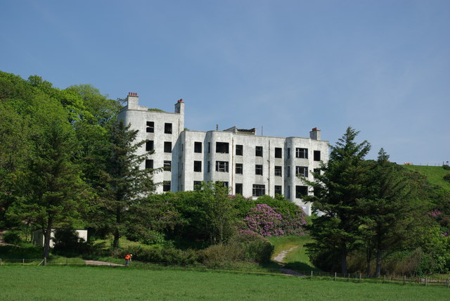
Keil Hotel

Keil Hotel is a former hotel near Southend, Kintyre in western Scotland. == History and architecture == It was constructed between 1937 and 1939 for Captain...

Battle of Dunaverty

The Battle of Dunaverty involved a battle and the siege of Dunaverty Castle in Kintyre, Scotland, in 1647. The events involved the Covenanter Army under...

Dunaverty Castle

Dunaverty Castle is located at Southend at the southern end of the Kintyre peninsula in western Scotland. The site was once a fort belonging to the Clan...

Nearby Amenities

Located within 500m of 55.29975,-5.7111405
Passing Place
Lat/Long: 55.3017899/-5.7089619
Glemanuilt
Source: OS7
Lat/Long: 55.3014938/-5.7117087
Passing Place
Lat/Long: 55.3022846/-5.7161059
Passing Place
Lat/Long: 55.3007112/-5.7137952
Power: pole
Lat/Long: 55.3031078/-5.7081492
Power: pole
Lat/Long: 55.3023548/-5.7087974
Power: pole
Lat/Long: 55.3016945/-5.7101846
Power: pole
Lat/Long: 55.3012457/-5.7111473
Power: pole
Lat/Long: 55.3017791/-5.7123525
Power: pole
Lat/Long: 55.3025238/-5.7170592
Power: pole
Lat/Long: 55.3024557/-5.7167764
Power: pole
Lat/Long: 55.3033315/-5.7156731
Power: pole
Lat/Long: 55.3029471/-5.7148078
Power: pole
Lat/Long: 55.3026721/-5.7142451
Power: pole
Lat/Long: 55.3022104/-5.7132975
Passing Place
Lat/Long: 55.3035209/-5.7073519
The data included in this document is from www.openstreetmap.org. The data is made available under ODbL.

Have you been to The Gane?

Leave your review of The Gane below (or comments, questions and feedback).