Gualann na' Leac

Coastal Feature, Headland, Point in Inverness-shire

Scotland

Gualann na' Leac

Rubha na Leac Leac means a flat or sloping slab or rock surface, and this one must have given the name of An Leac, Beinn na Leac and Gualainn na Leac nearby.
Rubha na Leac Credit: Anne Burgess

The requested URL returned error: 429 Too Many Requests

If you have any feedback on the listing, please let us know in the comments section below.

Gualann na' Leac Images

Images are sourced within 2km of 57.367043/-5.9964629 or Grid Reference NG5937. Thanks to Geograph Open Source API. All images are credited.

Rubha na Leac Leac means a flat or sloping slab or rock surface, and this one must have given the name of An Leac, Beinn na Leac and Gualainn na Leac nearby.
Rubha na Leac
Leac means a flat or sloping slab or rock surface, and this one must have given the name of An Leac, Beinn na Leac and Gualainn na Leac nearby.
Rubha na Leac This is the coarse Triassic conglomerate that is exposed only in a few places in Raasay. It is of the Stornoway Sandstone Formation, and was deposited in Triassic times, something like 260 million years ago.
Rubha na Leac
This is the coarse Triassic conglomerate that is exposed only in a few places in Raasay. It is of the Stornoway Sandstone Formation, and was deposited in Triassic times, something like 260 million years ago.
Headland at Rubha na Leac This is a deeply frustrating view. The rocks at the foot of the headland are in the next square to the south, but I couldn't get to them safely at sea level and would not have had time to climb up, over, down and then up again without holding up the rest of the group I was with. Most annoying!
Headland at Rubha na Leac
This is a deeply frustrating view. The rocks at the foot of the headland are in the next square to the south, but I couldn't get to them safely at sea level and would not have had time to climb up, over, down and then up again without holding up the rest of the group I was with. Most annoying!
Triassic Conglomerate This exposed section through the Stornoway Sandstone Formation at Rubha na Leac shows that the sandstone was formed in shifting channels. Sometimes the current was strong enough to move quite large pebbles, but at other times it was less energetic and only deposited finer sand, resulting in the smoother bands of rock. This was in the Triassic, about 260 million years ago.
Triassic Conglomerate
This exposed section through the Stornoway Sandstone Formation at Rubha na Leac shows that the sandstone was formed in shifting channels. Sometimes the current was strong enough to move quite large pebbles, but at other times it was less energetic and only deposited finer sand, resulting in the smoother bands of rock. This was in the Triassic, about 260 million years ago.
Rubha na Leac The photographer is photographing the steeper face of the rock layer in the centre of the image. This is a sill of igneous rock that was intruded into the Triassic sandstone when it was about 200 million years old. The heat of the molten rock baked the underlying sandstone, which made it harder and more resistant to erosion, so it has been left sticking up while the unbaked material below it, to the right in this view, has been removed.
Rubha na Leac
The photographer is photographing the steeper face of the rock layer in the centre of the image. This is a sill of igneous rock that was intruded into the Triassic sandstone when it was about 200 million years old. The heat of the molten rock baked the underlying sandstone, which made it harder and more resistant to erosion, so it has been left sticking up while the unbaked material below it, to the right in this view, has been removed.
Bouldery shoreline south of Rubha nà Leac Not the easiest place in the world to access by land. The view is across the Inner Sound to the mainland of Scotland.
Bouldery shoreline south of Rubha nà Leac
Not the easiest place in the world to access by land. The view is across the Inner Sound to the mainland of Scotland.
Rubha nà Leac Interesting agglomerate rock on the eastern side of Rubha nà Leac. The view is up the Inner Sound, with Rona on the left and the Scottish mainland on the right.
Rubha nà Leac
Interesting agglomerate rock on the eastern side of Rubha nà Leac. The view is up the Inner Sound, with Rona on the left and the Scottish mainland on the right.
Low tide at the foot of Beinn na Leac My kayak marks the northern edge, and the paddle the corner, of the grid square.  These rocks which are exposed only at low tide are covered in limpets and whelks, as well as various seaweeds.
Low tide at the foot of Beinn na Leac
My kayak marks the northern edge, and the paddle the corner, of the grid square. These rocks which are exposed only at low tide are covered in limpets and whelks, as well as various seaweeds.
View north from Rubha na Leac This small outlier of Triassic sandstone occurs at this spot on Raasay's wild eastern coast. It is a conglomerate assigned to the Stornoway Formation. The clearly visible summit of Dun Caan is formed from a basalt of Palaeogene age whilst the light coloured coastal cliffs are of early Jurassic age; sandstones assigned to the Ardnish Formation.
View north from Rubha na Leac
This small outlier of Triassic sandstone occurs at this spot on Raasay's wild eastern coast. It is a conglomerate assigned to the Stornoway Formation. The clearly visible summit of Dun Caan is formed from a basalt of Palaeogene age whilst the light coloured coastal cliffs are of early Jurassic age; sandstones assigned to the Ardnish Formation.
Rocky fissures at Creag nan Cadhaig These sinister-looking slots in rock are on Dun Caan, south-east from the summit. David Tyers has an image taken from a very similar location - <a title="https://www.geograph.org.uk/photo/3912456" href="https://www.geograph.org.uk/photo/3912456">Link</a>. He suggests that "The name Creag nan Cadhaig can perhaps be translated as rock of the small ravines".
The rising ground beyond the clefts reaches Beinn na' Leac at 319 metres.
Rocky fissures at Creag nan Cadhaig
These sinister-looking slots in rock are on Dun Caan, south-east from the summit. David Tyers has an image taken from a very similar location - Link. He suggests that "The name Creag nan Cadhaig can perhaps be translated as rock of the small ravines". The rising ground beyond the clefts reaches Beinn na' Leac at 319 metres.
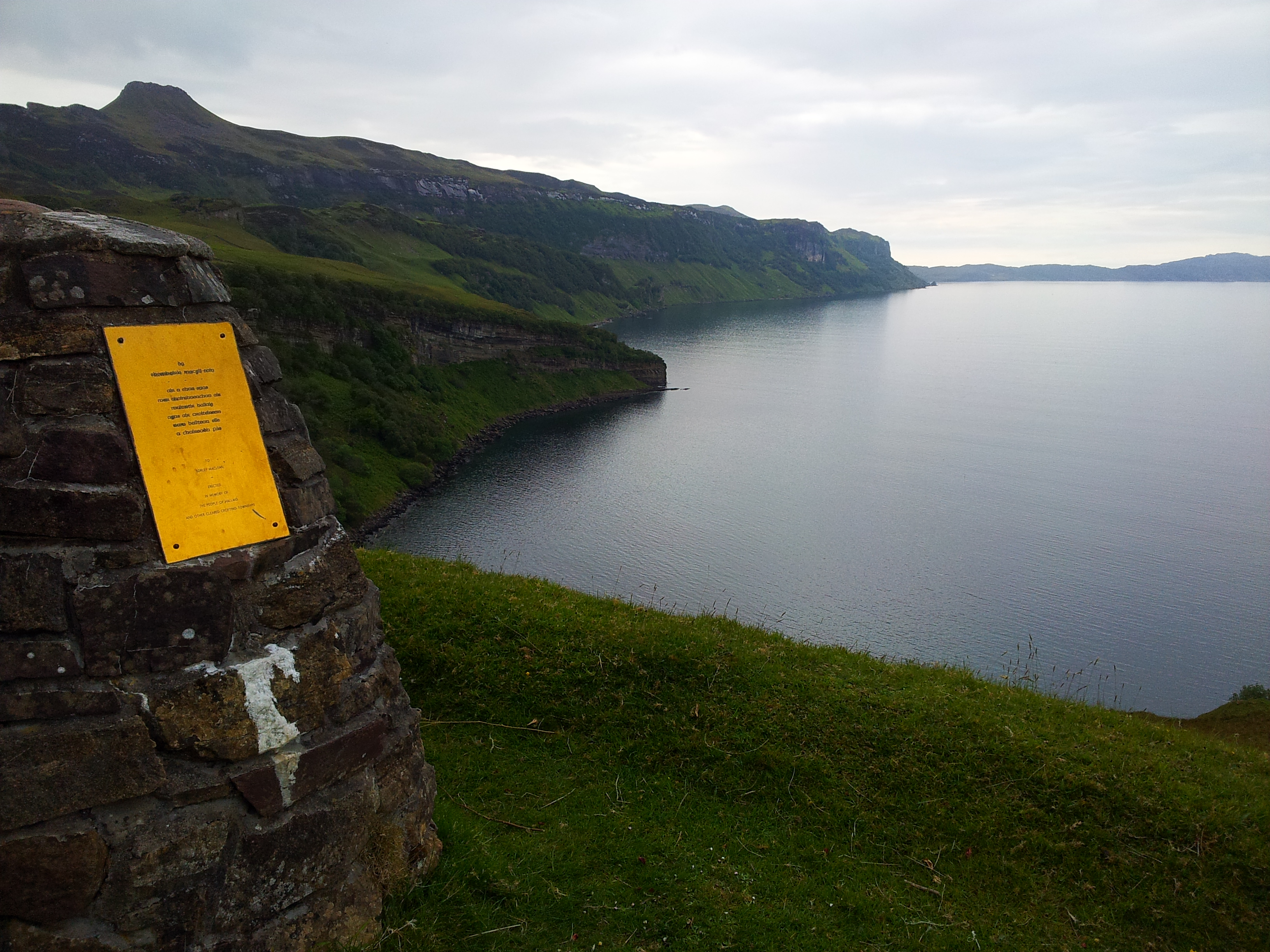
Abandoned settlement at Hallaig Site of the former settlement at Hallaig, with a view across the Inner Sound.
Abandoned settlement at Hallaig
Site of the former settlement at Hallaig, with a view across the Inner Sound.
House at North Fearns At the start of a lovely track northwards to Hallaig
House at North Fearns
At the start of a lovely track northwards to Hallaig
Rowan on the path to Hallaig Just beyond the cottage at North Fearns.
Rowan on the path to Hallaig
Just beyond the cottage at North Fearns.
A survivor at North Fearns A large, heavily leaning Rowan on the path to Hallaig, but still thriving.
A survivor at North Fearns
A large, heavily leaning Rowan on the path to Hallaig, but still thriving.
Trees on an outcrop at North Fearns With bracken and grass below.
Trees on an outcrop at North Fearns
With bracken and grass below.
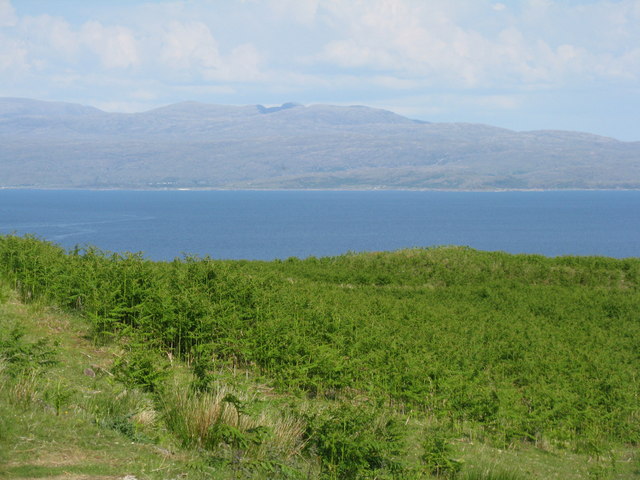
Applecross from North Fearns Looking northeast across the Inner Sound from Raasay.
Applecross from North Fearns
Looking northeast across the Inner Sound from Raasay.
Bracken covered hillside at North Fearns With rocky outcrops and small trees.
Bracken covered hillside at North Fearns
With rocky outcrops and small trees.
Bracken on Raasay The steep southeast side, looking across the Inner Sound to Applecross.
Bracken on Raasay
The steep southeast side, looking across the Inner Sound to Applecross.
Show me another place!

Gualann na' Leac is located at Grid Ref: NG5937 (Lat: 57.367043, Lng: -5.9964629)

Unitary Authority: Highland

Police Authority: Highlands and Islands

What 3 Words

///lordship.variety.quickly. Near Portree, Highland

Related Wikis

Hallaig

Hallaig is the most recognized poem of Sorley MacLean, an important Scottish poet of the 20th century. After writing it, MacLean rose to fame in the English...

Raasay

Raasay (; Scottish Gaelic: Ratharsair) or the Isle of Raasay is an island between the Isle of Skye and the mainland of Scotland. It is separated from Skye...

Inverarish

Inverarish (Scottish Gaelic: Inbhir Àrais) is a village that is the main settlement of the Isle of Raasay, in the civil parish of Portree, in the council...

Isle of Raasay distillery

Isle of Raasay distillery is a Scotch whisky distillery on the Inner Hebridean Isle of Raasay in Northwest Scotland. The distillery is owned by R&B Distillers...

Nearby Amenities

Located within 500m of 57.367043,-5.9964629
Source: PGS
Lat/Long: 57.3696033/-5.998026
Source: PGS
Lat/Long: 57.3701547/-5.9965683
Source: PGS
Lat/Long: 57.3703797/-5.9964104
Source: PGS
Lat/Long: 57.3706315/-5.9955686
Source: PGS
Lat/Long: 57.3709443/-5.995279
Source: PGS
Lat/Long: 57.3711334/-5.9949391
Source: PGS
Lat/Long: 57.370952/-5.9943711
Created By: almien_coastlines
Source: PGS
Lat/Long: 57.370939/-5.993272
Source: PGS
Lat/Long: 57.3698752/-5.9937481
Source: PGS
Lat/Long: 57.3697566/-5.9938794
Source: PGS
Lat/Long: 57.369501/-5.9940969
Source: PGS
Lat/Long: 57.3691474/-5.9941962
Source: PGS
Lat/Long: 57.368915/-5.9930313
Source: PGS
Lat/Long: 57.3683676/-5.9927143
Source: PGS
Lat/Long: 57.3678617/-5.9925407
Source: PGS
Lat/Long: 57.3671351/-5.9923471
Created By: almien_coastlines
Source: PGS
Lat/Long: 57.366854/-5.992703
Created By: almien_coastlines
Source: PGS
Lat/Long: 57.366087/-5.992641
Created By: almien_coastlines
Source: PGS
Lat/Long: 57.365832/-5.99262
Created By: almien_coastlines
Source: PGS
Lat/Long: 57.364298/-5.992495
Created By: almien_coastlines
Source: PGS
Lat/Long: 57.364042/-5.992474
Created By: almien_coastlines
Source: PGS
Lat/Long: 57.363519/-5.992906
Created By: almien_coastlines
Source: PGS
Lat/Long: 57.363008/-5.992864
Source: PGS
Lat/Long: 57.37043/-6.0011315
Source: PGS
Lat/Long: 57.37005/-6.0007649
Source: PGS
Lat/Long: 57.36991/-6.0005
Source: PGS
Lat/Long: 57.3697499/-5.9994031
Sorley Maclean Memorial
Historic: memorial
Lat/Long: 57.3679416/-5.996866
An Leac
Locality: abandoned_place
Place: locality
Lat/Long: 57.3625859/-5.9955523
Rubha na Lice
Natural: cape
Lat/Long: 57.3706858/-5.9939216
The data included in this document is from www.openstreetmap.org. The data is made available under ODbL.

Have you been to Gualann na' Leac?

Leave your review of Gualann na' Leac below (or comments, questions and feedback).