Achfary

Settlement in Sutherland

Scotland

Achfary

Loch More & Ben Stack Towards the foot of Loch More with the small but shapely Ben Stack beyond.
Loch More & Ben Stack Credit: Gordon Hatton

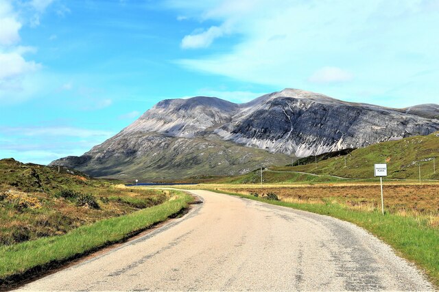
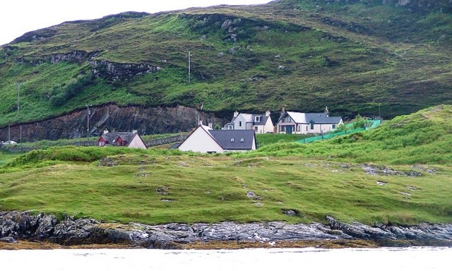
Achfary is a small village located in the county of Sutherland, in the northern part of Scotland. Situated in the Highlands, it is nestled within the picturesque landscape of the Scottish countryside. The village is approximately 10 miles southwest of Durness and lies near the banks of the River Dionard.

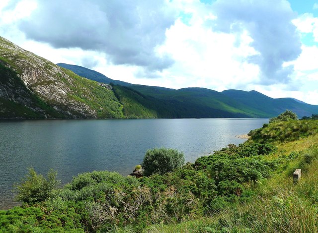
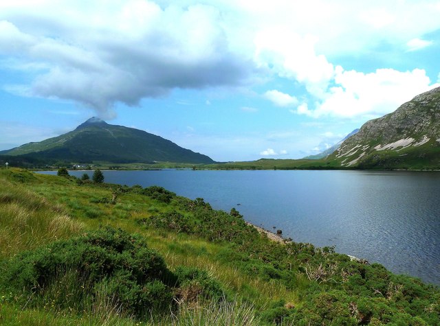
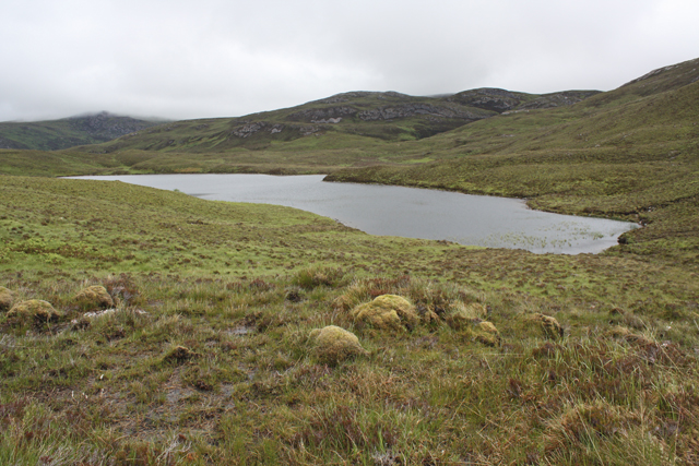
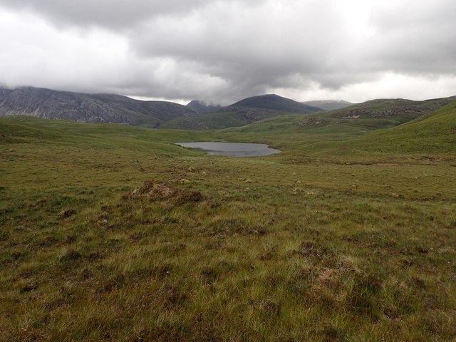
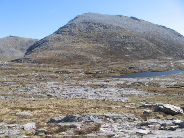
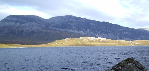
Achfary is known for its tranquil and idyllic setting, surrounded by rolling hills, vast moorlands, and stunning lochs. The area is a haven for outdoor enthusiasts, offering a range of activities such as hiking, fishing, and wildlife spotting. The nearby Loch Dionard is particularly popular for its fishing opportunities, attracting anglers from all over.

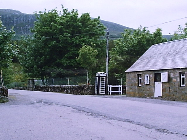
The village itself is small, with a close-knit community that maintains a welcoming and friendly atmosphere. It has a few amenities, including a local pub and a small village hall that hosts community events. The area is predominantly rural, with scattered cottages and farms dotting the landscape.

Historically, Achfary was an important hub for the local crofting community, and remnants of traditional crofting practices can still be seen in the surrounding area. The village is also known for its rich archaeological heritage, with several prehistoric sites and standing stones nearby.

Achfary offers visitors a chance to escape the hustle and bustle of city life and immerse themselves in the natural beauty of the Scottish Highlands. Whether it's exploring the wilderness or simply enjoying the peace and tranquility, Achfary is a place that embodies the charm and serenity of rural Scotland.

If you have any feedback on the listing, please let us know in the comments section below.

Achfary Images

Images are sourced within 2km of 58.304135/-4.9054127 or Grid Reference NC2938. Thanks to Geograph Open Source API. All images are credited.

Loch More & Ben Stack Towards the foot of Loch More with the small but shapely Ben Stack beyond.
Loch More & Ben Stack
Towards the foot of Loch More with the small but shapely Ben Stack beyond.
Loch More, Achfary In high water the stepping stones <a href="https://www.geograph.org.uk/photo/1263564">NC3039 : Stepping stones and Bridge</a> had disappeared. At this water level, there is a very strong current running from Loch More through the narrows.There is a sign on the bridge warning against using it. While it might be unsafe, it does make a very picturesque feature between Loch More and Loch Ealachan, know locally as the Ghillies' Loch. This is the loch on which the estate workers are allowed to fish. This was very a productive occupation in the days when sea trout runs were several orders of magnitude greater that at present. Arkle is very impressive in the background.
Loch More, Achfary
In high water the stepping stones NC3039 : Stepping stones and Bridge had disappeared. At this water level, there is a very strong current running from Loch More through the narrows.There is a sign on the bridge warning against using it. While it might be unsafe, it does make a very picturesque feature between Loch More and Loch Ealachan, know locally as the Ghillies' Loch. This is the loch on which the estate workers are allowed to fish. This was very a productive occupation in the days when sea trout runs were several orders of magnitude greater that at present. Arkle is very impressive in the background.
Loch More Viewed from the A838 near Achfarry. Loch More occupies a glaciated valley, reaching depths of 90 metres.
Loch More
Viewed from the A838 near Achfarry. Loch More occupies a glaciated valley, reaching depths of 90 metres.
Loch More View Looking down Loch More towards Ben Stack. The cloud was already building into what turned out to be a huge downpour.
Loch More View
Looking down Loch More towards Ben Stack. The cloud was already building into what turned out to be a huge downpour.
Ben Stack and Loch More
Arkle from An Earachd Arkle from the A838 at An Earachd.
Arkle from An Earachd
Arkle from the A838 at An Earachd.
A838 towards Laxford Bridge
Ben Screavie North western slopes near Loch nam Breac Buidhe.
Ben Screavie
North western slopes near Loch nam Breac Buidhe.
Loch nam Breac Buidhe Surrounded by boggy moorland north of Ben Screavie.
Loch nam Breac Buidhe
Surrounded by boggy moorland north of Ben Screavie.
Loch nam Breac Buidhe The loch was surrounded by moorland that was very dry at this time.
Loch nam Breac Buidhe
The loch was surrounded by moorland that was very dry at this time.
The A838 north of Achfary looking towards Arkle
Loch Nan Ealachan
Loch Nan Ealachan
End of Loch Stack with Arkle in the back
Wee jetty on the shore of Loch More
Estate road to Airdachuilinn The road is tarmacked as far as the house, whereafter it continues as an unsurfaced track.
Estate road to Airdachuilinn
The road is tarmacked as far as the house, whereafter it continues as an unsurfaced track.
Car park near Achfary There is space for a few cars to the west side of the bridge on the track to Airdachuilinn.
Car park near Achfary
There is space for a few cars to the west side of the bridge on the track to Airdachuilinn.
Lochans on SE Ridge of Ben Screavie There were a large number of delightful rocky lochans here.
Lochans on SE Ridge of Ben Screavie
There were a large number of delightful rocky lochans here.
Lochan near Top of Ben Screavie In spite of not being very high, Ben Screavie has quite a rocky top. Meallan Liath Coire Mhic Dhughaill in the distance.
Lochan near Top of Ben Screavie
In spite of not being very high, Ben Screavie has quite a rocky top. Meallan Liath Coire Mhic Dhughaill in the distance.
Show me another place!

Achfary is located at Grid Ref: NC2938 (Lat: 58.304135, Lng: -4.9054127)

Unitary Authority: Highland

Police Authority: Highlands and Islands

Also known as: Achadh Fairidh

What 3 Words

///learning.bathtubs.retract. Near Inchnadamph, Highland

Nearby Locations

Achadh Fairidh Achfary

Related Wikis

Achfary

Achfary (Scottish Gaelic: Achadh Taigh Phairidh) is a hamlet in the Scottish council area of Highland. To the east of the village lies Loch nan Ealachan...

A838 road

The A838 is a major road in Sutherland, in the Highland area of Scotland. It runs generally northwest from the A836 in the Lairg area to Laxford Bridge...

Ben Stack

Ben Stack (Scottish Gaelic: Beinn Stac) is a mountain in Sutherland, in the northwest of Scotland. It is 721 m (2,365 ft) high. It lies southeast of Laxford...

Eas Creag an Luchda

Eas Creag an Luchda is a waterfall of Scotland. == See also == Waterfalls of Scotland == References ==

Meallan Liath Coire Mhic Dhùghaill

Meallan Liath Coire Mhic Dhughaill (801 m) is a mountain in the Northwest Highlands, Scotland. It lies in the far north of Scotland between Lairg and Durness...

North West Sutherland National Scenic Area

North West Sutherland is a national scenic area (NSA) covering the mountains and coastal scenery of the northwestern part of the county of Sutherland...

Arkle (Sutherland)

Arkle (Scottish Gaelic: Airceil) is a mountain in Sutherland, in the far north-west corner of the Scottish Highlands. Like its sister Foinaven, the mountain...

Unapool

Unapool is a small settlement in the Assynt district of Sutherland in the Highland council area of Scotland. It is located on the A894 between Durness...

Nearby Amenities

Located within 500m of 58.304135,-4.9054127
Power: pole
Lat/Long: 58.3063498/-4.9090587
Power: pole
Lat/Long: 58.3041905/-4.9108633
Power: pole
Lat/Long: 58.3032127/-4.9088497
Power: pole
Lat/Long: 58.3026736/-4.9043933
Power: pole
Lat/Long: 58.3026326/-4.9031043
Power: pole
Lat/Long: 58.3026258/-4.9027111
Power: pole
Lat/Long: 58.3025675/-4.9000347
Barrier: cattle_grid
Bicycle: yes
Foot: yes
Lat/Long: 58.3034773/-4.9031371
Barrier: cattle_grid
Bicycle: yes
Foot: yes
Lat/Long: 58.3035929/-4.9020079
Power: pole
Lat/Long: 58.3074231/-4.9112293
Power: pole
Lat/Long: 58.3070314/-4.9104756
Power: pole
Lat/Long: 58.3067129/-4.9097514
Stepping stones - bridge
Tourism: attraction
Lat/Long: 58.3070301/-4.9019409
Power: pole
Lat/Long: 58.3057789/-4.9095358
Power: pole
Lat/Long: 58.3052463/-4.909981
Power: pole
Lat/Long: 58.3047228/-4.9104185
Power: pole
Lat/Long: 58.3025994/-4.9015004
Power: pole
Lat/Long: 58.3023035/-4.8982105
The data included in this document is from www.openstreetmap.org. The data is made available under ODbL.

Have you been to Achfary?

Leave your review of Achfary below (or comments, questions and feedback).