Geodha na Bròig

Coastal Feature, Headland, Point in Ross-shire

Scotland

Geodha na Bròig

Tiumpan Head Lighthouse
Tiumpan Head Lighthouse Credit: Peter Moore

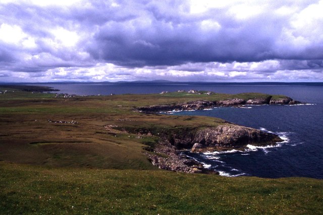
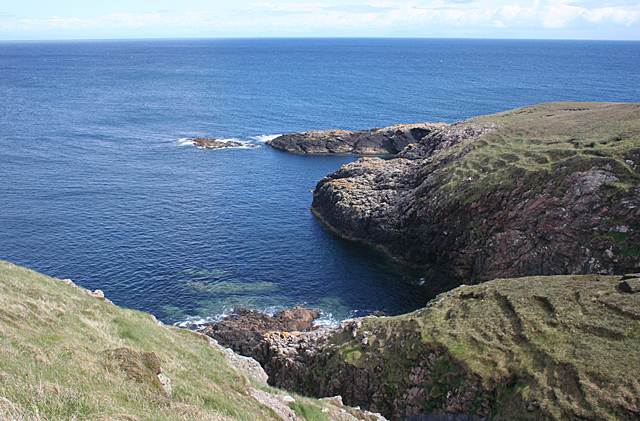
Geodha na Bròig, located in Ross-shire, Scotland, is a remarkable coastal feature known for its stunning headland and prominent point. Situated along the rugged coastline of the Scottish Highlands, this area offers breathtaking views and a unique natural environment.

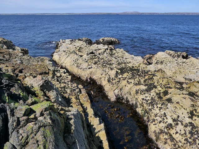
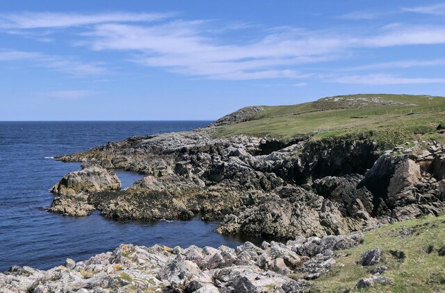
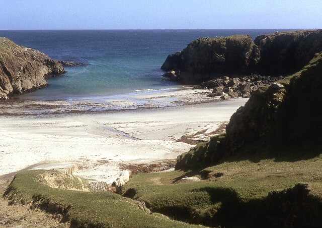
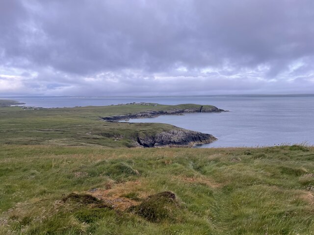
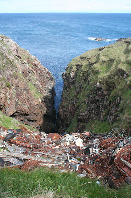
Geodha na Bròig is characterized by its towering cliffs that plunge dramatically into the Atlantic Ocean. These cliffs, made of rugged sandstone and shale, have been shaped by the relentless force of the waves over thousands of years, resulting in impressive rock formations and sea stacks. The headland juts out into the sea, offering panoramic vistas of the surrounding coastline and the vast expanse of the ocean.

The point of Geodha na Bròig is a significant landmark, attracting both nature enthusiasts and photographers. It provides an ideal vantage point for observing marine wildlife, such as seals, dolphins, and various seabird species. The area is also known for its diverse plant life, including hardy coastal grasses and wildflowers that cling to the cliffs.

Access to Geodha na Bròig is relatively easy, with a well-maintained footpath leading visitors along the cliff edge. However, caution is advised as the terrain can be uneven and exposed. The site is a popular destination for hikers and outdoor enthusiasts looking to experience the untamed beauty of the Scottish coastline.

Geodha na Bròig is not only a picturesque location but also holds cultural significance. It has been a source of inspiration for local artists and writers, who have captured its rugged charm in their works. Overall, this coastal feature is a must-visit for anyone seeking a glimpse of Scotland's wild and majestic landscape.

If you have any feedback on the listing, please let us know in the comments section below.

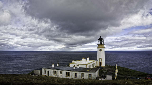
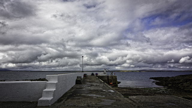
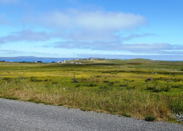
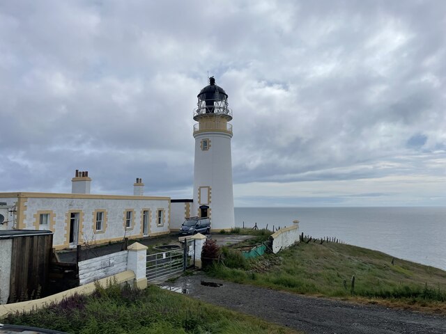
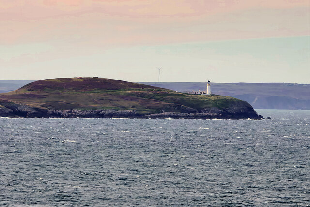
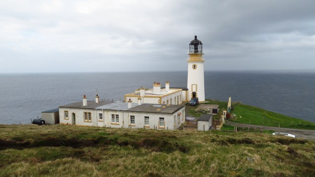
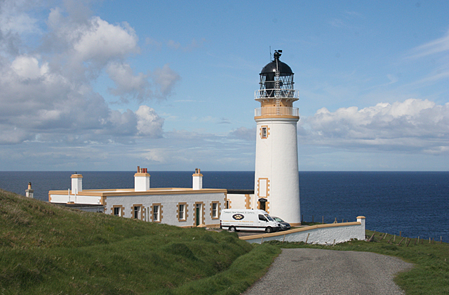
Geodha na Bròig Images

Images are sourced within 2km of 58.254932/-6.1368982 or Grid Reference NB5737. Thanks to Geograph Open Source API. All images are credited.

Tiumpan Head Lighthouse
The Pier at Port nan Giuran
Coastline below Cnoc Beag, Isle of Lewis Looking across Broad Bay/Loch a Tuath towards Bac and Griais.
Coastline below Cnoc Beag, Isle of Lewis
Looking across Broad Bay/Loch a Tuath towards Bac and Griais.
Looking across fields towards Cnoc Beag from the A866
The small pier at Portnagnan
View west from Tiumpan Head
Tiumpan Head Lighthouse
Coast below Cnoc Beag, Isle of Lewis Looking towards Rubha Meadhonach, the northern tip of the Eye Peninsula/An Rubha.
Coast below Cnoc Beag, Isle of Lewis
Looking towards Rubha Meadhonach, the northern tip of the Eye Peninsula/An Rubha.
Small beach at Sinigeadh, Eye Peninsula
Roads around An Rubha
Roads around An Rubha Geocaching is a type of global treasure hunt of people looking for caches, or hidden stashes of objects. Geocaching may also be described as a series of hide-and-seek games, where hiders provide online clues for seekers. Seekers use global positioning system (GPS) devices to find hidden caches
Roads around An Rubha
Geocaching is a type of global treasure hunt of people looking for caches, or hidden stashes of objects. Geocaching may also be described as a series of hide-and-seek games, where hiders provide online clues for seekers. Seekers use global positioning system (GPS) devices to find hidden caches
Coastline of An Rubhan
Tiumpan Head Lighthouse Geocaching is a type of global treasure hunt of people looking for caches, or hidden stashes of objects. Geocaching may also be described as a series of hide-and-seek games, where hiders provide online clues for seekers. Seekers use global positioning system (GPS) devices to find hidden caches
Tiumpan Head Lighthouse
Geocaching is a type of global treasure hunt of people looking for caches, or hidden stashes of objects. Geocaching may also be described as a series of hide-and-seek games, where hiders provide online clues for seekers. Seekers use global positioning system (GPS) devices to find hidden caches
Tiumpan Head Lighthouse Tiumpan Head is located at the far eastern end of Point in Lewis. The lighthouse located here marks the western limit of the Minch. Designed by David and Charles Stevenson, it was first lit in December 1900. Still an active lighthouse today, it was automated in 1985.

It is a Category C listed building (LB19209 <span class="nowrap"><a title="https://portal.historicenvironment.scot/designation/LB19209" rel="nofollow ugc noopener" href="https://portal.historicenvironment.scot/designation/LB19209">Link</a><img style="margin-left:2px;" alt="External link" title="External link - shift click to open in new window" src="https://s1.geograph.org.uk/img/external.png" width="10" height="10"/></span> Historic Environment Scotland).
Tiumpan Head Lighthouse
Tiumpan Head is located at the far eastern end of Point in Lewis. The lighthouse located here marks the western limit of the Minch. Designed by David and Charles Stevenson, it was first lit in December 1900. Still an active lighthouse today, it was automated in 1985. It is a Category C listed building (LB19209 LinkExternal link Historic Environment Scotland).
Tiumpan Head Lighthouse
Tigh-sholuis Rubh an t-Siumpain (Tiumpan Head Lighthouse) The lighthouse stands at the tip of the Eye Peninsula. It is 21 metres (69 feet) tall, and dates from 1900. It has been automated since 1985, and the buildings are now occupied by a kennels and cattery. The headland is named as Ceann an t-Siumpan on the 1:25,000 map, which seems rather odd.
Tigh-sholuis Rubh an t-Siumpain (Tiumpan Head Lighthouse)
The lighthouse stands at the tip of the Eye Peninsula. It is 21 metres (69 feet) tall, and dates from 1900. It has been automated since 1985, and the buildings are now occupied by a kennels and cattery. The headland is named as Ceann an t-Siumpan on the 1:25,000 map, which seems rather odd.
Fidigeadh If you use <a href="https://www.geograph.org.uk/photo/1525394">NB5737 : Stile and footpath sign at Tiumpan Head</a> and walk down a little way, this is the view that greets you.
Fidigeadh
If you use NB5737 : Stile and footpath sign at Tiumpan Head and walk down a little way, this is the view that greets you.
Dumping Ground One of the most striking changes in the Western Isles since I first visited them is that the heaps of rusting cars, machinery and other metal objects have mostly been removed from the countryside. However the long arm of the local authority has evidently failed to the reach the head of the geodha at Fidigeadh, which is disfigured by this motley collection of rusting barbed wire, car parts and pieces of wood.
Dumping Ground
One of the most striking changes in the Western Isles since I first visited them is that the heaps of rusting cars, machinery and other metal objects have mostly been removed from the countryside. However the long arm of the local authority has evidently failed to the reach the head of the geodha at Fidigeadh, which is disfigured by this motley collection of rusting barbed wire, car parts and pieces of wood.
Show me another place!

Geodha na Bròig is located at Grid Ref: NB5737 (Lat: 58.254932, Lng: -6.1368982)

Unitary Authority: Na h-Eileanan an Iar

Police Authority: Highlands and Islands

What 3 Words

///pothole.joyously.clouds. Near North Tolsta, Na h-Eileanan Siar

Related Wikis

Tiumpan Head Lighthouse

The Tiumpan Head Lighthouse is an active lighthouse located in Tiumpan Head, Isle of Lewis, Outer Hebrides, Scotland. == History == The idea for the Tiumpan...

Portvoller

Portvoller (Scottish Gaelic: Port Mholair) is a small village on the north tip of the Eye Peninsula (which along with Melbost and Parkend makes up Point...

Portnaguran

Portnaguran (Scottish Gaelic: Port nan Giùran) is a settlement situated within Point, on the Isle of Lewis, in the Outer Hebrides, Scotland. Portnaguran...

Broker, Lewis

Broker (Scottish Gaelic: Brocair) is a small hamlet next to the village of Portvoller and Portnaguran on the Eye Peninsula located on the east side of...

Nearby Amenities

Located within 500m of 58.254932,-6.1368982
Bus Stop
Portvoller
Naptan AtcoCode: 6010731783
Naptan Bearing: W
Naptan CommonName: Portvoller
Naptan Indicator: Village
Naptan Landmark: Village
Naptan NaptanCode: 94723932
Naptan Street: Village
Naptan Verified: no
Source: naptan_import
Lat/Long: 58.2534427/-6.1441864
Passing Place
Lat/Long: 58.2545376/-6.14347
Passing Place
Lat/Long: 58.2556395/-6.1427741
Turning Circle
Lat/Long: 58.2535252/-6.1441922
Geodha nan Sgarbh
Place: locality
Source: https://getoutside.ordnancesurvey.co.uk/local/geodha-nan-sgarbh-na-h-eileanan-an-iar-hs20ha
Lat/Long: 58.2525817/-6.1402866
Parking
Lat/Long: 58.2583564/-6.1412904
Passing Place
Lat/Long: 58.2583373/-6.1411429
Turning Circle
Lat/Long: 58.257533/-6.1430338
Power: pole
Lat/Long: 58.2585801/-6.1415519
The data included in this document is from www.openstreetmap.org. The data is made available under ODbL.

Have you been to Geodha na Bròig?

Leave your review of Geodha na Bròig below (or comments, questions and feedback).