Acairseid an Rubha

Coastal Feature, Headland, Point in Inverness-shire

Scotland

Acairseid an Rubha

Camus Daraich A sandy beach east of the Point of Sleat.
Camus Daraich Credit: Ian Taylor

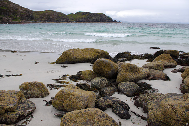
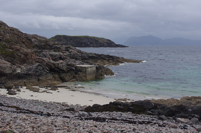
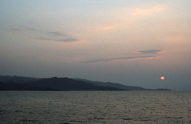
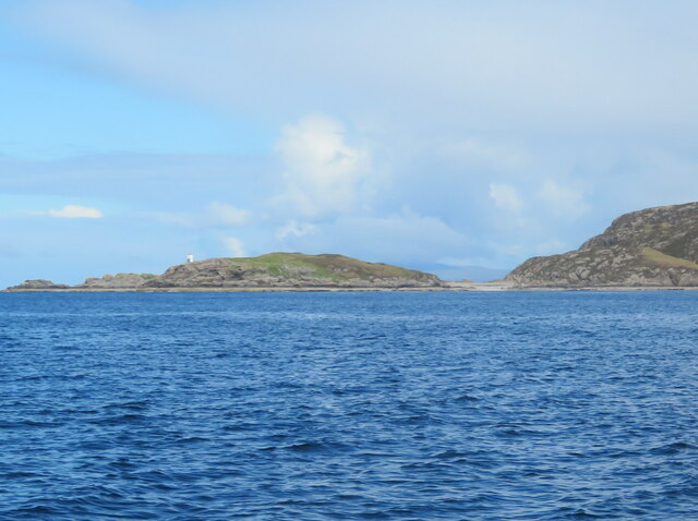
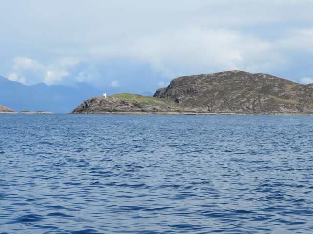
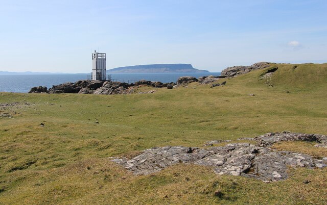
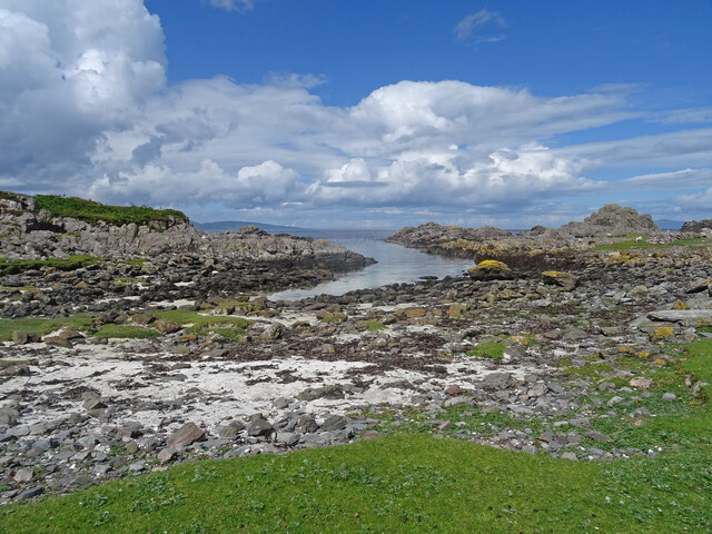
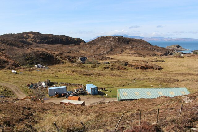
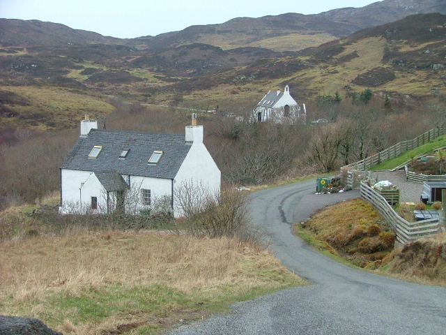
Acairseid an Rubha is a prominent coastal feature located in Inverness-shire, Scotland. It is a headland or point that juts out into the North Atlantic Ocean, offering stunning views of the surrounding landscape.

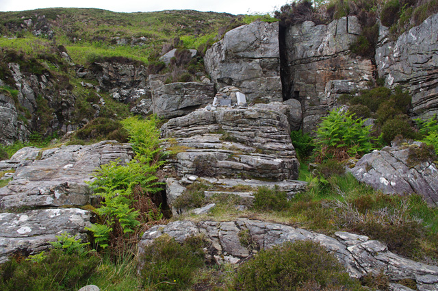
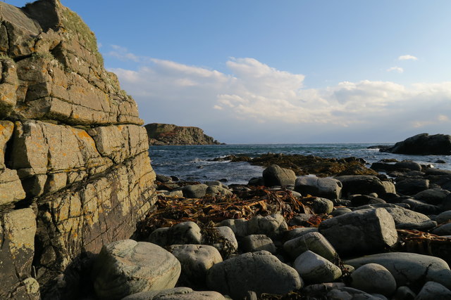
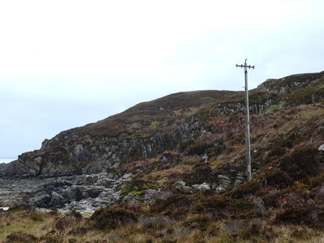
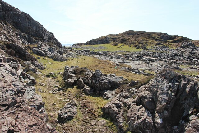
The headland is known for its rugged cliffs, which rise steeply from the water below. These cliffs are composed of various rock formations, including sandstone and granite, and display intricate patterns created by years of erosion caused by wind and waves. The geological diversity of the area makes it a popular destination for geologists and nature enthusiasts alike.

Acairseid an Rubha is also home to a diverse range of flora and fauna. The headland provides habitat for various seabird species, including gulls, puffins, and razorbills, which can often be seen nesting on the cliffs. The surrounding waters are teeming with marine life, including seals and dolphins, making it a great spot for wildlife spotting.

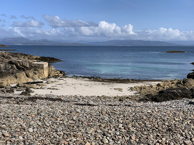
Visitors to Acairseid an Rubha can enjoy a number of outdoor activities, such as hiking and birdwatching. There are several walking trails that lead to the headland, allowing visitors to explore the area at their own pace. The breathtaking views and serene atmosphere make it an ideal location for nature photography and relaxation.

Overall, Acairseid an Rubha is a remarkable coastal feature in Inverness-shire, offering visitors a chance to immerse themselves in the beauty of Scotland's natural landscape.

If you have any feedback on the listing, please let us know in the comments section below.

Acairseid an Rubha Images

Images are sourced within 2km of 57.028205/-6.0234402 or Grid Reference NG5500. Thanks to Geograph Open Source API. All images are credited.

Camus Daraich A sandy beach east of the Point of Sleat.
Camus Daraich
A sandy beach east of the Point of Sleat.
Memorial cairn, Camus Daraich Memorial for William Taylor, an airman in 70 Squadron during WWII. There are 2 other plaques, presumably commemorating his wife and daughter.
Memorial cairn, Camus Daraich
Memorial for William Taylor, an airman in 70 Squadron during WWII. There are 2 other plaques, presumably commemorating his wife and daughter.
Memorial cairn and outcrop, Camus Daraich See <a href="https://www.geograph.org.uk/photo/5417917">NM5699 : Memorial cairn, Camus Daraich</a> for a closer view of the cairn.
Memorial cairn and outcrop, Camus Daraich
See NM5699 : Memorial cairn, Camus Daraich for a closer view of the cairn.
Beach near Point of Sleat A small sandy beach on the east side of the Point of Sleat. North Morar is just visible in the distance.
The concrete pier may have been built to enable unloading of materials for construction of the lighthouse.
Beach near Point of Sleat
A small sandy beach on the east side of the Point of Sleat. North Morar is just visible in the distance. The concrete pier may have been built to enable unloading of materials for construction of the lighthouse.
Camas Daraich Beach Tide in, looking East towards a small island.
Camas Daraich Beach
Tide in, looking East towards a small island.
Point of Sleat The Point of Sleat from offshore. The lighthouse is just visible, below the high-point (Creag Mhor) of the second promontory. The sun has just risen above the third promontory (Ard Thurinish).
Estimated camera position NM547980.
Point of Sleat
The Point of Sleat from offshore. The lighthouse is just visible, below the high-point (Creag Mhor) of the second promontory. The sun has just risen above the third promontory (Ard Thurinish). Estimated camera position NM547980.
Small beach on Point of Sleat White sand and a turquoise sea in the Sound of Sleat, with Mallaig and the Morar beaches visible on the far mainland shore. The concrete structure on the left is a pier associated with access to the nearby Sleat Point light. <a href="https://www.geograph.org.uk/photo/377298">NM5699 : Point of Sleat Light</a>
Small beach on Point of Sleat
White sand and a turquoise sea in the Sound of Sleat, with Mallaig and the Morar beaches visible on the far mainland shore. The concrete structure on the left is a pier associated with access to the nearby Sleat Point light. NM5699 : Point of Sleat Light
Old telegraph pole, Camas Daraich What was its purpose? Was there a telephone connection to the Point of Sleat lighthouse? I did not see any other poles in the area.
Old telegraph pole, Camas Daraich
What was its purpose? Was there a telephone connection to the Point of Sleat lighthouse? I did not see any other poles in the area.
The Point of Sleat Lighthouse <span class="nowrap"><a title="https://en.wikipedia.org/wiki/Point_of_Sleat_Lighthouse" rel="nofollow ugc noopener" href="https://en.wikipedia.org/wiki/Point_of_Sleat_Lighthouse">Link</a><img style="margin-left:2px;" alt="External link" title="External link - shift click to open in new window" src="https://s1.geograph.org.uk/img/external.png" width="10" height="10"/></span>  at the southernmost extremity of the Isle of Skye.
The Point of Sleat
Lighthouse LinkExternal link at the southernmost extremity of the Isle of Skye.
The Point of Sleat Lighthouse <span class="nowrap"><a title="https://en.wikipedia.org/wiki/Point_of_Sleat_Lighthouse" rel="nofollow ugc noopener" href="https://en.wikipedia.org/wiki/Point_of_Sleat_Lighthouse">Link</a><img style="margin-left:2px;" alt="External link" title="External link - shift click to open in new window" src="https://s1.geograph.org.uk/img/external.png" width="10" height="10"/></span> at the southernmost extremity of the Isle of Skye.
The Point of Sleat
Lighthouse LinkExternal link at the southernmost extremity of the Isle of Skye.
Camas Daraich
Camas Daraich
The rocky Point of Sleat
Beacon at Point of Sleat The south tip of the Isle of Skye.  In the background is the Island of Eigg.
Beacon at Point of Sleat
The south tip of the Isle of Skye. In the background is the Island of Eigg.
Dead Jellyfish A few of the hundreds of dead Jellyfish washed up Camas Daraich beach on the Sleat peninsula on Skye.
Dead Jellyfish
A few of the hundreds of dead Jellyfish washed up Camas Daraich beach on the Sleat peninsula on Skye.
Point of Sleat Scenery Looking west at the isthmus just north of the Point of Sleat. Land in the distance is the very top of Rum.
Point of Sleat Scenery
Looking west at the isthmus just north of the Point of Sleat. Land in the distance is the very top of Rum.
Waterfall off the track to Point of Sleat Just to the north of the track to Point of Sleat, walkers are treated to the sight of this waterfall.
Waterfall off the track to Point of Sleat
Just to the north of the track to Point of Sleat, walkers are treated to the sight of this waterfall.
Waterfall by the track to Point of Sleat
Acairseid an Rubha Rum in the background.
Acairseid an Rubha
Rum in the background.
Show me another place!

Acairseid an Rubha is located at Grid Ref: NG5500 (Lat: 57.028205, Lng: -6.0234402)

Unitary Authority: Highland

Police Authority: Highlands and Islands

What 3 Words

///dialect.remainder.comet. Near Armadale, Highland

Nearby Locations

Acairseid an Rubha

Related Wikis

Aird of Sleat

Aird of Sleat (Scottish Gaelic: Àird Shlèite) is a village on the Isle of Skye in Scotland. It is at the southern end of the Sleat peninsula, 4 miles...

Ardvasar

Ardvasar (Scottish Gaelic: Àird a’ Bhàsair) is a village near the southern end of the Sleat peninsula, on the Isle of Skye in Scotland. It is just to the...

Armadale, Skye

Armadale (Scottish Gaelic: Armadal) is a village near the southern end of the Sleat peninsula on the Isle of Skye, in the Highland council area of Scotland...
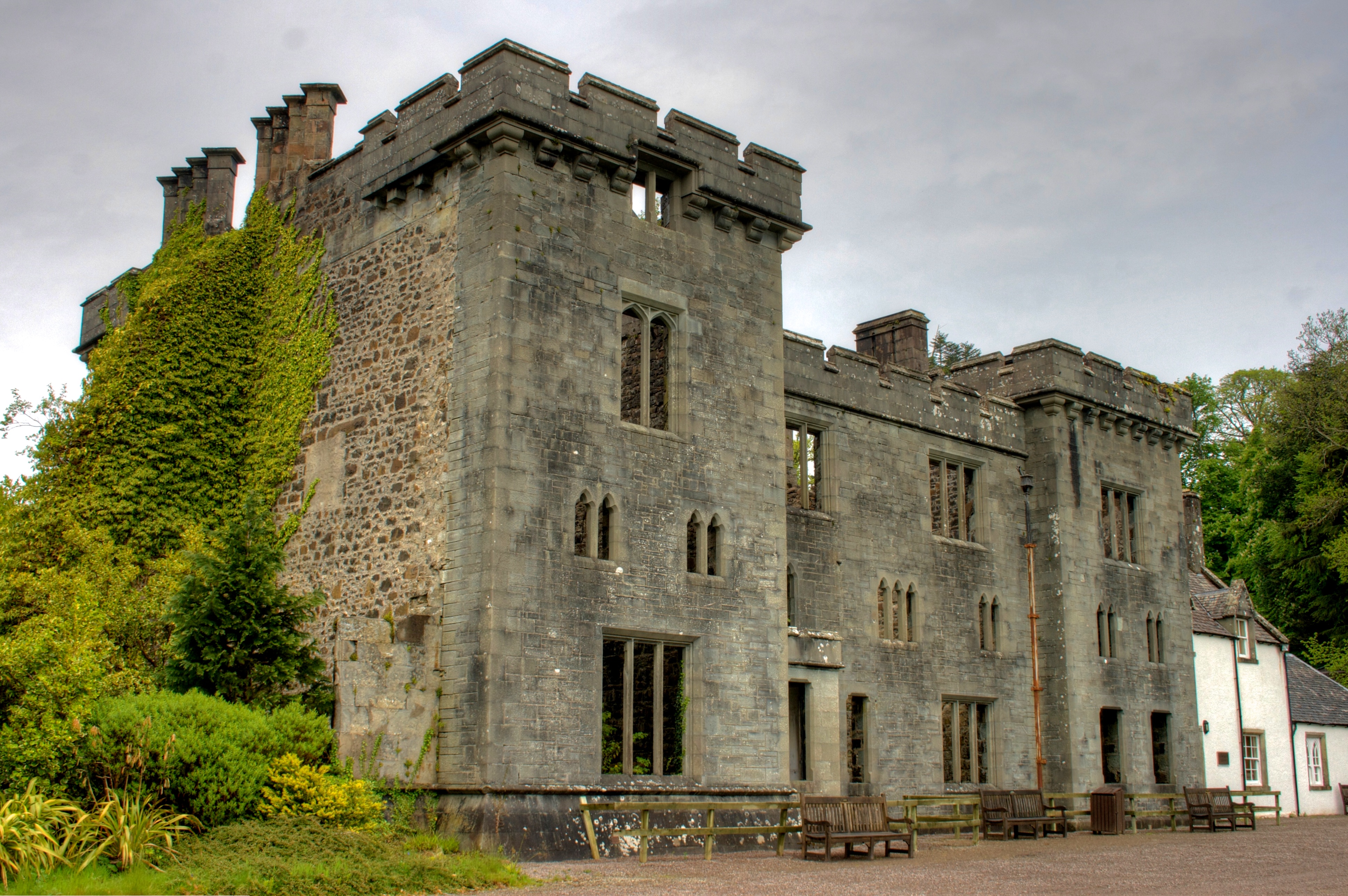
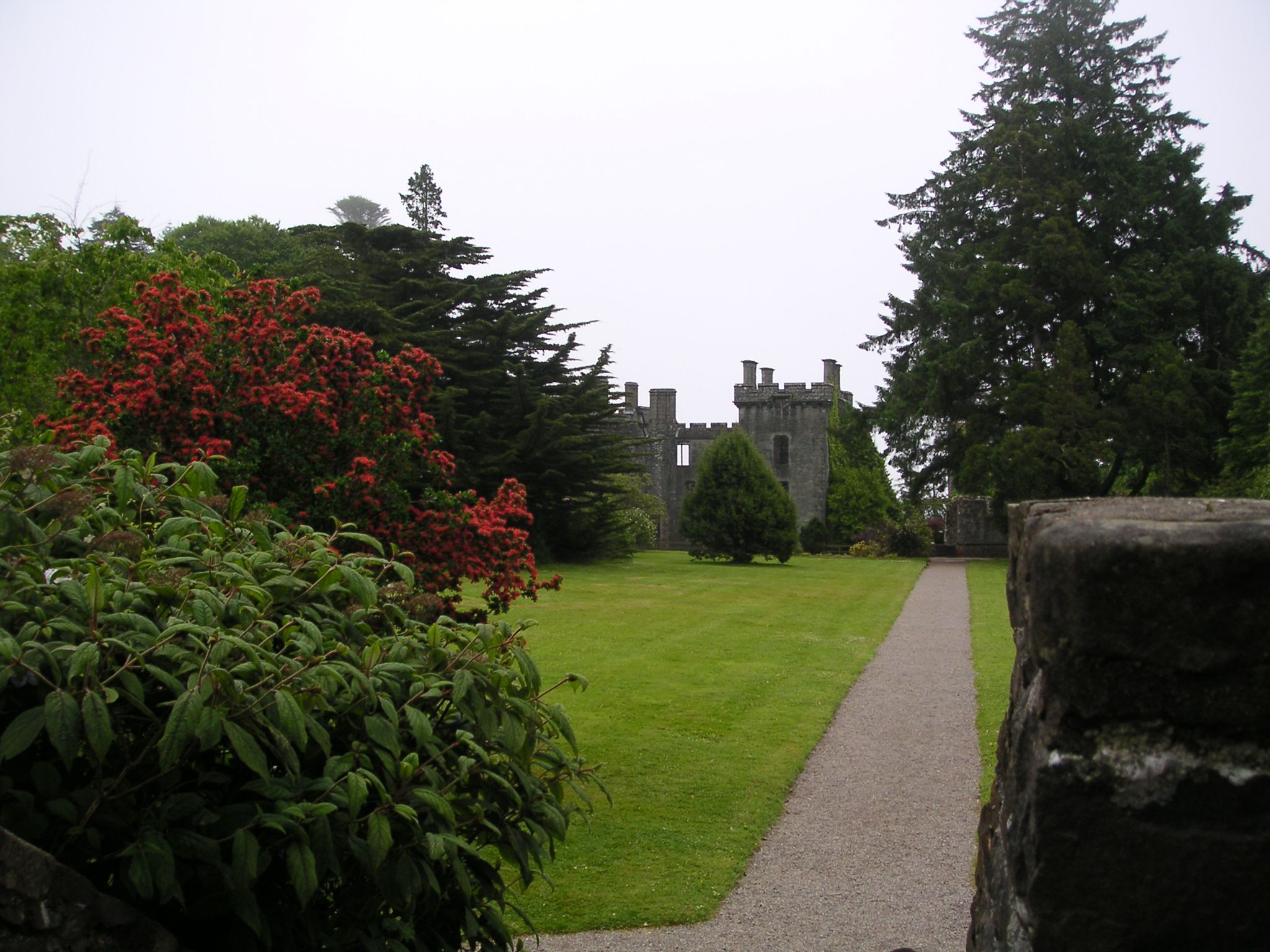
Armadale Castle

Armadale Castle is a ruined country house in Armadale, Skye, former home of the MacDonalds. A mansion house was first built here around 1790, facing south...

Tarskavaig

Tarskavaig (Tarsgabhaig in Scottish Gaelic) is a crofting village on the west coast of Sleat on the Isle of Skye in Scotland. It sits in a glen which meets...

Nearby Amenities

Located within 500m of 57.028205,-6.0234402
Ford: yes
Lat/Long: 57.0283082/-6.0169264
The data included in this document is from www.openstreetmap.org. The data is made available under ODbL.

Have you been to Acairseid an Rubha?

Leave your review of Acairseid an Rubha below (or comments, questions and feedback).